Saturday, December 31, 2011
Year in Review - Cycling
I'll come right out and say it - this has been an amazing year. Whatever made it happen, I sure hope I don't lose it.
Total miles: 5805. Almost 1400 more than last year, and highest annual mileage ever.
I rode my bike 213 days this year.
Commuted about 1500 of those miles. If I don't ride to work, I face a gauntlet starting with the receptionist, all the way to my desk..."where's your bike?". I love my current contract - lots of meetings on the main campus, our building is not on the main campus, and it is quicker to ride the bike than to drive. And I can park in the buildings and never have to worry about locking up. I had a 100% commute rate in the BTA Bike Commute Challenge.
17 rides of more than 100 miles.
2 centuries
12 200km
1 300km
1 400km
1 600km
I would have to say that Sweetpea got the bulk of the riding love this year - all but a couple of the Rando rides, plus trips to Ireland and California. Bleriot got all the commutes, and poor Lemond has probably less than 300 miles ridden on it in total.
Organized rides - only two, RSVP and RAPSody. I'll probably ride them again next year, lots of fun.
Randonneurs USA riding
4524 km. Most ever.
Completed my second R-12 in September.
Earned my first-ever Super Randonneur by completing a 200k, 300k, 400k, and 600k in a calendar year. I am still stupidly pleased and insufferably proud about this.
Rode a couple of sub-10 hour 200km rides. Whoever that Lynne was, I'd like her to show up more often :-)
The hardest rides I did were:
1. Bikenfest, the Oct 200k. 11522 vertical feet. I am not sure I ever wanted to just lay down and die on any other ride I have done.
2. The 400k. I couldn't stay awake, which made riding through the night somewhat of a challenge. Did get to see two sunrises!
3. The 600k, because, well, it was a 600. Way outside of my comfort zone. I was never worried about not finishing in time on the second day. Well, ok, there were a few bad hours in there on day 1.
Learnings: I CAN pull myself out of a massive bonk. Still to learn: don't bonk in the first place.
I CAN ride >10000 vertical feet in a day. RAMROD is definitely a possibility (I am shallow. I want the jersey.)
Goals. Hmm. More 300km rides. I need to get to where I can just go out and ride one, rather like I approach a 200km ride now. Quit being terrified of 400km rides. A 1000km would be very cool.
Acknowledgements:
Sweetpea, for being such a great bike (thank you Natalie)
Fitz, because I'm out riding a lot.
Cecil, Susan, Michal, and Lesli, for being such great riding buddies. Looking forward to more rides with you in the coming year!
Wednesday, December 28, 2011
Riding in the Desert
We are here for a week, so I figured to get in some rides. Rummaging around on bikely.com, I found a 60 mile loop by a jckramer. I've met him. Went back later, and that entry was gone, but there was a similar one. Remapped it in bike route toaster, so I'd get a cue sheet. More on that later.
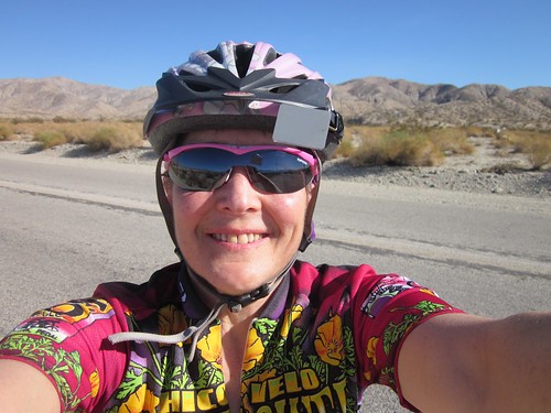
Packed Sweetpea, but left the fenders at home. Yes, Sweetpea will get a sunburn. Little Pink Bear forgot to hop in the bike case. Guess I'd have to talk to myself.
So here is the route, more or less: http://www.bikely.com/maps/bike-path/Palm-Springs-60-mi-loop. I did modify it slightly at the end.
Got on the road about 9am. Made sure I had a couple snacks, and two full bottles of water/NUUN. And sunscreen.
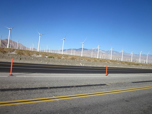 The route headed north past an extensive wind farm. They weren't turning, so maybe I was safe. Through some annoying road construction, and gently up to turn right on Pierson heading through Desert Hot Springs. I did pause at a 7-11. They did not have a restroom for customers. Except... "are you on a bicycle?" Nice. Bought and consumed a Gatorade, removed the arm (long since shoved down to my wrists) and knee warmers, applied sunscreen, went to put on some lip glop... Went back into the store and bought a Chapstick.
 Now heading SE, down Hacienda Rd. It was supposed to turn into Bennett, but never did. Still dumped me onto Dillon, which was where I needed to be, but sooner than the cue sheet indicated. According to my AAA road map, there is no Bennett Rd, so I did not miss anything. Careful viewing of the satellite images reveals that there might be a DIRT road there, but I didn't see it intersect with Hacienda. Gentle climbing again, about 2%. With a slight headwind. I kept pushing myself to keep it above 12mph, with varying success.
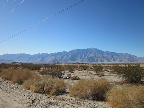 Starting to get much less populated, and, past Sky Valley, nothing but desert and scrub. The bike computer indicated that I should have found Thousand Palms Canyon Rd by now, but nothing. Pulled out my phone and tried Google Maps (cheating, I know), but it couldn't connect. I had signal and all, but no maps. The AAA map had stuck a big street index right over that whole area. Ok then. I'd go for another mile or so and see if I ran into it. I couldn't see any road, but I did see three cars turning into what looked no different than the surrounding scrub. And there it was.
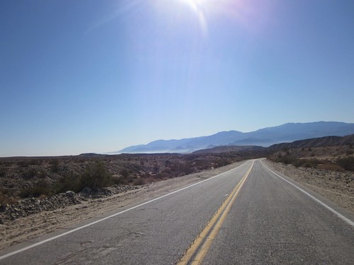 This was a very fun descent. Eventually I found the thousand palms (in the canyon, naturally) in the Coachella Valley Nature Preserve. Then 5 or so more miles and I was back in civilization. Indian Wells, to be precise. Their roads are paved with the nicest asphalt and mostly have wide outer lanes, which, for me, is heaven. There was a stretch of shopping districts that eventually took me to CA-111, where I'd spend the next 16 miles. It started out with a really nice buffered bike lane. And, finally, a tailwind. I was thinking this could be really nice.
 Not so much. The next town along, Palm Desert, didn't believe in such niceties as shoulders or bike lanes. The road varied from 2-3 lanes in each direction, so you'd think there would be enough room for everyone. Mostly, but it was cozier than I would have liked. Many parking lot entries, and more traffic lights than SW Beaverton Hillsdale, all of them red. But yet, there was that tailwind. Rancho Mirage wasn't much better, and I kept looking at my odometer muttering "5 more miles...". Fitz called while I was passing through Crystal City; we figured we'd get back about the same time.
The route had me continuing on Business CA-111. I should have taken the right to stay on CA-111; I could have gotten back from there as well. Eventually got onto the Palm Springs bike path system. I don't like them. They are meant for riders pootling along on cruiser bikes. They meander. They cross driveways. It is not clear who has right of way at intersections. I stopped and looked; didn't want to get run over by a right-turning motorist. I couldn't stand it any longer,and turned onto Tahquitz Way; on street bike lanes. By now I was just about finished.
Turning into the parking lot, I spied a familiar person unloading his golf clubs. Perfect timing!
On that bike route toaster comment - it appears to get its rights and lefts mixed up from time to time. Plus it throws in a "take the first..." when the turn is not the first left or right. Insert control points, rather than a track point at each turn, or they won't appear on the cue sheet. Takeaway - proofread the cue sheet!
Not so much. The next town along, Palm Desert, didn't believe in such niceties as shoulders or bike lanes. The road varied from 2-3 lanes in each direction, so you'd think there would be enough room for everyone. Mostly, but it was cozier than I would have liked. Many parking lot entries, and more traffic lights than SW Beaverton Hillsdale, all of them red. But yet, there was that tailwind. Rancho Mirage wasn't much better, and I kept looking at my odometer muttering "5 more miles...". Fitz called while I was passing through Crystal City; we figured we'd get back about the same time.
The route had me continuing on Business CA-111. I should have taken the right to stay on CA-111; I could have gotten back from there as well. Eventually got onto the Palm Springs bike path system. I don't like them. They are meant for riders pootling along on cruiser bikes. They meander. They cross driveways. It is not clear who has right of way at intersections. I stopped and looked; didn't want to get run over by a right-turning motorist. I couldn't stand it any longer,and turned onto Tahquitz Way; on street bike lanes. By now I was just about finished.
Turning into the parking lot, I spied a familiar person unloading his golf clubs. Perfect timing!
On that bike route toaster comment - it appears to get its rights and lefts mixed up from time to time. Plus it throws in a "take the first..." when the turn is not the first left or right. Insert control points, rather than a track point at each turn, or they won't appear on the cue sheet. Takeaway - proofread the cue sheet!
The route headed north past an extensive wind farm. They weren't turning, so maybe I was safe. Through some annoying road construction, and gently up to turn right on Pierson heading through Desert Hot Springs. I did pause at a 7-11. They did not have a restroom for customers. Except... "are you on a bicycle?" Nice. Bought and consumed a Gatorade, removed the arm (long since shoved down to my wrists) and knee warmers, applied sunscreen, went to put on some lip glop... Went back into the store and bought a Chapstick.
Now heading SE, down Hacienda Rd. It was supposed to turn into Bennett, but never did. Still dumped me onto Dillon, which was where I needed to be, but sooner than the cue sheet indicated. According to my AAA road map, there is no Bennett Rd, so I did not miss anything. Careful viewing of the satellite images reveals that there might be a DIRT road there, but I didn't see it intersect with Hacienda. Gentle climbing again, about 2%. With a slight headwind. I kept pushing myself to keep it above 12mph, with varying success.
Starting to get much less populated, and, past Sky Valley, nothing but desert and scrub. The bike computer indicated that I should have found Thousand Palms Canyon Rd by now, but nothing. Pulled out my phone and tried Google Maps (cheating, I know), but it couldn't connect. I had signal and all, but no maps. The AAA map had stuck a big street index right over that whole area. Ok then. I'd go for another mile or so and see if I ran into it. I couldn't see any road, but I did see three cars turning into what looked no different than the surrounding scrub. And there it was.
This was a very fun descent. Eventually I found the thousand palms (in the canyon, naturally) in the Coachella Valley Nature Preserve. Then 5 or so more miles and I was back in civilization. Indian Wells, to be precise. Their roads are paved with the nicest asphalt and mostly have wide outer lanes, which, for me, is heaven. There was a stretch of shopping districts that eventually took me to CA-111, where I'd spend the next 16 miles. It started out with a really nice buffered bike lane. And, finally, a tailwind. I was thinking this could be really nice.
Not so much. The next town along, Palm Desert, didn't believe in such niceties as shoulders or bike lanes. The road varied from 2-3 lanes in each direction, so you'd think there would be enough room for everyone. Mostly, but it was cozier than I would have liked. Many parking lot entries, and more traffic lights than SW Beaverton Hillsdale, all of them red. But yet, there was that tailwind. Rancho Mirage wasn't much better, and I kept looking at my odometer muttering "5 more miles...". Fitz called while I was passing through Crystal City; we figured we'd get back about the same time.
The route had me continuing on Business CA-111. I should have taken the right to stay on CA-111; I could have gotten back from there as well. Eventually got onto the Palm Springs bike path system. I don't like them. They are meant for riders pootling along on cruiser bikes. They meander. They cross driveways. It is not clear who has right of way at intersections. I stopped and looked; didn't want to get run over by a right-turning motorist. I couldn't stand it any longer,and turned onto Tahquitz Way; on street bike lanes. By now I was just about finished.
Turning into the parking lot, I spied a familiar person unloading his golf clubs. Perfect timing!
On that bike route toaster comment - it appears to get its rights and lefts mixed up from time to time. Plus it throws in a "take the first..." when the turn is not the first left or right. Insert control points, rather than a track point at each turn, or they won't appear on the cue sheet. Takeaway - proofread the cue sheet!
Sunday, December 11, 2011
The Pie Ride
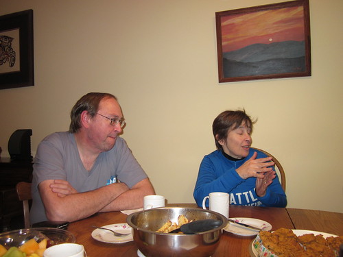
Usually sometime on a Wednesday, I start plotting what ride I'll be doing on the weekend. This time of the year, I have to (heavily) recruit folks, or go with the local club ride. When Dr. Codfish mentioned that there would be a Permanent Populaire out of his town (Oakville, WA), well, I was tempted. Oakville isn't too far away from Centralia. When he mentioned Pain au Chocolat... that sealed it. I was completely planning to go by myself, but the lure of baked goods put Susan over the edge.
She showed up right around 7am, so we'd get there in plenty of time for the 10am start. Then she went back home to get something she'd forgotten (15-20 min round trip), and I loaded the car. I knew we'd still get there in plenty of time for the 10am start. We arrived at 9:27am, lots of time to change shoes, decide I didn't need to wear any more than I wore last weekend (starting temperature 33 degrees), and faff around some more. And watch Albert assemble his S&S-coupled Co Motion tandem. That's how you put a tandem in a Camaro. :-)
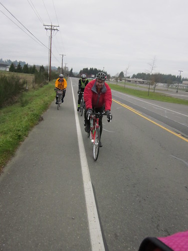
In all we were me, Susan, Paul, Albert, Allison, and Alan. Off to Harry's Market for starting receipts, and then away we went. It was cold, and it took about 15 minutes for my hands to join the rest of me. We headed east-ish, to Rochester, Grand Mound and Centralia. Somewhere around Grand Mound I realized I had ridden here before - the Capital Cycling Club (Olympia) used run the Two County Double Metric Century out here, and over some of the same roads.
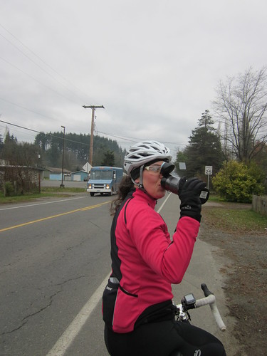
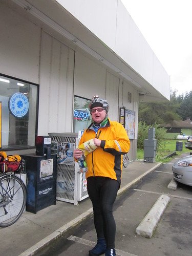
We needed a stop in Centralia, and after some discussion (Texaco or Starbucks?), stopped at Starbucks. And who should be there but John V! We had hoped he'd be riding, but this was the next best thing. A cheese danish and a Pumpkin Spice Latte (mostly into my thermal jug) later, off again, through Chehalis and another 10 or so miles to the turnaround at Mary's Corner. Pretty farm country, but looking kind of bleak in the cold and clouds. The last couple miles to Mary's Corner were uphill, and with atailwind headwind. Discouraging. But Mary's Corner finally appeared. I found everyone but Paul inside. Got some Pringles and my receipt, and we all loitered around and visited, waiting for Paul.
And Paul arrived, got some snacks, and we all set out again. I had been wearing lightweight long finger gloves. The downhill and cold proved too much for them; I stopped to pull on the lobster claws. Still not wearing a jacket :-) We did have a lovely tailwind and it blew me all the way back to Chehalis. It blew almost everyone else back faster. Oh well.
The ride through Chehalis was interesting. My bike computer display completely checked out, and none of the streets I was riding on (which seemed to be the correct ones) matched the street names on the cue sheet. Right around Market and Cascade, the road went onto Cascade... Ack. I turned left onto Washington, and it eventually dumped me onto National, which is where I was supposed to end up. Paul is going to revisit the cue sheet.
Then things got bouncy. And flat. Rear tire flat. Pulled over into a handy parking lot, such that Paul would see me when he rode by. It being cold and rather damp (aggressive mist for the past 4 or so miles, not that I'd know, because my bike computer was sulking), I elected to just swap out the tube AND tire. All good, until I went to get the spare tire on. I'd forgotten how very tight those Michelins are on the Aerohead rims. Fortunately Paul came along, and we managed to wrestle the tire back on. A woman exiting the parking lot asked if we were ok. Yes, just finishing up, having great fun here. She said we should be careful, because we could get very cold standing around. Yes, I've heard that :-)
Given my lack of navigational cues, I figured I'd stick with Paul through Centralia. Pulled ahead on Hwy 99, eventually made the turn onto Old Hwy 9 (navigation was easier at this point), and thought I saw Paul's headlight behind me. It was a bicycle headlight. Actually several of them - Albert, Allison, Susan and Alan had stopped at the Starbucks again for hot drinks. Paul came up shortly thereafter, and we continued on the last 10-ish miles. The stretch on Hwy 12 and Elma Gate Road had beautiful views to the west (sun getting very low) and north (misty hills).
Into Harry's Market again. The cashier: "you all need the receipts, right?". She even called out to Paul as he was leaving - "you forgot your receipt!" From there we all coasted back to Paul's (about a mile), and feasted on cheese and crackers, pasta with sundried tomatoes and walnuts, fruit, various hot beverages, Susan's pumpkin muffins, and the promised Pain au Chocolat. All very wonderful, followed by an equally wonderful hot shower. Thank you!
Brief pause in Centralia on the way back. Of course, at the Chevron, and my favorite night cashier was working. We exchanged greetings.
Turned on the radio to keep us both awake. The station I listen to usually plays music from my HS/University years, but it was House of Hair hour, so Susan got to sing along; I didn't know any of them!
The route itself was 68 miles, total for the day 70 miles. Riding average 13.89mph. It did not get above 37 degrees; avg temp was 34.9.
She showed up right around 7am, so we'd get there in plenty of time for the 10am start. Then she went back home to get something she'd forgotten (15-20 min round trip), and I loaded the car. I knew we'd still get there in plenty of time for the 10am start. We arrived at 9:27am, lots of time to change shoes, decide I didn't need to wear any more than I wore last weekend (starting temperature 33 degrees), and faff around some more. And watch Albert assemble his S&S-coupled Co Motion tandem. That's how you put a tandem in a Camaro. :-)
In all we were me, Susan, Paul, Albert, Allison, and Alan. Off to Harry's Market for starting receipts, and then away we went. It was cold, and it took about 15 minutes for my hands to join the rest of me. We headed east-ish, to Rochester, Grand Mound and Centralia. Somewhere around Grand Mound I realized I had ridden here before - the Capital Cycling Club (Olympia) used run the Two County Double Metric Century out here, and over some of the same roads.
We needed a stop in Centralia, and after some discussion (Texaco or Starbucks?), stopped at Starbucks. And who should be there but John V! We had hoped he'd be riding, but this was the next best thing. A cheese danish and a Pumpkin Spice Latte (mostly into my thermal jug) later, off again, through Chehalis and another 10 or so miles to the turnaround at Mary's Corner. Pretty farm country, but looking kind of bleak in the cold and clouds. The last couple miles to Mary's Corner were uphill, and with a
And Paul arrived, got some snacks, and we all set out again. I had been wearing lightweight long finger gloves. The downhill and cold proved too much for them; I stopped to pull on the lobster claws. Still not wearing a jacket :-) We did have a lovely tailwind and it blew me all the way back to Chehalis. It blew almost everyone else back faster. Oh well.
The ride through Chehalis was interesting. My bike computer display completely checked out, and none of the streets I was riding on (which seemed to be the correct ones) matched the street names on the cue sheet. Right around Market and Cascade, the road went onto Cascade... Ack. I turned left onto Washington, and it eventually dumped me onto National, which is where I was supposed to end up. Paul is going to revisit the cue sheet.
Then things got bouncy. And flat. Rear tire flat. Pulled over into a handy parking lot, such that Paul would see me when he rode by. It being cold and rather damp (aggressive mist for the past 4 or so miles, not that I'd know, because my bike computer was sulking), I elected to just swap out the tube AND tire. All good, until I went to get the spare tire on. I'd forgotten how very tight those Michelins are on the Aerohead rims. Fortunately Paul came along, and we managed to wrestle the tire back on. A woman exiting the parking lot asked if we were ok. Yes, just finishing up, having great fun here. She said we should be careful, because we could get very cold standing around. Yes, I've heard that :-)
Given my lack of navigational cues, I figured I'd stick with Paul through Centralia. Pulled ahead on Hwy 99, eventually made the turn onto Old Hwy 9 (navigation was easier at this point), and thought I saw Paul's headlight behind me. It was a bicycle headlight. Actually several of them - Albert, Allison, Susan and Alan had stopped at the Starbucks again for hot drinks. Paul came up shortly thereafter, and we continued on the last 10-ish miles. The stretch on Hwy 12 and Elma Gate Road had beautiful views to the west (sun getting very low) and north (misty hills).
Into Harry's Market again. The cashier: "you all need the receipts, right?". She even called out to Paul as he was leaving - "you forgot your receipt!" From there we all coasted back to Paul's (about a mile), and feasted on cheese and crackers, pasta with sundried tomatoes and walnuts, fruit, various hot beverages, Susan's pumpkin muffins, and the promised Pain au Chocolat. All very wonderful, followed by an equally wonderful hot shower. Thank you!
Brief pause in Centralia on the way back. Of course, at the Chevron, and my favorite night cashier was working. We exchanged greetings.
Turned on the radio to keep us both awake. The station I listen to usually plays music from my HS/University years, but it was House of Hair hour, so Susan got to sing along; I didn't know any of them!
The route itself was 68 miles, total for the day 70 miles. Riding average 13.89mph. It did not get above 37 degrees; avg temp was 34.9.
Monday, December 5, 2011
December, Check
Mindful of what happened right after I finished my first R-12 (Dec 2008, three weeks solid of snow and ice!), I planned to get the December ride in as early as possible. The route was Hillsboro-Dallas-Hillsboro. Not epic, and not likely to get interestingly icy. Weather was to be sunny and cold (30-45 degrees F)
I thought awhile about riding Lemond, but Sweetpea has the lighting, the carrying capacity, and the comfort.
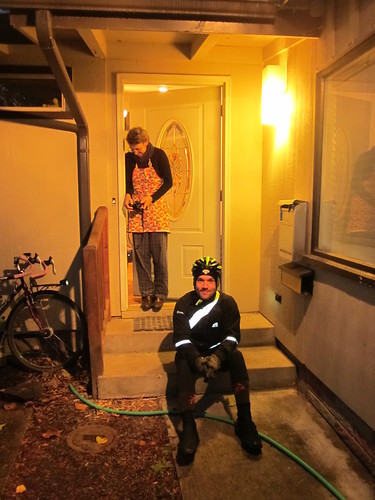
Recruited Michal to join me. He and his wife got up at 3:30am (ow), and drove up from Eugene so he could ride. We arranged to meet in the Freddie's parking lot. I got there, and watched them drive in, and wander around a bit before parking :-) Rode over, and arranged with Cyndi to meet up at my house at the end.
The store opened at 7, so we had to wait until then to go in and get a receipt. On the road by 7:15. Still very dim.
The exit from Hillsboro out to SW Fern Hill south of Forest Grove is very familiar to me - I had ridden this route 3 times previously, plus my local club rides all over this part of the county. Probably didn't even need to print out the cue sheet.
The sun had trouble coming out. We didn't see it the entire outbound leg. That said, I still ditched my jacket and heavy gloves in the first 8 miles. Rode the rest of the way in a long sleeved wool baselayer, long sleeved OrRando jersey, thermal Shebeest vest, summer mesh gloves with ragg gloves over them, shorts, Craft Storm tights, wool cap, wool socks, PI X-Alp Goretex shoes, and some old Louis Garneau booties that are worthless when it rains. And chemical toe warmers. Michal had on a few more layers, and I think he shivered every time he looked at me.
The scenery riding south along Spring Hill/North Valley/Ribbon Ridge/Kuehne/Abbey was its usual outstanding self. My favorite clerk was working at the Dayton Center Market, our first control. It was slowly (sort of) warming up.
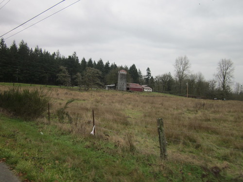
The boring stretch to Amity, then 6+ miles on Hwy 99, then onto Bethel Rd. We saw some other cyclists headed north. Clearly we weren't the only idiots out this day. Fields of grazing sheep. Cute fluffy grazing sheep. Also a few llamas, cattle, and some horses. Big fields turning green with winter wheat. Farm buildings. The antique fire truck at the corner of Bethel and Perrydale. Whereupon Michal took the only picture of the day.... "that firetruck is a lot more antique than I thought it would be"
Then, over the rollers to Dallas, and into the Safeway, with the indoor seating, hot deli counter and Starbucks. More sesame chicken and a Pumpkin Spice Latte for me; Michal had soup and a wrap, and expressed doubt that I was drinking actual coffee.
After a 45 or so minute pause, we headed back out. There was a bit of sun, but sadly, also a bit of headwind. The view from the tops of the hills (I refuse to call them rollers) to the north was outstanding. No stops between Dallas and Dayton. Michal wanted to flip his cue sheet, but I pointed out that there was absolutely no way we were getting lost. The headwind finally gave it up around Dayton. My bike computer display decided it was too cold, and hid. It was still recording, but not sharing. Last battery change was in April; might be time to do it again.
Topped up various liquids, ate something (I started working on a muffin; took almost to Ribbon Ridge to finish off). Michal took off his shoes for a bit. Called spouses to give them an ETA.
Last push northward. Long slanting rays of the sun as it dropped below the hills. Stopped at the corner of Ribbon Ridge and North Valley to turn on all the lights and swap in the clear lenses. We hadn't taken off the reflective gear all day; nothing to do there. North on North Valley, north on Spring Hill, climbed the last rise of any significance just past Catherine and Rick's house. A car honked at us (friendly honk) - thought it was Catherine and Rick, but she says it wasn't them.
Pretty sunset. Rode past the wetlands at the north end, on to Fern Hill. Starting to get dim... Sucked down a gel (Cherry Chocolate. Tasty.) for the final push. Full dark showed up somewhere on Geiger/LaFollett. It wasn't really DARK dark - waxing moon and some ambient light from our surroundings as we skirted the southern boundaries of Forest Grove, Cornelius, and Hillsboro. Finally, north on Minter Bridge, right on River, and the last turn onto Davis. (Still a black hole past Brookwood).
Into Starbucks for the receipt (free with purchase of coffee). The barista asked about our ride, then offered that she had ridden to Forest Grove once (15 miles? tops?). I asked if she had fun, and yes, she did. We then loaded the bikes into the Element and drove home. Cyndi had arrived. I put the last ingredients in the soup and took a very hot shower. Dinner. Visiting. Completing the perm cards (in the mail, Ray :-) ). Plotting for next month. Maybe Donuts to Total Domination. Or Three Prairies. Michal wants to see that part of the valley in daylight.
All in all, a pleasant ride with great company!
Feeling awfully creaky today.
126 miles, 11:16 elapsed time, 13.74 avg mph. Slowdown after lunch. Power-mass improvement indicated.
I thought awhile about riding Lemond, but Sweetpea has the lighting, the carrying capacity, and the comfort.
Recruited Michal to join me. He and his wife got up at 3:30am (ow), and drove up from Eugene so he could ride. We arranged to meet in the Freddie's parking lot. I got there, and watched them drive in, and wander around a bit before parking :-) Rode over, and arranged with Cyndi to meet up at my house at the end.
The store opened at 7, so we had to wait until then to go in and get a receipt. On the road by 7:15. Still very dim.
The exit from Hillsboro out to SW Fern Hill south of Forest Grove is very familiar to me - I had ridden this route 3 times previously, plus my local club rides all over this part of the county. Probably didn't even need to print out the cue sheet.
The sun had trouble coming out. We didn't see it the entire outbound leg. That said, I still ditched my jacket and heavy gloves in the first 8 miles. Rode the rest of the way in a long sleeved wool baselayer, long sleeved OrRando jersey, thermal Shebeest vest, summer mesh gloves with ragg gloves over them, shorts, Craft Storm tights, wool cap, wool socks, PI X-Alp Goretex shoes, and some old Louis Garneau booties that are worthless when it rains. And chemical toe warmers. Michal had on a few more layers, and I think he shivered every time he looked at me.
The scenery riding south along Spring Hill/North Valley/Ribbon Ridge/Kuehne/Abbey was its usual outstanding self. My favorite clerk was working at the Dayton Center Market, our first control. It was slowly (sort of) warming up.
The boring stretch to Amity, then 6+ miles on Hwy 99, then onto Bethel Rd. We saw some other cyclists headed north. Clearly we weren't the only idiots out this day. Fields of grazing sheep. Cute fluffy grazing sheep. Also a few llamas, cattle, and some horses. Big fields turning green with winter wheat. Farm buildings. The antique fire truck at the corner of Bethel and Perrydale. Whereupon Michal took the only picture of the day.... "that firetruck is a lot more antique than I thought it would be"
Then, over the rollers to Dallas, and into the Safeway, with the indoor seating, hot deli counter and Starbucks. More sesame chicken and a Pumpkin Spice Latte for me; Michal had soup and a wrap, and expressed doubt that I was drinking actual coffee.
After a 45 or so minute pause, we headed back out. There was a bit of sun, but sadly, also a bit of headwind. The view from the tops of the hills (I refuse to call them rollers) to the north was outstanding. No stops between Dallas and Dayton. Michal wanted to flip his cue sheet, but I pointed out that there was absolutely no way we were getting lost. The headwind finally gave it up around Dayton. My bike computer display decided it was too cold, and hid. It was still recording, but not sharing. Last battery change was in April; might be time to do it again.
Topped up various liquids, ate something (I started working on a muffin; took almost to Ribbon Ridge to finish off). Michal took off his shoes for a bit. Called spouses to give them an ETA.
Last push northward. Long slanting rays of the sun as it dropped below the hills. Stopped at the corner of Ribbon Ridge and North Valley to turn on all the lights and swap in the clear lenses. We hadn't taken off the reflective gear all day; nothing to do there. North on North Valley, north on Spring Hill, climbed the last rise of any significance just past Catherine and Rick's house. A car honked at us (friendly honk) - thought it was Catherine and Rick, but she says it wasn't them.
Pretty sunset. Rode past the wetlands at the north end, on to Fern Hill. Starting to get dim... Sucked down a gel (Cherry Chocolate. Tasty.) for the final push. Full dark showed up somewhere on Geiger/LaFollett. It wasn't really DARK dark - waxing moon and some ambient light from our surroundings as we skirted the southern boundaries of Forest Grove, Cornelius, and Hillsboro. Finally, north on Minter Bridge, right on River, and the last turn onto Davis. (Still a black hole past Brookwood).
Into Starbucks for the receipt (free with purchase of coffee). The barista asked about our ride, then offered that she had ridden to Forest Grove once (15 miles? tops?). I asked if she had fun, and yes, she did. We then loaded the bikes into the Element and drove home. Cyndi had arrived. I put the last ingredients in the soup and took a very hot shower. Dinner. Visiting. Completing the perm cards (in the mail, Ray :-) ). Plotting for next month. Maybe Donuts to Total Domination. Or Three Prairies. Michal wants to see that part of the valley in daylight.
All in all, a pleasant ride with great company!
Feeling awfully creaky today.
126 miles, 11:16 elapsed time, 13.74 avg mph. Slowdown after lunch. Power-mass improvement indicated.
Wednesday, November 16, 2011
Errata (the cue sheet was correct)
In the previous post I alluded to what we interpreted as a cue sheet error for the Perm 1177 Eugene-Beaverton 200km . We followed Howell Prairie Rd to its intersection with Hwy 99E, dutifully turned left and... were misplaced.
Except we weren't on Howell Prairie Rd. It crosses Mt Angel-Gervais Road. Despite the impression that Google Maps gives, Mt Angel-Gervais is very much the major road, and Howell Prairie looks like a slightly upgraded driveway. The road curves to the left, and we followed right along...
See below for details. Should have gone straight (red line). Won't make that mistake again!

Sorry Bill...
Sunday, November 13, 2011
Eugene to Portland 200 km Adventure
The forecast for Saturday, Nov 12 called for "rain late", late defined as noon. The forecast for Woodburn called for .25" of rain. We'd be passing though in late afternoon. Was this permanent going to be fun or what?
It did not take any arm-twisting at all to get Lesli and Michal on board with a permanent for November. They both live in Eugene, so I thought we should start or finish there. Bill A has perms going in both directions. The prevailing winds in November are from the south. Eugene to Portland it was. Kevin was a delightful addition. The route ended barely a mile from my house, so all were invited to come over for a post-ride feed, and, for the Eugene crowd, showers. Michal's wife Cyndi was driving up to take them back to Eugene, as the train schedule was not as accommodating.
For maximum adventure bonus, I purchased tickets for myself and Sweetpea on the Friday evening train to Eugene. I had planned to ride to the Sunset Transit center, catch the MAX downtown, and ride over to Union Station. Fitz was not working late this Friday, and offered to drop me off instead. I took him up on it.
(Brief sidebar) I go for really long rides. But it is still just the most amazing thing for me when I do a significant ride that starts or ends at my house. So, yeah, I was going to RIDE from Eugene to my house. Cool!
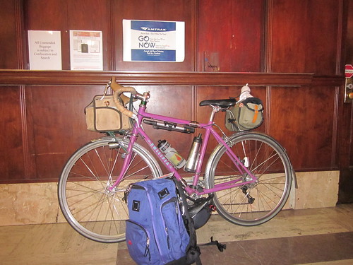
Got my ticket from the machine, got Sweetpea a baggage tag, sat around for a bit, then it was time to board. The baggage car was at the far end. Sweetpea and a nice Co-Motion went up on the bike racks. I am pretty sure they had a nice visit. I do love a train ride. Got myself some Mac and Cheese in the food car, then walked back to my seat, knitted on my sock, and watched the light out the window.
Lesli collected me at the train station. She and Sara fed me some more, we dithered on what to take on the bikes. Met their delightful dog Chaz - so calm and friendly, and exhibits that "I worship anything you might be intending to do" behavior. I admired the Sidi shoe display in their bike room, and finally got some sleep.
We had a great pre-ride breakfast - eggs, cheese, tortillas, granola (made by Sara, yummy!) and coffee, then went outside to await the arrival of Michal, Kevin, and Cyndi. They showed up almost immediately, and we started into a round of pre-ride documentation and snack-swapping (cookies and well-buttered Rye Molasses muffins). Lesli and I gave Cyndi our bags, and the four of us set out for the official start, Full City Coffee.
Got a mocha to go, and, with some degree of difficulty, managed to secure a starting receipt. A couple walking by... "where are you riding today?" Beaverton. Got the usual response :-)
Followed Lesli and Michal out of Eugene, and then we were out in the country, with much less stressful navigation requirements.
It sprinkled for a bit, then stopped. And stayed stopped for a very long time. We worked our way north, first through Coburg, then threading our way through the hills to Brownsville (Sutterdown, if you are a Dies the Fire fan). Took off my jacket, cap, and heavy gloves along the way. Rode for most of the rest of the ride in shortfinger gloves and a wind vest. I think I made some of my fellow riders chilly just looking at me :-)
Brief pause there for a pause, where I learned that Lesli is a football fan (big game this Saturday, UO vs Stanford). She was recording the game for subsequent playback. Other conversations on mapping, maps, bits of SF reading, Archival Clothing,...
The valley was full-on autumn - really bright colors from the non-native species, green fields where the winter wheat, hay, and grass were starting, brown stubble in the freshly plowed fields, and lots of goats, sheep, cows and horses. A couple of chaser dogs, but with two dog owners along, I wasn't worried - they had nice commanding NO. STOP. GO HOME voices.
Lesli - "so, does this remind you of Ireland?". No. In Ireland, the green goes to 11. I was pretty amazed by that, but there does exist a place that is greener than the Willamette Valley!
We had a consistent strong tailwind all day. Got to love that.
From Brownsville we continued north through Lebanon and Crabtree, and onto Hungry Hill Road, for the sole covered bridge on this route. After rummaging around for the info control answer, we headed into Scio for a pause at the Scio Market. Started getting overcast here.
After Scio, the route took us to Stayton on a route that did not include Richardson Gap or Cole School Rd. Wonderful, I thought. No 15% grades! Then we came around a corner and... a wall. Both Michal and Lesli had completely edited this out of their memory from the last time they rode this route. Ground our way to the top. Well, most of us did. Michal has bionic climbing legs, and dropped us. Bike computer post-ride analysis shares a blip of 14%, mostly 11-12%.
Then rolling along the top of the ridge (amazing view off to the NW) and.... Michal came up with a flat. We pulled into a handy driveway and did the pit crew thing. He had a spare tire and went directly to that. I deflated the tube, and found the wire in the tire. Kevin extracted the wire. We packed everything back up. 10 minutes total.
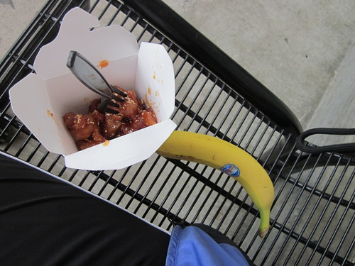
Then into Stayton, for our lunch stop. At this point, we really were on track for a 10-ish hour total ride time. Perused the deli counter. I really didn't want a sandwich. Safeway has a great hot food deli... I went for .45 lbs of sesame chicken and a banana. Oh, that was yummy.
From Stayton on through Aumsville (site of a really destructive tornado not too long ago. We don't HAVE tornadoes in Oregon, which makes it really disturbing) and then onto Howell Prairie Road.
Howell Prairie Road is 18 miles long, and, as I have said before, a prime location for wind farms. I cannot remember a time I have ridden it when the winds were favorable. Until this ride. We had a killer tailwind, and flew north, usually at speeds in excess of 17mph. Complete enjoyment and lots of pictures. Fresh autumn air. This was fun.
Arrived at the intersection at Hwy 99E, where we were to go to Woodburn. Turned L as instructed on the cue sheet, and were supposed to find Boone's Ferry Rd within a half mile. After about a mile of beating our way into a headwind, we didn't find it. I pulled up Google Maps on my phone, and discovered that we should have turned R. At least we'd get blown back to the turn. And so, After an error on our part, we corrected and headed into Woodburn and the taqueria. Mmmm. I had asada tacos with tomatillo sauce and lime. I had two, and they were tiny (and only $1 in total). Might get 3 or 4 next time.
It was now starting to rain, and getting...dim. Also, chilly. I started shaking, and pulled the jacket, cap, heavy gloves and reflective gear back on, and headed out to Hubbard. With the wind at our backs, the rain wasn't so annoying, and we all quickly warmed up. By the time we hit the outskirts of Canby, it was dark.
Headed north on Airport Rd, and then it was time to get onto I-5, to cross the Willamette River. Picture it - dark. raining. Freeway shoulder. Freeway shoulder under construction. I ran over some interesting-sounding things on the Boone Bridge (I second Bill and probably every other cyclist in a 200 mile radius wanting that non-motorized traffic bridge built from the northern terminus of Boone's Ferry Rd across the Willamette. Soon. It is funded.), and hoped I would not flat. Then the construction barrels started encroaching on more and more of the shoulder, to the point where we were just about riding in the lane... Down the off-ramp, left on Wilsonville Rd and (this was going to continue until we got into Beaverton proper) stopped to check the cue sheet and street signs. When we could see the street signs.
Through the office park for several miles, then a pause at the Chevron before the last 13 miles. Note to self - print future cue sheets out in 16pt font. If it hadn't been for Kevin's sharp eyes, we'd have gone off-route a few times. A passer-by at the Chevron station... "I do not envy you folks". We were quick to assure him that this was best fun ever. Not sure he was convinced.
The stretch to Tualatin was not much fun, but eventually we got a bike lane back (busy, narrow road in what used to be a quiet backwater).
Then through some parks, popping out into Tigard (lots of cue sheet checks), then around the back of Washington Square, at which point we didn't need much cue sheet checking at all; this is within 4 miles of my house. I scooted very cautiously across the Tracks of Death on SW 5th Ave. No way was I getting this close to the end to wipe out on those tracks. We did miss the turn onto Griffith in the dark, so went around the corner on Lombard and Canyon. Lesli got a finishing receipt at Starbucks.
Now, the last bit home. Cyndi had just arrived. We walked in, and it smelled like somewhat more than the split pea soup, cornbread and apple cake I was expecting... Fitz upped the ante and added meatloaf and a cabbage-apple slaw.
Perm card completions (had to get all the references to shared receipts straight), dishes and eating utensils, habanero jelly for the cornbread (thank you Cecil!), and we settled down to eat. And eat. The UO-Stanford game was still on, so the football fans (Cyndi and Lesli) were checking on that, and were very happy with the result.
Total time: 12:14
Total distance: 136.49mi
My riding average 14.5mph. It WAS 15.5 by the time we got to Woodburn, but all the start-stop the last 13 miles didn't help.
All the pictures here
Michal's pics
Great November perm. Now, which to do for December?
It did not take any arm-twisting at all to get Lesli and Michal on board with a permanent for November. They both live in Eugene, so I thought we should start or finish there. Bill A has perms going in both directions. The prevailing winds in November are from the south. Eugene to Portland it was. Kevin was a delightful addition. The route ended barely a mile from my house, so all were invited to come over for a post-ride feed, and, for the Eugene crowd, showers. Michal's wife Cyndi was driving up to take them back to Eugene, as the train schedule was not as accommodating.
For maximum adventure bonus, I purchased tickets for myself and Sweetpea on the Friday evening train to Eugene. I had planned to ride to the Sunset Transit center, catch the MAX downtown, and ride over to Union Station. Fitz was not working late this Friday, and offered to drop me off instead. I took him up on it.
(Brief sidebar) I go for really long rides. But it is still just the most amazing thing for me when I do a significant ride that starts or ends at my house. So, yeah, I was going to RIDE from Eugene to my house. Cool!
Got my ticket from the machine, got Sweetpea a baggage tag, sat around for a bit, then it was time to board. The baggage car was at the far end. Sweetpea and a nice Co-Motion went up on the bike racks. I am pretty sure they had a nice visit. I do love a train ride. Got myself some Mac and Cheese in the food car, then walked back to my seat, knitted on my sock, and watched the light out the window.
Lesli collected me at the train station. She and Sara fed me some more, we dithered on what to take on the bikes. Met their delightful dog Chaz - so calm and friendly, and exhibits that "I worship anything you might be intending to do" behavior. I admired the Sidi shoe display in their bike room, and finally got some sleep.
We had a great pre-ride breakfast - eggs, cheese, tortillas, granola (made by Sara, yummy!) and coffee, then went outside to await the arrival of Michal, Kevin, and Cyndi. They showed up almost immediately, and we started into a round of pre-ride documentation and snack-swapping (cookies and well-buttered Rye Molasses muffins). Lesli and I gave Cyndi our bags, and the four of us set out for the official start, Full City Coffee.
Got a mocha to go, and, with some degree of difficulty, managed to secure a starting receipt. A couple walking by... "where are you riding today?" Beaverton. Got the usual response :-)
Followed Lesli and Michal out of Eugene, and then we were out in the country, with much less stressful navigation requirements.
It sprinkled for a bit, then stopped. And stayed stopped for a very long time. We worked our way north, first through Coburg, then threading our way through the hills to Brownsville (Sutterdown, if you are a Dies the Fire fan). Took off my jacket, cap, and heavy gloves along the way. Rode for most of the rest of the ride in shortfinger gloves and a wind vest. I think I made some of my fellow riders chilly just looking at me :-)
Brief pause there for a pause, where I learned that Lesli is a football fan (big game this Saturday, UO vs Stanford). She was recording the game for subsequent playback. Other conversations on mapping, maps, bits of SF reading, Archival Clothing,...
The valley was full-on autumn - really bright colors from the non-native species, green fields where the winter wheat, hay, and grass were starting, brown stubble in the freshly plowed fields, and lots of goats, sheep, cows and horses. A couple of chaser dogs, but with two dog owners along, I wasn't worried - they had nice commanding NO. STOP. GO HOME voices.
Lesli - "so, does this remind you of Ireland?". No. In Ireland, the green goes to 11. I was pretty amazed by that, but there does exist a place that is greener than the Willamette Valley!
We had a consistent strong tailwind all day. Got to love that.
From Brownsville we continued north through Lebanon and Crabtree, and onto Hungry Hill Road, for the sole covered bridge on this route. After rummaging around for the info control answer, we headed into Scio for a pause at the Scio Market. Started getting overcast here.
After Scio, the route took us to Stayton on a route that did not include Richardson Gap or Cole School Rd. Wonderful, I thought. No 15% grades! Then we came around a corner and... a wall. Both Michal and Lesli had completely edited this out of their memory from the last time they rode this route. Ground our way to the top. Well, most of us did. Michal has bionic climbing legs, and dropped us. Bike computer post-ride analysis shares a blip of 14%, mostly 11-12%.
Then rolling along the top of the ridge (amazing view off to the NW) and.... Michal came up with a flat. We pulled into a handy driveway and did the pit crew thing. He had a spare tire and went directly to that. I deflated the tube, and found the wire in the tire. Kevin extracted the wire. We packed everything back up. 10 minutes total.
Then into Stayton, for our lunch stop. At this point, we really were on track for a 10-ish hour total ride time. Perused the deli counter. I really didn't want a sandwich. Safeway has a great hot food deli... I went for .45 lbs of sesame chicken and a banana. Oh, that was yummy.
From Stayton on through Aumsville (site of a really destructive tornado not too long ago. We don't HAVE tornadoes in Oregon, which makes it really disturbing) and then onto Howell Prairie Road.
Howell Prairie Road is 18 miles long, and, as I have said before, a prime location for wind farms. I cannot remember a time I have ridden it when the winds were favorable. Until this ride. We had a killer tailwind, and flew north, usually at speeds in excess of 17mph. Complete enjoyment and lots of pictures. Fresh autumn air. This was fun.
It was now starting to rain, and getting...dim. Also, chilly. I started shaking, and pulled the jacket, cap, heavy gloves and reflective gear back on, and headed out to Hubbard. With the wind at our backs, the rain wasn't so annoying, and we all quickly warmed up. By the time we hit the outskirts of Canby, it was dark.
Headed north on Airport Rd, and then it was time to get onto I-5, to cross the Willamette River. Picture it - dark. raining. Freeway shoulder. Freeway shoulder under construction. I ran over some interesting-sounding things on the Boone Bridge (I second Bill and probably every other cyclist in a 200 mile radius wanting that non-motorized traffic bridge built from the northern terminus of Boone's Ferry Rd across the Willamette. Soon. It is funded.), and hoped I would not flat. Then the construction barrels started encroaching on more and more of the shoulder, to the point where we were just about riding in the lane... Down the off-ramp, left on Wilsonville Rd and (this was going to continue until we got into Beaverton proper) stopped to check the cue sheet and street signs. When we could see the street signs.
Through the office park for several miles, then a pause at the Chevron before the last 13 miles. Note to self - print future cue sheets out in 16pt font. If it hadn't been for Kevin's sharp eyes, we'd have gone off-route a few times. A passer-by at the Chevron station... "I do not envy you folks". We were quick to assure him that this was best fun ever. Not sure he was convinced.
The stretch to Tualatin was not much fun, but eventually we got a bike lane back (busy, narrow road in what used to be a quiet backwater).
Then through some parks, popping out into Tigard (lots of cue sheet checks), then around the back of Washington Square, at which point we didn't need much cue sheet checking at all; this is within 4 miles of my house. I scooted very cautiously across the Tracks of Death on SW 5th Ave. No way was I getting this close to the end to wipe out on those tracks. We did miss the turn onto Griffith in the dark, so went around the corner on Lombard and Canyon. Lesli got a finishing receipt at Starbucks.
Now, the last bit home. Cyndi had just arrived. We walked in, and it smelled like somewhat more than the split pea soup, cornbread and apple cake I was expecting... Fitz upped the ante and added meatloaf and a cabbage-apple slaw.
Perm card completions (had to get all the references to shared receipts straight), dishes and eating utensils, habanero jelly for the cornbread (thank you Cecil!), and we settled down to eat. And eat. The UO-Stanford game was still on, so the football fans (Cyndi and Lesli) were checking on that, and were very happy with the result.
Total time: 12:14
Total distance: 136.49mi
My riding average 14.5mph. It WAS 15.5 by the time we got to Woodburn, but all the start-stop the last 13 miles didn't help.
All the pictures here
Michal's pics
Great November perm. Now, which to do for December?
Saturday, November 5, 2011
Annual Verboort Sausage Populaire
It is November again, time for the Verboort Sausage Festival, and so, time for the Oregon Randonneurs Verboort Populaire. Any ride that ends up at a sausage festival is one to do. (Also rides that include ferries, or cross international boundaries.)
Getting ready - not so much. The weather was going to be rainy and 40's. Wool, wool, wool, Craft Storm Tights and the Showers Pass Elite jacket. And food. I get home from rides, sometimes with more food than I started with, so I toss it in the freezer and pull it out for the next ride. This ride, I retrieved some cookies from the last ride with Michal.
Lots of socializing around at the start; big crowd, despite the weather. Lesli and I had planned to ride together to continue our conversation from the Bikenfest, and Diane (riding buddy since 2003!) joined us. Andy S. gave me a fair amount of trash talk about the quantity of food I had been carrying along on the 600 last June... "I got a hernia just lifting up your bike". Wish I could figure out how to carry less stuff, but it just doesn't work out that way. And I am happy to have the food and spare clothing along!
Turned loose at 9am (drizzling), heading east to Longbottoms Coffee in Hillsboro, our first control about 12 miles along. Rode along with former co-worker Ian for a bit; we caught up on doings at my former place of employ (layoffs again. boo.)
Got there, got my card signed, and.... Lesli wanted an espresso. Service there is, um, not fast. So we stood around and waited. And got a bit chilly. And finally, she got it, sucked it down and we left. But we didn't get very far, because my front tire became exceedingly squashy. (Crud)
Back to fix it. Couldn't find anything in the tire, so crossed my fingers and changed out the tube. BikePortland's participant took my picture. First flat I've had in months (and second flat all year), and that's what I'll be remembered for. Fortunately, it was possibly the fastest tire change EVER. No messing around with tire levers to put the tire back on. I like that.
Off again, heading north over Hwy 26. I saw on the cue sheet that we were going up the fabled Jackson Quarry Hill, and mentally deduced the route was Helvetia to Jackson Quarry. I mean, why go any other way when that way is so darn pretty? Well, it wasn't, it was Helvetia to West Union to Jackson Quarry. Our alternate was .2 mile longer, but much, much, much nicer scenery. Lesli hadn't ridden there before, because no brevet or perm uses that route (I have a perm design in process which does; stay tuned), and I enjoyed pointing out my favorite parts (most of them). A teeny bit more climbing, but worth it for the view. (What it looks like in nicer weather)
Back on the published route, around a few turns, and at the base of the Jackson Quarry Hill. I only know one way to go up it, so punched it and made myself work all the way to the top. Too many years racing Jason to the top (score, Jason: some really big number, Lynne: 1). Then down Mason Hill (wheeee!) and back to Jackson School/Shadybrook/...
Chatting all the way north on Dairy Creek made it go pretty quickly. Consumed that entire bag of cookies. They were very, very good. Could have eaten more! The field of alpacas had 4 cute baby ones this year. Don't know where the grownups were. Vegan sausage and a rando mocha, chatting w/Susan F and Lesli about how I am leading her astray (what? ride in the WINTER?) and time to head back down. It was chilly for a few miles until we warmed up. The trees at the ornamental nursery were spectacular - rows of green, then yellow, then red. We plotted next weekend's adventure - Bill Alsup's Eugene to Portland 200k permanent. I've got the train ticket for me and Sweetpea for next Friday evening already. Also ordered a rack for Sweetpea, for the inevitable pannier of stuff.
Crossed at Frogger Junction, and then off to Banks, quick pause, and west on Cedar Canyon. The wetlands haven't really filled up yet. In a month they should be spectacular. Back along Hwy 6, up Stafford Rd, and the last short number of miles to the end. Except the stretch on Kemper/Visitation seems to take much too long.
Lesli: "I know we are there when I hear polka music and see oxygen tanks and walkers." We got the polka music and a couple of walkers, but no oxygen tanks this year. Diane and I rehashed some previous year's rides - "remember when it was sunny?"
Finished and cards signed, we set off in search of sausage on a stick, coffee, and uncooked sausage to take home. Got the sausage and coffee in the bingo tent (visited with Brian from Olympia, who was having an amazing run at bingo). Located the bulk sausage sales, and managed to buy somewhat less than 2 pounds this year.
Back to the Grand Lodge, where Lesli, Diane, and I were all completely prepared to soak in the hot pool. Frozen feet and hot water is an exquisite feeling, I must say. We defrosted for a good 20-30 minutes. Great finish to a great day.
Stats: 65 miles in total, 62 and a bit for the populaire.
total elapsed time for the populaire 5:27. Analysis: about 15 minutes more riding, a flat, and a bit too much faffing.
Riding pace for the populaire: 14.03 avg mph
Overall pace (includes the coast back to the start) 13.83 avg mph
Saturday, October 22, 2011
Not Entirely Recovered From The Half Marathon
Which bike ride to do this weekend? If I had been quicker to commit, could have ridden a 100k populaire and rolled over 4000 RUSA km. Or, I could ride with Portland Velo, which I have not done for a few months. So, out the door shortly after 8am, to be in Hillsboro for the 9am start. I was riding Sweetpea, as it was supposed to rain. Attached myself to Dana and JRod's 16-18mph group. Someone looked at Sweetpea and wondered if I did a little randonneuring. I do a lot of randonneuring :-) and he was rando-curious. So I suggested he come out for the Verboort ride in a couple of weeks and did a fair amount of evangelizing.
The route was Carpenter Creek, starting at LaCie in Hillsboro, heading west, through Verboort, and skirting Forest Grove to the west. We stopped at the new park at the corner of Thatcher and David Hill (plumbing!). Everyone was pulling off jackets and gloves and really didn't have a place to stow them. There was a movement afoot to stash them all in my Carradice, but I wasn't going for it. Swung my leg up to get back on the bike and REALLY whacked my shin on a bike rack. It smarted for a good 5 miles, and I will probably have a spectacular bruise. We continued up David Hill and turned left on Forest Gale rather than getting there via Thatcher. Nicer route.
Pause at a convenience store for one rider who had forgotten his water. I'd been moving through my water bottles, so bought some water to top up. No one accepted my offer of water, and we still had at least 20 miles to go. Okay then. Difference between club riders and randos. Always top up the water bottles.
Over to Stringtown Rd, then onto Carpenter Creek and up. Maybe a mile climb, not hard. The view from the top was breathtaking - autumn scenery to the south and west, and an amazing color display at the ornamental nursery just past the summit and then looking down to Dilley Rd from Plumlee. The group paused, but I continued on. Working hard to keep up, so I elected to not stop; they'd catch up.
Crossed HWY 47 at Spring Hill, and listened to what appeared to be a million geese honking on the approach to Fern Hill. North on Fern Hill, east on Geiger, watching huge flocks of geese wheel in the sky. I was fading (yes, I was eating). More to the point, my quads and hamstrings were hurting. Through Cornelius, chatting with Ellen, on complete autopilot back to the start. Dana stayed back with us, which was nice, but not needed. (I am also a ride leader, but not playing one today). And done.
Chatted with KRhea; he promised the triathlon pictures he took that we have not seen yet. He told me about his new bike, which will be purple - we got to this thread because Sweetpea is purple and he really likes purple and "you don't see it often".
Joined Dana, JRod, and Ron at Longbottoms for a Farm Plate and a nice long visit before heading out the 10 miles back home. While we were sitting there, an older woman came over and said: "I just have to tell you - you look so fit and healthy. So many women don't these days." Um. Thank you. That was novel and unexpected, for sure.
Then headed home, with not quite so much zip. Stopped in Cedar Hills and took a couple of ibuprofen. Sloooow. Must not be recovered, because this is too short a distance with not much climbing to make me hurt this much.
62.7 miles for the day, for an overall average of 13.9. The average up until the last 10 miles was 14.5mph. Just 29 miles shy of 5000 miles ridden this year. It should happen in the next week.
Postscript: It did not rain. Not even drizzle. However, my brilliantly reflective and long red mudflaps got a lot of love. You can get them here: Rainy Day Biking
Monday, October 17, 2011
Don't Try This At Home
A year ago, I ran my first half marathon. I was pretty pleased to have finished, and signed up for it again this year. Started running, took a break some time before the 400k, and finally made myself start running again, in September. Right. Get myself in shape for a half in less than two months. Clearly spending too much time on the bicycle.
Longest run since September was 8 miles; most were between 4 and 5 miles. A total of 11 runs. Denial works really well, it does.
Yesterday Cecil and I rode out from her house to pick up our race packets in Vancouver, WA. We took the scenic route (well, mostly scenic; not possible to make Hayden Island or parts of Interstate Blvd scenic), including two crossings of the I-5 bridge and a stop for late lunch at Cup and Saucer in Kenton. All told, about 35 miles.
Bonus encounter - riding into Vancouver... Cecil: "I recognize the fairings on those bents!". Yes, indeed. Random, unannounced ride on the east side (ok, this ride east side AND Vancouver), and yes, we run into Dave and/or Edna. Every single time. Went inside and visited for a bit, then went and picked up our race packets.
Heading out of Vancouver, I heard a "Lynne! Lynne!"... Whereupon a person I had never met before introduced himself and said he recognized the bear. (!)
Great ride with Cecil. We should do this more often. I think we will.
(oh, right, I was talking about a run.)
Met Cecil right at 7am at Kettleman's for pre-race bagels and coffee. About 7:45, we thought we should go North.
Parking was a teeny bit of a challenge; we got a space 3 (or so) blocks away. Stood around. Dropped my bag in the bag drop. Visiting with Laura R. We knew other folks were running, but did not see them beforehand. Half-heartedly participated in the pre-race warmup. Got our iPods going (me - Box of Rain. Cecil - Velvet Underground. I do not think there is any intersection at all on our iPods)
13.1 miles in front of me, and face it, I had not properly trained. All I could count on was that I had run the distance before, had done a bit of running, and had the endurance from all that cycling. Finishing would be good.
We filtered up to the front, to get out ahead of the walkers. Aaaaand we were off. Cecil zipped off (she's a real jackrabbit), and I plonked along at a relatively steady pace. Got passed by all the fast girls. Out east along the river, through an industrial park, keep going... I walked through the water stops (roughly every two miles) and got some water, and sucked down a gel every 30 minutes (roughly every three miles). What? Every three miles? I was running right at 10:00? I could tell when the gel kicked in. I could also tell when it was wearing off. Turn around and head back. Lots of folks still heading out.
Plonk plonk plonk... Right around mile 9, we turned right, ran up a ramp, and down into Fort Vancouver. Well, the park that is Fort Vancouver - the fort (or a reasonably accurate reproduction) is over a bit to the east in the park. East past Pearson Field (airport). East out of the park/airfield, past some malls, then north (and up a bit of a hill), and....turning west for the last time. Still keeping close to that 10 minute mile. I don't reliably run that fast in training.
Lots of little kids all holding out their hands for high fives. Fun for both of us. West back into Fort Vancouver, then up another hill, past Officers' Row, across I-5. Getting close now!
A few more blocks, crowds getting larger, then right, up one block, right again and done!
Susan O was cheering from the sidelines. Gave them back my timing chip, and went off to find Cecil and food. Also found Susan O, Linda and Scott (Linda ran fast! Scott cheered.), Jill and Catherine.
Much hugging and picture taking!
And, checking my time...
bib number: 820
age: 55
gender: F
location: Portland, OR
overall place: 722 out of 1922
division place: 25 out of 86
time: 2:12:30
pace: 10:07
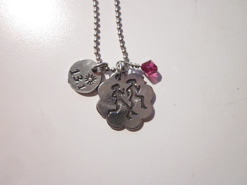
new personal record!
But, about that don't try this at home... Aftermath. More than 24 hours after, I still hurt. Don't skimp on the training and think your awesome endurance will carry you through. I mean, it WILL, but, at least in my case, I was writing checks my legs couldn't cash.
Longest run since September was 8 miles; most were between 4 and 5 miles. A total of 11 runs. Denial works really well, it does.
Yesterday Cecil and I rode out from her house to pick up our race packets in Vancouver, WA. We took the scenic route (well, mostly scenic; not possible to make Hayden Island or parts of Interstate Blvd scenic), including two crossings of the I-5 bridge and a stop for late lunch at Cup and Saucer in Kenton. All told, about 35 miles.
Bonus encounter - riding into Vancouver... Cecil: "I recognize the fairings on those bents!". Yes, indeed. Random, unannounced ride on the east side (ok, this ride east side AND Vancouver), and yes, we run into Dave and/or Edna. Every single time. Went inside and visited for a bit, then went and picked up our race packets.
Heading out of Vancouver, I heard a "Lynne! Lynne!"... Whereupon a person I had never met before introduced himself and said he recognized the bear. (!)
Great ride with Cecil. We should do this more often. I think we will.
(oh, right, I was talking about a run.)
Met Cecil right at 7am at Kettleman's for pre-race bagels and coffee. About 7:45, we thought we should go North.
Parking was a teeny bit of a challenge; we got a space 3 (or so) blocks away. Stood around. Dropped my bag in the bag drop. Visiting with Laura R. We knew other folks were running, but did not see them beforehand. Half-heartedly participated in the pre-race warmup. Got our iPods going (me - Box of Rain. Cecil - Velvet Underground. I do not think there is any intersection at all on our iPods)
13.1 miles in front of me, and face it, I had not properly trained. All I could count on was that I had run the distance before, had done a bit of running, and had the endurance from all that cycling. Finishing would be good.
We filtered up to the front, to get out ahead of the walkers. Aaaaand we were off. Cecil zipped off (she's a real jackrabbit), and I plonked along at a relatively steady pace. Got passed by all the fast girls. Out east along the river, through an industrial park, keep going... I walked through the water stops (roughly every two miles) and got some water, and sucked down a gel every 30 minutes (roughly every three miles). What? Every three miles? I was running right at 10:00? I could tell when the gel kicked in. I could also tell when it was wearing off. Turn around and head back. Lots of folks still heading out.
Plonk plonk plonk... Right around mile 9, we turned right, ran up a ramp, and down into Fort Vancouver. Well, the park that is Fort Vancouver - the fort (or a reasonably accurate reproduction) is over a bit to the east in the park. East past Pearson Field (airport). East out of the park/airfield, past some malls, then north (and up a bit of a hill), and....turning west for the last time. Still keeping close to that 10 minute mile. I don't reliably run that fast in training.
Lots of little kids all holding out their hands for high fives. Fun for both of us. West back into Fort Vancouver, then up another hill, past Officers' Row, across I-5. Getting close now!
A few more blocks, crowds getting larger, then right, up one block, right again and done!
 |
| I just finished! (picture by Susan Otcenas) |
Susan O was cheering from the sidelines. Gave them back my timing chip, and went off to find Cecil and food. Also found Susan O, Linda and Scott (Linda ran fast! Scott cheered.), Jill and Catherine.
 |
| Jill, Catherine, Cecil and me at the finish (picture by Susan Otcenas) |
And, checking my time...
bib number: 820
age: 55
gender: F
location: Portland, OR
overall place: 722 out of 1922
division place: 25 out of 86
time: 2:12:30
pace: 10:07
new personal record!
But, about that don't try this at home... Aftermath. More than 24 hours after, I still hurt. Don't skimp on the training and think your awesome endurance will carry you through. I mean, it WILL, but, at least in my case, I was writing checks my legs couldn't cash.
Sunday, October 2, 2011
Vertical Feet. Most ever.
This song played in my head for most of the climb to Lost Lake. I was pretty sure I was not going to make the control by the cut-off time - I'd need to average 7mph the whole way up...
But back to the beginning. The October OrRando brevet is traditionally John Kramer's Bikenfest, out of Hood River or Bingen. This year John proposed a two-loop route out of Hood River, with over 10,000 vertical feet of climbing. I'll come right out and say that I voted for last year's route. Really pretty, and only 7800 vertical feet. I've never done anything more than that in one go. There was a 40% (at least) chance of rain forecasted. Three years ago I DNFed on this very ride in miserable conditions, and was very much hoping that would NOT be the case this time.
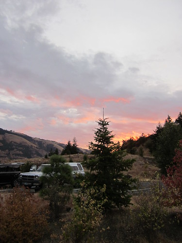
But here I was, admiring a glorious sunrise from the Twin Tunnels West Trailhead and visiting with the other riders, waiting for the start. Lesli was riding (yay!) along with the other usual suspects. Well, most of them. Lesli: "Where's Michal?"
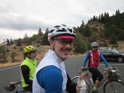
John mentioned that there were some sharp curves descending from Lost Lake, and recommended we be off the Lost Lake descent by dark. And so, at 7:30, off we went.
The first loop was out to The Dalles and a bit beyond. First we rode on the Twin Tunnels (Mosier Tunnels) trail into Mosier. Wish I'd been quicker with the camera; there was a great shot of the pack silhouetted against the Columbia River down below. Then some climbing. When we topped out, I could see what had to be Chenoweth in the distance at the bottom - we were headed in that general direction. The descent was pretty scary - lots of gusty crosswinds. I started getting tense, which meant the bike started to shimmy a bit. Knee against the top tube put an end to that, but I was happy to get down to the bottom.
My left foot was not staying attached to the pedal particularly well. Perhaps it is time to replace the cleat.
Conversations with Lesli about wool jerseys, specifically the upcoming OrRando wool jersey, triathlons, mid-life crises (or, how I ended up doing really long rides), life at UO, PBP,... Lesli never runs out of conversation, which is great. Every so often we'd look back and wonder what happened to Michal. And then... there he was! Some confusion about getting to the correct end of the trailhead, so he started about 15 minutes later, and pushed it ("flexed his awesome") to catch up. He was just hoping he wouldn't pay for that later.
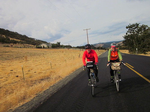
Approaching a control, we found John waiting for us - a secret control :-)
More wandering around up and down, through The Dalles and out, with Lesli, Michal, Bill, Jeff, and Norm, eventually ending up somewhere east of The Dalles, and then turned around to head back to the start. We paused in The Dalles for some supplies (Industrial Size Payday Bar for me) and water, then headed west on Old Hwy 30. This is a beautiful stretch of road, above I-84, with great views of the Columbia River, and a gentle climb (many switchbacks) up to Rowena Crest. Same highway engineer who designed the climb to Crown Point, but this one is somewhat longer.
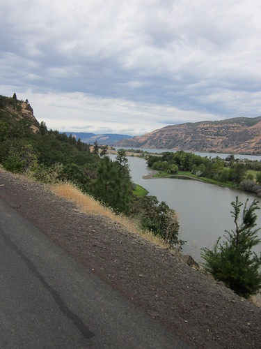
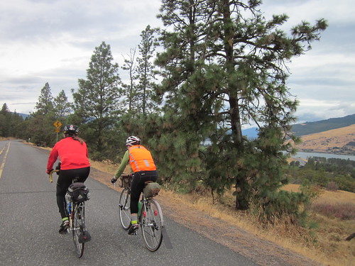
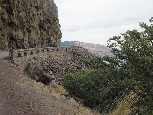
Then along the tops of the ridge, and down to Mosier for some food. The place with espresso, sandwiches and ice cream was CLOSED :-( so we went next door to the market. I had an eggroll. Should have had two. Lesli bought a corndog. Lingering issues from the Alabama public schools have rendered me unable to face a corndog. Plus, they make them with substandard cheap turkey hot dogs (an abomination all by themselves), and wrap them in the worst cornbread ever. My sister-in-law says I'd change my mind if I had one made with decent cornbread and a good Kosher hot dog. But I digress...
Checking my bike, because it was handling strangely and the shifting was off... both my S&S couplers were loose! Why, I don't know, because I crank them down pretty tight. Must have been the chipseal a couple of weeks ago. Brief pause to tighten them up. And remind myself to go back to checking them before each ride.
Up to the trailhead; brief confusion as to where the trailhead actually WAS, then up and through the tunnels again, eventually ending back at our cars. Some people had sandwiches. Others ate cookies and other junk :-) Proceeding onward, up a truly vicious climb (I walked, max grade 14%), and then southward towards Parkdale. Very pretty. This loop of the ride followed The Fruit Loop. I saw several purveyors from our farmer's market. Pears were looking about ready to harvest. Then onto a very discouraging stretch of Hwy 35. Bits of drizzle, but nothing very exciting. I stopped and removed the leg warmers. Uphill, and a nasty chipseal surface. Lesli and Michal pulled away here; I wouldn't see them again for a very long time. Caught up to Bill, then moved on.
Great view of Mt Hood from the north.
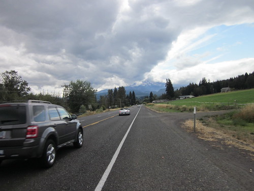
Finally a descent (not that anyone should get excited here; lots more climbing to come), and some rollers into Parkdale. Greg came by at this point, and we arrived in Parkdale together. I desperately needed something to eat, and bought a turkey wrap. Consumed half of it right on the spot (it was very big).
Then off toward Dee (more orchards; the Hood River Valley is really pretty), and the turnoff to the final really big climb of the day. John thoughtfully provided the cumulative elevation gain on the cue sheet, and I could see that between miles 90 and 96, it would be interesting.
Greg came by and went ahead. I eventually caught and passed another rider. This is so very rare that I do feel compelled to mention it :-) Made it to the Wahtum Lake turnoff. Slog, slog, slog. I had to keep my average above 7mph to make the Lost Lake Store (14 mi from the turnoff) by the cutoff time; 5:51. Every so often I'd see a rider headed down. I was surprised how long it did take to see the riders. I figured they'd be long gone. Never did see the Lolo Pass turn, but eventually realized I was on the miles 90-96 stretch. Every so often I'd take a few bites of the turkey wrap. It was helping. And every so often I'd stop. It was a very pretty stretch of road, but it was also a soul-sucking slog uphill. Never got above 7%; mostly 5% with bits of 3%. I liked those. Stopped and sucked down a gel. Conversations in my head about turning around, or laying down and dying right there. It was getting maybe a bit damp; pulled on the TBB vest. Saw a few more riders headed down. Then, glory, hallelujah, a rider said - the turn is right there! Down to the store; saw Lesli leaving. She told me Michal was still inside and pretty cold. Got the store with over 20 minutes to spare. Greg said he should have told me it was an info control; the times are just on the cue sheet for pacing... "I knew you'd kill yourself getting up here". Yeah.
Went inside for some food. Found Michal. He was pretty cold and shaky. It wasn't almost a bonk. It was a real bonk. I have done this to myself enough times that I know it when I see it. Refilled my bottles (consumed the ENTIRE bottle of Nuun on the way up). Drank a hot chocolate. Should have eaten something myself. Stupid. Visited with the proprietor. Washed my face - I was covered in salt crust. That felt so good. Went back out to the bike to get all the clothing I was going to put on for the descent. Preteen girl walking by: "that is SUCH a pretty bike. Purple is my favorite color!" :-)
A couple of riders came and left. Added a few layers (dry baselayer. heaven.). Michal moved past the "if I eat that I am going to throw up" phase, and we headed back down. Really nice pavement at the top. We leapfrogged down - Michal is a faster descender, and he'd stop every so often, I'd zip by, and then he'd come flying by. Then we hit the road construction and slowed down somewhat, making it to the bottom before dark. Barely. Removed a couple of layers, as it was now much warmer (dropping about 2000 feet will do that), and headed out for the last 15 miles.
And then I bonked. We walked one uphill. I finished off the Payday bar and extracted my tortilla- Nutella wrap and finished it off. We were both getting stupid and forgot we made one turn and made it again at the next intersection... And we were lost. Michal called John, and I finally remembered I had Google Maps on my phone. Between all that we got un-lost, and found Jeff back at the intersection where we should have gone straight.
More wandering through Hood River in the pitch black, but I caught a lot of the road signs at crucial points. Lesli and Sarah cheered us on through downtown. Lesli looked like she'd already had her shower. Sigh. Then, with 7 minutes left, up the last half mile. The food had kicked in and I wasn't bonking anymore. Would we make it? It would be very, very close.
We did. On the final minute. John said it would have been a photo finish, but, of course, it was 9pm and pitch dark.
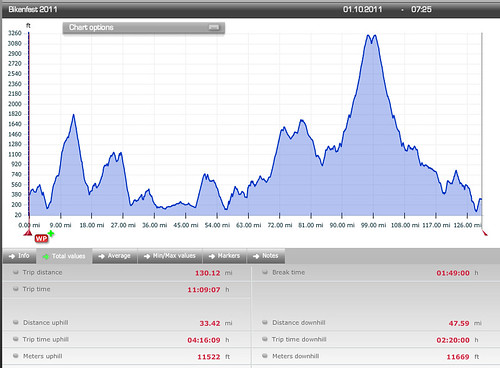
A bit of visiting, some stargazing (WOW! lots of stars!), a Coke, a nice crunchy Honeycrisp apple, and it was time to drive home. Put the iPod on the Epic playlist, cranked up the volume and headed west. Home by 10:30. Still must unload the car. A visit to the scale says I dropped 6 pounds. They'll be back, but I guess I rode really hard yesterday.
All the pics here
Stats: 130.2 mi
11522 vertical feet (OW)
11.66mph avg
But back to the beginning. The October OrRando brevet is traditionally John Kramer's Bikenfest, out of Hood River or Bingen. This year John proposed a two-loop route out of Hood River, with over 10,000 vertical feet of climbing. I'll come right out and say that I voted for last year's route. Really pretty, and only 7800 vertical feet. I've never done anything more than that in one go. There was a 40% (at least) chance of rain forecasted. Three years ago I DNFed on this very ride in miserable conditions, and was very much hoping that would NOT be the case this time.
But here I was, admiring a glorious sunrise from the Twin Tunnels West Trailhead and visiting with the other riders, waiting for the start. Lesli was riding (yay!) along with the other usual suspects. Well, most of them. Lesli: "Where's Michal?"
John mentioned that there were some sharp curves descending from Lost Lake, and recommended we be off the Lost Lake descent by dark. And so, at 7:30, off we went.
The first loop was out to The Dalles and a bit beyond. First we rode on the Twin Tunnels (Mosier Tunnels) trail into Mosier. Wish I'd been quicker with the camera; there was a great shot of the pack silhouetted against the Columbia River down below. Then some climbing. When we topped out, I could see what had to be Chenoweth in the distance at the bottom - we were headed in that general direction. The descent was pretty scary - lots of gusty crosswinds. I started getting tense, which meant the bike started to shimmy a bit. Knee against the top tube put an end to that, but I was happy to get down to the bottom.
My left foot was not staying attached to the pedal particularly well. Perhaps it is time to replace the cleat.
Conversations with Lesli about wool jerseys, specifically the upcoming OrRando wool jersey, triathlons, mid-life crises (or, how I ended up doing really long rides), life at UO, PBP,... Lesli never runs out of conversation, which is great. Every so often we'd look back and wonder what happened to Michal. And then... there he was! Some confusion about getting to the correct end of the trailhead, so he started about 15 minutes later, and pushed it ("flexed his awesome") to catch up. He was just hoping he wouldn't pay for that later.
Approaching a control, we found John waiting for us - a secret control :-)
More wandering around up and down, through The Dalles and out, with Lesli, Michal, Bill, Jeff, and Norm, eventually ending up somewhere east of The Dalles, and then turned around to head back to the start. We paused in The Dalles for some supplies (Industrial Size Payday Bar for me) and water, then headed west on Old Hwy 30. This is a beautiful stretch of road, above I-84, with great views of the Columbia River, and a gentle climb (many switchbacks) up to Rowena Crest. Same highway engineer who designed the climb to Crown Point, but this one is somewhat longer.
Then along the tops of the ridge, and down to Mosier for some food. The place with espresso, sandwiches and ice cream was CLOSED :-( so we went next door to the market. I had an eggroll. Should have had two. Lesli bought a corndog. Lingering issues from the Alabama public schools have rendered me unable to face a corndog. Plus, they make them with substandard cheap turkey hot dogs (an abomination all by themselves), and wrap them in the worst cornbread ever. My sister-in-law says I'd change my mind if I had one made with decent cornbread and a good Kosher hot dog. But I digress...
Checking my bike, because it was handling strangely and the shifting was off... both my S&S couplers were loose! Why, I don't know, because I crank them down pretty tight. Must have been the chipseal a couple of weeks ago. Brief pause to tighten them up. And remind myself to go back to checking them before each ride.
Up to the trailhead; brief confusion as to where the trailhead actually WAS, then up and through the tunnels again, eventually ending back at our cars. Some people had sandwiches. Others ate cookies and other junk :-) Proceeding onward, up a truly vicious climb (I walked, max grade 14%), and then southward towards Parkdale. Very pretty. This loop of the ride followed The Fruit Loop. I saw several purveyors from our farmer's market. Pears were looking about ready to harvest. Then onto a very discouraging stretch of Hwy 35. Bits of drizzle, but nothing very exciting. I stopped and removed the leg warmers. Uphill, and a nasty chipseal surface. Lesli and Michal pulled away here; I wouldn't see them again for a very long time. Caught up to Bill, then moved on.
Great view of Mt Hood from the north.
Finally a descent (not that anyone should get excited here; lots more climbing to come), and some rollers into Parkdale. Greg came by at this point, and we arrived in Parkdale together. I desperately needed something to eat, and bought a turkey wrap. Consumed half of it right on the spot (it was very big).
Then off toward Dee (more orchards; the Hood River Valley is really pretty), and the turnoff to the final really big climb of the day. John thoughtfully provided the cumulative elevation gain on the cue sheet, and I could see that between miles 90 and 96, it would be interesting.
Greg came by and went ahead. I eventually caught and passed another rider. This is so very rare that I do feel compelled to mention it :-) Made it to the Wahtum Lake turnoff. Slog, slog, slog. I had to keep my average above 7mph to make the Lost Lake Store (14 mi from the turnoff) by the cutoff time; 5:51. Every so often I'd see a rider headed down. I was surprised how long it did take to see the riders. I figured they'd be long gone. Never did see the Lolo Pass turn, but eventually realized I was on the miles 90-96 stretch. Every so often I'd take a few bites of the turkey wrap. It was helping. And every so often I'd stop. It was a very pretty stretch of road, but it was also a soul-sucking slog uphill. Never got above 7%; mostly 5% with bits of 3%. I liked those. Stopped and sucked down a gel. Conversations in my head about turning around, or laying down and dying right there. It was getting maybe a bit damp; pulled on the TBB vest. Saw a few more riders headed down. Then, glory, hallelujah, a rider said - the turn is right there! Down to the store; saw Lesli leaving. She told me Michal was still inside and pretty cold. Got the store with over 20 minutes to spare. Greg said he should have told me it was an info control; the times are just on the cue sheet for pacing... "I knew you'd kill yourself getting up here". Yeah.
Went inside for some food. Found Michal. He was pretty cold and shaky. It wasn't almost a bonk. It was a real bonk. I have done this to myself enough times that I know it when I see it. Refilled my bottles (consumed the ENTIRE bottle of Nuun on the way up). Drank a hot chocolate. Should have eaten something myself. Stupid. Visited with the proprietor. Washed my face - I was covered in salt crust. That felt so good. Went back out to the bike to get all the clothing I was going to put on for the descent. Preteen girl walking by: "that is SUCH a pretty bike. Purple is my favorite color!" :-)
A couple of riders came and left. Added a few layers (dry baselayer. heaven.). Michal moved past the "if I eat that I am going to throw up" phase, and we headed back down. Really nice pavement at the top. We leapfrogged down - Michal is a faster descender, and he'd stop every so often, I'd zip by, and then he'd come flying by. Then we hit the road construction and slowed down somewhat, making it to the bottom before dark. Barely. Removed a couple of layers, as it was now much warmer (dropping about 2000 feet will do that), and headed out for the last 15 miles.
And then I bonked. We walked one uphill. I finished off the Payday bar and extracted my tortilla- Nutella wrap and finished it off. We were both getting stupid and forgot we made one turn and made it again at the next intersection... And we were lost. Michal called John, and I finally remembered I had Google Maps on my phone. Between all that we got un-lost, and found Jeff back at the intersection where we should have gone straight.
More wandering through Hood River in the pitch black, but I caught a lot of the road signs at crucial points. Lesli and Sarah cheered us on through downtown. Lesli looked like she'd already had her shower. Sigh. Then, with 7 minutes left, up the last half mile. The food had kicked in and I wasn't bonking anymore. Would we make it? It would be very, very close.
We did. On the final minute. John said it would have been a photo finish, but, of course, it was 9pm and pitch dark.
A bit of visiting, some stargazing (WOW! lots of stars!), a Coke, a nice crunchy Honeycrisp apple, and it was time to drive home. Put the iPod on the Epic playlist, cranked up the volume and headed west. Home by 10:30. Still must unload the car. A visit to the scale says I dropped 6 pounds. They'll be back, but I guess I rode really hard yesterday.
All the pics here
Stats: 130.2 mi
11522 vertical feet (OW)
11.66mph avg
Sunday, September 18, 2011
I Did This Ride Just Because
The R-12 is complete. I didn't NEED to do another Rando ride this month. But there it was - the SIR Fall 200km. Starting in Olympia and heading west. The Kitsap and areas south. Bill wanted to ride, but was undecided about going up the night before or driving up in the morning. Portland Timbers game the night before, so I'd have to drive up. We joined forces.
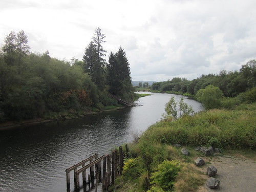
Due to the aforementioned Timbers game (they won!) and pre-ride preparations, I had a grand total of 3.5 hours of sleep when my alarm went off at 3:30am.
Collected Bill (who had an alarm clock mishap) and started north, only 45 minutes past our planned departure time. Would we make it before the 7am start? Yes indeed, arrived at 6:45am, fell out of Shiny Red Element (Bill now covets my car. He can get in line.), registered, pulled on my shoes, jacket, helmet and reflective gear, and pulled out with the group at 7am.
Of course, 5 miles into it, that was mostly the last I'd see of anyone else. The first part of the ride had us working our way up to Steamboat Island. Saw a pack of riders headed back. It was grey and gloomy, and after Steamboat Island, it commenced to rain. I had a rain jacket. I did not have booties, and I was wearing my Keen sandals. My feet did get cold and wet.
Then more riding around Kamilche Point and the Little Skookum Inlet (I think) by Taylor Towne, where I checked the route sheet and elected to press on to Arcadia before buying any food. I had plenty. The controls on this route were mostly info controls in remote locations. Only two on-course timed controls.
Rained off and on, finally giving it up a bit before Arcadia. I felt the lack of my usual coffee intake. But wait! I had Penguin Caffeinated Mints! Time to give them a try. Not only were they tasty, and perked me up a bit, but my poor frozen feet warmed up as well. Found another rider at the store in Arcadia, which the map reveals as just SE of Shelton (hey! I've been THERE!). I also found an Industrial Size Payday Bar, which kept me going all the way to the timed control at 75 miles.
After Arcadia-Shelton, it finally warmed up enough that I took off the jacket and started taking a few pictures. The sun came out a few times.
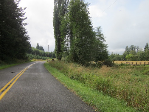
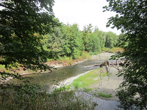
Long stretch on Cloquallum Road, followed by another long stretch on Cloquallum-Satsop Road, and finally at 75 miles, the timed and staffed control at Schafer State Park.
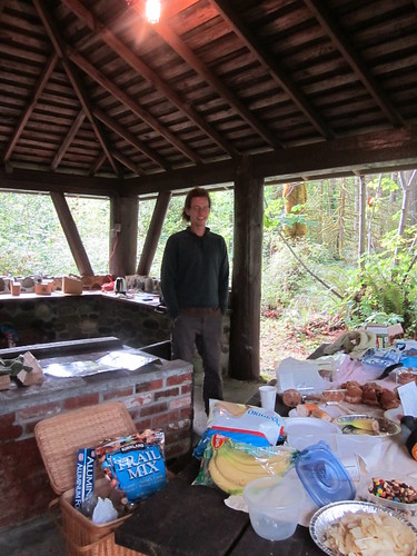
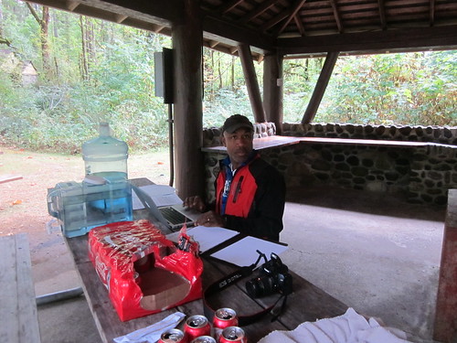
Found Ian and Mill and lots of food. I stuck around for probably longer than I should have, but it was nice to have a conversation with someone other than myself for a bit. Ian did tell me that there were 8-10 riders still behind me. He also said there would be a fun descent from the Satsop (never finished) nuclear power plant, which we'd ride right by.
Satsop road was pretty, if long. Lots of long stretches on this route, most in what seemed to be pretty remote areas. Not hardly any traffic. I had to keep eating. Still working on that Payday bar. Yes, it was that big.
Through the town of Satsop, across Hwy 12, and the flats to the last real climb up to the nuclear plant.
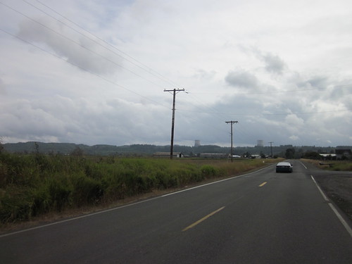
Not a hard climb by any means, but after the wind and rolling hills and chipseal, I was starting to fade a bit. Paused at the summit to get a picture or two, take some Ibuprofen, and eat. The descent was every bit as wonderful as promised. I don't believe I have EVER seen nicer pavement.
Another long, mostly flat and headwindy stretch to get to Hwy 12, a couple miles there, and the next timed control in Malone. I was definitely tired, bought Fritos and a Doubleshot, sat on the store steps and consumed them. Mox Chehalis road wound its way through a valley. More chipseal and headwinds. And some idiots in a pickup with the entire road wide open, who felt the need to pass with less than a foot of room between us. They were the only ones all day - every other driver was very considerate.
Finally popped out for the 10.9 mile stretch on SR 8. Slight climb for the first 5 or 6 miles. But I had my very own lane (a very wide, non-chipseal shoulder) and no headwind. And then... a descent. For the rest of the SR-8 leg, and the next bit on Old Hwy 410.
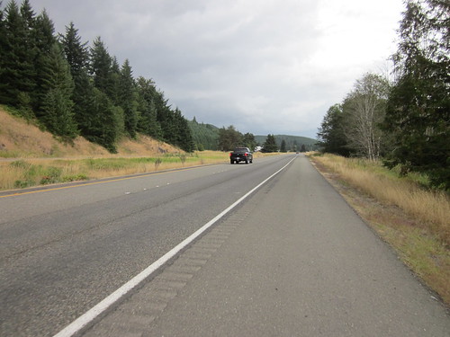
Finally, crossing (I honestly don't remember if there was an overpass or underpass) Hwy 101, and back onto Mud Bay Rd. Past the Blue Heron Coffee Co, up the hill, and into Olympia. About a mile from the end it started to rain with extreme prejudice, so a brief stop to pull the jacket back on. Past the Safeway where we started, looking for Division St and the pizza place.... And there it was.
Mill came out and grabbed my bike, pointed me inside, and got me some hot tea. Enjoyed visiting with the other riders and volunteers and Narayan (who dropped by). Pizza. Hot tea. Listening to many PBP stories. Gradually feeling less disoriented. Rode back to the Safeway with John and Jesse to get the car (and the dry change of clothes). Back to Vic's Pizza as Bill arrived. Dry clothes, more visiting, and negotiating with Bill on who would drive. More to the point, if I drove first, Bill could have a beer.
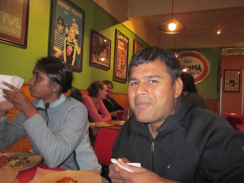
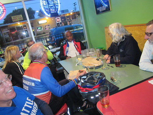
The drive home was interesting. It was pouring and dark, with the attendant limited visibility. I finally had to give it up at the rest stop around exit 45. Bill took over, and, of course, it stopped raining. Brief stop for refueling (both the car and us), and home. I kept conking out once we crossed the I-5 bridge, but did get alert enough to drive the 1.2 miles from Bill's home to mine. I didn't even unpack the car. Shower and bed.
So, 11:06 total elapsed time, 127.52 miles, 13.09 avg (oh, that's slow), 6240 vertical feet.
Due to the aforementioned Timbers game (they won!) and pre-ride preparations, I had a grand total of 3.5 hours of sleep when my alarm went off at 3:30am.
Collected Bill (who had an alarm clock mishap) and started north, only 45 minutes past our planned departure time. Would we make it before the 7am start? Yes indeed, arrived at 6:45am, fell out of Shiny Red Element (Bill now covets my car. He can get in line.), registered, pulled on my shoes, jacket, helmet and reflective gear, and pulled out with the group at 7am.
Of course, 5 miles into it, that was mostly the last I'd see of anyone else. The first part of the ride had us working our way up to Steamboat Island. Saw a pack of riders headed back. It was grey and gloomy, and after Steamboat Island, it commenced to rain. I had a rain jacket. I did not have booties, and I was wearing my Keen sandals. My feet did get cold and wet.
Then more riding around Kamilche Point and the Little Skookum Inlet (I think) by Taylor Towne, where I checked the route sheet and elected to press on to Arcadia before buying any food. I had plenty. The controls on this route were mostly info controls in remote locations. Only two on-course timed controls.
Rained off and on, finally giving it up a bit before Arcadia. I felt the lack of my usual coffee intake. But wait! I had Penguin Caffeinated Mints! Time to give them a try. Not only were they tasty, and perked me up a bit, but my poor frozen feet warmed up as well. Found another rider at the store in Arcadia, which the map reveals as just SE of Shelton (hey! I've been THERE!). I also found an Industrial Size Payday Bar, which kept me going all the way to the timed control at 75 miles.
After Arcadia-Shelton, it finally warmed up enough that I took off the jacket and started taking a few pictures. The sun came out a few times.
Long stretch on Cloquallum Road, followed by another long stretch on Cloquallum-Satsop Road, and finally at 75 miles, the timed and staffed control at Schafer State Park.
Found Ian and Mill and lots of food. I stuck around for probably longer than I should have, but it was nice to have a conversation with someone other than myself for a bit. Ian did tell me that there were 8-10 riders still behind me. He also said there would be a fun descent from the Satsop (never finished) nuclear power plant, which we'd ride right by.
Satsop road was pretty, if long. Lots of long stretches on this route, most in what seemed to be pretty remote areas. Not hardly any traffic. I had to keep eating. Still working on that Payday bar. Yes, it was that big.
Through the town of Satsop, across Hwy 12, and the flats to the last real climb up to the nuclear plant.
Not a hard climb by any means, but after the wind and rolling hills and chipseal, I was starting to fade a bit. Paused at the summit to get a picture or two, take some Ibuprofen, and eat. The descent was every bit as wonderful as promised. I don't believe I have EVER seen nicer pavement.
Another long, mostly flat and headwindy stretch to get to Hwy 12, a couple miles there, and the next timed control in Malone. I was definitely tired, bought Fritos and a Doubleshot, sat on the store steps and consumed them. Mox Chehalis road wound its way through a valley. More chipseal and headwinds. And some idiots in a pickup with the entire road wide open, who felt the need to pass with less than a foot of room between us. They were the only ones all day - every other driver was very considerate.
Finally popped out for the 10.9 mile stretch on SR 8. Slight climb for the first 5 or 6 miles. But I had my very own lane (a very wide, non-chipseal shoulder) and no headwind. And then... a descent. For the rest of the SR-8 leg, and the next bit on Old Hwy 410.
Finally, crossing (I honestly don't remember if there was an overpass or underpass) Hwy 101, and back onto Mud Bay Rd. Past the Blue Heron Coffee Co, up the hill, and into Olympia. About a mile from the end it started to rain with extreme prejudice, so a brief stop to pull the jacket back on. Past the Safeway where we started, looking for Division St and the pizza place.... And there it was.
Mill came out and grabbed my bike, pointed me inside, and got me some hot tea. Enjoyed visiting with the other riders and volunteers and Narayan (who dropped by). Pizza. Hot tea. Listening to many PBP stories. Gradually feeling less disoriented. Rode back to the Safeway with John and Jesse to get the car (and the dry change of clothes). Back to Vic's Pizza as Bill arrived. Dry clothes, more visiting, and negotiating with Bill on who would drive. More to the point, if I drove first, Bill could have a beer.
The drive home was interesting. It was pouring and dark, with the attendant limited visibility. I finally had to give it up at the rest stop around exit 45. Bill took over, and, of course, it stopped raining. Brief stop for refueling (both the car and us), and home. I kept conking out once we crossed the I-5 bridge, but did get alert enough to drive the 1.2 miles from Bill's home to mine. I didn't even unpack the car. Shower and bed.
So, 11:06 total elapsed time, 127.52 miles, 13.09 avg (oh, that's slow), 6240 vertical feet.
Subscribe to:
Posts (Atom)
