Showing posts with label Arizona. Show all posts

Sunday, March 31, 2019

Perm Pop in Tucson

Being as we were going to be in Tucson for a week, I started looking around for a RUSA perm to ride.  Michal’s excellent map provided a list of perm pops (typically just over 100k, about all I’m up to at this time), and John Lee’s #3752 Rillito - Pantano - Saguaro Sashay showed only 1600 vertical feet and a lot of separated bike path.  And a National Park (gotta exercise that Senior National Park Pass sometime).

Excellent.  An exchange of email, including a scan of the required signed release and a general range of days I might choose to ride during (LOVE the new “slippery perm start time” rules, I DO.  Especially during vacation, when one isn’t all that super detailed about daily plans.)

We drove down to Tucson from Portland, so I did’t have to disassemble and pack a bike; brought the Lemond Zurich, with the Specialized Power Mimic saddle I am trying out.

So, after a careful study of the weather (there’s altitude and heat here, which I am not really accustomed to), picked the least hot day.  The plan was that I’d start around 9am; Fitz would drop me off at the start and play a nearby round of golf, as these activities consume about the same amount of time.

Got to the Jack in the Box, unloaded the bike, said goodbye and had my traditional pre-ride orange juice, breakfast being consumed previously.


Started out, and quickly realized that I didn’t need to navigate the first 2 miles, because all the cyclists were headed to the Loop, just like me.  The outgoing leg of the first out and back (after a bit of off-course, caused by turning immediately left onto the first bridge I saw, rather than the one just a bit up on the right) flew right along.  It is spring, and Tucson is blooming.  Passed a couple of parks with restrooms to remember for the return.

Got to the turnaround, snapped a picture of the info control and headed back.  Wait.  There’s a headwind.  Not supposed to have a headwind.  It wasn’t that bad, but it was more fun zipping along at 18-19mph.

I was using RWGPS to direct me along.  It seemed a bit confused after the turn until a good mile past where I had gotten on the Loop at the Mountain Ave Bridge.  I was “off course”, which it claimed was 8.6 ft to the right.  Or, in the Rillito River Wash.  Go figure.  Anyway, as I was to be on the Loop for awhile, it didn’t much matter.

The Tanque Verde crossing was interesting, in that I had to cloverleaf up to the road, cross the wash, and continue on the other side, to transition to the Pantano River Path.  A bit drier out this way, and some super trippy trail decorations - painted rocks around plants, glittery stuff, and so on.

The Loop is essentially a 2 lane road, but for non-motorized transport.  Nice 2 lane road.  It was fabulous to ride on.

Leaving the Loop at mile 27.7 to get onto Golf Links Rd, heading out to Saguaro National Park.  If you are looking for services of the food variety (you’ll find restrooms and water along the Loop at several points; not marked, but you’ll see them off to the side), Golf Links Rd is where you’ll find it.  There’s a shiny new Circle K on the right, and various fast food options on either side; you’ll be returning this way, and there’s another Circle K at Harrison and Golf Links.  That’s about all there is to recommend about Golf Links, but it does get you where you are needing to go.  After a brief stretch on Houghton, you turn onto Old Spanish Trail, which has considerably less traffic and pristine pavement.

And then, not quite 3 miles along, you’ll come to the Saguaro National Park entrance.  There are restrooms, a bottle filling station, and a nice covered area with more water, if you want to pause to reapply sunscreen, refill your bottles, and eat your banana.

If you’ve not got a National Park pass, there is a fee to enter.  The ranger said “you know the drill” (MANY MANY CYCLISTS HERE), and I said “nope”, and she immediately warned me about the first descent, which is super steep and has a hard right at the bottom.  It comes right up, too.  I really  appreciated that warning.

So, the Cactus Forest Loop (the road in the park) is ranked one of the top 15 National Forest roads for a bike ride.  As it was still early enough in the spring, everything was green and flowering.  The number of saguaro cacti was staggering.  Apparently they grow here in greater numbers than anywhere else.  Wish I’d had a proper camera.  I took pictures, but they don’t really capture it.


The route is one-way until the Tanque Verde trailhead access (also signed “Picnic Area”), so you can enjoy the first 3.4 miles of delightful roller coaster riding without worrying about oncoming vehicles.  The speed limit is 15mph, so the chances of unpleasant vehicle interaction are greatly reduced.  I was there on a weekday; it might be more crowded on a weekend.  Lots of pull outs if you want to take pictures.

After the first info control at Loma Verde, the road does start a reasonably steady climb with not as many bits of downhill.  Not depressingly steep, though.  Be sure to keep pushing the water and electrolytes.


After the Tanque Verde info control, it is downhill for miles.  Old Spanish Trail rolls a bit, but then Golf Links Rd rewards you with a downhill all the way to the Loop.  The turn to get back on the Loop is a left at Pantano Parkway.  I kind of spaced there, so did a Copenhagen Left at the crosswalk after the turn.


Then it is just 13 miles back on the path/Mountain Ave/Ft Lowell Rd.  You can cut into the parking lot at the Sketchers and get back to the Jack in the Box (if that is where you are choosing to finish) without having to go all the way to Campbell Ave.

It is a delightful ride, and I’d recommend it if you are planning to be in Tucson.

Thursday, February 27, 2014

Arivaca CCW 210km. In Arizona!

I have taken to suggesting that our winter week-in-the-sun happen in a place where there is also randonneuring.  When we planned this year's escape, I picked Tucson.  Friend Susan O had ridden the Arivaca 210km perm, and recommended it.  Husband: "see if you can find someone to ride with you!".  Well, ok.  Joined the AZRandon google group and advertised.  And got a response!

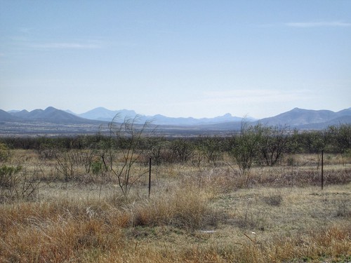
View to the north

After some email exchange finding a mutually agreeable date and time, Susan R and I registered for the counterclockwise version of the route - she doesn't like riding on Ajo Rd after dark.  Something about heavy traffic and junk on the shoulder.  Either way was fine with me.

Our respective spouses dropped us off at 6:45am at the McDonalds.  Bought some cookies, put on my summer shoes, said goodbyes, and headed out.  It was still quite chilly; I was wearing arm warmers, knee warmers, a windbreaker and a wind/reflective vest.  The shoulder was pretty yucky - expansion bumps and debris.  It improved after 5 or 6 miles, and the traffic dropped off as well.

I had fiddled with the adjustment on my new saddle, and there was some unfavorable interaction with the saddlebag and the rear wheel.  Several pauses to try to get it to that sweet spot of comfort and non-interference.  The Rachet Rocket got much use.  Susan wants one.

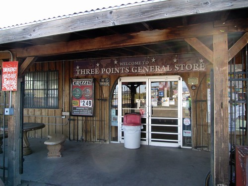
Three Points General Store

After 15 miles of headwind and saddle tweaking, we arrived at the first control.   Still not warm enough to remove the jacket.  Consumed a banana and some V-8.  I made sure I had plenty of water, including an extra bottle.  Susan offered to carry it, because my saddlebag was still having issues.  We had 45 miles of desert and no services.

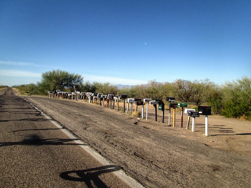
Long line of mailboxes on Arivaca-Sasabe Rd

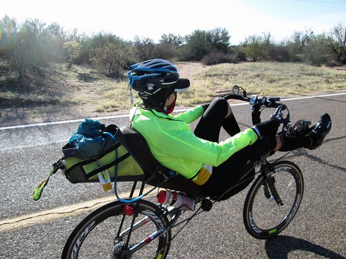
Susan riding along, Arivaca-Sasabe Rd

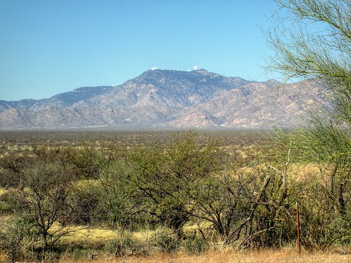
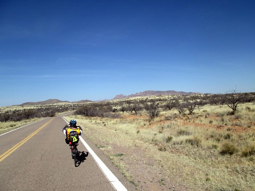
We were now out of the headwind, heading toward Mexico.  If we missed the next turn...  Lots of desert, and views of Kitt Peak Observatory.

Kitt Peak Observatory

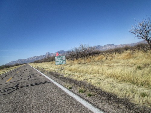
I was hoping to see a road runner, but it was not to be.  We did see many Border Patrol vehicles, and passed through a Border Control checkpoint.  Cleanest portapotties ever.

Border Control Ahead

A couple more saddle adjustments, as well as a bottle refill.  I was drinking Skratch (husband: "what is that?" me: "artisanal Gatorade") and Perpetuem.  Started out with Caffe Latte mixed with coffee.  Went to Orange Vanilla later.  Ate my sandwich.

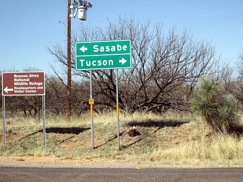
The turn we didn't want to miss

We stopped to get a picture at the turn, and wave at the Border Patrol guy sitting there in his vehicle.  Then nine miles of rolling on to Arivaca.  There is a store, but no public restroom.  We stocked up (Greek yogurt, banana, V-8) and relocated to some "shade".  The local restaurant has bathrooms off their patio, and are very nice about people coming in to use it.

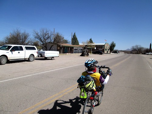
Entering Arivaca

After a not overly long stop, we continued rollering along.  Susan said the next batch of rollers were pretty fun, and, once we summitted out of Arivaca, they were indeed great fun.  Lots of cattle guards, too.  Bzzzzp!

Delightful stretch, rollering down to I-19

It was easier riding into the wind there - air is drier and thinner.

Another Border Control checkpoint.  We stopped because the sign said Stop, and chatted up the staff.  They were interested in the ride, and probably thought we were more than a little nuts.  More exceptionally clean portapotties.  Shortly after that we came up to the I-19 frontage road, and paused for a water refill.

Then north, and then west and north again through Green Valley.  Nice pavement, wide bike lanes, because they were meant to be shared with golf carts.  Susan's rear derailleur checked out here, and we pulled into a golf course parking lot to poke at it.  A guy came over and poked as well, and he got it unstuck and working again.  The last on-course control was a few miles further north - another Circle K.  Their Circle K stores are so much cleaner and nicer than I remember the ones here in Oregon.  Of course, I haven't stopped in one since forever, probably because the last one in Salem was so grubby.

More bananas and water and nuts.  Then we popped out on Duval Mine Rd, right by the Titan Missile Museum, which Fitz and I had just visited the day before.  There were really big trucks, and not very much road for a few miles.  Then a cyclist came by who knew Susan, so they chatted for awhile.  I was not in the best place, mentally.  The road was going up, it was the hottest part of the day, and the snacks had not yet kicked in.

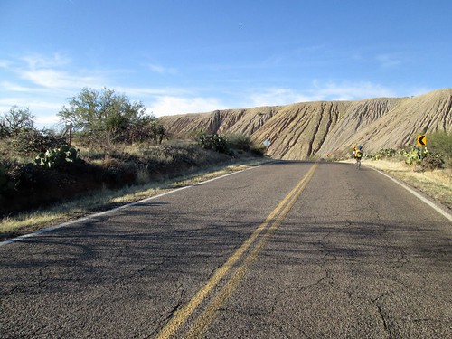
Then we turned onto Mission Rd.  Nine more miles of climbing, and then Susan promised me an awesome descent.  The food kicked in and my mood and pace improved.  We were riding along the back side of the Asarco open-pit copper mine.  Impressive huge piles of mine tailings.  Watching the miles tick by, and soon we were at the top.  I was still plenty warm, and didn't need to add any layers.

Back side of the Asarco open pit copper mine, Mission Rd

It was a great descent - nice pavement, not steep, but enough that I could keep well above 20mph most of the way down.  Eventually I could see the San Xavier Mission (we'd been there the day before as well), and knew that we'd be running out of downhill soon.  Darn.

Still not dark, but it was thinking about it.  We kept on Mission Rd for several more miles, before turning onto something else, where it finally did get dark.  Susan couldn't read her cue sheet or see her computer.  I could do both, so was calling out distances, not that there were many turns to the finish.

After the last turn onto Calle Don Miguel, I could see the McDonald's up ahead.  Whee!

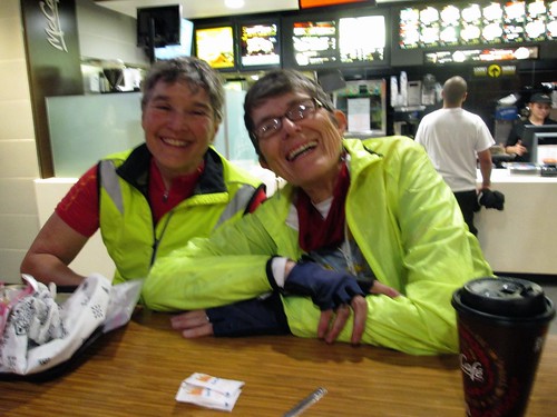
Fitz was inside waiting; tapped on the window, then went in to get a Coke and fries.  Kirk (Mr. Susan) was there also, and we visited and snacked for a bit before heading out.

Celebrating the finish

Very fun ride, and quite different from riding here in the Northwet.

130 miles/12:12 elapsed.  Wasted a lot of time with the saddle adjustment; I'll have to get it right when the bike goes back together.

Aftermath notes: while the saddle was not yet perfectly adjusted, I had none of the customary post-ride sore spots.  Not a one.  That alone is worth it.  The shoes on the other hand...  Maybe my feet are not the intended demographic for those shoes.