Showing posts with label RUSA. Show all posts

Friday, December 13, 2019

Mondial - Nevertheless, She Persisted

I discovered Randonneuring back in 2006, and officially joined up in 2007.  It has been the best 12 bicycling years of my life.  Many great rides, and many great friends.  I still ride with folks I met on my first 200km!

This past September, my cumulative RUSA kilometers rolled over 40000, which qualifies me for the RUSA Mondial Award, the circumference of the earth being roughly 40000 km.

It wasn't easy.  There were a couple of major health setbacks, one which put me off the bike for 6 months and another knocked my annual distance totals way down (still recovering from that one).

But here I am, and here it is:


By the numbers:
40028 km, ridden in a total time of 2393:54:00

Rides
30 ACP brevets
3 ACP fleches
4 RUSA brevets
3 RUSA dart populaires
21 RUSA populaires 
and
182 RUSA permanents

Ride distance
135 100ks (populaires and permanent populaires, 9 longer than 110km)
97 200ks (loosely speaking.  15 rides were in the 210-218 km distance)
10 300ks
3 360ks
3 400ks
and
2 600ks

Awards accumulated along the way:

Bikes
Some rides on my Lemond Zurich.  Not many, and not longer than a 200k.
2007- August 2010 - the Rivendell Bleriot
August 2010 onward - the custom Sweetpea.  I've worn out and replaced all the components at least once.

Acknowledgements
(a few names from the cast of thousands)
Cecil, Michal, Ray, Susan O, Kevin L, Kevin B, Jeff A, Lesli, Jason, Peg, Narayan, Keith M, and RB

Saturday, February 17, 2018

Electronic Proof of Passage; What Works for Me

Randonneurs USA has provided for Electronic Proof of Passage, acceptable forms to be agreed upon by the rider and the permanent owner.

The following works for me:

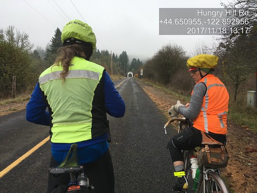
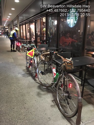
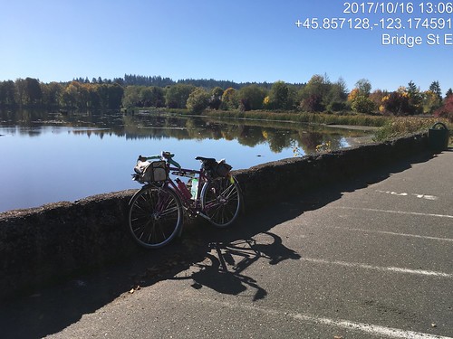
I am a total fan of Timestamp Camera, a free phone app which imprints the timestamp AND location on the picture as it is being taken.  It even has a cool feature to superimpose a translucent overlay of the MAP with location dot in the upper right corner.

As the pictures are timestamped, I will also accept them for timed controls.  You and/or your bike need to be in the picture (SR-600 type of documentation), and the picture should be of something which is clearly the control location.

Like so:

Michal and Lesli, approaching the Hoffmann Bridge

Finish at the Fred Meyer Starbucks in Beaverton

(before I discovered the text formatting options, but it is an unambiguous pic of the control!)

Sweetpea at Vernonia Lake.  Pretty picture as well as photo verification.

Settings changes for best readability:
Position - select "One line to the edge" and "Time in below"
Format - yyyy/mm/dd, lat/long, City/State; optionally select Display Map
Font - default?  I  use ArialMT
Input - if you wanted, you could put your name and route name/number.
Opacity - move the background opacity to about 1/3 of the slider.

For total fancyness, in the menu (upper row of icons), if appears that you can set it up to send email to someone as each pic is taken.  It creates the email, but you still need to tap Send.  Still Very  Cool.

Monday, July 10, 2017

Revisiting the Columbia River Gorge

I can't remember the last time I rode in the Columbia River Gorge.  March 2014, when I finished my own perm out of time?

This month's ORR 200k was the Hollywood-Wind River 200 (this version matches the cue sheet).  I'd ridden it before, back in September 2011, when I was in MUCH more fit.  But as I'd survived Dayton-Beaver, I figured I'd finish in time, if not in style.

Recruited Michal to ride with me; he and Cyndi showed up the night before, in time for dinner.  Given that the ride was starting at 6am, we'd need to get up at 4am, so early bedtime all around.  The plan was for me to drive to the start with them, and Fitz would show up at the finish (McMenamin's Kennedy School) to join us for dinner and take me home.

(There are no pictures, although it was a gorgeous day.  Sorry.)

We all met at Wilshire Park.  I was the only woman riding.  Hmph.  Checked out the park's facilities, but it was too early and they weren't open.  We'd find something suitable along the way.

Off at 6am, headed north to the Columbia River.  We had a brief confusion at the NE33rd/Columbia Blvd overpass (cue was hidden in the discussion rather than on it's own line), but quickly resolved it and found ourselves at the west boundary of the airport.  I suggested we ride on the bike path, rather than Marine Drive, and we did that whenever possible.  Best of course when the path is on the river side of the road :-)

Into Troutdale, with a brief stop at the McD's (not for food :-) ), and out the Historic Columbia River Hwy (US-30).  It is up for about 26 miles, but not oppressively so.  Michal wanted to turn onto Bell Rd, but I hauled him back.  The mist/clouds got very thick at this point, almost to "drizzle".  I knew it wouldn't last long, and hadn't even packed a rain jacket.

Popped out at the top and dropped down to Vista House, our first control.  From there, we had the fun descent down to Latourell Falls, and kept dropping for awhile, eventually arriving at the gentle rollers heading east to Warrendale, then the less gentle rollers to the end of the road (unless one wants to get on I-84) and the start of the new part of the path to Cascade Locks.  I love riding the path, but prefer it in the other direction.

Hefting the bike down the (50+, with landings every 10) stairs was a bit painful, but we got there.

Ruckel Creek was a shadow of its former self, but still pretty.

We paused very briefly to refill bottles at the park in Cascade Locks and headed over the bridge ($1 toll for bicycles now).  The crosswinds were pretty spectacular, but I got a few chances to look down and watch the bridge deck vanish as I rode along.  The fast boys were heading west just as we arrived at SR-14 on the Washington side.

We continued east to Stevenson, for a food stop at the grocery.  Terrible sandwich - too much bread, and the turkey and cheese were completely without flavor.  Ick.  Then again eastward to the turn onto Wind River Rd, passing through Carson after the turn.

Wind River Rd climbs almost 1000 feet in 8+ miles.  The tailwind wasn't really there.  Passed the RBA lurking in Carson on the way up; she said she got a ride in after we had all finished that part of the route.  We saw 4 or 5 riders headed back, including Kevin L.

Now, I have ridden this route twice before, and knew where the info control would be.  By this point, our bike computers were not agreeing with the cue sheet; I used the road mile markers, and started looking for the control after we passed by mile marker 8.  Ah, there it was (zipties on the road sign).  Saw Michal further down the road, but I was too wiped to yell.  I figured he'd see me and come back, and eventually he did.  Talking with Kevin later, he said he couldn't find the info control either.  Ate a little something, and headed back down.

Now, THAT was fun!  We could see the Oregon side of the river, and the road stair-stepping down back to SR-14.  Then we hit the Headwind.

We paused again in Stevenson for more water.  I think I drank a quart just standing there, and ate a few more things.  We'd have that headwind all the way back.  It was weird, though - it would blow really hard, and then not much; probably mitigated by the trees, and the road curves following the river's edge.  I had been worried about time when we got to the Wind River Rd control, but not so much after the return.  And, indeed, the headwind wasn't delaying us nearly as much as I thought it might.  Another brief pause at Beacon Rock (Michal was ahead and waiting for me.  There was definitely some of that today), then onward.

Lots of wildflowers in bloom on both sides of the river - sweetpeas, lupines, batchelors button, foxglove, and many I didn't know the names of.

At mile 91, the last big climb of the day appeared.  We chugged up SR-14.  Michal, of course was ahead.  I may have walked a bit.  The turn was onto Krogstad Rd, which is unsigned, and probably doesn't even rise to the level of "driveway".  Like I said, I have been here before, and knew what I was looking for.  As it turned out, the fence is gone, and the house is repainted, but the road sign on the other side did say "Riverside", and it was a bit past where the climbing lane went away.

So I was there, but no Michal.  Ok, maybe he'd gone on and would be found further along.  Krogstad is very quiet and very shaded, but no less climby :-)  A bit more walking, while eating a Payday bar, more riding, finally at the intersection with Canyon Creek.  No Michal.  At this point, our texts crossed in the mail.  He'd overshot the turn and waited for me after the turn, then came back.  Didn't find me, but found Kevin, who'd stopped in Carson.  So I texted that we'd meet up at the next control (Washougal Mercantile), and continued on.  And finally, downhill.  A slow downhill to start, but then it dropped a bit more.  After a few miles of this, I found myself at the store, and bought an ice cream bar and a Coke.  The staff hadn't seen any other riders since 2:20 (they were well-trained in the signing of the cards by now).  Halfway through the ice cream bar, Michal appeared, and a time after that, Kevin.  We all had a good sit and eat before heading on.

Michal: "what's it like now?  No more climbs?"  Nope.  Downhill to Washougal, rolling westward, a bit of a short pitch at Ellsworth, and that's about it. (He rode this with me the last time.  You'd think he'd remember.)

Washougal River Road was a gentle descent, only needed a bit of pedaling to keep up a good pace.  Drivers would stack up behind us and then pass with little difficulty; only one yeller.  And the motorcycle that almost side-swiped me in Washougal; you'd think they'd know better.

Though Washougal, through Camas.  The new roundabout after Camas onto 6th/Old Evergreen Hwy is a very welcome addition.  Old Evergreen Hwy has terrible pavement, but it does look like some parts have been replaced.  About 12 miles out, we stopped and texted our respective spouses, and then slogged on.  I should have eaten something here.

Eventually we saw the I-205 Bridge high above us and knew the turn onto Ellsworth wouldn't be far.  Up Ellsworth, up onto the bridge (that was easier), and then, once on the bridge, downhill all the way to Oregon.  Other than riding on the bridge is really noisy (bike path is in the middle of all the lanes), way fun.

We then navigated south of the airport, crossed over Lombard and Columbia, wandered the neighborhoods a bit and finished.  Cyndi was out front looking for us, but we didn't see the RBA, so she watched our bikes while we got our cards signed at the desk (and in my case, stamped; all McMenamin places have delightful rubber stamps).

Fitz appeared, and my bike was secured in the car.  Michal, Cyndi, and Kevin also went off to secure bikes.  We got a table and waited for them to come back in.  The RBA came by and got my card.  After Michal and Cyndi came in, she got Michal's card, and also Kevin's (he elected to just go home).

Beverages were ordered, and eventually food.  Cyndi kept trying to get Michal to split something with her, but he thought he could eat an entire meal himself.  Fitz usually also tries to get me to split something, but he knew better than to try that after I had just finished a big ride. :-)

12:47 elapsed time.  I lost 3 lbs, but they mostly returned.  It will be nice when I am more fit and can finish this ride in less time.  Working on it.

Wednesday, May 3, 2017

Where'd that Nice Weather Come From?

We've had an exceptionally wet winter/spring so far.  As the joke goes "it has only rained twice - once for 45 days, and then for 35 days".  Riding has not been happening.  It isn't so much the RAIN, but the accompanying floods and thunderstorms.

Ray was casting about for company on his North Plains - Carlton perm pop.  I haven't ridden it since Halloween, 2015.  Time to get back out there.  Kevin L, who has not been riding much for the last couple years, but was a consistent ride companion before that, also joined us.  Excellent!

Epic Ride Weather's Prediction for the Day
We had the standard meet-up (note: niece A, who will, in a few weeks move from being Ensign A to Lt Dr A informed me that the proper term is "rally point") at the North Plains Mc Donalds.  As always, I get in line behind someone who doesn't know what they want, have never been to a Mc Donalds, and the guy (who is nice, but) running the cash register is super chatty.

Pre-ride faffing, signing of the release, discussion about team formation for a Will Rando dart pop (or maybe it is a Dart.  Route planning for the dart pop would be easier), and eventually we were off.

Headed down Vadis Rd, Kevin was explaining why he was on his plastic bike and not his Rawland: "it is in between saddles".  I asked him how many bikes he had.  After much mental calculations... "Do I really have 13 bikes???".  Heck, he could have borrowed a saddle from one of the others!  Another person to mention when the spouse thinks my bike collection is excessive.  Actually, he can't now, because he's got just as many as I do.

I had started out the day with arm and knee warmers.  Ray and Kevin had on jackets and baselayers.

Heading down to Verboort on Evers Rd, we found two recent additions to the Washington County Quilt Barn Trail.  If RUSA ever allows photographic proof of passage, I might make up a perm pop which visits many of them.  Although I could come up with some lame info control questions, I suspect most will go for the picture proof route.

Quilt block on NW Osterman

Quilt Block on NW Osterman

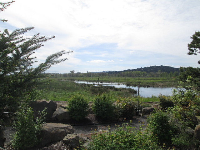
There was a substantial pause at the Fern Hill Wetlands.  After this one, I reverted to my "I'm going now; you'll catch up" practice.  The wetlands plantings have grown, and the water is wonderfully high.  Lost the armwarmers here.

Fern Hill Wetlands

Ray and Kevin discussing bike builds

There was a noticeable headwind, which boded well for the return.

The route itself is relatively uneventful, but for the One Hill.  It is a steeper climb from the north, but paved.  Withycombe (the descent) is gravel, steep, and this day, much loose gravel.  There was a lot of trepidation, but I did successfully descend.  I wasn't worried so much about the climb on the return, because it is a lot slower.

Ray, Carlton elevator, and perm card at the Carlton Bakery
We arrived at the Carlton Bakery to find it full of bicyclists, also out enjoying the nice weather.  Fortunately, they were all leaving, so we ordered our pastries and coffee, and had an outside table to ourselves.  Removed the knee warmers.

And then we headed back.  The tailwind was an excellent push.  I did end up walking the last bit of Withycombe, because I lost my line and had a choice of stopping or toppling.

Kevin and Ray at the summit of Withycombe Rd.
Yamhill elevator
Fini
Sun.  Tailwind.  Not a lot of traffic.  I even got sunburned.  This was a great day.


Tuesday, April 4, 2017

Birkie 200k Brevet Success!

So, the last 200k was unsuccessful.  Darn.  Try again.

The ORRando Birkie 200k was this past Saturday. This was my very first 200k, back in 2007.  The route has changed slightly - rather than the out and back from Vernonia, the route heads from Forest Grove to Vernonia via Gales Creek/Hwy 6/Timber Rd/Hwy 47, and then continues on Hwy 47 to Hwy 202.  To make up the missing distance, the route continues 7 miles past The Birk (formerly the Birkenfeld Store, now a cafe and music venue with irregular hours) to an info control.  The return is back to Vernonia, then taking the Banks Vernonia Trail to (natch) Banks, and heading south to Forest Grove.

Now that we've got all that straight...

Friday afternoon was spent giving Sweetpea the first bath of the year.  So very dirty, with lots of stuff stuck under the fenders.

Friday night was Rando Slumber Party at the Fitzsimmons Home for Wayward Randonneurs - Lesli, Ruth (who I finally got to meet in person), Michal and Cyndi all showed up, and we had a couple hours of social time before the 9pm bedtime.

Michal was returning a bike which was borrowed for the express purpose of loaning a bike to Bill Walton to ride.  He thought it would be fun to get a picture comparing it to my bike.


Everyone was up at 5.  Breakfast was coffee, eggs, bacon, Rye Molasses muffins, and bread which Michal baked.  He also provided the home-roasted coffee.  The kitchen was slightly over peak capacity, what with riders organizing their food and cooking breakfast :-)

Lesli and Ruth thought I'd be riding with them, but after a reveal of their planned pace... Yeah, no.  I'm not there yet.  Michal was going for time, so he'd be off as well.  But there in the parking lot I found Ray. :-)  We have been known to ride together.

Signed in.  The RBA assured me it wasn't going to rain.  She wanted to get out and do a few hours riding herself, hence the optimism.

(That's me in the pink vest.  Pic by Cyndi Wenks)

And, at 7am, away we went.  We did see Lesli and Ruth, and I almost caught them at the stoplight in Gales Creek, but it turned green, they went, and then red again by the time I got there.  Last I saw of them all day.

Deidre from Vancouver passed me on the climb.  I would have thought she'd be ahead, maybe she got started a bit after everyone else.

The Timber climb was accomplished with no stress.  I wasn't fast, but I didn't care.  The RBA was lurking after the second switchback, we chatted a bit as I slowly pedaled by.  Found Ray at the top (he gets ahead and waits and drinks coffee); we dropped into Timber and up the other side, admiring the two properties which are infested with lively barking Aussies.

Had great fun dropping through the curves to Hwy 26, and Ray and I had the gift of a no-wait crossing.

It had been drizzling off and on.  I was wearing two wool jerseys, a vest, wool knickers, long socks and a wool cap.  I had wool overgloves which never stayed on longer than three miles.  Left the booties in Michal's car.  I did have an "it might rain" jacket and Rainlegs, but never pulled them on.

I can't think of a time I rode the stretch from Hwy 26 to Vernonia as fun.  Usually raining with a headwind, or trying to keep up with the group.  I had fun this day.  Came up on Ray (our riding style is best described as "leapfrog"); he'd decided it really was raining.  Kept on going; he found me just before Vernonia.  We stopped at Black Bear Coffee (another punch for my card!), and found RB, who was riding Ray's perm pop and hanging out.

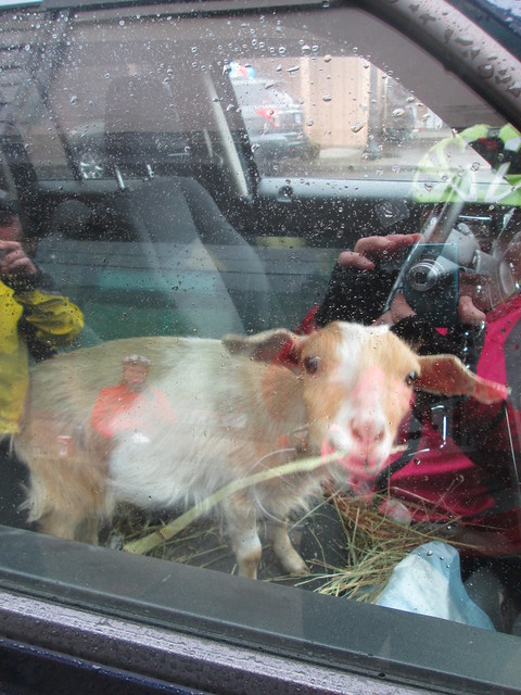
Of great interest in Vernonia was the goat in the truck.  Inside the truck.  On the front seat.

Passenger Goat

After a bottle refill (no guaranteed food/water for the next 100k), some coffee, and a substantial snack, I headed out.  Ray wasn't quite ready.  I had fun riding along here as well.  Ray found me around Mist, and then stopped again.  I got to Birkenfeld and pulled over to eat some rice pudding and a hard boiled egg, and we set out to find the info control.

Ray

By this point, 5 or so riders had passed us heading back.  Once past Birkenfeld, Hwy 202 gets hilly - short, abrupt ups and downs, with many crossings of the Nehalem River.  The first 4 miles went quickly, the last 3, not so much. Found Ray at the control.  Holden arrived just as we were turning back.


If you look close, you'll see Ray up ahead

Nehalem River

Back to Birkenfeld - The Birk wasn't technically open, but Ray's bike was there.  So I went in and the proprietor grabbed my water bottle and filled it (he's nice that way), took care of some other business, and we headed back to Vernonia.

Near Mist

We were supposed to have a tailwind.  Not so much.  So it was rather more of a slog than I had thought it might be, and kept checking my odometer more than necessary.  But we kept at it, and held a reasonably steady pace, and got to Vernonia in good time.  Fine dining at the Shell Station (deviled eggs!) which we took over to Anderson Park, which has restrooms with no line, and running water.


So, now we were in Vernonia, and, as Ray put it, "heck, we are already done".  Well, 30 miles to go, but we know them so very well. Ten miles of easy climb, ten miles of perfect descent, and ten miles of flat surface streets.

We were now on the Banks Vernonia Trail.  Yay.  No drivers, no idiots in pickups either coal-rolling or close passing (with much laying on of horn).  Aside: the only driver I signaled not to pass because I could see oncoming traffic, who started to edge out to pass, then saw the car and dropped back, was a police officer.

So, on the trail.  I could tell I was tired; not ascending at my usual pace.  But it was now sunny, and we had tons of time, and the shared goal of finishing in 12 hours would be nice (Ray's first 200k in 18 months).  We got to Tophill, and I gave it up and walked the last two switchbacks.  It was either that or fall over.  I found Ray at the Stub Stewart road crossing, and we then happily bombed on down.


There was a picture pause for a clump of blooming trilliums, and then, when passing by Wingham Farms (cool, they have a website!  Go visit!), we stopped to talk with Julie (the farmer), who said she really needed a t-shirt that identified her as Romulus and Remus' mother.  Long discussion about their farm.

Julie, one of the farmers at Wingham Farms

Romulus hanging out on the trail

We had gotten to which sheep her neighbor was raising (Texel - a Dutch down breed - meat sheep, but quality fleece), when Holden arrived.  His wife is also into fibers, so the conversation might have gotten a bit fiber-geeky.

So.  Time is slipping by.  Gotta go.  After a brief stop at the trailhead, we headed out for the last 9 miles.  When we got to the turn onto Roy Road, Ray went straight.  Clearly autopiloting back to North Plains.  Holden followed right along :-)  I yelled, they came back.

Ray got ahead at the first traffic circle, and finished just before us.  But our official time was 11:59 elapsed.  Good enough for me.

 
(Ray and I at the finish.  Pic by Cyndi Wenks)

Michal and Cyndi were hanging around, because they were going to drop me back home, but Fitz texted that he was on his way over.  So they stuck around long enough to say hi, and then started their long drive down south.


The RBA wanted to know if she'd see me in 2 weeks for the 300k.  Mmm.  Not this year.  Not ready.  I hurt in places that have never hurt before.  The 200ks will have to be a little more routine before I make the distance jump.

Fitz and I got dinner there, poked our head back in to say goodbye to the RBA (there had been still one rider out; he finished while we were eating), and headed home ourselves.

What went well:

  • I never put on the rain jacket.  It just wasn't raining hard enough, and, midafternoon, cleared off for good.  I think my shoes are waterproof for persistent mist/drizzle.
  • I kept up on the food.  This trip the food offerings brought along were: 2 packets of Gatorade/maltodextrin (and one in the bottle), hard boiled eggs, two containers of rice pudding, two Rye Molasses muffins with butter, random Kind bars, a Payday bar, and some other little things (gels and chocolate) which I didn't break into.  Ate all the things I listed specifically, but for one muffin.  Plus a deviled egg (two halves) in Vernonia on the return.  Convinced Ray he wanted the other two.

Wednesday, March 22, 2017

Success on the North Plains - Banks Vernonia Trail Perm Pop

The last time I had a successful through ride on the trail was the Verboort Populaire in November.  Since then we've had snow, ice, biblical quantities of rain, and so on.  We've tried to ride the trail twice, and been turned back both times.

Surely the trail would be open.  I recruited Ray by promising no thunderstorms (hey, it's his perm pop!), and we set out at 8am-ish this morning.

Epic Ride Weather's take on the day:


It wasn't raining when we started out.  No rain jackets.  I had a wool base layer, jersey, and neon wind vest.  Skipped the waterproof socks; living dangerously. We passed through Banks (ugh, school traffic; Banks has one street.  Maybe it has more, but only one major one.) and onto the trail.

There was a picture pause at Wingham Farms (home of Romulus and Remus, the herding dogs), because they'd moved the chickens into the cow pasture, and had the cows in the chicken space.  They also have cute baby goats.


Onward.  The sun came and went.  Upward (railroad grade).  We got to the Stub Stewart Park road crossing, and... there was a sign - "Trail Closed 1 Mile Ahead".

As we say, there's closed and there's closed.  Nothing at a mile.  We kept going.  There might have been a landslide, but nothing on the trail.  Eventually we starting seeing staggering numbers of alder trees broken off and on the ground, although the trail was clear.  Closer to the summit, we came across some trail workers.  After a conversation, where they said the trail was usable at least as far as the summit, we went on.


Lots of alders down, although the trail was clear, except for some silt from the rain.  The pictures don't really do it justice.

Past Tophill, there was a lot more small litter on the trail.  We found one branch to move off, some short areas of deep silt and gravel, and, closer in to Vernonia, one downed tree with branches across the trail - easily managed.  By now we had a fairly persistent light drizzle, not enough to dig out our jackets.

Beaver Creek and the Nehalem River were running fast and high, but not flooding.  Heading out the the lake, we finally had to concede that it was, in fact, raining, and quickly donned our jackets.  We looped around the lake and decided we did have enough time for some coffee.


Off to Black Bear Coffee.  We walked in the door and... "where's your case of pastries?"  They'd moved the coffee/pastry operation to the far north end of the building!  They now also have a punch card - we are both there often enough to make it worth our while, so, yes, we each snagged one.  Mine will stay in my rando wallet, so as to always be at the ready.  The one cinnamon bun left was so very large that Ray and I elected to split it.


We were fairly expedient and headed back out, still wearing our jackets.  Not very far along, we pulled them off, and I went on, figuring Ray would catch up soon.  He found me before Tophill.

Down, and up.  Tophill is the only steep section of the trail.  I stress about the climb on the return, but found myself almost all the way up before realizing that I was past the steepest switchback and hadn't been thinking about it at all.  Nice.

We then enjoyed the descent (as always!), realized we had over an hour and only 8 miles to go in Banks, and finished up.

Fancy pic from the bike computer:


6:14 elapsed.

Gotta mend these! (I was wearing these when I was left-hooked; all the abrasions showed up as ever-growing holes a few months later)


Monday, March 20, 2017

Success With Rickey's Populaire

Last weekend was the Oregon Randonneurs Rickey's Populaire.  A fun ride.  It has two climbs, and much gentle rolling, rural scenery, and finishes at a brewpub.  Can't go wrong.

In previous years I have ridden to the start, since it was along my regular work commute, and fairly mindless.  Not up to that this year; I was just going for success.

The weather took a sudden turn for the worse, so, of course, I modified the wardrobe.  To keep my feet dry, I wear the Showers Pass Waterproof Socks, my Lake boots (if they were waterproof, it didn't last), and some battered Endura shoe covers over that.  My feet get damp, but they don't get wet, so I suspect all the liquid is self-generated.

No plans to ride with anyone, but that's ok.

But wait!  At the drippy start (riders huddling under RBA Susan France's car hatch), a car pulled up.  It was Andrew, who I haven't seen riding in awhile.  But the bike...  he pulled a lovely Atlantis out of his car, with dual old-style Schmidt E-6 headlamps.  Wait.  Wait.  Wait.  "You bought David R's Atlantis!  Good deal!" (mystery of why he was selling many bike parts solved; he didn't need them any longer)

He allowed as he had not been riding and it would be slow and lonesome.  I was quick to assure him it wouldn't be (lonesome, that is).

His front bag, sadly, was still back in his garage.  He had a reusable grocery sack in which to stow items, but no way to attach it.  But wait!  I had a Rivendell-approved John's Irish Strap in my saddlebag.

At 9am we set out.  Given the weather forecast (plug for the Epic Ride Weather app), it wasn't a large crowd.

Andrew, Ray, and I were toward the back, and rode "together" for the entire route.  Sometimes they'd get ahead and wait.  Sometimes we'd be stopped, and I'd go on and they'd quickly catch up.

So we spent a rainy day chasing colorful zip-ties.  I was, of course, slow on the climbs, but I got there.  No walking, which might have been a possibility on Plumlee.

The first four hours were continuous rain, but not cold rain.  While every single watercourse was full, and the Killin wetlands were really full, and Gales Creek was higher than I've seen it, there was only one very shallow road flood - Gaston Road, where the Tualatin River and Wapato Creek bracket the road.

We were mostly quartering into the wind until somewhere on Gales Creek Rd.  Fortunately we turned east just as the wind was racheting up to "really annoying", and enjoyed the push to the end.

From Gaston until the end (20 miles), the rain stopped, which was also enjoyable.   We stopped on LaFollette Road to pull of the rain gear and maybe dry out a bit.

Then they smelled the barn and I rode the final 10 miles in solitude.  Not that I was unhappy about it.  For that matter, no thoughts of gloom and doom at all on the ride.

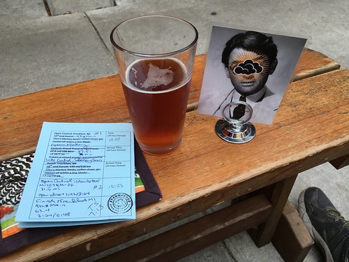
No pictures, because it was so very wet.  Well, pictures were taken of the info controls (with Timestamp Camera, a free app), so I wouldn't have to take my card out to write on it; took care of that at the finish.

Visited with Susan at the finish, and helped her with her basket of tots.

Sunday, August 14, 2016

Permanent Populaire #3164: Frankfort - Sleeping Bear - Glen Arbor 102km

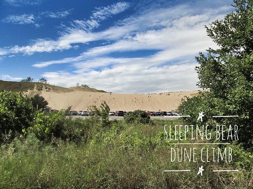
Sleeping Bear Dune Climb

Route
Cue sheet
Registration Form

Note: while I charge no fee for this perm, you MUST purchase a park pass to ride through the Sleeping Bear National Lakeshore.  The fee was $7.00 in 2016.

This route takes you from Frankfort, through the Sleeping Bear National Lakeshore, into Glen Arbor, and back again.

Starting at 4th and Main in Frankfort, your options for a control are Crescent Bakery, L'Chayim Delicatessen and maybe the coffee shop across the street whose name I do not remember.

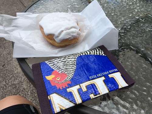
Frittering (or more specifically Lemon Bismarcking) away the time before the start

You head east on Main Street, away from Lake Michigan, turn left onto 7th Street, which rapidly becomes M-22, heading north.

Three rollers out of town, and then you ride along Crystal Lake until the left turn onto Sutter Rd.  I am ever so pleased to report that Sutter Rd has been repaved!  It hasn't gotten any flatter, though.

The deer statues seen by the side of the road and in yards are not statues.  You might also spot a flock of wild turkeys.

At the end of Sutter Rd you turn left onto M-22 again, and there's minimal navigation for miles and miles and miles.  You'll pass the Platte Lake store (Riverside Canoe Trips, mi 11.7) if you need anything; there's nothing for the next 10 miles.  Well, lots of trees, as this is Up North.  Eventually the terrain starts rolling.

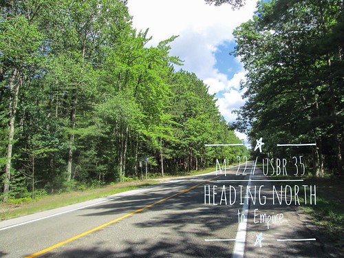
Heading north on M-22/USBR-35

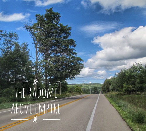
When you see the Radome up ahead, Empire isn't far away.  You'll drop 200 feet into town.

The Empire Radome

Right at the intersection of M-22 and M-72 (traffic light), there is an EZ-Mart, which may be more interesting on your return.

But, more importantly, you can turn right onto M-72, go a block, and the Sleeping Bear Dunes National Lakeshore office on the left will sell you that park pass.

Continuing north on M-22, you'll climb up a bit, and then turn left onto M-109.

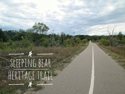
You'll see the Sleeping Bear Heritage Trail on your left, and you may prefer to cut over to it when you get a chance.  I hopped on at Pierce Stocking Drive.  There are driveways, and eventually, the Duneswood Resort.  It is a lot nicer riding on the trail - shaded and no RVs or pickups hauling boats!

If you did not get your park pass in Empire, you must buy one in the parking lot just past Hunter Rd, mi 27.3.

On your left is the famous Dune Climb, where people (mostly children) scramble up and down for hours.  There is also hiking at the top.  This is not to be confused with the EPIC dune climb at the end of the Pierce Stocking Drive, where the dune plunges precipitously down to Lake Michigan, and there are signs warning that you must pay for your own rescue if you can't climb back up.  Good times.

So, continuing along the Sleeping Bear Heritage Trail - there are a few steep bits, but they are all short - you'll eventually come to the first info control.  The sign is on the right, and it is the second sand turnaround.

Sleeping Bear Heritage Trail

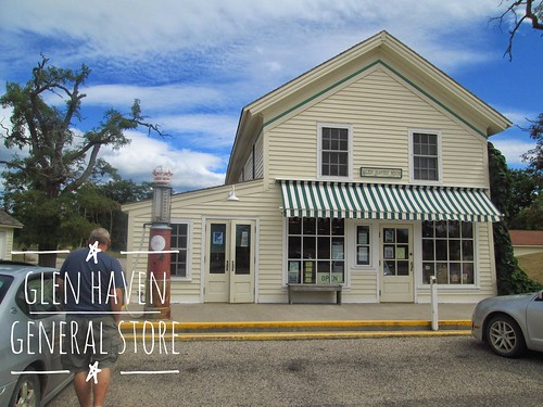
By now the trees have receded into dune scrub foliage, and a mile or so later, you will arrive in the restored historic town of Glen Haven.  There's another info control here, or you can buy something in the General Store.  Note: they DO NOT sell anything to drink, but there is a water fountain outside, as well as very nice restrooms.

Glen Haven General Store

Continue on the path between the store and the restrooms, heading to and straight through the D. H. Day Campground.  The trail pops out the other side, ending at Pine Haven Drive.  Turn right, and then left on M-109, for a short couple of miles into Glen Arbor.

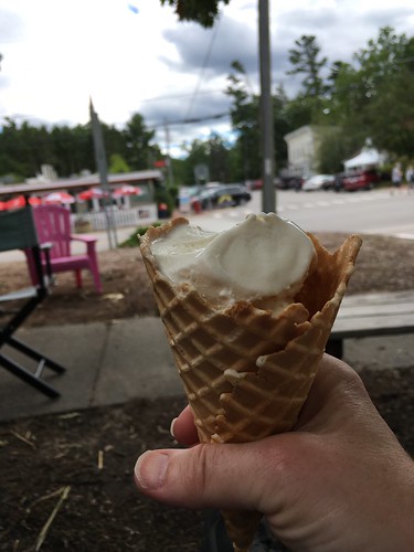
Ice Cream in Glen Arbor

Glen Arbor is the turnaround control.  You'll find a market on the corner of M-22 and M-109, and continuing straight (M-109 merges into M-22 North), you'll find ice cream places and a coffee shop.  There is also Art's, with their famous pool table on hydraulics, but service might be slow.

And then you turn around and retrace the route back to Frankfort.  By then, Crescent Bakery is probably closed, but Stormcloud Brewing will be open, as will The Cool Spot (ice cream!) as well as many other places to get something to eat and/or drink.

Fini, Stormcloud Brewery


Monday, February 8, 2016

That's a Wrap

So, I have this surgery thing coming up, and I'll be off the bike for however long it takes to recover.  The doctor said 4-6 weeks, but I am betting she didn't mean I'd be able to crank out a 200k by then.  Given that, I deliberately abandoned my current R-12 run, because otherwise I'd be stressing myself into attempting a 200k before the end of March, which would probably be a bad idea.  I did think I might be able to keep the P-12 going.

With that in mind, I rounded up a group of friends to ride Ray's North Plains Banks Vernonia 100k, my very favorite local 100k.

Ray, Susan O, Michal, Graham, and Steve all turned up.  The day was cloudy, but not rainy.

I like ice cream.  Even if it is 40 degrees.

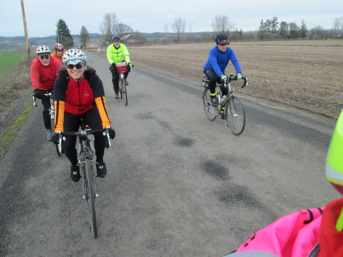
As is often the case when I ride with more than one person, the group fragmented.  Michal stuck with me the whole stretch to Vernonia.  Overall, this was a faster pace than the last outing, as Susan was back on an upright bike.

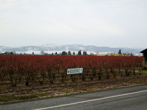
Blueberries, Harrington Rd

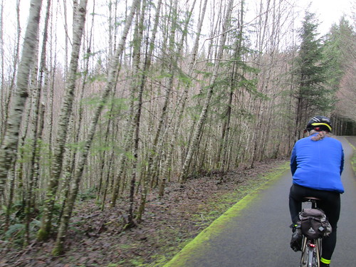
Michal and the birches.  Or alders.

There was a 5k run in progress, fortunately not too many participants!

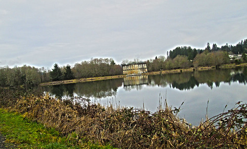
Vernonia Lake, old mill building

We didn't see the others at the lake - when we met up at the Black Bear, they said they'd all taken the Adventure Detour.  We took the Road Detour.

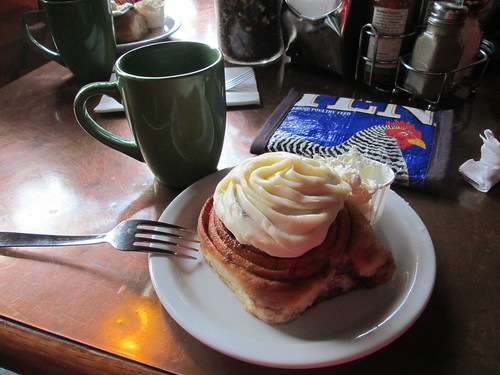
We ALL had the sticky bun, heated, with butter

Susan told me my sticky bun with frosting, heated, with butter was already ordered. :-)  For that matter EVERYONE ordered one.

Eventually I figured we should head back.

We regrouped at the Banks Trailhead.  I was starting to feel done, but we had only 9 more miles to go.

All, back on Wilkesboro Rd

Spring is coming.  Wilkesboro Rd

Fitz had been hitting a bucket of balls close by, and joined us at the finish.

Thanks everyone for joining me!