Sunday, April 22, 2012

The Gift - OrRando Hot Springs 300k

Last time this route was used, it was in conjunction with a 600k, and it was the second 300k I rode.  I was wanting better all-around this time.

Breitenbush River

Baked up some more amaretti cookies, and made them into sandwich cookies with the homemade Nutella.  Mixed up a batch of hummus, and made some wraps.  Packed a couple of bananas and bars and gels.

Weather was going to be amazing.  I couldn't believe it, and did toss my booties and helmet cover in the bag, just in case...  I also packed sunscreen :-)

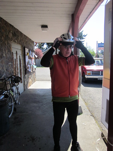
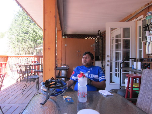
Kevin came over, so he wouldn't have ride the 30 miles to Newberg to the start.  He added some big cookies and an avocado-bean burrito to my food stash.  Loaded everything into the car, and was completely organized, including dinner and dessert by 8pm. (This doesn't happen very often)

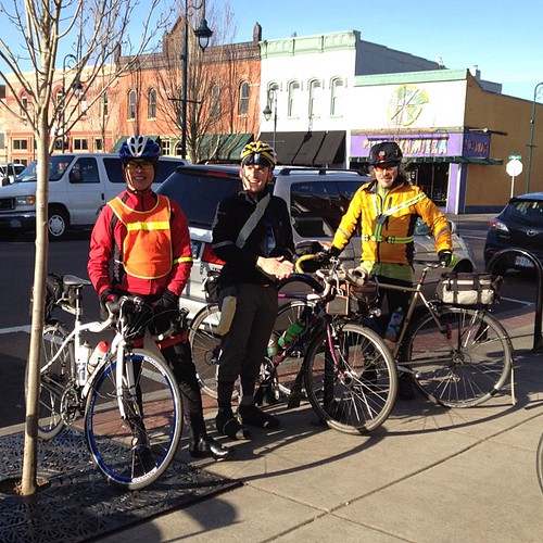
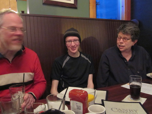
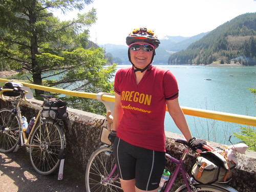
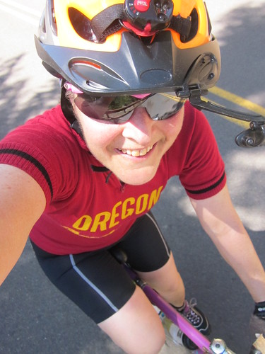
Up at 4am, breakfast, and we were in Newberg by 5:30am.  Handed off some cookies to Kevin and Narayan.  Was really happy to see Peg; it has been a very long while since we've been on a ride together.  Michal eventually appeared, and he and Cyndi got some amaretti-Nutella cookies as well.  They also gave me some cookies.  These pre-ride food swaps are great fun.

What with Michal still not being quite organized, we pulled out a few minutes after the official start.  No worries.  One does not ride a 300k in the first 10 minutes, and I don't have a prayer of hanging onto the fast group.

Foggy Champoeg sunrise

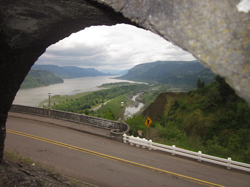
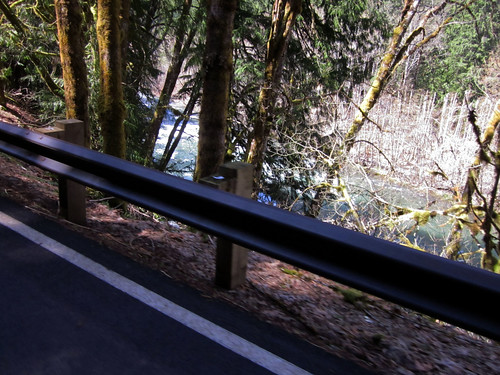
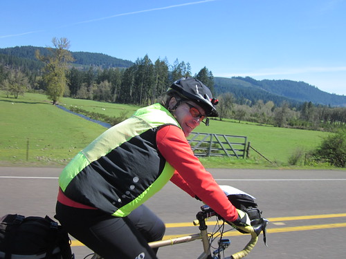
The start was foggy and damp.  Sometimes really foggy.  We overtook a few riders, and rode for awhile with Ken, Ray, and Peg.  We had planned on a few bonus miles by riding the side roads paralleling the first 12 miles of SR-22.  But somehow, in the fog, we made a wrong turn and ended up on the south side of SR-22, but not on the right road. I can see what happened now, but that did add a few more bonus miles.

Into Stayton with Ray (pause), then on eastward.  Got to the Lyons control, where I ate (something) and drank (something), enjoyed some people watching, and eventually proceeded on.

Ray at Lyons

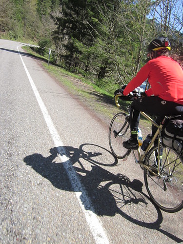
Ray went on here, and Michal and I continued on together.  We were gently climbing the whole way - my inclinometer said 0%, but I could watch the altimeter tick up.

Between Lyons and Mill City

Back onto SR-22 past Mill City (by then I'd ditched the jacket, vest, arm warmers, cap, overgloves, and knee warmers and added sunscreen).  A brief stop at The Maples rest stop, because it was the last facility until Detroit, plus there was Free Coffee and Cookies).

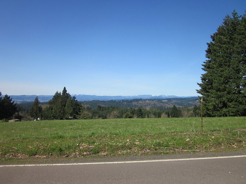
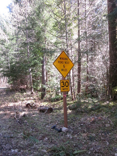
The climb up was very gradual, and we must have had a tailwind, because it was no problem at all.  Sunny.

Shadows!

Above Big Cliff Dam

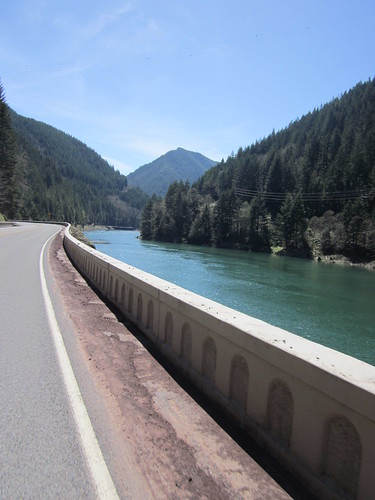
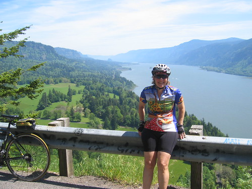
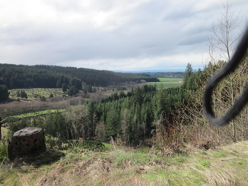
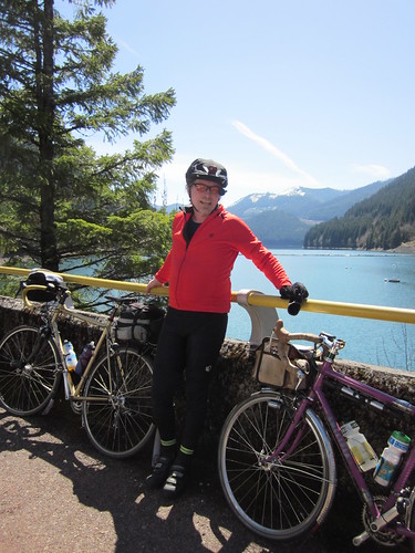
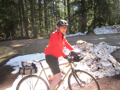
Pause at Detroit Dam for pictures and stretching.  Michal finally removed all his extraneous layers. We saw 4 riders headed back, which puts them almost 40 miles ahead of us...

MIchal at Detroit Dam

Me at Detroit Dam

Into Detroit; paused at the store right on the corner.  Many riders there, but they were all headed down. (20 miles up on us).  More snacks and visiting, but that last 11.8 miles of climbing wasn't going to happen by itself.

Corndog!  Food of the Gods!

Ed, Kevin, ??? at Detroit

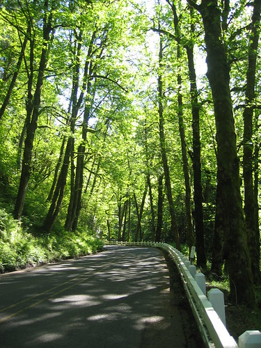
Still a very gentle grade, and a wonderfully quiet road.  Bits of snow still there in the shade.

Climbing Panda

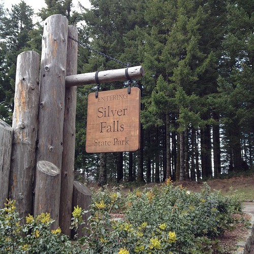
Eventually got to the turnaround (the cue sheet and the brevet card did not quite agree on distance or hints), snapped a few pictures and headed down.

Proof of turnaround control attainment

Michal in the snow

And there was the headwind.  So, downward we went, but it was not a screaming descent.


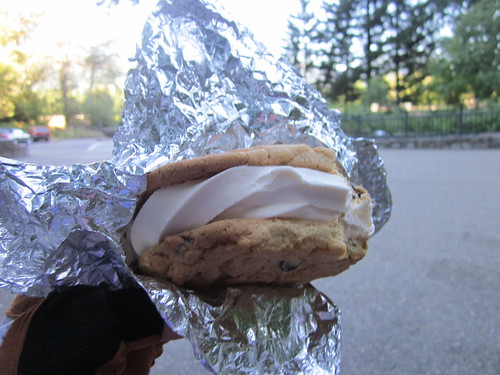
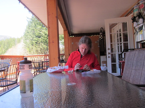
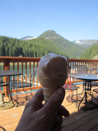
Back into Detroit, where I felt the beginnings of a bonk.  Time for that enormous burrito.  The store had a very nice back deck overlooking the lake, so we decamped there to sit and eat.  And I did consume that entire burrito (and it was huge), plus an ice cream cone chaser.  Narayan came through - he'd gone rather far past the turnaround, so got some bonus miles there.

Michal updating Facebook

Still life with ice cream cone

Narayan in Detroit

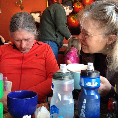
Then the 20 mile descent back to Mill City on SR-22.  We still had that headwind, but it was much, much, much nicer than descending in the rain, getting buffeted around by the wind, and getting buzzed by RVs.  Another pause at The Maples, then into Mill City (Michal puts his GPS on supplementary battery power), and then Lyons.  We leapfrogged Narayan through this stretch, and when he arrived at the Lyons control, I had a big container of Pringles for us all to snack on.  He told us all about PBP, and he and I relived the Tahuya 600k of last June.  Then he headed out, and we eventually followed, finding him on Old Mehama Rd.

Into Stayton, for the last on-course control and some chicken noodle soup.  My stomach had been crabby for quite awhile, and that looked like it would help.  I also had some antacids and a banana.  Narayan stopped in and said he was going to keep moving.  We figured we'd chase on, but we didn't see him again.

By now, the wind had died down.  I was fully expecting a headwind all the way north, especially on Howell Prairie Rd.  (Ray calls it "Howl" Prairie for a very good reason).  No headwind.  East on SR-22 for a few miles (really big shoulder), onto the Shaw Highway, and pulled over at the start of Howell Prairie to pull on armwarmers and reflective gear.  I may have also put on my jacket; I was starting to get chilly.

Howell Prairie Road sunset

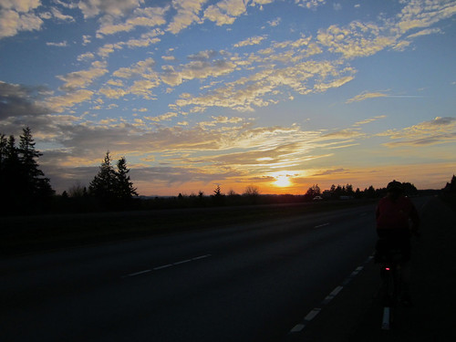
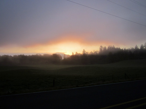
Started snacking on those amaretti sandwich cookies, but moving north at a pace that was pretty special.  I get excited anytime I am moving at a pace greater than 15mph, and we had stretches of 18mph.  Gorgeous sunset.  This was the gift, for sure.

Another pause a couple miles before Gervais - knee warmers, and pounding on my shoulder knots.  The nice folks whose barnyard complex we had pulled into offered water, but we were ok there.

I was starting to get the sleepies, so crunched on some caffeinated mints.  They didn't seem to do much, so I had a few more, with my last banana.  And then, all of a sudden, I wasn't dozy anymore.  Nice!  This does say I should start cutting back on my caffeine intake, for the looming 400k and 600k brevets.

Into and through Gervais, north on Butteville, looking for Arbor Grove - I usually approach from a slightly different direction.  We stopped to consult maps.  From the darkness... "are you looking for Arbor Grove?  Keep on for another mile".  Nice people out there tonight, for sure.

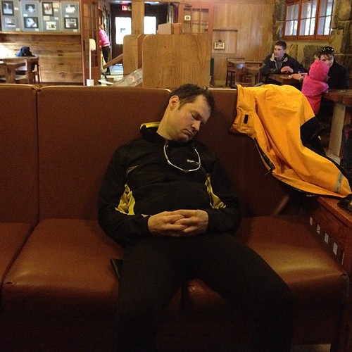
Once on Arbor Grove, I was completely on autopilot.  Last few miles, and we were done at about 11:30.  Before midnight, which was the goal for both of us.  Cyndi opened the door, and we visited with the finishers still hanging around.  I had a Pepsi, and got a shower before driving myself and Kevin back north.

Kevin wanted to know about my post ride recovery process... hmm.  sleep in.  successfully walk down the stairs.  unload the car.  eat everything that isn't nailed down.  I think he was looking for something like a recovery ride.  That will happen tomorrow, when I commute to/from work :-)

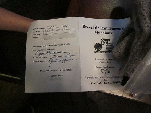
Stats: 196 mi, 14.5mph avg, 5862 vertical feet.  That average is the fastest this year for a rando ride.

Got a nice start on my suntan, too.

Many more pics http://www.flickr.com/photos/lynnefitz/sets/72157629876576275/with/7103488689/

Friday, April 13, 2012

Permanent #1513: Beaverton - Bridge of the Gods - Beaverton 202km


UPDATED 24 Nov 2018
the route (ride with gps)
cue sheet, and
the reg form

Columbia Gorge

Route availability:

24 Nov 2018 All the roads and trails have reopened!  The Washington Park section of the route is also open.

17 Feb 2018 sadly, this permanent is currently not available due to the Eagle Creek Fire.

News Flash (12/15/2016)! The Washington Park Reservoirs are under construction, totally changing the route through the park on the outbound.  I'll update the cue sheet when someone wants to ride the route, because it may change between now and then. Here's the current park map: http://www.portlandoregon.gov/water/article/586276

News Flash! Toll for bicycles on the bridge is 0.50.  Back after several years of no toll for bikes.

pretty much guaranteed May-October.  Outside of that, I'll be checking the weather before I accept your registration.  The Columbia River Gorge can be very dangerous in the winter.

Starting in Beaverton (again, one block from the Beaverton Transit Center), you'll head north and east, uphill through a quiet neighborhood and onto the Sunset Highway Multi-use Path (or, as I call it, the Bicycle Freeway).  Then down through Washington Park (CHECK THE PARK MAP), and your first info control.

From there, you proceed through downtown Portland, crossing the Willamette on the Steel Bridge, then heading north and east (another info control in there...) to the I-205 Bike Path, and the Glen L Jackson bridge across the Columbia River into Washington.  Looping off the bridge, you'll follow the Old Evergreen Highway east into Camas, for the first timed control.  I myself am partial to the Burgerville :-)  There are also gas stations and coffee shops and such in Historic Camas.

Exiting Camas, what used to be a simple left turn onto SR-14 has now become many traffic circles.  Not to worry, just keep following the signs for SR-14 East, Kennewick, and you will get there.

Then, onto SR-14, climbing up to Cape Horn, for an amazing view to the east.

Me at Cape Horn


Proceeding east, and DOWN, you'll proceed past Skamania (store/food), Beacon Rock (water, restrooms, scenery), North Bonneville (see the dam!), and past the Bridge of the Gods into Stevenson, for your next timed control.  Grocery on the left, plus coffee shops and restaurants.

Back to Bridge of the Gods, where you'll cross into Oregon.  If it is your first trip across, maybe you don't want to look down.  Metal grating, exercise caution.

Looping off the bridge (0.50 toll for bicycles, be prepared), you enter Cascade Locks.  The Char Burger (burgers, cafeteria style) is right in front of you, and there is a grocery and some food places off to the right.


Bridge of the Gods

The bike path entrance is just to the right of the westbound freeway on-ramp.  Welcome to Middle-Earth.  You'll go under the freeway (tunnel), up to the fish hatchery, getting back on the trail by proceeding the wrong way on the left side of the freeway off-ramp (only for a bit).  Then up some stairs, eventually ending up at a campground.  Turn right, cross the campground entry road, and you are back on the path again.

Under the freeway, up some switchbacks (another great view of Bonneville Dam), then follow along next to the freeway.  Now you will be riding on the new part of the trail, across Moffett Creek, up some switchbacks, and then over McCord Creek.

The new bridge on the new trail

Great views of the river and the Washington side from here.  Then you pop out into a parking lot/trailhead, turn R, turn L onto the frontage road, and you will soon find yourself on the scenic highway.

Pass campgrounds (Ainsworth), a waterfall (Horsetail Falls) and tunnels (Oneonta tunnel; be sure to ride through it), eventually arriving at Multnomah Falls.  While not a control, there are restrooms and food.  And really nice ice cream sandwiches and coffee.

Multnomah Falls ice cream sandwich

Up the stairs

Multnomah Falls

Continuing westward, passing many more waterfalls, at Latourell Falls, the road winds up to Vista House at Crown Point.  More amazing views, also restrooms and a small snack bar, both downstairs.

Scenic Highway

Then the last bit up, and on to the best descent ever.  (Optional scenic possibility - Women's Forum State Park on the right) Be sure to enjoy Bell Rd!

Then along the Sandy River, cross over at the bridge, and you are in Troutdale. Park on the left right over the bridge has restrooms and water. Troutdale offers ice cream, coffee, restaurants, and a convenience store (great for popsicles on a really hot day).

Turn right, go under the freeway, loop around the back side of the airport, then on to Marine Drive all the way to I-205.  Just before I-205, turn left over Marine Drive, and follow the path to NE Alderwood.

The next timed control at NE 47th and NE Columbia offers a 7-11, a Dutch Bros coffee, and a Subway.  The balance of the ride is through town, and can be slow going, so don't linger too long here.

From here, proceed west and south through NE Portland, down to and across the Broadway Bridge, then up through NW Portland, crossing Burnside to enter Washington Park.  You'll ride up Stearns Way, which is not signed, and is paved (freshly-remodeled park entrance trail).  It switchbacks up, popping out just below the entry to the Rose Garden.  Info control at the corner of SW Rose Park, right behind the bus stop.

Up through Washington Park, pass the Rose Garden, archery area, and the zoo, then up on SW Canyon Ct and the Sunset Bike Path to the Sylvan summit.  Starbucks on your right.

Pretty much downhill all the way from here, back the way you came.  The Starbucks at the finish closes at 7pm, but there are many receipt opportunities at the corner of SW 117th and SW Canyon Rd.  There is another Starbucks at the Fred Meyer across the street, by the grocery at the SW corner of the store complex.  There is also a Jackson's gas station c-store, across SW Canyon, one block to the west.

Sunday, April 8, 2012

Just riding around. Mostly uphill...

No specific ride plans yesterday.  My normal riding partners were either off riding the flèche, or not up to riding or climbing for hours.

Looking south, from Old Germantown Rd

Speaking of the flèche, the Duck Flying North team would be passing through Forest Grove about breakfast time on Saturday.  And I had gotten inspired by Heidi Swift's 10,000 foot day (inspired.  not that crazy.  I'm not riding the TdF route this summer.)  After a little quality time with ridewithgps.com, I planned to meet the boys at Maggie's Buns, then go off and climb some hills.  Skyline Boulevard, which does some pretty nice elevation changes all by itself, also has many roads that climb up to it from both the north and the south.  I planned to wander up and down some of the south side climbs.

Woke up at 4am (not intentionally), so I checked on the Ducks' progress.  They had passed through Salem.  Doing the math, I planned to be where they'd be by 8am.  17+ miles west of home, by the most expedient route - Baseline-TV Highway.  Not one I'd pick for later in the day, but ok for that early.  6:45am, after a quick matzo brei breakfast (the Passover equivalent of French Toast; I eat it for 8 days straight.  Yum.), I was on my way.  A bit stressed that I'd miss them, so I pushed it.  Close to freezing, but sunny.

8:05am, there I was.  No bicycles scattered around outside.  I was parking my bike, when I realized that I recognized the van parked right there on the street.  Went in, found Cyndi, ordered breakfast (eggs and veg; figured someone would be happy to eat the toast), and settled down for a nice 45 minute visit.

Ducks Flying North arrive in Forest Grove

Then the team rolled in.  They looked a little out of it, having ridden through the night.  Food ordered, coffee consumed, cards signed, some even tried to take a little nap...

Catching a nap

And off they went, and off I went, to find those promised hills.  Riding north on Porter Rd, I saw many, many Portland Velo pace groups out... hi Lynne!, hi Lynne!...  Recognized Tom D and a few others (you all look alike in helmets and club kit, sorry).  Stopped in North Plains, bought some juice and a candy bar.  While consuming the juice, who should ride through but Maria and Nick with a couple other friends.  They were headed for Vernonia.

Finally, at 33 miles, I started climbing.  First climb was Mason Hill-Solberger-Moreland, 7 miles.  After awhile, one starts wondering where the top is!  Then a fun drop down NW Skyline-Johnson-Logie Trail, and along Helvetia and Philips Rd.

I can hardly wait to see what the Milk plants look like

Started the second climb there, Old Cornelius Pass-Rock Creek-Eliot, 5.7 miles.  At the very top, I came upon a group of cyclists.  The captain on the tandem was Steve R, a friend of both Cecil and Andrew.  We caught up, reviewed our planned routes.  His comment on mine: "that will keep you out of trouble".  Yeah.

By now, getting tired.  I was NOT going to skip the next climb, Old Germantown, but did decide that rather than drop down Springville and ride back up via Laidlaw-Thompson, I'd just continue along on Skyline.  It is still climbing...

So, down Skyline to Cornelius Pass, crossed, then ground up the stretch to Brooks.  Best roller coaster descent on Brooks.  Sadly, too short.  Left on Kaiser, up around the corner, then eventually left on Germantown to Old Germantown.  This is a special little climb, just over 2 miles, but the grade makes up for it, and the switchbacks are killers.  It got me today.  The phone book delivery and I had a fun little race to the top.  He eventually won.

More climbing along NW Skyline, finally cresting at NW Greenleaf, down to Burnside, back onto Skyline, for the final little bit up to the intersection of SW Barnes and SW Skyline.  Antenna farm!

All downhill from there.

Bike computer sez: 77.7 miles, at a not exciting average pace. 5900 vertical feet.
The route (I am sure the truth on the vertical feet lies somewhere in between)

Sunday, April 1, 2012

Burning Matches

The inaugural Or Rando brevet this year was Michael Wolfe's Molalla Foothills 200km (what? No Birkie?  That's why I created the Beaverton-Birkenfeld-Beaverton Permanent :-) )

The original route had a climb in the middle that was, to say the least, intimidating.  Mapping it out on ridewithgps had bits of 22%.  Oh well, less than 2 miles.  I could walk it, if necessary.  But the weather remained persistently bad/wet/windy, and that climb was apparently quite exposed, so the route was changed.  About 800 less feet of climbing.  We'd still have to go over that ridge, but not THAT way.

In a flash of insight that will make some of my riding partners SO very proud of me, I annotated the cue sheet.  Where the climbs started and finished, and (the important part here), instructions to EAT! every 12-13 miles.  I even ate when the cue sheet said to eat.  Things with 200+ calories, too!  Usually more calories.

soggy cue sheet

Up at 4:45, on the road by 6, for the 7am start.  Many riders at the start, including the Portland Crew, who rode over.  I don't want to know what time THEY got up.  Except Asta - she hadn't slept in 24 hours.

Raining, raining, raining.  Off we went at 7am, quickly diverging from familiar roads.  I rode along with Oliver for awhile, then I stopped at a handy blue room (climbing over a fence was involved) and he went on.  Eventually ended up on Dickey Prairie Rd.  We caught glimpses of the Molalla River - it was running very fast and high. The first climb was a 12+ mile ride up Molalla  Forest Road, following the river.  Beautiful fairytale forest.  Lots of water features - the river, of course, plus many, many waterfalls.  (Maria, later: "I could have done without the water from the sky water feature")  It was, of course, raining heavily.  Gentle climb; about 3 miles from the top I saw the returning fast group.  My feet were sopping wet.  At the turnaround control (thank you Keith K!), I ate a banana and the other half of a nutritionally dubious pastry.  Keith obligingly zipped up the pit zips on my jacket for the descent (if I took off the gloves, it would have been a bit of a challenge getting them back on).  Asked if anyone had dry feet.  Hysterical laughter.

Lovely descent, and into Molalla.  Saw Asta, David and others heading out.  Cruised through town looking for a place to get food, and settled on Subway.  Got a breakfast muffin and some regrettable coffee; did a bit of blotting excess moisture.  Squeezed out the gloves (made puddles). My cue sheet had a big wet spot (need to get another 8.5x11 ziploc!), so downloaded the cue sheet to my phone, just in case.  Ah, technology.

Time for climb #2.  This climb is over the same ridge as the Portland Wheelmen's Spring/Pioneer century, but different roads than I have been over.  Not difficult, just up.  Then down (whee!) and eventually into Silverton, where I found many bicycles with luggage and blinky lights parked outside the coffee shop.  Joined the changing group inside (some leaving, some arriving), and ordered a bagel with lox cream cheese.  Lots of tasty calories there, and I ate the entire thing while visiting with Maria, Nick, and Rob (who ordered TWO hotdogs).

Nowhere to go from Silverton but up.  The climb started right from Silverton, and did not finish until the Silver Falls State Park entrance - 19 miles along the ridge.  It was pretty, but very painful - not killer steep, but the headwind screaming in from the south made it very challenging.  But!  Not raining!  Sun!  Lost the jacket and heavy gloves, and started to dry out some.  Except my feet.

Looking down the valley

That bagel and cream cheese should have kept me going for a good long time, but at most 10 miles into it, I was dragging.  I figured a gel would do it.  They kick in quickly, and I can really feel it.  One peanut butter gel later, I made it another 5 miles.  And ate another gel.  Gels are like matches, you either have to keep sucking them down, or follow with something longer-lasting.  I was looking forward to something at the Silver Falls Lodge.  There was mentioned a fire and hot chocolate.

Stopped to take a picture, SURELY I was near the top.  No, but it was a pretty picture.  Finally, finally, I got to the park entrance sign.  And then it started sleeting/hailing.  Quickly pulled on the jacket and dropped for a couple of miles to the lodge.

Glory hallelujah!

Met Karel S at the parking lot entrance.  I don't know if he was having a flat, or waiting out the sleet.  In any case, he drove out from Montana to ride, and he's riding my two perms on Sunday and Monday.  Likes to get his riding's worth of any road trip.  I am in awe.

Went into the parking lot.  Where's the lodge?  Saw David and Asta headed out; they pointed me in the right direction - it is way off the parking lot, and not signed.  Lots of bikes with blinkies and luggage on the porch.  Went in, found the roaring fire and the park ranger to sign my card.  But no hot chocolate - I arrived at 4:10, and the snack bar shut down promptly at 4.

Snoring

I did peel off my rain booties, shoes and socks, and set them by the fire.  Got some dry socks out of my bag.  Maria and Nick arrived.  Nick sat down on the sofa and fell asleep.  He was even snoring :-)  After pausing there for a bit, I reassembled (the dry socks weren't much with really wet shoes), refilled my water bottle, and headed out.  By this point, I was owed a downhill and a tailwind.

North Falls, Silver Falls State Park

A pause for a picture at the North Falls overlook, and more rolling climbs until mile 97, then a really nice descent into the outskirts of Silverton.  Not raining, but I was still wearing the jacket.

Stopped in Silverton long enough to pull on the reflective gear and turn on my other rear blinkie (I ran the headlight and one rear blinkie all day.  Seemed safer, as I was mostly riding by myself.)  Maria, Jeff, and Nick came along, and then went ahead.  Opened my bag of sunflower seed filled pretzels, and munched on those heading north on Meridian Rd.

There was the expected tailwind.  Found Ted, Bukie, and Jeff in Monitor.  Updated the husband on location and distance out (15 miles), then pressed on.  Twilight on Meridian Road.  

Twilight, Meridian Rd

Turning onto Zimmerman, it started raining.  Then it REALLY started raining.  If I'd just been out riding around, I'd have headed north on Meridian until Lone Elder.  The route took a teeny bite off the distance, and over much quieter roads.  Raining, raining, raining.  What seemed like forever, but was really only 2 miles out, I pulled over and had a little pity party.  Me and the remains of my Nutella sandwich.  Then topped the rise from the river (really it was RIGHT THERE), and... there was Canby.  I knew where I was (I knew where I was miles back, but I was beat), headed north past the schools and swim center, crossed 99W, turned left on 2nd and started looking for the pub.  Sure enough, building with many bicycles with luggage and blinkies leaned outside.

Ever so happy to be done

After detemining that there was no way I'd get home in time to see any of the Portland Timbers game, ordered some dinner and visited with Rob, Asta, Theo, Michael R (great volunteer; we haven't had a chance to talk in a long while), and others, as they came and went.

David, Rob and Michael R

Stats from my bike computer: 133.3mi (a few extra wandering around Molalla), 12.58 avg
Vertical feet: ridewithgps: 5845, my bike computer: 7355.  I am sure the truth lies somewhere in that range.
1451 miles, ytd, 611miles for March (whoo!)

All the pics here