Since that last 200k, attempts at actual riding have been a bust. We sat in the North Plain McDonalds watching people slip and fall, and decided to be prudent. Then there was another attempt last week, only to find the trail closed with many downed trees from our snowstorms. Plus all those snowstorms. We've gotten a decade's worth of snow so far this winter!
The Oregon Randonneurs Feb 200k was Hillsboro-Dallas. It isn't a difficult route. I've set personal speed records on this one.
The day before, we had freezing rain (!) It melted early enough that Michal could drive up the night before.
It was going to rain. We had ALL our rain gear organized for the next morning.
So, the next morning, it was warm (high 40's). We both ditched a layer, but I, at least, stuck mine in my saddlebag. It wasn't even raining very hard.
However, the headwind was relentless. Trying to draft Michal was challenging; the wind kept shifting little bits, making it really hard to find that sweet spot.
By the time we got to Amity, we were right at minimum pace, with the hilliest part of the route in front of us, and no places to shelter from the wind. My pace had been dropping, and I didn't see that changing.
I called it in Amity (46 miles) and was completely prepared to ride back solo, indeed, I told Michal (several times) to keep going. I could even ride home from the start, or, barring that, visit my newest grandson, who lives close by. He wasn't buying it, so we went over to the Amity Market (wait, what, it is a Mexican Restaurant and Bar now?) and got something to eat before heading back.
I did put on that dry baselayer.
The tailwind was nice for awhile, then it tailed off (boo). Graham found us in Dayton, and we rode along for a few miles, then he went ahead.
We eventually made it back shortly after 6pm, so we'd been out there 10 1/2 hours. I'd been hoping the tailwind would have pushed us all the way back, but not so much.
On the bright side, my heart rate was 30 beats per minute lower on the return.
Only a randonneur would consider a 94+ mile ride a failure.
Showing posts with label rain. Show all posts
Showing posts with label rain. Show all posts
Monday, February 6, 2017

Friday, December 2, 2016
First 200k In 11 Months
And, oddly enough, our it seems to be annual "Ride a 200k on Civil War Day", the civil war in question is the Oregon State - University of Oregon football game.
I took the Coast Starlight from PDX to Eugene, given as how they've now got bicycle service AND a better schedule than the Cascades.
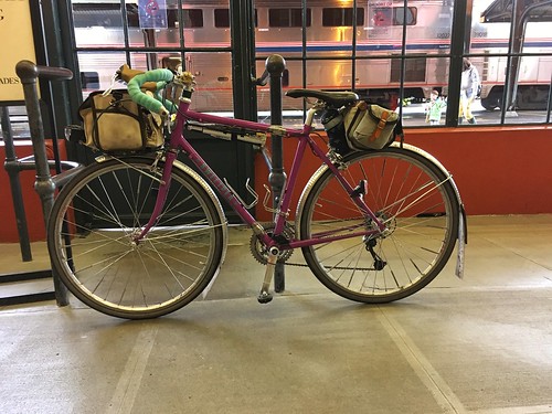
Pro: better schedule and cushier seats
Con: coach passengers sit in the very tail end of the train, baggage car is right behind the locomotive. It is a very long train and "the stop in Eugene is 4 minutes!". No wifi, and the water dispenser in the car was empty. And the lighting was dim.
But with all that, I made good progress knitting on my sock, to the point of finishing it, but not weaving in the ends; I wanted better lighting!
First off the train, and scampered up to the front (as the conductor was announcing Last Call!), to find Michal holding my bike, waiting for me to show up with the claim ticket. Whew.
Our route was Bill Alsup's Perm #1177: Eugene to Beaverton.
And so, up at 5am for the 7am start. The drop down Michal's hill was kind of scary in the dark, like it always is, but I didn't work up to the whole bike shaking, like has happened before. We found Chris at the coffee shop, and got ourselves some coffee as well.
Sunrise wasn't until 7:25am, so we got to enjoy heading north out of Eugene in the dawn. All the coffee for breakfast and at the start meant that the customary pause at Armitage State Park was again observed. We also decided that it wouldn't be raining any time soon, and ditched our rain jackets. Once over the McKenzie River and through Coburg, we were out in the rural Willamette Valley for most of the day. Not that we could SEE anything, because there was a persistent fog, which stayed with us until we started the climb on Gap Rd (mile 22 or thereabouts). We then dropped into Brownsville, pausing at the Chevron c-store, where I discovered PayDay bites, a convenient form factor presentation of the PayDay bar.
North through Brownsville, re-enacting the final scene in Stand By Me, then out the other side, eventually arriving at a road blockage. Now, there's nothing OUT there, but looking ahead, we could see a small herd of cattle on the road. It turned out to be the annual moving of the bulls from one field to another, and we watched them being herded by several guys on ATVs and an SUV bringing up the rear.
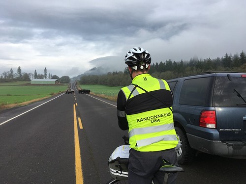
That settled, we continued on north. Now, it was supposed to be raining most of the day, but we hadn't seen any rain to this point, and the skies looked like we wouldn't, for awhile anyway. There were even bits of sunlight!
Passed through Lebanon, and Crabtree, on to our first control at the Hoffman Covered Bridge. Although, the info control answer was found at the corner of Crabtree Drive and Hungry Hill Rd, rather than at the bridge, 1.6 miles further along.
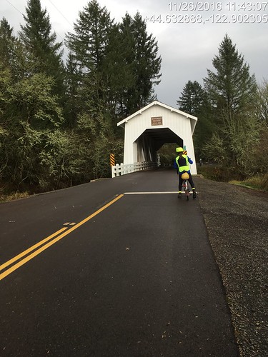
After the bridge, a driver stopped to warn us that there was a chaser dog up ahead "on one of the downhills". We did not find the chaser dog, but I did find a shard of glass, so there was a pause to fix the flat. I just swapped in a fresh tube.
A few more ups and downs, and we found Chris waiting for us in Scio. It wasn't a control, so we kept going, encountering the Leffler Grade. I didn't know if I'd be riding up it or walking it; maybe a third of the way up, walking all of a sudden became a very attractive option. Once at the top, we rolled along the ridgeline, finally dropping back down and entering Stayton (67 miles), our first open control. On this route, the preferred stop is the Safeway; for other routes, the Roth's Market. Drank down a half teaspoon of salt before going in.
I got a rice bowl with orange chicken, and Michal and Chris cheerfully refilled my bottles (one with plain water, the other needed hot water for the Gatorade-Tea-Maltodextrin beverage). I ate about half of the orange chicken and rice. I really like orange chicken, and white rice seemed to be a good thing for my stomach. Michal thought he'd have a taste, and proceeded to make serious inroads on the leftovers.
And with that, my stomach was all of a sudden very much happier, and we had a tailwind to Aumsville, and all was right with the world. It looked like it might start raining at the corner of Shaw Hwy and Hwy 214, so Chris pulled on his rain jacket. Michal and I didn't bother; we couldn't see where it would get any worse than a bit of drizzle. And, indeed, it cleared right up.
We also had a helpful tailwind on all 18+ miles of Howell Prairie Rd, and the first 2+ miles of gentle uphill didn't seem burdensome at all. There's not much to say about Howell Prairie - the berry bushes are pretty with their fall coloring, lots of wide open space, the elevators at the Pratum Co-op. Once you cross the Little Pudding River, there are more trees.
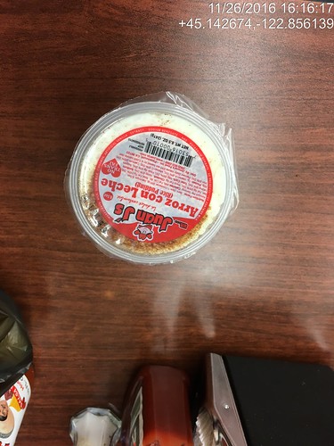
At the northern terminus we crossed Hwy 99E, turned into the wind for a bit, and then picked up Boones Ferry Rd (we'd see a lot of this road off and on for awhile), and ended up in downtown Woodburn, our next control. We usually stop at the Del Sol market and get tacos or tamales. We both ordered tacos, and I am pleased to report that I managed my entire transaction in Spanish (and yes, there was an actual conversation), then foraged around the store for other things. I found Arroz con Leche (rice pudding!) in the refrigerated case, in a single serving container, and promptly snapped it up. It was much better than the tacos - I had ordered Asada tacos, and they were dry and bland; I kind of expect Carne Asada to be moist and flavorful. We never found Chris; he had gone ahead.
Michal noted that the cars passing by had their windshield wipers on. Darn. On with the rain jackets and rain legs. I was already wearing my Showers Pass waterproof socks; they'd likely get another trial. I didn't bother to pull on the helmet rain cover.
So now it was dark and raining. My helmet headlight seemed rather uninspired, and the stretch from Hubbard (just north of Woodburn) to Aurora (just south of Wilsonville) was not clear in my mind. Michal had been fiddling with his gps and got it working again, so we'd be ok.
Heading out of Hubbard, we picked up Boones Ferry Rd again. The traffic was rather heavier than in previous years; maybe these were folks headed home from the aforementioned football game. I see now that we just head north on Boones Ferry, cross Ehlen, and then turn right on Keil, cross a very busy road (the rain had gotten much heavier), follow Keil to Airport, and head north to Miley, at which point I no longer need a cue sheet.
Yes. Well. From Miley Rd to get to Wilsonville, there is the small matter of crossing the Willamette River. At this point the only way across is the Boone Bridge shoulder, which is a busy stretch of I-5.
So, dark. Pouring rain. Four lanes of high speed traffic. Lots of debris on the shoulder - wheel parts, shredded tire parts, possibly a departed opossum or two. Good times.
After exiting I-5, turning left onto Wilsonville Rd (there is also the part where one must leave the shoulder and move left two lanes), and onto the relative quiet of Boones Ferry Rd... Whew. We then turned into the industrial park, and I was on my work commute home from my stints at Microsoft in Wilsonville.
After topping out on the small climb on Boones Ferry Rd (there we are again), we dropped down into Tualatin. There is usually a bike lane until there isn't, and the descent is ever so much more fun in the summer evening sunlight. By now I was feeling soaked through, but not too much further to go!
Through Tualatin park, over the river and into Cook Park in Tigard, north on Hall Blvd, left into Old Downtown Tigard, then out the west side, the non-intuitive left onto Greenburg Rd, cross over Hwy 217, and ride up the back side of Washington Square Mall... North on Scholls Ferry, and finally the left turn into the neighborhood before the last bit. We actually got across to the turn lane without having to resort to the crosswalk and sidewalk to get to Elm St.
Through the unmarked and very subtle cut-though (always helps to have a local guide at this point), down 5th Ave (where I just wanted to turn right through the office park and go home!), under Hwy 217, up Griffith, and done. 12:22 elapsed time.
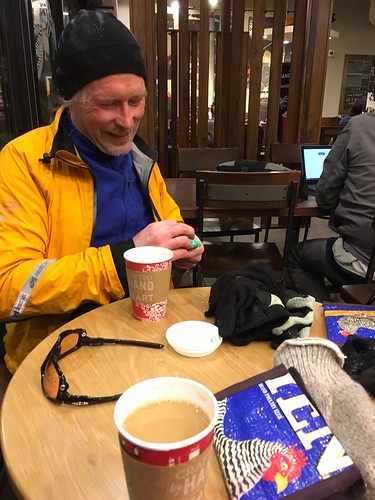
I barricaded my bike with tables and chairs up against the Starbucks window, and went inside to find hot coffee, and Chris A and Chris W (who rode one of my local perms and was planning to meet us at the finish). They had obviously been there awhile, certainly long enough to change into dry clothing :-) They eventually took their respective leaves, we finished our hot drinks, and rode the last mile to my house, where Fitz and Cyndi were awaiting our arrival.
Hot showers first, but Fitz had made an enormous pot of turkey chili and fresh cornbread. With pie for dessert.
I took the Coast Starlight from PDX to Eugene, given as how they've now got bicycle service AND a better schedule than the Cascades.
Pro: better schedule and cushier seats
Con: coach passengers sit in the very tail end of the train, baggage car is right behind the locomotive. It is a very long train and "the stop in Eugene is 4 minutes!". No wifi, and the water dispenser in the car was empty. And the lighting was dim.
But with all that, I made good progress knitting on my sock, to the point of finishing it, but not weaving in the ends; I wanted better lighting!
First off the train, and scampered up to the front (as the conductor was announcing Last Call!), to find Michal holding my bike, waiting for me to show up with the claim ticket. Whew.
Our route was Bill Alsup's Perm #1177: Eugene to Beaverton.
And so, up at 5am for the 7am start. The drop down Michal's hill was kind of scary in the dark, like it always is, but I didn't work up to the whole bike shaking, like has happened before. We found Chris at the coffee shop, and got ourselves some coffee as well.
Sunrise wasn't until 7:25am, so we got to enjoy heading north out of Eugene in the dawn. All the coffee for breakfast and at the start meant that the customary pause at Armitage State Park was again observed. We also decided that it wouldn't be raining any time soon, and ditched our rain jackets. Once over the McKenzie River and through Coburg, we were out in the rural Willamette Valley for most of the day. Not that we could SEE anything, because there was a persistent fog, which stayed with us until we started the climb on Gap Rd (mile 22 or thereabouts). We then dropped into Brownsville, pausing at the Chevron c-store, where I discovered PayDay bites, a convenient form factor presentation of the PayDay bar.
North through Brownsville, re-enacting the final scene in Stand By Me, then out the other side, eventually arriving at a road blockage. Now, there's nothing OUT there, but looking ahead, we could see a small herd of cattle on the road. It turned out to be the annual moving of the bulls from one field to another, and we watched them being herded by several guys on ATVs and an SUV bringing up the rear.
That settled, we continued on north. Now, it was supposed to be raining most of the day, but we hadn't seen any rain to this point, and the skies looked like we wouldn't, for awhile anyway. There were even bits of sunlight!
 |
| pic by Michal Young |
After the bridge, a driver stopped to warn us that there was a chaser dog up ahead "on one of the downhills". We did not find the chaser dog, but I did find a shard of glass, so there was a pause to fix the flat. I just swapped in a fresh tube.
A few more ups and downs, and we found Chris waiting for us in Scio. It wasn't a control, so we kept going, encountering the Leffler Grade. I didn't know if I'd be riding up it or walking it; maybe a third of the way up, walking all of a sudden became a very attractive option. Once at the top, we rolled along the ridgeline, finally dropping back down and entering Stayton (67 miles), our first open control. On this route, the preferred stop is the Safeway; for other routes, the Roth's Market. Drank down a half teaspoon of salt before going in.
I got a rice bowl with orange chicken, and Michal and Chris cheerfully refilled my bottles (one with plain water, the other needed hot water for the Gatorade-Tea-Maltodextrin beverage). I ate about half of the orange chicken and rice. I really like orange chicken, and white rice seemed to be a good thing for my stomach. Michal thought he'd have a taste, and proceeded to make serious inroads on the leftovers.
And with that, my stomach was all of a sudden very much happier, and we had a tailwind to Aumsville, and all was right with the world. It looked like it might start raining at the corner of Shaw Hwy and Hwy 214, so Chris pulled on his rain jacket. Michal and I didn't bother; we couldn't see where it would get any worse than a bit of drizzle. And, indeed, it cleared right up.
 |
| pic by Michal Young |
At the northern terminus we crossed Hwy 99E, turned into the wind for a bit, and then picked up Boones Ferry Rd (we'd see a lot of this road off and on for awhile), and ended up in downtown Woodburn, our next control. We usually stop at the Del Sol market and get tacos or tamales. We both ordered tacos, and I am pleased to report that I managed my entire transaction in Spanish (and yes, there was an actual conversation), then foraged around the store for other things. I found Arroz con Leche (rice pudding!) in the refrigerated case, in a single serving container, and promptly snapped it up. It was much better than the tacos - I had ordered Asada tacos, and they were dry and bland; I kind of expect Carne Asada to be moist and flavorful. We never found Chris; he had gone ahead.
Michal noted that the cars passing by had their windshield wipers on. Darn. On with the rain jackets and rain legs. I was already wearing my Showers Pass waterproof socks; they'd likely get another trial. I didn't bother to pull on the helmet rain cover.
So now it was dark and raining. My helmet headlight seemed rather uninspired, and the stretch from Hubbard (just north of Woodburn) to Aurora (just south of Wilsonville) was not clear in my mind. Michal had been fiddling with his gps and got it working again, so we'd be ok.
Heading out of Hubbard, we picked up Boones Ferry Rd again. The traffic was rather heavier than in previous years; maybe these were folks headed home from the aforementioned football game. I see now that we just head north on Boones Ferry, cross Ehlen, and then turn right on Keil, cross a very busy road (the rain had gotten much heavier), follow Keil to Airport, and head north to Miley, at which point I no longer need a cue sheet.
Yes. Well. From Miley Rd to get to Wilsonville, there is the small matter of crossing the Willamette River. At this point the only way across is the Boone Bridge shoulder, which is a busy stretch of I-5.
So, dark. Pouring rain. Four lanes of high speed traffic. Lots of debris on the shoulder - wheel parts, shredded tire parts, possibly a departed opossum or two. Good times.
After exiting I-5, turning left onto Wilsonville Rd (there is also the part where one must leave the shoulder and move left two lanes), and onto the relative quiet of Boones Ferry Rd... Whew. We then turned into the industrial park, and I was on my work commute home from my stints at Microsoft in Wilsonville.
After topping out on the small climb on Boones Ferry Rd (there we are again), we dropped down into Tualatin. There is usually a bike lane until there isn't, and the descent is ever so much more fun in the summer evening sunlight. By now I was feeling soaked through, but not too much further to go!
Through Tualatin park, over the river and into Cook Park in Tigard, north on Hall Blvd, left into Old Downtown Tigard, then out the west side, the non-intuitive left onto Greenburg Rd, cross over Hwy 217, and ride up the back side of Washington Square Mall... North on Scholls Ferry, and finally the left turn into the neighborhood before the last bit. We actually got across to the turn lane without having to resort to the crosswalk and sidewalk to get to Elm St.
Through the unmarked and very subtle cut-though (always helps to have a local guide at this point), down 5th Ave (where I just wanted to turn right through the office park and go home!), under Hwy 217, up Griffith, and done. 12:22 elapsed time.
I barricaded my bike with tables and chairs up against the Starbucks window, and went inside to find hot coffee, and Chris A and Chris W (who rode one of my local perms and was planning to meet us at the finish). They had obviously been there awhile, certainly long enough to change into dry clothing :-) They eventually took their respective leaves, we finished our hot drinks, and rode the last mile to my house, where Fitz and Cyndi were awaiting our arrival.
Hot showers first, but Fitz had made an enormous pot of turkey chili and fresh cornbread. With pie for dessert.
Tuesday, December 22, 2015
Solstice Ride
Over the past several years, the Solstice Ride has become a thing. Ride through the longest night of the year. A few years ago, Susan recruited riders to join her in riding Ken's Lunch at Nick's permanent, using the McMenamin's Hotel Oregon in McMinnville as the midpoint, with pizza and coffee.

Sadly, I couldn't summon up the stomach to eat a real breakfast, so I ordered toast and cottage cheese (a bland protein). Jason H (it was him!) was in a similar state, so we commiserated and picked at our food. I did snag a taste of Cyndi's hash, and wished I'd had the appetite to eat more.
I never could play, because it was either my dad's birthday, or some social event. This year, after checking the calendar, I suggested to my mom that if she was having a party for dad that it not be Saturday night. There was a social event, but I begged off. Cake and ice cream were scheduled for Sunday afternoon, after Asher (our grandson) woke up from his nap. I'd probably be awake from my nap by then as well.
And then it started raining. And raining. And flooding. Susan spent a very large amount of time visiting all the county (two counties!) flood websites and maps, and came up with a reroute that detoured around every single flooded location.
It was supposed to be rainy and low 40's that night. Prime hypothermia territory, so I packed extra socks, baselayer, caps, and gloves. Planned to wear newspaper sacks over my socks (I have still not yet achieved non-leaky foot coverings). Bought another thermal bottle, so I could have two bottles of hot liquid calories. Eating with fluffy gloves on is problematic. Drinking is easier.
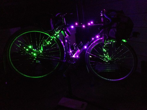
Bought purple and green LED holiday lights and spoke reflectors for the bike.
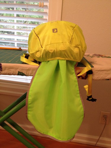
Made a hi-viz reflective neck flap for my helmet cover, so water wouldn't run off the cover and onto my back/neck via my rain jacket collar.
Susan suggested that another rider and I start earlier, because the timing was such that the turnaround food would be ready at 11:30pm, and maybe we wouldn't make it in 5.5 hours. So we planned to start a half hour before the main group.
I spent the afternoon lying around reading a book. Almost as good as sleeping.
Arrived at the start (Grand Central Bakery), unloaded the bike and asked Chris W to watch it while I found a place to park the car. Met some riders I didn't know.
Interesting conversation with some other patrons - one was French and was curious about the "Randonneur" on so many of our jerseys. "It means hiker!" Yes, it does, and also a type of bicyclist. He'd never heard of PBP. One of the women was amazed that we were planning to ride through the night. Yes, we have lights and reflective gear. Had any of us ever been hit by a car? Well, yes, that would be me. The bike was seriously crunched. I was lucky. And Susan said: "it wasn't her fault. The driver wasn't looking." True that.
"Did you all come down from Seattle to do this?" Some riders did, but you don't have live in Seattle to get that blue wool jersey.
Admired all the decorated bikes. Asta's was a work of art, with green lights on the rims.
Susan gave Anita the Tracks of Death warning, but also said that I knew all about them (only 1.5 miles from my house), and I'd not let her go zipping across them.
I'd finished my eggnog latte and pastry (serious meal consumed a couple hours before), It was 5:30, and time for us to depart. Norm snapped a few pictures of us before we pulled out.
photo by Norm Carr
Anita is not from around here, so she was counting on me to navigate us through the suburbs and small towns for the first 20 or so miles. No worries on my part, other than it is harder to see navigational signs in the dark.
Our first interesting bit was the Fanno Creek Trail. I was wondering how that section of the trail had fared in the rain, and, sure enough, we got to a Closed, Detour sign. Amazingly enough, the detour was signed all the way through the neighborhood! The last sign was not too well placed, but I realized we'd end up on Scholl's Ferry if we didn't get back on the trail, and, sure enough, there was the sign, placed right where our headlights wouldn't catch it.
Successful navigation of the Tracks of Death, and then traversing through Beaverton south of Farmington Rd, crossing north into Aloha and continuing west on Johnson (wow, nice new pavement!), and finally into Hillsboro, passing by the Intel Ronler Acres fab, and out to North Plains, our first control.
While it was dark, it wasn't raining, and I finally pulled off the warm overgloves and rode with just ratty short finger gloves. The jacket, jersey, and baselayer were zipped and unzipped as necessary.
Anita said "so, I hear you spin...", which led to a long conversation on spinning and knitting.
We had a brief pause at North Plains, and then headed south. We were out in the country now, and only had to pass through the small town of Cornelius. I knew where the right turn after Cornelius was, but Anita had gotten ahead and passed it. I stopped and yelled. And yelled. She finally noticed that my light wasn't following, and came back.
A bit further along, we passed by the Fern Hill wetlands, which were FULL. The field on the other side of the road was also flooded. At the corner of Geiger and Fern Hill, the road heading north was flooded and closed, which is why we went through Cornelius, rather than Forest Grove.
The route went all the way down Fern Hill/Spring Hill/North Valley, to Ribbon Ridge. I pointed out the flooded wetlands to the west, and said we'd probably see cars parked at the road end of the flooded driveways (they have boats for just this eventuality). It had been raining lightly off and on (mostly off), but we did have a noticeable headwind as soon as we turned south from North Plains. It was a surprisingly bright night, even though it was cloudy. Or maybe the purple and green lights on my bike gave me that impression. Even though I've got a Luxos headlight, it still seemed rather less dark than it should have been.
As we got to the southern end of this leg, I started looking for bike headlights. I could see a group behind us as we were headed up Ribbon Ridge to Kuehne, and they caught us on Kuehne, so we all rode the last 12 miles sort of together.
Asta, Anita and I were so caught up in admiring the decorations in downtown McMinnville that we rode right past the control and had to head back a few blocks. The locals were delighted by our brightly lit bikes.
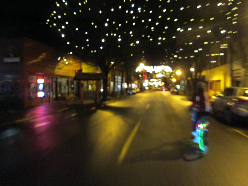
 |
| No Flash, photo by Graham Ross |
 |
| Bicycle Headlights, photo by Graham Ross |
We rolled our bikes right into the hotel, where they joined all the twinkly bikes already parked. One hotel staffer, clearly not in on the program... "you rode all the way from Portland? Are you going to stay here and ride back tomorrow?"
 |
| photo by Norm Carr |
I was starting to wobble and shiver, so Susan suggested I put on a dry shirt. Asta came along, just to make sure I didn't fall over :-) Dry shirt installed, I drank a lot of water, a gel, a handful of salt, some coffee, and managed to eat a piece of really good pizza. I wish I'd had the appetite for more (the McMenamins Hood River Pizza), because it was really, really good. My stomach was unhappy, probably because my sinuses were dripping down my throat the whole way out.
I also changed my socks. The plastic bags had prevented leakage, but they were soggy from sweat. Again, if we hadn't had an extended stop, this wouldn't have been an issue. But if I'm damp, I will get cold on a protracted stop.
So, dry baselayer, dry socks, and a dry cap, damp jersey over that :-) and we all headed out. Norm had planned to be sweep, so we rode together the whole way back. There was a cracking tailwind any time we were headed north, which was most of the way to North Plains. While Norm and I have been on several of the same rides, we really haven't had an opportunity for extended conversation, and it was really nice to finally get to do that.
Still not raining, other than the occasional drizzle. By now there was absolutely NO ONE on the roads but us. There was a police car with lights flashing on Ribbon Ridge, but nothing else there, so we singled up and went around.
At one point Norm said "well, it's 2:30 in the morning... " Me: "don't say that! I don't want to know!" But I wasn't getting in the least bit sleepy, which I had worried about, as my night riding track record isn't the best.
Though the wetlands, and up to North Plains, where we found pretty much everyone else. Jeff L, Michal, and Chris were heading out, but the balance of the riders were sitting around drinking coffee and eating salty snacks. My stomach was still crabby, so I went for some pretzels. Norm produced a generic Pepcid, which I took with some hope that it might help. He also had a collapsible flask of something :-) but found no takers for that.
A store patron (3:40am) "aren't you all up early!" No, no, we haven't gone to sleep.
Now we would be going generally south and east, and would have a headwind for the last 23 miles, as well as various traffic control devices, because we were back within the Urban Growth Boundary.
It was windy. Heading south was a challenge. And it finally started to rain. We slogged our way back through Hillsboro, Aloha, and Beaverton, onto the Fanno Creek Trail, where we did have one navigational question. Norm: "GPS says go this way." Ok. It really was the only way to go; the other turn dumped us onto a street.
As we were headed up the final couple miles (Multnomah Blvd), another cyclist came up. I thought it might be Jason H, but I wasn't sure. There was an interesting navigational bit to get us up the hill a couple blocks to the finish (Multnomah/SW Portland, the Bermuda Triangle of the city), and, hey! We were finished! Five minutes to spare! (35 minutes for Norm and Jason)
 |
| Finish at Fat City Cafe, photo by Michal Young |
Other than the not-eating part, it was a lively breakfast gathering. Cards were finished and handed back to Susan for transfer to the perm owner. Stories were told. Some had been worried that Anita and I would get misplaced on the outgoing Fanno Creek Trail detour. (Not really. Not only am I a local, but this is MY local; I ride through the neighborhood fairly often, although not usually on the trail, but I do know where it goes, as well as how to get to the end via the surface streets.)
Cyndi wouldn't hear of my walking the bike down to the car, nor would she and Michal hear of Asta riding home. So we were all stuffed in the van and I was shuttled down to my car. My car warms up very quickly, so I didn't freeze on the drive home.
I took a very hot shower and conked out for a nap. The bike remained in the car until Monday afternoon.
Knowing That An Official Finish Wasn't Likely
There we sat in Hits the Spot cafe, trying to pick a perm pop which was maybe achievable, given the staggering amount of rain and flooding we'd had the past week. (For the record, every Oregon perm I own is probably still flooded out.) North Plains Carlton would take us down Fern Hill Rd, which reliably floods every single heavy rain, as well as floodable stretches on Spring Hill Rd.
North Plains Banks Vernonia runs right along a couple of creeks. Vernonia was flooded, and all approaches to the town were also flooded. Roads washed away. The trail status was "closed from Manning to Vernonia", with no specifics. More than one of us really wanted to know how the trail was doing, so off we went.
The leg from North Plains to Banks was fine, although we could see where the creeks had flooded and run over the road in several places.
The trail from Banks to Manning had some litter, and, again, we could see where the trail had been flooded. There were still some underwater bits, but they were neither long nor deep.
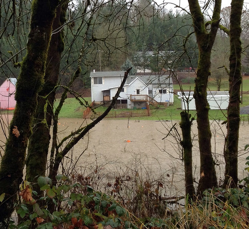
Then the fun began. There was some litter on the trail, but nothing worth stopping and pitching to the side. Then, a bit before the Buxton Trestle...
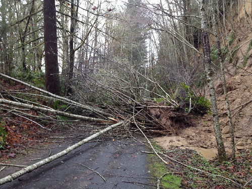
It was thought that maybe we could go around on the right, but, poking the sludge with stick revealed that it had the consistency of quicksand. Ok, Let's give up and over on the left a try. Between the three of us, we were able to relay the bikes around the top of the tree.
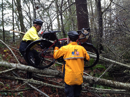
"Only one portage". Ok, good to know we have limits.
It was raining heavily on and off. Feet were still good. Hands were still good.
Proceeding on, we passed a few other runners and cyclists. Every so often we'd stop and pitch a big branch off to the side. There was another fallen tree, which was also successfully maneuvered off the trail.
The Nowakowski Rd crossing was clear, but the road up hill was flooded. Tophill was uneventful, and the trail was pretty clear heading down towards Vernonia, but at the McDonald Rd crossing, the Trail Closed signage stepped up a notch. Perhaps we should head back. One rider: "I didn't think we'd get this far!"
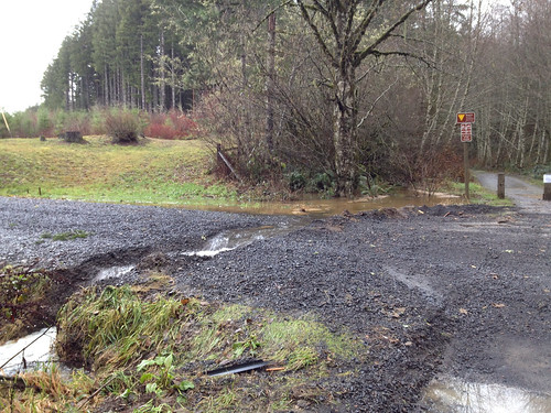
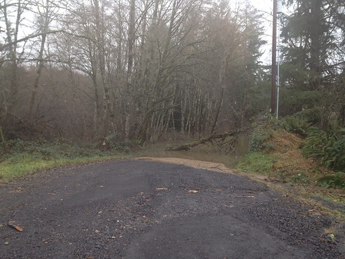
Headed back up. The descent was less fun than usual, because we were all wet, and it was cold and raining.
Portaged back over the fallen tree, and then stopped to feed someone, who was running low on zip.
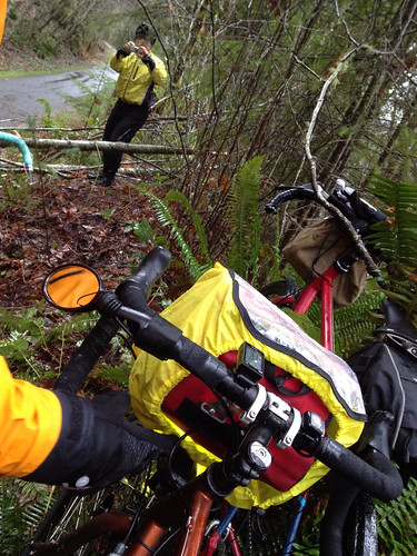
Quote: "If I wasn't having so much fun, I'd be cold and miserable!".
We thought about stopping for coffee in Banks, but by then we'd stopped descending, added another layer or two, and were warmed up, so we headed all the way back to North Plains.
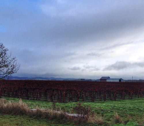
The guys loaded up and went right on home; I went back into the cafe with my towel and dry shoes (what, you don't carry a towel in your car?), and drank several cups of coffee!
North Plains Banks Vernonia runs right along a couple of creeks. Vernonia was flooded, and all approaches to the town were also flooded. Roads washed away. The trail status was "closed from Manning to Vernonia", with no specifics. More than one of us really wanted to know how the trail was doing, so off we went.
The leg from North Plains to Banks was fine, although we could see where the creeks had flooded and run over the road in several places.
The trail from Banks to Manning had some litter, and, again, we could see where the trail had been flooded. There were still some underwater bits, but they were neither long nor deep.
Then the fun began. There was some litter on the trail, but nothing worth stopping and pitching to the side. Then, a bit before the Buxton Trestle...
It was thought that maybe we could go around on the right, but, poking the sludge with stick revealed that it had the consistency of quicksand. Ok, Let's give up and over on the left a try. Between the three of us, we were able to relay the bikes around the top of the tree.
"Only one portage". Ok, good to know we have limits.
It was raining heavily on and off. Feet were still good. Hands were still good.
Proceeding on, we passed a few other runners and cyclists. Every so often we'd stop and pitch a big branch off to the side. There was another fallen tree, which was also successfully maneuvered off the trail.
The Nowakowski Rd crossing was clear, but the road up hill was flooded. Tophill was uneventful, and the trail was pretty clear heading down towards Vernonia, but at the McDonald Rd crossing, the Trail Closed signage stepped up a notch. Perhaps we should head back. One rider: "I didn't think we'd get this far!"
Headed back up. The descent was less fun than usual, because we were all wet, and it was cold and raining.
Portaged back over the fallen tree, and then stopped to feed someone, who was running low on zip.
Quote: "If I wasn't having so much fun, I'd be cold and miserable!".
We thought about stopping for coffee in Banks, but by then we'd stopped descending, added another layer or two, and were warmed up, so we headed all the way back to North Plains.
The guys loaded up and went right on home; I went back into the cafe with my towel and dry shoes (what, you don't carry a towel in your car?), and drank several cups of coffee!
Wednesday, November 11, 2015
Verboort Populaire
I like this ride. How can one NOT like a ride which goes through Timber, Oregon, where everything is HO scale, to Vernonia, where the delights of Black Bear Coffee await, and then a return on the Banks Vernonia Trail?
(Note: not many pictures. Rain. Long finger gloves.)
I did some recruiting with a new cycling buddy a month or so ago, and she signed up to ride. You know, populaires, the gateway drug to randonneuring?
Because of various things, I arrived at the start just in time to sign in before the pre-ride announcements, so we departed 10 minutes after the appointed hour of 9am.
I didn't get a cue sheet, and I hadn't printed one out, but it really wasn't needed.
Kathryn, Bill A, and I headed out through Forest Grove, to Gales Creek, and onto Hwy 6. Kathryn and I stopped at the c-store just before the turn onto Timber Rd; Bill passed us there; we didn't see him again.
Note: the portapotty outside the store is now locked, but the key is inside. It seems to stay much cleaner that way.
It started raining somewhere along here. I had worried that I would be too warm in my AmFib tights, booties, and jacket, but the body adjusted, so it was about right. Slogged on up the switchbacks to find Kathryn with another rider who had a sliced tire. We didn't have a tire boot (maybe I did, but, in the rain, didn't dig as fully in the saddlebag as I might have), but we suggested he use a dollar bill. He did have one, and was going to give that a try. We left him to it.
The rain was exceptionally heavy for awhile, and, despite the fresh coat of sealer on the booties, the feet started getting soggy. (Note to self, inspect for yet more leaky spots)
We summitted and enjoyed the descent down through Timber. Although Kathryn has done a serious amount of riding in this area, she'd never ridden this route to Vernonia. I pointed out the buffalo just north of Timber.
After a bit of a wait to cross Hwy 26, we continued along the last 12 miles to Vernonia. The rain let up some. Kathryn said she had never voluntarily ridden this kind of distance in the rain.
Ah, finally to the intersection with Hwy 47, and we could see riders headed back on the trail. We arrived in Vernonia and pulled into The Black Bear. Many rando bikes parked outside, although we didn't see them inside; they must have been on the tavern side. The kitchen was not backed up, so I ordered half a Reuben sandwich and an enormous mocha; Kathryn had a grilled cheese sandwich. The remains of the mocha went into my insulated bottle.
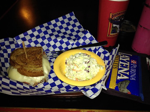
(Note: not many pictures. Rain. Long finger gloves.)
I did some recruiting with a new cycling buddy a month or so ago, and she signed up to ride. You know, populaires, the gateway drug to randonneuring?
Because of various things, I arrived at the start just in time to sign in before the pre-ride announcements, so we departed 10 minutes after the appointed hour of 9am.
I was channeling Captain Overpacker, in that I had extra socks, extra cap, knee warmers in case it got too warm to be wearing thermal tights, and extra gloves. I was wearing my new custom OrRando wool cap.
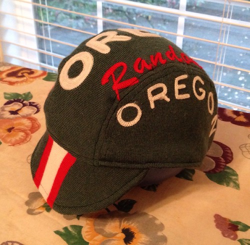
I didn't get a cue sheet, and I hadn't printed one out, but it really wasn't needed.
Kathryn, Bill A, and I headed out through Forest Grove, to Gales Creek, and onto Hwy 6. Kathryn and I stopped at the c-store just before the turn onto Timber Rd; Bill passed us there; we didn't see him again.
Note: the portapotty outside the store is now locked, but the key is inside. It seems to stay much cleaner that way.
It started raining somewhere along here. I had worried that I would be too warm in my AmFib tights, booties, and jacket, but the body adjusted, so it was about right. Slogged on up the switchbacks to find Kathryn with another rider who had a sliced tire. We didn't have a tire boot (maybe I did, but, in the rain, didn't dig as fully in the saddlebag as I might have), but we suggested he use a dollar bill. He did have one, and was going to give that a try. We left him to it.
The rain was exceptionally heavy for awhile, and, despite the fresh coat of sealer on the booties, the feet started getting soggy. (Note to self, inspect for yet more leaky spots)
We summitted and enjoyed the descent down through Timber. Although Kathryn has done a serious amount of riding in this area, she'd never ridden this route to Vernonia. I pointed out the buffalo just north of Timber.
After a bit of a wait to cross Hwy 26, we continued along the last 12 miles to Vernonia. The rain let up some. Kathryn said she had never voluntarily ridden this kind of distance in the rain.
Ah, finally to the intersection with Hwy 47, and we could see riders headed back on the trail. We arrived in Vernonia and pulled into The Black Bear. Many rando bikes parked outside, although we didn't see them inside; they must have been on the tavern side. The kitchen was not backed up, so I ordered half a Reuben sandwich and an enormous mocha; Kathryn had a grilled cheese sandwich. The remains of the mocha went into my insulated bottle.
I spent a bit of time in the restroom blotting the excess water from my tights and jersey. I wasn't cold when I was riding, but removing the extra water would leave much less to evaporate on its own. The AmFib tights are pretty good at keeping me from feeling wet, but they do hold some water. (Note: these are several years old; not to be construed as a review on the current version.)
As we were headed out, I saw Andy and Jeff across the street. And here I thought we were at the very end. They (and Renee, who is Mrs. Andy) caught us on the trail. I heard Andy talking to Kathryn, and called back, asking if he was hitting her up for snacks, because it was her first rando expedition. They pulled ahead at Tophill, but not before Andy and I did a lot of catching up.
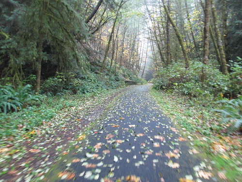
The trail was full of leaves from the deciduous trees, and it was beautiful, if occasionally a bit difficult to distinguish the trail from the not-trail.
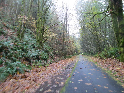
We summitted, and descended with a bit more caution than usual, what with the leaves and the wet bridges.
As we were headed out, I saw Andy and Jeff across the street. And here I thought we were at the very end. They (and Renee, who is Mrs. Andy) caught us on the trail. I heard Andy talking to Kathryn, and called back, asking if he was hitting her up for snacks, because it was her first rando expedition. They pulled ahead at Tophill, but not before Andy and I did a lot of catching up.
The trail was full of leaves from the deciduous trees, and it was beautiful, if occasionally a bit difficult to distinguish the trail from the not-trail.
We summitted, and descended with a bit more caution than usual, what with the leaves and the wet bridges.
One pause by Buxton, so I could swap off my saturated shortfinger gloves (the wool overgloves had been discarded miles ago) for a pair of warm and water-repellent (sort of) synthetic gloves. The gloves were dry, my hands were a bit damp, so there was a lot of wiggling to get my fingers in them. My hands were instantly much, much happier.
Through Banks, onto Wilkesboro, with the standard comments about the new Tracks of Death and Why Didn't They Put in a Bump-Out so the Bikes Could Safely Ride Across Them. Pretty fields, but no picture today.
Through Banks, onto Wilkesboro, with the standard comments about the new Tracks of Death and Why Didn't They Put in a Bump-Out so the Bikes Could Safely Ride Across Them. Pretty fields, but no picture today.
At the turn from Evers onto Osterman, Kathryn said that she hadn't turned the cue sheet, and we really had a bit further to go than earlier reported. My reply - the finish is just around that corner. (And my bike computer was less than a tenth of a mile off the cue sheet distance :-) )
The most difficult part of the ride was wading through the festival traffic to get to the finish at the bingo tent at the far end of the festival. The RBA and host were lurking at the entrance, so we leaned our bikes on handy walls, and went in to complete the finish rituals.
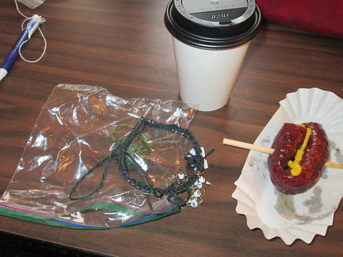
I pulled off my cap and wrung it out, said goodbye to Kathryn (she had a thing she had to be at), and bought sausage on a stick and a cup of coffee. As I was now off the signed release, it was coffeeneuring and socializing time. And knitting a bit on the Flower Fair Isle sock #2.
The RBA and host were going over the rider list, and asked if we had seen Jeff L. Um, yeah. They were ahead of us...
A few minutes later, I saw them pull in. Wondering how exactly did they get misplaced, I asked. Andy: "it said to turn left on Wilkesboro, and we did, except we found ourselves on Hwy 6!" I have done that exactly once, myself. Heading south out of Banks, after crossing under Hwy 6, the on-ramp is the first left, with a protected left turn, and, a mere few yards later is the left onto Wilkesboro, just before the decrepit white building, with no protected left.
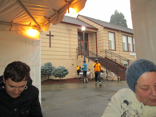
After everyone had gotten sausage on a stick and beverage of choice (no beer there), more socializing. One of the festival workers was trying to sell us bingo cards, and asked about the ride. "Where did you start?" Forest Grove. Pause. You could see her thinking. Verboort is only 2 miles from Forest Grove. I helpfully clarified: "by way of Vernonia."
I walked over to the bulk sales area to get some sausage to take home for dinner. We had company coming and that was going to be dinner. Oops. Guess I didn't ride fast enough :-( Sent a text to the spouse alerting him, so alternate plans could be made. I'd be getting home not too far ahead of everyone else.
Went back to get my bike and found the other three getting ready to head back. They had planned to ride on Martin, but I suggested Porter, because it was not the main road. And so, a bit over two miles later, we were back. They took their leave, and I started loading up the car. Bill A came over - he'd done it right, and gone by a coffee shop in Forest Grove.
Now headed home to get dinner underway. I didn't get out of the wet clothing and into the shower until I got part of dinner cooking. Fitz had bought more sausage at the Farmer's Market that morning, just to have it around, so main course was managed.
Now headed home to get dinner underway. I didn't get out of the wet clothing and into the shower until I got part of dinner cooking. Fitz had bought more sausage at the Farmer's Market that morning, just to have it around, so main course was managed.
Tuesday, November 3, 2015
The Rains Return - North Plains Carlton 100k
Ray was planning to ride the Orenco-Gaston 100k. After a very dry summer and early fall, the wet weather pattern has finally returned. It was going to be windy, and, later in the day, very, very wet.
He reconsidered, and suggested North Plains-Carlton, at which point I was game. Sort of. I was worried about flooding. Spouse was less than supportive. Ray figured it had been so dry that it would take a lot of rain to cause flooding.
I had the usual obsession over What to Wear, which happens every year when the weather changes. Got dressed, stepped outside (it was WARM), and removed a few layers. My only concession to the possible rain was a helmet cover.
So there we were, Ray, Mrs. Ray (she was just there for breakfast), and me, having breakfast at the Spot and snarking around with the owner.
Not raining when we departed, and indeed, although there were occasional bands of rain, nothing that rose to the level of needing rain gear. There was a stiff headwind the whole way to Carlton. We were looking forward to the corresponding tailwind on the return.
Ray got a flat on Fryer Rd, just a couple of miles from the turnaround in Carlton. He changed it in less than 10 minutes. I am impressed.
We stopped at our usual place, the Carlton Bakery. They were pushing various pumpkin baked goods, but I stayed with the Pain au Chocolate and a cup of coffee.
(For the record, I had calories in the bottle and a pbj sandwich for on-route consumption).
No rain headed back, and we did have that tailwind, which blew us north for a good long while. All good until somewhere between Gaston and Forest Grove (about 50 miles in), the rain decided to be more consistent. And persistent.
I finally pulled over just before Forest Grove to add a rain jacket, but didn't bother with anything else. I was already wet, but not sopping. Feet were still dry. How much worse could it get?
Ha. The skies opened and the wind shifted to smack us in face. My shoes filled up. Fortunately, it wasn't cold. That was a long 14 miles to the end. Ray and I see-sawed, and finally stayed together just after Roy. Which is good, because even though it is only 5-ish miles from there, that stretch always seems longer.
We noted our time at the finish, loaded up the bikes, and went inside. In my case, I had tossed in a towel, a dry shirt and some flip-flops, and walked in drying my hair.
The owner brought us coffee, and suggested that if we wanted to wring anything out, we should do it in the bathroom. I poured out my shoes (really), extracted gallons of water from the socks, changed my shirt, and did a LOT of blotting on the knickers.
No pictures, because I thought it would be raining more. Which is too bad, because the fall colors were wonderful, and we saw deer, buffalo, cattle, a whole bunch of cute goats, a heron in flight, and Ray spotted a beaver.
No flooding on the route. The Fern Hill Wetlands still have lots of capacity. The weather reporters did say that even though it was not quite a record rainfall day, it was close. Almost 2 inches.
Shoes are drying on the furnace intake.
Learning: be more proactive with the rain gear!
He reconsidered, and suggested North Plains-Carlton, at which point I was game. Sort of. I was worried about flooding. Spouse was less than supportive. Ray figured it had been so dry that it would take a lot of rain to cause flooding.
I had the usual obsession over What to Wear, which happens every year when the weather changes. Got dressed, stepped outside (it was WARM), and removed a few layers. My only concession to the possible rain was a helmet cover.
So there we were, Ray, Mrs. Ray (she was just there for breakfast), and me, having breakfast at the Spot and snarking around with the owner.
Not raining when we departed, and indeed, although there were occasional bands of rain, nothing that rose to the level of needing rain gear. There was a stiff headwind the whole way to Carlton. We were looking forward to the corresponding tailwind on the return.
Ray got a flat on Fryer Rd, just a couple of miles from the turnaround in Carlton. He changed it in less than 10 minutes. I am impressed.
We stopped at our usual place, the Carlton Bakery. They were pushing various pumpkin baked goods, but I stayed with the Pain au Chocolate and a cup of coffee.
(For the record, I had calories in the bottle and a pbj sandwich for on-route consumption).
No rain headed back, and we did have that tailwind, which blew us north for a good long while. All good until somewhere between Gaston and Forest Grove (about 50 miles in), the rain decided to be more consistent. And persistent.
I finally pulled over just before Forest Grove to add a rain jacket, but didn't bother with anything else. I was already wet, but not sopping. Feet were still dry. How much worse could it get?
Ha. The skies opened and the wind shifted to smack us in face. My shoes filled up. Fortunately, it wasn't cold. That was a long 14 miles to the end. Ray and I see-sawed, and finally stayed together just after Roy. Which is good, because even though it is only 5-ish miles from there, that stretch always seems longer.
We noted our time at the finish, loaded up the bikes, and went inside. In my case, I had tossed in a towel, a dry shirt and some flip-flops, and walked in drying my hair.
The owner brought us coffee, and suggested that if we wanted to wring anything out, we should do it in the bathroom. I poured out my shoes (really), extracted gallons of water from the socks, changed my shirt, and did a LOT of blotting on the knickers.
No pictures, because I thought it would be raining more. Which is too bad, because the fall colors were wonderful, and we saw deer, buffalo, cattle, a whole bunch of cute goats, a heron in flight, and Ray spotted a beaver.
No flooding on the route. The Fern Hill Wetlands still have lots of capacity. The weather reporters did say that even though it was not quite a record rainfall day, it was close. Almost 2 inches.
Shoes are drying on the furnace intake.
Learning: be more proactive with the rain gear!
Monday, February 2, 2015
Rainy February Tour of Washington and Yamhill Counties
Earlier this week, the spouse asked: "are you riding this Sunday?" Wondering what brought this on, I asked why. "Well, it is a new month". Indeed it is. Also a day of a major sportsing event on the tv. So major that everyone would be inside watching.
Except me. And, after an email exchange with Michal, him, too.
He and Cyndi arrived in time for a yummy dinner - Fitz made tortilla soup, and I made up a batch of cornbread. I'll take just about any excuse for making cornbread.
We were riding my 1401: Beaverton-Hagg Lake-Carlton perm, and after some discussion and negotiation, settled on a 6:30am start time.
I was looking at Wundermap as we were eating breakfast. The forecast had been for "showers early, clearing off in the afternoon". The map was solid green and yellow. Well, that was unfortunate. We were prepared, but still...
Our options for start locations that early on a Sunday were limited, but the Starbucks was open. Not only that, they were now open until 8pm, so we wouldn't have to finish at another place. Even better: "If you save your receipt, you can get a pastry for $1.00 after 2pm". We assured them we were all about saving our receipts, and would see them that evening.
And so we set out in the rain. We headed west and north for about 10 miles, popping out of the Urban Growth Boundary just west of NW Cornelius Pass Rd on West Union. My legs felt vaguely leaden. The route is not flat - goes up and down forever. After passing through the Helvetia area, we looped around and through North Plains, past the lumber mill (pause for me to pump up the front tire; seemed surprisingly squashy, but not going flat), Banks, where there was a brief pause, and then out Cedar Canyon and back along Stafford/Strohmayer/Kansas City... to Forest Grove, our first timed control. Now, I can get to Forest Grove by a fairly direct route; 18 miles. Or we could take the scenic 42 mile route, which is this perm.
Again, because Sunday, not much open in Forest Grove, especially before 11am. Since we arrived about 10:30, our options were the convenience store and the lottery deli. Wanting to be expedient, we stopped at the c-store. There was cue sheet flippage here, done very carefully, because we didn't want to get them wet and we were awfully saturated by this point.
Now we were headed off to Hagg Lake, which has the most concentrated climbing of the route. As always, once the initial ramp is surmounted, it is a fun loop around the lake. It seemed by now that we had been riding forever, but it wasn't even after noon. I think the rain started clearing away here, but I don't remember. My gloves were pretty heavy; I squeezed them out, which helped. They'd be cold after I took them off, but would warm up in about 15 minutes. I felt somewhat zippier after the stop in Forest Grove, but I don't think it showed much :-)
After leaving Hagg Lake, we discovered that there was a headwind. We did stop in Gaston, because we needed to top up liquids (Lynne eats a banana and some fruitcake).
So, 15 miles of headwind to Carlton. While I wasn't flying along, my pace wasn't too bad, except on the three bigger hills, where I fell back.
Michal's GPS was actively trying to sabotage his route in Yamhill; I had to retrieve him from a wrong turn. Now just 3 miles to Carlton along the shoulder of Hwy 47. A little narrow for my taste, but certainly rideable.
Ray had introduced me to the Carlton Bakery a couple weekends before. Oh my goodness, yes! Not only are they a bakery, they've got soup, sandwiches, coffee, and, of course, many tasty baked things.


One of the best half hour control stops ever. I decided it was truly done raining, and removed the Rainlegs.
Now we were headed north and east, and fully expecting a tailwind. And, indeed, the pace we were riding increased, with much less effort. One of the more enjoyable traverses of North Valley/Spring Hill.
Brief pause to apologize for not a lot of pictures - I wore different gloves, and they weren't conducive to pulling out the camera while moving, nor, for that matter, getting food from my bag. They weren't wool. I was hoping for serious water resistance, but they gave that up. At least my hands stayed warm.
Just before Forest Grove, we turned east, and then a few miles of south (boo), then back east and some north again. Just north of the Rood Bridge, we found ourselves back in the Urban Growth Boundary, and had only a bit over 10 miles to go. One more on-course timed control. 6 miles to go, all mostly on SW Baseline; a straight shot to Beaverton.
We pulled in at 6:40pm, for 12:10 elapsed time. And we produced our receipts from the morning and got our $1 pastries!
Got home just as the sportsing event ended. Excellent timing.
Except me. And, after an email exchange with Michal, him, too.
 |
| Bribery works. |
We were riding my 1401: Beaverton-Hagg Lake-Carlton perm, and after some discussion and negotiation, settled on a 6:30am start time.
I was looking at Wundermap as we were eating breakfast. The forecast had been for "showers early, clearing off in the afternoon". The map was solid green and yellow. Well, that was unfortunate. We were prepared, but still...
Our options for start locations that early on a Sunday were limited, but the Starbucks was open. Not only that, they were now open until 8pm, so we wouldn't have to finish at another place. Even better: "If you save your receipt, you can get a pastry for $1.00 after 2pm". We assured them we were all about saving our receipts, and would see them that evening.
 |
| Starbucks Start |
Again, because Sunday, not much open in Forest Grove, especially before 11am. Since we arrived about 10:30, our options were the convenience store and the lottery deli. Wanting to be expedient, we stopped at the c-store. There was cue sheet flippage here, done very carefully, because we didn't want to get them wet and we were awfully saturated by this point.
Now we were headed off to Hagg Lake, which has the most concentrated climbing of the route. As always, once the initial ramp is surmounted, it is a fun loop around the lake. It seemed by now that we had been riding forever, but it wasn't even after noon. I think the rain started clearing away here, but I don't remember. My gloves were pretty heavy; I squeezed them out, which helped. They'd be cold after I took them off, but would warm up in about 15 minutes. I felt somewhat zippier after the stop in Forest Grove, but I don't think it showed much :-)
After leaving Hagg Lake, we discovered that there was a headwind. We did stop in Gaston, because we needed to top up liquids (Lynne eats a banana and some fruitcake).
So, 15 miles of headwind to Carlton. While I wasn't flying along, my pace wasn't too bad, except on the three bigger hills, where I fell back.
Michal's GPS was actively trying to sabotage his route in Yamhill; I had to retrieve him from a wrong turn. Now just 3 miles to Carlton along the shoulder of Hwy 47. A little narrow for my taste, but certainly rideable.
Ray had introduced me to the Carlton Bakery a couple weekends before. Oh my goodness, yes! Not only are they a bakery, they've got soup, sandwiches, coffee, and, of course, many tasty baked things.
And a rubber stamp.
 |
| Of course I can make that stamp work with the card! |
Now we were headed north and east, and fully expecting a tailwind. And, indeed, the pace we were riding increased, with much less effort. One of the more enjoyable traverses of North Valley/Spring Hill.
Brief pause to apologize for not a lot of pictures - I wore different gloves, and they weren't conducive to pulling out the camera while moving, nor, for that matter, getting food from my bag. They weren't wool. I was hoping for serious water resistance, but they gave that up. At least my hands stayed warm.
Just before Forest Grove, we turned east, and then a few miles of south (boo), then back east and some north again. Just north of the Rood Bridge, we found ourselves back in the Urban Growth Boundary, and had only a bit over 10 miles to go. One more on-course timed control. 6 miles to go, all mostly on SW Baseline; a straight shot to Beaverton.
We pulled in at 6:40pm, for 12:10 elapsed time. And we produced our receipts from the morning and got our $1 pastries!
Got home just as the sportsing event ended. Excellent timing.
Wednesday, January 21, 2015
Not Entirely Fun, But A Beautiful Route
Ray was rounding up riders for his newest perm pop, North Plains-Carlton. There was rumored to be a very nice bakery in Carlton. Every time I have ridden through there, it has been the grocery store or the convenience store. Adequate, really, but a bakery would definitely improve the ambiance!
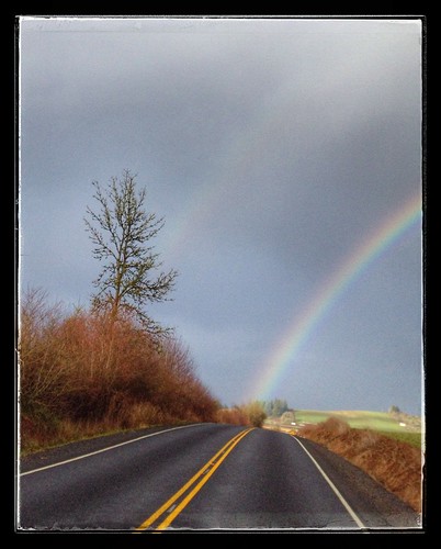
It was going to rain. Bands of rain, interspersed with no rain. There would be a 10-15 mile headwind on the outbound leg. I kept muttering "not as bad as that ride with Theo, not as bad as that ride with Theo..."
Riders ended up being Ray, RB, Chris, and me. After second breakfast at the Mc D's in North Plains, we headed out. Strangely, riding west wasn't really an issue. And it was raining. At one point, there was a stop to adjust layers, but I kept on going. "I am slow, you all will easily catch me"
Now, after the last ride/flatfest, I bought new tubes, replaced one tire, and moved my front tire, which looked pretty good, and had not yet flatted, to the rear. You can see where this is going. About 15 miles in, just past Fisher Farms, I came up with a rear flat. On a new tube :-(
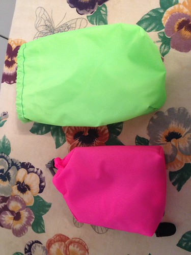
Pulled out my bright pink flat fixing stuff bag (to some trash talk), and Ray and I set about repair. Swapped on the spare tire and another tube, pumped it up, and off we went. I even remembered to wear the gloves, so my hands weren't filthy. "Aren't you all glad I went ahead?" :-)
The spare tire felt squirmy/weird the entire ride, but it held.
Onward through the wind and rain. The guys would pull ahead, but occasionally I'd come up on one or more waiting. Once we got to Hwy 240, the hilly part of the ride commenced. Usually, unless one is a certain perm owner who always includes a gravel/dirt interlude, one gets to Carlton heading west into Yamhill, then south to Carlton. It can be shortened by going OVER the hill one is mostly riding around. The views are great.
So there it was - a climb, and a descent on gravel. Very hard pack, with loose bits, so I kept the speed way down. Found the bakery in Carlton (it hides behind a coffee stand, but it is on the left, just around the corner) and everyone else.
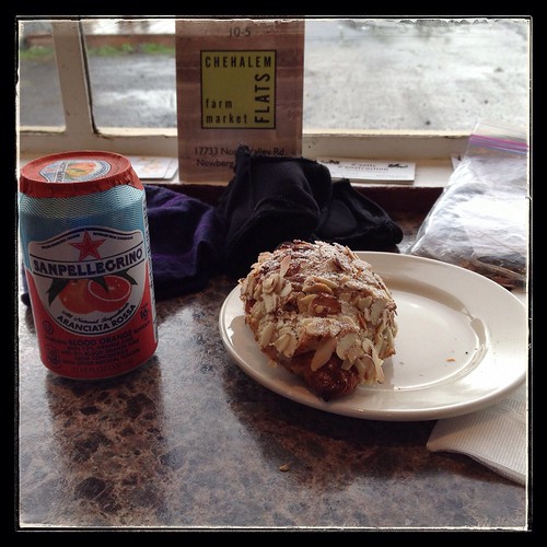
So there was a sit to enjoy my croissant and Pellegrino. There was supposed to be a tailwind on the return.
Off we went, now climbing UP the gravel road. No stops. I am pretty sure there was a tailwind, but I didn't feel the love quite as much as everyone else. Don't know what it is, other than I am going to the gym 2-3 times a week now, and perhaps my body hasn't quite adapted. In any case, it is very frustrating to me, and my head was going to really bad places by this point. Fortunately, the scenery was great.
Ate a banana, half a pbj, some Endurolytes, and a gel, in hopes that it would improve my zip. And some ibuprofen for the hurts.
North on Spring Hill, eventually turning onto Fern Hill, and, a bit before the water treatment plant, I spotted a cyclist headed my way. It turned out to be RB, who had come back to see if I was "making adequate progress". We found the rest of the group at the Fernhill Wetlands, but kept going.
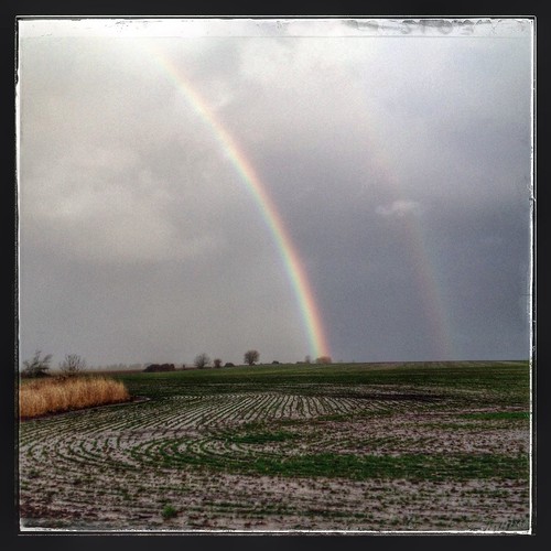
There were some double rainbows.
In my head: "Forest Grove to Verboort, 2 miles, Verboort to Roy, 4 miles, Roy to North Plains, 6 miles." I wasn't feeling quite so bad at this point, mostly because I couldn't see anyone up ahead that I felt I had to push to catch up to.
We had planned to finish at the cafe, and I found everyone in there, already drinking coffee. My coffee quickly appeared, and the owner already knew what I was going to order. She remembered from last time. I think I am now a "regular".
Good things: it did rain a LOT, but my feet did not get wet (Lake shoes with Endura booties over them). Rainlegs do a dandy job of keeping the "raining on you" feeling away. And I did finish with 24 minutes to spare.
The new tires arrived yesterday; I'll get them on the bike before the next ride.
It was going to rain. Bands of rain, interspersed with no rain. There would be a 10-15 mile headwind on the outbound leg. I kept muttering "not as bad as that ride with Theo, not as bad as that ride with Theo..."
Riders ended up being Ray, RB, Chris, and me. After second breakfast at the Mc D's in North Plains, we headed out. Strangely, riding west wasn't really an issue. And it was raining. At one point, there was a stop to adjust layers, but I kept on going. "I am slow, you all will easily catch me"
Now, after the last ride/flatfest, I bought new tubes, replaced one tire, and moved my front tire, which looked pretty good, and had not yet flatted, to the rear. You can see where this is going. About 15 miles in, just past Fisher Farms, I came up with a rear flat. On a new tube :-(
Pulled out my bright pink flat fixing stuff bag (to some trash talk), and Ray and I set about repair. Swapped on the spare tire and another tube, pumped it up, and off we went. I even remembered to wear the gloves, so my hands weren't filthy. "Aren't you all glad I went ahead?" :-)
The spare tire felt squirmy/weird the entire ride, but it held.
Onward through the wind and rain. The guys would pull ahead, but occasionally I'd come up on one or more waiting. Once we got to Hwy 240, the hilly part of the ride commenced. Usually, unless one is a certain perm owner who always includes a gravel/dirt interlude, one gets to Carlton heading west into Yamhill, then south to Carlton. It can be shortened by going OVER the hill one is mostly riding around. The views are great.
So there it was - a climb, and a descent on gravel. Very hard pack, with loose bits, so I kept the speed way down. Found the bakery in Carlton (it hides behind a coffee stand, but it is on the left, just around the corner) and everyone else.
So there was a sit to enjoy my croissant and Pellegrino. There was supposed to be a tailwind on the return.
Off we went, now climbing UP the gravel road. No stops. I am pretty sure there was a tailwind, but I didn't feel the love quite as much as everyone else. Don't know what it is, other than I am going to the gym 2-3 times a week now, and perhaps my body hasn't quite adapted. In any case, it is very frustrating to me, and my head was going to really bad places by this point. Fortunately, the scenery was great.
Ate a banana, half a pbj, some Endurolytes, and a gel, in hopes that it would improve my zip. And some ibuprofen for the hurts.
North on Spring Hill, eventually turning onto Fern Hill, and, a bit before the water treatment plant, I spotted a cyclist headed my way. It turned out to be RB, who had come back to see if I was "making adequate progress". We found the rest of the group at the Fernhill Wetlands, but kept going.
There were some double rainbows.
In my head: "Forest Grove to Verboort, 2 miles, Verboort to Roy, 4 miles, Roy to North Plains, 6 miles." I wasn't feeling quite so bad at this point, mostly because I couldn't see anyone up ahead that I felt I had to push to catch up to.
We had planned to finish at the cafe, and I found everyone in there, already drinking coffee. My coffee quickly appeared, and the owner already knew what I was going to order. She remembered from last time. I think I am now a "regular".
Good things: it did rain a LOT, but my feet did not get wet (Lake shoes with Endura booties over them). Rainlegs do a dandy job of keeping the "raining on you" feeling away. And I did finish with 24 minutes to spare.
The new tires arrived yesterday; I'll get them on the bike before the next ride.
Tuesday, May 6, 2014
Nonsensical, Yes Indeed
I had posted in the Oregon Randonneur and Seattle Randonneur Facebook pages, looking for riders interested in participating in Fleche Northwest. Narayan promptly signed on, followed quickly by Geoff, Keith, and Paul. As they were all from Seattle, I'd be wearing the blue jersey for this one.

The weather looked to be not bad, and there would even be a tailwind. Oh my. Shipped a box of clothes off to the hotel in Olympia. Bicycle cleaned. Previous saddle pulled out of the closet and reinstalled.
Day of, did the last food preparations (lox and bagel is a tasty ride snack), and dozed for about an hour in the afternoon. I can't say I slept, but I didn't do anything else.
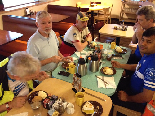
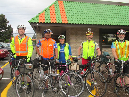
The guys all drove to Olympia and caught the train there. Then they hopped the MAX train, and I met them at the transit center, where we coasted back down to the house. They all had a pre-dinner beer, then dinner all around. Then it was time to ride over to the start (7 minutes tops), and have our pre-ride pie and coffee. Fitz joined us there and took our only team picture. Keith thanked me for organizing and all. Me: "you say that NOW."
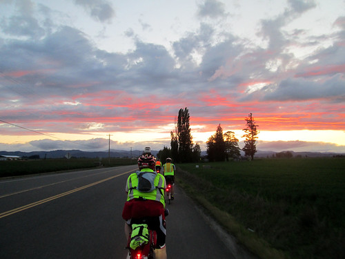
Given that the first 32 turns of our 78 turn cue sheet were getting us 12.1 miles to the edge of the Urban Growth Boundary, I took the lead. We had an amazing sunset as we headed towards Banks, our first control.
It was dark as we emerged from the control and started towards Vernonia on the Banks Vernonia Trail. I love my Luxos U headlight - it lit up the trail from edge to edge and illuminated well forward. Nice views of the stars and crescent moon at the road crossings.
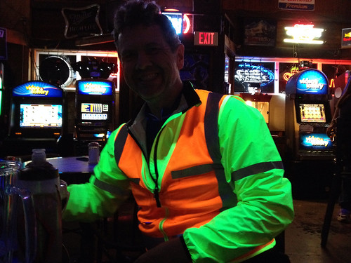
Popped out into Vernonia, and had a brief discussion as to whether we should use the Cedar Side Inn or the bar across the street for a control. I suggested we go into the Cedar Side Inn, in case anyone wanted food. It was QUITE lively and loud in there. Blacklights, too, so we lit up the place in our neon/reflective vests. There was a birthday party going on, and Birthday Girl was completely entranced with our adventure. She ended up buying a round of coffee for us, and would have gotten us drinks, if we'd wanted them.
It was starting to get cold, so we all pulled on more layers. Not raining, so I didn't go so far as to add booties and RainLegs.
A couple of locals warned us about rude and/or drunk drivers on the road to Astoria. We thanked them and headed out. (For the record, until we got close to Astoria, we saw only three cars)
Given my spectacular bonk on the 300k a couple weeks ago, Narayan made it a point to make sure I was eating. My timer watch had given it up on the 300k, so I bought a countdown timer app for the phone. I had food. Also lots of Perpetuem. So I was, indeed, eating.
My plan, at least, was to take a short rest stop at the Jewell Elk Refuge. There is water, and the bathrooms are heated. We could conk out in one of them. Randos know the classiest places to stop. We arrived with plenty of time - no need to be to Astoria before 6am - so filled up bottles, took care of other business, then sat down and dozed for about 20 minutes.
The coffee from Vernonia was making my stomach quite unhappy. I kept sipping liquids and eating quiet food, but it wasn't helping much.
Then, a couple miles out from the stop, at mile 82, the rain started. Darn. Pause while some of us added rain gear. Spun our way up to the Coast Range summit at mile 86. The rain got more insistent, and then even more so as we descended 11 miles. Brrr. The headlight was just wonderful, though.
Somewhere along there (Olney?) we pulled over and ended up doing a glove handout - one rider who shall remain nameless had only shortfinger gloves, so I loaned him my extra wool gloves. Keith shared some gloves with another rider. By this point I was wearing shortfinger gloves, Smartwool liner gloves, and ragg gloves with grippy palms over those. The outer two layers of gloves were worn intermittently for the balance of the ride.
Then there was a not really flat 11 mile stretch to Astoria, where we could see the Astoria airport and Warrenton as we rode by. The sky gradually lightened. What with the clouds and rain, I am sure the sun was there somewhere, but not yet seen. There was one really evil metal grid bridge. I was riding with Paul at this point, and we worked our way around the peninsula Astoria sits on, passing the bridge, and ending up at the Pig and Pancake. We found the other three inside, wet helmets and gloves and jackets draped everywhere.
Food and beverages were ordered; some attempted a nap.
This year I managed to eat all my hashbrowns, two eggs and almost a half a piece of toast. Antacids were produced to settle my stomach. Keith consumed a massive plate of biscuits and gravy. I am in awe.
Breakfast over, we then crossed over the Astoria Megler Bridge (4 miles long!) into Washington. The rain had let up some, but not stopped entirely. We wandered upriver a bit, and then rode up and over a ridge, heading inland.
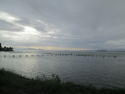
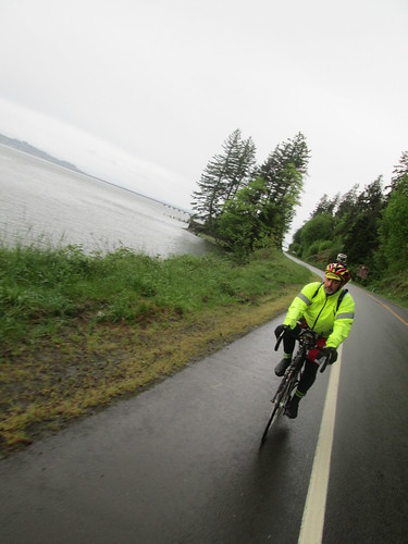
Brief pause in Naselle for someone to buy food, but nothing was open yet. We were behind time, but this was expected; I knew we'd make it up. And now, there was nothing but riding between here and Raymond. We did have our tailwind. We also had the seemingly endless little climbs. And rain. And more rain. Heavy rain. I think all the rain in the universe was concentrated in the area around South Bend/Raymond as we were passing through. Munched on some more antacids; they were settling my stomach.
So that we wouldn't lose time there, I made the call to pull into a c-store in South Bend, and then we'd ride through Raymond, and the looming 4 hills. The first is a 400 foot climb, with a not particularly good shoulder, followed by three more 150-200 feet climbs. The road got much better. The other riders pulled ahead, and I didn't see anyone until the last climb, where I found Narayan. We all regrouped briefly, planning to stop at the Chevron in Montesano. I fell off the back again, and rode the 8 miles to Montesano solo.
Found everyone in the store. My first order of business was to swap the batteries in the SPOT, because it was telling me the batteries were low. Then I bought some peanut butter crackers; I was pretty tired of sweet stuff. We were almost an hour ahead of where I had been last year; looking good!
Then we headed off to McCleary, our 22 hour control. It looked like we'd get to take an actual break there. But wait! What was this headwind? Ack. So, slogging eastward, again riding solo after awhile. Bad, negative thoughts going through my head, along the lines of "I will never do this again, ever". I am sure this is partly because every single brevet I have ridden this year, and a fair number of permanents have been in very suboptimal weather.
The shoulder improves greatly once in Elma, but after awhile, one gets the feeling that McCleary is a myth, never to be found. But eventually it was, and there were bicycles parked outside the Subway, and many "wet floor" signs on the floor :-)
There was plenty of time to get a bowl of soup, a flatizza, and a Coke. We spread out on the booths, and left massive puddles wherever we stood or sat. I only wish I had not been so thoroughly saturated, because it really wasn't very warm in there. Well, it may have been warm enough if I had been dry.
Just before 5pm, we started reassembling for the final push. We had to ride together for the last two hours, so Narayan suggested I lead. Into the pouring rain, out of town, and over the hill to get onto Hwy 8. Lots of fast traffic, but also wonderfully wide shoulders; no worries. So there we were, and Keith rides up to tell me the other three are off the back. ??? Slowed down for the others to catch up.
Gentle uphill for about 10 miles, but it really didn't seem that far. Then downhill, off Hwy 8, and downhill some more, at which point there was only the climb just past the Blue Heron Bakery, and a couple of miles navigating through Olympia.
By now I was not considering finding a spot to wait until just before 7pm to finish right at 24 hours (tradition). Too cold and wet. The suggested route in to the finish location was a bit weird. I had scoped it out on Google Street View, but still made the gps-equipped team members lead us in. And there was still confusion at the bridge. But finish we did, at 6:48pm.
Dripped our way into the hotel, to be welcomed by riders who had finished earlier and taken hot showers and were wearing dry clothing :-)
Geoff and Paul changed and took themselves right back to Seattle, but Narayan, Keith, and I went out for some tasty Thai food. More random visiting back at the hotel, back to the room to chat with Susan and Asta, and then oblivion.
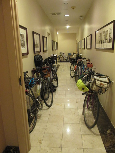
The next morning Susan got me some coffee (thank you!) while I packed up and organized. Looked like I'd be wearing yesterday's riding clothes for the trip to the train station - didn't want to be sitting on the train in wet clothes. Ewww.
But anyway, first there was first breakfast (hotel's continental breakfast) with many of the riders, and then we all adjourned to second breakfast (the after-ride banquet). Much fun, hearing about the other rides. Except possibly the team that didn't get rained on until the last 10 miles, and had warm sunny skies.
As planned, we took the Lowball Award. The route was even .1km longer than last year. :-)
Then it was time to change into the still damp jersey and shorts, and head off to the train station. Susan had concocted a route, but Andy S suggested we go a different way, involving some of the local bike trails. I know we ended up on the Chehalis-Western trail, but am not entirely sure how we got there. And coming off the trail, the development we rode through looked very familiar. Once we popped out on the Yelm Highway, I recognized the RAPsody route. Just a bit of riding there, and we were at the train station.
James was there as well :-) The train pulled in, we handed up our bikes, and went to find some seats. Shortly after departing, I changed my clothes, which was much better for everyone around me. The train arrived about 20 minutes early; Fitz was there very soon thereafter to collect us.
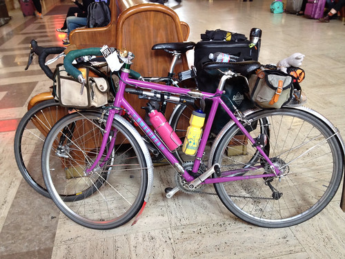
What went right? Surprisingly, a lot of things. Alert readers will note that I said nothing about falling asleep on the bike, bonking, having saddle issues or shoe issues.
What I wore - started out with a LS wool jersey, Louis Garneau Neo Power shorts, wool sports bra (very important), wool quarter socks, Assos gloves, stripey homemade cycling cap, and Gore Visibility Vest. In Vernonia I swapped on a wool beanie, and added a short sleeve wool jersey and wool armwarmers underneath. Also my Showers Pass jacket, venerable PI kneewarmers, some toe covers. When the rain set in, on went the helmet cover, wool longfinger gloves, RainLegs and Endura rain booties. Before the end (LONG before the end), I was completely saturated, but not cold, as long as I was moving. Stops weren't so very relaxing, because I'd start to shiver.
Randonesia is setting in, even.
All the pictures (not many, too wet to pull the camera out very much) here
| Route profile - not flat by any definition |
I planned to re-use last year's route, with one change - we'd go around in Astoria, rather than over. That was painful. The route got .1 km longer, 360.1 km total, but I still figured we'd be a shoo-in for the Lowball Award. The team name, by a vote of the 5 team members, was Nonsense Prevails.
The weather looked to be not bad, and there would even be a tailwind. Oh my. Shipped a box of clothes off to the hotel in Olympia. Bicycle cleaned. Previous saddle pulled out of the closet and reinstalled.
Day of, did the last food preparations (lox and bagel is a tasty ride snack), and dozed for about an hour in the afternoon. I can't say I slept, but I didn't do anything else.
The guys all drove to Olympia and caught the train there. Then they hopped the MAX train, and I met them at the transit center, where we coasted back down to the house. They all had a pre-dinner beer, then dinner all around. Then it was time to ride over to the start (7 minutes tops), and have our pre-ride pie and coffee. Fitz joined us there and took our only team picture. Keith thanked me for organizing and all. Me: "you say that NOW."
Given that the first 32 turns of our 78 turn cue sheet were getting us 12.1 miles to the edge of the Urban Growth Boundary, I took the lead. We had an amazing sunset as we headed towards Banks, our first control.
 |
| Banks Thriftway control - Paul, Geoff, Lynne. Photo by Keith Moore |
Popped out into Vernonia, and had a brief discussion as to whether we should use the Cedar Side Inn or the bar across the street for a control. I suggested we go into the Cedar Side Inn, in case anyone wanted food. It was QUITE lively and loud in there. Blacklights, too, so we lit up the place in our neon/reflective vests. There was a birthday party going on, and Birthday Girl was completely entranced with our adventure. She ended up buying a round of coffee for us, and would have gotten us drinks, if we'd wanted them.
It was starting to get cold, so we all pulled on more layers. Not raining, so I didn't go so far as to add booties and RainLegs.
A couple of locals warned us about rude and/or drunk drivers on the road to Astoria. We thanked them and headed out. (For the record, until we got close to Astoria, we saw only three cars)
Given my spectacular bonk on the 300k a couple weeks ago, Narayan made it a point to make sure I was eating. My timer watch had given it up on the 300k, so I bought a countdown timer app for the phone. I had food. Also lots of Perpetuem. So I was, indeed, eating.
My plan, at least, was to take a short rest stop at the Jewell Elk Refuge. There is water, and the bathrooms are heated. We could conk out in one of them. Randos know the classiest places to stop. We arrived with plenty of time - no need to be to Astoria before 6am - so filled up bottles, took care of other business, then sat down and dozed for about 20 minutes.
 |
| Napping. photo by Keith Moore |
Then, a couple miles out from the stop, at mile 82, the rain started. Darn. Pause while some of us added rain gear. Spun our way up to the Coast Range summit at mile 86. The rain got more insistent, and then even more so as we descended 11 miles. Brrr. The headlight was just wonderful, though.
Somewhere along there (Olney?) we pulled over and ended up doing a glove handout - one rider who shall remain nameless had only shortfinger gloves, so I loaned him my extra wool gloves. Keith shared some gloves with another rider. By this point I was wearing shortfinger gloves, Smartwool liner gloves, and ragg gloves with grippy palms over those. The outer two layers of gloves were worn intermittently for the balance of the ride.
Then there was a not really flat 11 mile stretch to Astoria, where we could see the Astoria airport and Warrenton as we rode by. The sky gradually lightened. What with the clouds and rain, I am sure the sun was there somewhere, but not yet seen. There was one really evil metal grid bridge. I was riding with Paul at this point, and we worked our way around the peninsula Astoria sits on, passing the bridge, and ending up at the Pig and Pancake. We found the other three inside, wet helmets and gloves and jackets draped everywhere.
Food and beverages were ordered; some attempted a nap.
 |
| Narayan, Paul, and Geoff. Photo by Keith Moore |
Breakfast over, we then crossed over the Astoria Megler Bridge (4 miles long!) into Washington. The rain had let up some, but not stopped entirely. We wandered upriver a bit, and then rode up and over a ridge, heading inland.
Brief pause in Naselle for someone to buy food, but nothing was open yet. We were behind time, but this was expected; I knew we'd make it up. And now, there was nothing but riding between here and Raymond. We did have our tailwind. We also had the seemingly endless little climbs. And rain. And more rain. Heavy rain. I think all the rain in the universe was concentrated in the area around South Bend/Raymond as we were passing through. Munched on some more antacids; they were settling my stomach.
So that we wouldn't lose time there, I made the call to pull into a c-store in South Bend, and then we'd ride through Raymond, and the looming 4 hills. The first is a 400 foot climb, with a not particularly good shoulder, followed by three more 150-200 feet climbs. The road got much better. The other riders pulled ahead, and I didn't see anyone until the last climb, where I found Narayan. We all regrouped briefly, planning to stop at the Chevron in Montesano. I fell off the back again, and rode the 8 miles to Montesano solo.
Found everyone in the store. My first order of business was to swap the batteries in the SPOT, because it was telling me the batteries were low. Then I bought some peanut butter crackers; I was pretty tired of sweet stuff. We were almost an hour ahead of where I had been last year; looking good!
Then we headed off to McCleary, our 22 hour control. It looked like we'd get to take an actual break there. But wait! What was this headwind? Ack. So, slogging eastward, again riding solo after awhile. Bad, negative thoughts going through my head, along the lines of "I will never do this again, ever". I am sure this is partly because every single brevet I have ridden this year, and a fair number of permanents have been in very suboptimal weather.
The shoulder improves greatly once in Elma, but after awhile, one gets the feeling that McCleary is a myth, never to be found. But eventually it was, and there were bicycles parked outside the Subway, and many "wet floor" signs on the floor :-)
There was plenty of time to get a bowl of soup, a flatizza, and a Coke. We spread out on the booths, and left massive puddles wherever we stood or sat. I only wish I had not been so thoroughly saturated, because it really wasn't very warm in there. Well, it may have been warm enough if I had been dry.
Just before 5pm, we started reassembling for the final push. We had to ride together for the last two hours, so Narayan suggested I lead. Into the pouring rain, out of town, and over the hill to get onto Hwy 8. Lots of fast traffic, but also wonderfully wide shoulders; no worries. So there we were, and Keith rides up to tell me the other three are off the back. ??? Slowed down for the others to catch up.
Gentle uphill for about 10 miles, but it really didn't seem that far. Then downhill, off Hwy 8, and downhill some more, at which point there was only the climb just past the Blue Heron Bakery, and a couple of miles navigating through Olympia.
By now I was not considering finding a spot to wait until just before 7pm to finish right at 24 hours (tradition). Too cold and wet. The suggested route in to the finish location was a bit weird. I had scoped it out on Google Street View, but still made the gps-equipped team members lead us in. And there was still confusion at the bridge. But finish we did, at 6:48pm.
Dripped our way into the hotel, to be welcomed by riders who had finished earlier and taken hot showers and were wearing dry clothing :-)
Geoff and Paul changed and took themselves right back to Seattle, but Narayan, Keith, and I went out for some tasty Thai food. More random visiting back at the hotel, back to the room to chat with Susan and Asta, and then oblivion.
The next morning Susan got me some coffee (thank you!) while I packed up and organized. Looked like I'd be wearing yesterday's riding clothes for the trip to the train station - didn't want to be sitting on the train in wet clothes. Ewww.
But anyway, first there was first breakfast (hotel's continental breakfast) with many of the riders, and then we all adjourned to second breakfast (the after-ride banquet). Much fun, hearing about the other rides. Except possibly the team that didn't get rained on until the last 10 miles, and had warm sunny skies.
As planned, we took the Lowball Award. The route was even .1km longer than last year. :-)
Then it was time to change into the still damp jersey and shorts, and head off to the train station. Susan had concocted a route, but Andy S suggested we go a different way, involving some of the local bike trails. I know we ended up on the Chehalis-Western trail, but am not entirely sure how we got there. And coming off the trail, the development we rode through looked very familiar. Once we popped out on the Yelm Highway, I recognized the RAPsody route. Just a bit of riding there, and we were at the train station.
James was there as well :-) The train pulled in, we handed up our bikes, and went to find some seats. Shortly after departing, I changed my clothes, which was much better for everyone around me. The train arrived about 20 minutes early; Fitz was there very soon thereafter to collect us.
What went right? Surprisingly, a lot of things. Alert readers will note that I said nothing about falling asleep on the bike, bonking, having saddle issues or shoe issues.
What I wore - started out with a LS wool jersey, Louis Garneau Neo Power shorts, wool sports bra (very important), wool quarter socks, Assos gloves, stripey homemade cycling cap, and Gore Visibility Vest. In Vernonia I swapped on a wool beanie, and added a short sleeve wool jersey and wool armwarmers underneath. Also my Showers Pass jacket, venerable PI kneewarmers, some toe covers. When the rain set in, on went the helmet cover, wool longfinger gloves, RainLegs and Endura rain booties. Before the end (LONG before the end), I was completely saturated, but not cold, as long as I was moving. Stops weren't so very relaxing, because I'd start to shiver.
Randonesia is setting in, even.
All the pictures (not many, too wet to pull the camera out very much) here
Subscribe to:
Posts (Atom)