Which bike ride to do this weekend? If I had been quicker to commit, could have ridden a 100k populaire and rolled over 4000 RUSA km. Or, I could ride with Portland Velo, which I have not done for a few months. So, out the door shortly after 8am, to be in Hillsboro for the 9am start. I was riding Sweetpea, as it was supposed to rain. Attached myself to Dana and JRod's 16-18mph group. Someone looked at Sweetpea and wondered if I did a little randonneuring. I do a lot of randonneuring :-) and he was rando-curious. So I suggested he come out for the Verboort ride in a couple of weeks and did a fair amount of evangelizing.
The route was Carpenter Creek, starting at LaCie in Hillsboro, heading west, through Verboort, and skirting Forest Grove to the west. We stopped at the new park at the corner of Thatcher and David Hill (plumbing!). Everyone was pulling off jackets and gloves and really didn't have a place to stow them. There was a movement afoot to stash them all in my Carradice, but I wasn't going for it. Swung my leg up to get back on the bike and REALLY whacked my shin on a bike rack. It smarted for a good 5 miles, and I will probably have a spectacular bruise. We continued up David Hill and turned left on Forest Gale rather than getting there via Thatcher. Nicer route.
Pause at a convenience store for one rider who had forgotten his water. I'd been moving through my water bottles, so bought some water to top up. No one accepted my offer of water, and we still had at least 20 miles to go. Okay then. Difference between club riders and randos. Always top up the water bottles.
Over to Stringtown Rd, then onto Carpenter Creek and up. Maybe a mile climb, not hard. The view from the top was breathtaking - autumn scenery to the south and west, and an amazing color display at the ornamental nursery just past the summit and then looking down to Dilley Rd from Plumlee. The group paused, but I continued on. Working hard to keep up, so I elected to not stop; they'd catch up.
Crossed HWY 47 at Spring Hill, and listened to what appeared to be a million geese honking on the approach to Fern Hill. North on Fern Hill, east on Geiger, watching huge flocks of geese wheel in the sky.
I was fading (yes, I was eating). More to the point, my quads and hamstrings were hurting. Through Cornelius, chatting with Ellen, on complete autopilot back to the start. Dana stayed back with us, which was nice, but not needed. (I am also a ride leader, but not playing one today). And done.
Chatted with KRhea; he promised the triathlon pictures he took that we have not seen yet. He told me about his new bike, which will be purple - we got to this thread because Sweetpea is purple and he really likes purple and "you don't see it often".
Joined Dana, JRod, and Ron at Longbottoms for a Farm Plate and a nice long visit before heading out the 10 miles back home. While we were sitting there, an older woman came over and said: "I just have to tell you - you look so fit and healthy. So many women don't these days." Um. Thank you. That was novel and unexpected, for sure.
Then headed home, with not quite so much zip. Stopped in Cedar Hills and took a couple of ibuprofen. Sloooow. Must not be recovered, because this is too short a distance with not much climbing to make me hurt this much.
62.7 miles for the day, for an overall average of 13.9. The average up until the last 10 miles was 14.5mph.
Just 29 miles shy of 5000 miles ridden this year. It should happen in the next week.
Postscript: It did not rain. Not even drizzle. However, my brilliantly reflective and long red mudflaps got a lot of love. You can get them here: Rainy Day Biking
Saturday, October 22, 2011
Monday, October 17, 2011
Don't Try This At Home
A year ago, I ran my first half marathon. I was pretty pleased to have finished, and signed up for it again this year. Started running, took a break some time before the 400k, and finally made myself start running again, in September. Right. Get myself in shape for a half in less than two months. Clearly spending too much time on the bicycle.
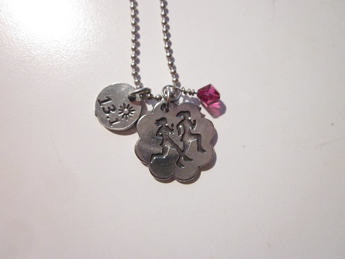
Longest run since September was 8 miles; most were between 4 and 5 miles. A total of 11 runs. Denial works really well, it does.
Yesterday Cecil and I rode out from her house to pick up our race packets in Vancouver, WA. We took the scenic route (well, mostly scenic; not possible to make Hayden Island or parts of Interstate Blvd scenic), including two crossings of the I-5 bridge and a stop for late lunch at Cup and Saucer in Kenton. All told, about 35 miles.
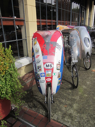
Bonus encounter - riding into Vancouver... Cecil: "I recognize the fairings on those bents!". Yes, indeed. Random, unannounced ride on the east side (ok, this ride east side AND Vancouver), and yes, we run into Dave and/or Edna. Every single time. Went inside and visited for a bit, then went and picked up our race packets.
Heading out of Vancouver, I heard a "Lynne! Lynne!"... Whereupon a person I had never met before introduced himself and said he recognized the bear. (!)
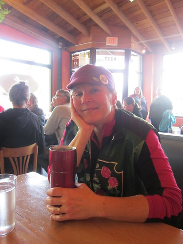
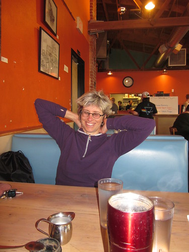
Great ride with Cecil. We should do this more often. I think we will.
(oh, right, I was talking about a run.)
Met Cecil right at 7am at Kettleman's for pre-race bagels and coffee. About 7:45, we thought we should go North.
Parking was a teeny bit of a challenge; we got a space 3 (or so) blocks away. Stood around. Dropped my bag in the bag drop. Visiting with Laura R. We knew other folks were running, but did not see them beforehand. Half-heartedly participated in the pre-race warmup. Got our iPods going (me - Box of Rain. Cecil - Velvet Underground. I do not think there is any intersection at all on our iPods)
13.1 miles in front of me, and face it, I had not properly trained. All I could count on was that I had run the distance before, had done a bit of running, and had the endurance from all that cycling. Finishing would be good.
We filtered up to the front, to get out ahead of the walkers. Aaaaand we were off. Cecil zipped off (she's a real jackrabbit), and I plonked along at a relatively steady pace. Got passed by all the fast girls. Out east along the river, through an industrial park, keep going... I walked through the water stops (roughly every two miles) and got some water, and sucked down a gel every 30 minutes (roughly every three miles). What? Every three miles? I was running right at 10:00? I could tell when the gel kicked in. I could also tell when it was wearing off. Turn around and head back. Lots of folks still heading out.
Plonk plonk plonk... Right around mile 9, we turned right, ran up a ramp, and down into Fort Vancouver. Well, the park that is Fort Vancouver - the fort (or a reasonably accurate reproduction) is over a bit to the east in the park. East past Pearson Field (airport). East out of the park/airfield, past some malls, then north (and up a bit of a hill), and....turning west for the last time. Still keeping close to that 10 minute mile. I don't reliably run that fast in training.
Lots of little kids all holding out their hands for high fives. Fun for both of us. West back into Fort Vancouver, then up another hill, past Officers' Row, across I-5. Getting close now!
A few more blocks, crowds getting larger, then right, up one block, right again and done!
Susan O was cheering from the sidelines. Gave them back my timing chip, and went off to find Cecil and food. Also found Susan O, Linda and Scott (Linda ran fast! Scott cheered.), Jill and Catherine.
Much hugging and picture taking!
And, checking my time...
bib number: 820
age: 55
gender: F
location: Portland, OR
overall place: 722 out of 1922
division place: 25 out of 86
time: 2:12:30
pace: 10:07
new personal record!
But, about that don't try this at home... Aftermath. More than 24 hours after, I still hurt. Don't skimp on the training and think your awesome endurance will carry you through. I mean, it WILL, but, at least in my case, I was writing checks my legs couldn't cash.

Longest run since September was 8 miles; most were between 4 and 5 miles. A total of 11 runs. Denial works really well, it does.
Yesterday Cecil and I rode out from her house to pick up our race packets in Vancouver, WA. We took the scenic route (well, mostly scenic; not possible to make Hayden Island or parts of Interstate Blvd scenic), including two crossings of the I-5 bridge and a stop for late lunch at Cup and Saucer in Kenton. All told, about 35 miles.
Bonus encounter - riding into Vancouver... Cecil: "I recognize the fairings on those bents!". Yes, indeed. Random, unannounced ride on the east side (ok, this ride east side AND Vancouver), and yes, we run into Dave and/or Edna. Every single time. Went inside and visited for a bit, then went and picked up our race packets.

Heading out of Vancouver, I heard a "Lynne! Lynne!"... Whereupon a person I had never met before introduced himself and said he recognized the bear. (!)


Great ride with Cecil. We should do this more often. I think we will.
(oh, right, I was talking about a run.)
Met Cecil right at 7am at Kettleman's for pre-race bagels and coffee. About 7:45, we thought we should go North.
Parking was a teeny bit of a challenge; we got a space 3 (or so) blocks away. Stood around. Dropped my bag in the bag drop. Visiting with Laura R. We knew other folks were running, but did not see them beforehand. Half-heartedly participated in the pre-race warmup. Got our iPods going (me - Box of Rain. Cecil - Velvet Underground. I do not think there is any intersection at all on our iPods)
13.1 miles in front of me, and face it, I had not properly trained. All I could count on was that I had run the distance before, had done a bit of running, and had the endurance from all that cycling. Finishing would be good.
We filtered up to the front, to get out ahead of the walkers. Aaaaand we were off. Cecil zipped off (she's a real jackrabbit), and I plonked along at a relatively steady pace. Got passed by all the fast girls. Out east along the river, through an industrial park, keep going... I walked through the water stops (roughly every two miles) and got some water, and sucked down a gel every 30 minutes (roughly every three miles). What? Every three miles? I was running right at 10:00? I could tell when the gel kicked in. I could also tell when it was wearing off. Turn around and head back. Lots of folks still heading out.
Plonk plonk plonk... Right around mile 9, we turned right, ran up a ramp, and down into Fort Vancouver. Well, the park that is Fort Vancouver - the fort (or a reasonably accurate reproduction) is over a bit to the east in the park. East past Pearson Field (airport). East out of the park/airfield, past some malls, then north (and up a bit of a hill), and....turning west for the last time. Still keeping close to that 10 minute mile. I don't reliably run that fast in training.
Lots of little kids all holding out their hands for high fives. Fun for both of us. West back into Fort Vancouver, then up another hill, past Officers' Row, across I-5. Getting close now!
A few more blocks, crowds getting larger, then right, up one block, right again and done!
 |
| I just finished! (picture by Susan Otcenas) |
Susan O was cheering from the sidelines. Gave them back my timing chip, and went off to find Cecil and food. Also found Susan O, Linda and Scott (Linda ran fast! Scott cheered.), Jill and Catherine.
 |
| Jill, Catherine, Cecil and me at the finish (picture by Susan Otcenas) |
And, checking my time...
bib number: 820
age: 55
gender: F
location: Portland, OR
overall place: 722 out of 1922
division place: 25 out of 86
time: 2:12:30
pace: 10:07
new personal record!
But, about that don't try this at home... Aftermath. More than 24 hours after, I still hurt. Don't skimp on the training and think your awesome endurance will carry you through. I mean, it WILL, but, at least in my case, I was writing checks my legs couldn't cash.
Sunday, October 2, 2011
Vertical Feet. Most ever.
This song played in my head for most of the climb to Lost Lake. I was pretty sure I was not going to make the control by the cut-off time - I'd need to average 7mph the whole way up...
But back to the beginning. The October OrRando brevet is traditionally John Kramer's Bikenfest, out of Hood River or Bingen. This year John proposed a two-loop route out of Hood River, with over 10,000 vertical feet of climbing. I'll come right out and say that I voted for last year's route. Really pretty, and only 7800 vertical feet. I've never done anything more than that in one go. There was a 40% (at least) chance of rain forecasted. Three years ago I DNFed on this very ride in miserable conditions, and was very much hoping that would NOT be the case this time.
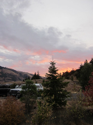
But here I was, admiring a glorious sunrise from the Twin Tunnels West Trailhead and visiting with the other riders, waiting for the start. Lesli was riding (yay!) along with the other usual suspects. Well, most of them. Lesli: "Where's Michal?"
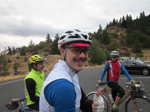
John mentioned that there were some sharp curves descending from Lost Lake, and recommended we be off the Lost Lake descent by dark. And so, at 7:30, off we went.
The first loop was out to The Dalles and a bit beyond. First we rode on the Twin Tunnels (Mosier Tunnels) trail into Mosier. Wish I'd been quicker with the camera; there was a great shot of the pack silhouetted against the Columbia River down below. Then some climbing. When we topped out, I could see what had to be Chenoweth in the distance at the bottom - we were headed in that general direction. The descent was pretty scary - lots of gusty crosswinds. I started getting tense, which meant the bike started to shimmy a bit. Knee against the top tube put an end to that, but I was happy to get down to the bottom.
My left foot was not staying attached to the pedal particularly well. Perhaps it is time to replace the cleat.
Conversations with Lesli about wool jerseys, specifically the upcoming OrRando wool jersey, triathlons, mid-life crises (or, how I ended up doing really long rides), life at UO, PBP,... Lesli never runs out of conversation, which is great. Every so often we'd look back and wonder what happened to Michal. And then... there he was! Some confusion about getting to the correct end of the trailhead, so he started about 15 minutes later, and pushed it ("flexed his awesome") to catch up. He was just hoping he wouldn't pay for that later.
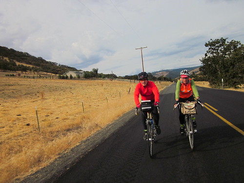
Approaching a control, we found John waiting for us - a secret control :-)
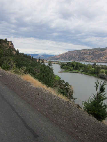
More wandering around up and down, through The Dalles and out, with Lesli, Michal, Bill, Jeff, and Norm, eventually ending up somewhere east of The Dalles, and then turned around to head back to the start. We paused in The Dalles for some supplies (Industrial Size Payday Bar for me) and water, then headed west on Old Hwy 30. This is a beautiful stretch of road, above I-84, with great views of the Columbia River, and a gentle climb (many switchbacks) up to Rowena Crest. Same highway engineer who designed the climb to Crown Point, but this one is somewhat longer.
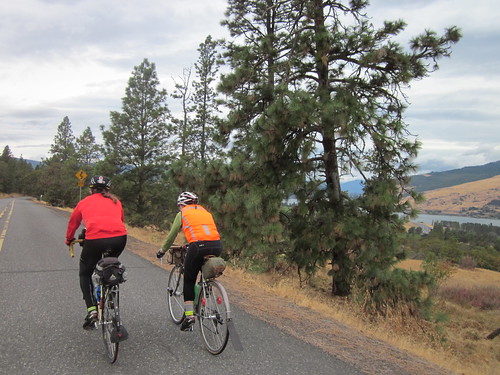
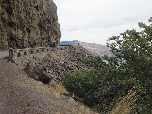
Then along the tops of the ridge, and down to Mosier for some food. The place with espresso, sandwiches and ice cream was CLOSED :-( so we went next door to the market. I had an eggroll. Should have had two. Lesli bought a corndog. Lingering issues from the Alabama public schools have rendered me unable to face a corndog. Plus, they make them with substandard cheap turkey hot dogs (an abomination all by themselves), and wrap them in the worst cornbread ever. My sister-in-law says I'd change my mind if I had one made with decent cornbread and a good Kosher hot dog. But I digress...
Checking my bike, because it was handling strangely and the shifting was off... both my S&S couplers were loose! Why, I don't know, because I crank them down pretty tight. Must have been the chipseal a couple of weeks ago. Brief pause to tighten them up. And remind myself to go back to checking them before each ride.
Up to the trailhead; brief confusion as to where the trailhead actually WAS, then up and through the tunnels again, eventually ending back at our cars. Some people had sandwiches. Others ate cookies and other junk :-) Proceeding onward, up a truly vicious climb (I walked, max grade 14%), and then southward towards Parkdale. Very pretty. This loop of the ride followed The Fruit Loop. I saw several purveyors from our farmer's market. Pears were looking about ready to harvest. Then onto a very discouraging stretch of Hwy 35. Bits of drizzle, but nothing very exciting. I stopped and removed the leg warmers. Uphill, and a nasty chipseal surface. Lesli and Michal pulled away here; I wouldn't see them again for a very long time. Caught up to Bill, then moved on.
Great view of Mt Hood from the north.
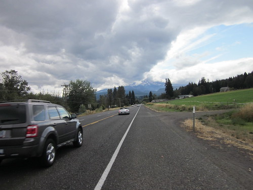
Finally a descent (not that anyone should get excited here; lots more climbing to come), and some rollers into Parkdale. Greg came by at this point, and we arrived in Parkdale together. I desperately needed something to eat, and bought a turkey wrap. Consumed half of it right on the spot (it was very big).
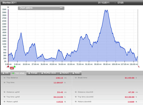
Then off toward Dee (more orchards; the Hood River Valley is really pretty), and the turnoff to the final really big climb of the day. John thoughtfully provided the cumulative elevation gain on the cue sheet, and I could see that between miles 90 and 96, it would be interesting.
Greg came by and went ahead. I eventually caught and passed another rider. This is so very rare that I do feel compelled to mention it :-) Made it to the Wahtum Lake turnoff. Slog, slog, slog. I had to keep my average above 7mph to make the Lost Lake Store (14 mi from the turnoff) by the cutoff time; 5:51. Every so often I'd see a rider headed down. I was surprised how long it did take to see the riders. I figured they'd be long gone. Never did see the Lolo Pass turn, but eventually realized I was on the miles 90-96 stretch. Every so often I'd take a few bites of the turkey wrap. It was helping. And every so often I'd stop. It was a very pretty stretch of road, but it was also a soul-sucking slog uphill. Never got above 7%; mostly 5% with bits of 3%. I liked those. Stopped and sucked down a gel. Conversations in my head about turning around, or laying down and dying right there. It was getting maybe a bit damp; pulled on the TBB vest. Saw a few more riders headed down. Then, glory, hallelujah, a rider said - the turn is right there! Down to the store; saw Lesli leaving. She told me Michal was still inside and pretty cold. Got the store with over 20 minutes to spare. Greg said he should have told me it was an info control; the times are just on the cue sheet for pacing... "I knew you'd kill yourself getting up here". Yeah.
Went inside for some food. Found Michal. He was pretty cold and shaky. It wasn't almost a bonk. It was a real bonk. I have done this to myself enough times that I know it when I see it. Refilled my bottles (consumed the ENTIRE bottle of Nuun on the way up). Drank a hot chocolate. Should have eaten something myself. Stupid. Visited with the proprietor. Washed my face - I was covered in salt crust. That felt so good. Went back out to the bike to get all the clothing I was going to put on for the descent. Preteen girl walking by: "that is SUCH a pretty bike. Purple is my favorite color!" :-)
A couple of riders came and left. Added a few layers (dry baselayer. heaven.). Michal moved past the "if I eat that I am going to throw up" phase, and we headed back down. Really nice pavement at the top. We leapfrogged down - Michal is a faster descender, and he'd stop every so often, I'd zip by, and then he'd come flying by. Then we hit the road construction and slowed down somewhat, making it to the bottom before dark. Barely. Removed a couple of layers, as it was now much warmer (dropping about 2000 feet will do that), and headed out for the last 15 miles.
And then I bonked. We walked one uphill. I finished off the Payday bar and extracted my tortilla- Nutella wrap and finished it off. We were both getting stupid and forgot we made one turn and made it again at the next intersection... And we were lost. Michal called John, and I finally remembered I had Google Maps on my phone. Between all that we got un-lost, and found Jeff back at the intersection where we should have gone straight.
More wandering through Hood River in the pitch black, but I caught a lot of the road signs at crucial points. Lesli and Sarah cheered us on through downtown. Lesli looked like she'd already had her shower. Sigh. Then, with 7 minutes left, up the last half mile. The food had kicked in and I wasn't bonking anymore. Would we make it? It would be very, very close.
We did. On the final minute. John said it would have been a photo finish, but, of course, it was 9pm and pitch dark.
A bit of visiting, some stargazing (WOW! lots of stars!), a Coke, a nice crunchy Honeycrisp apple, and it was time to drive home. Put the iPod on the Epic playlist, cranked up the volume and headed west. Home by 10:30. Still must unload the car. A visit to the scale says I dropped 6 pounds. They'll be back, but I guess I rode really hard yesterday.
All the pics here
Stats: 130.2 mi
11522 vertical feet (OW)
11.66mph avg
But back to the beginning. The October OrRando brevet is traditionally John Kramer's Bikenfest, out of Hood River or Bingen. This year John proposed a two-loop route out of Hood River, with over 10,000 vertical feet of climbing. I'll come right out and say that I voted for last year's route. Really pretty, and only 7800 vertical feet. I've never done anything more than that in one go. There was a 40% (at least) chance of rain forecasted. Three years ago I DNFed on this very ride in miserable conditions, and was very much hoping that would NOT be the case this time.

But here I was, admiring a glorious sunrise from the Twin Tunnels West Trailhead and visiting with the other riders, waiting for the start. Lesli was riding (yay!) along with the other usual suspects. Well, most of them. Lesli: "Where's Michal?"

John mentioned that there were some sharp curves descending from Lost Lake, and recommended we be off the Lost Lake descent by dark. And so, at 7:30, off we went.
The first loop was out to The Dalles and a bit beyond. First we rode on the Twin Tunnels (Mosier Tunnels) trail into Mosier. Wish I'd been quicker with the camera; there was a great shot of the pack silhouetted against the Columbia River down below. Then some climbing. When we topped out, I could see what had to be Chenoweth in the distance at the bottom - we were headed in that general direction. The descent was pretty scary - lots of gusty crosswinds. I started getting tense, which meant the bike started to shimmy a bit. Knee against the top tube put an end to that, but I was happy to get down to the bottom.
My left foot was not staying attached to the pedal particularly well. Perhaps it is time to replace the cleat.
Conversations with Lesli about wool jerseys, specifically the upcoming OrRando wool jersey, triathlons, mid-life crises (or, how I ended up doing really long rides), life at UO, PBP,... Lesli never runs out of conversation, which is great. Every so often we'd look back and wonder what happened to Michal. And then... there he was! Some confusion about getting to the correct end of the trailhead, so he started about 15 minutes later, and pushed it ("flexed his awesome") to catch up. He was just hoping he wouldn't pay for that later.

Approaching a control, we found John waiting for us - a secret control :-)
More wandering around up and down, through The Dalles and out, with Lesli, Michal, Bill, Jeff, and Norm, eventually ending up somewhere east of The Dalles, and then turned around to head back to the start. We paused in The Dalles for some supplies (Industrial Size Payday Bar for me) and water, then headed west on Old Hwy 30. This is a beautiful stretch of road, above I-84, with great views of the Columbia River, and a gentle climb (many switchbacks) up to Rowena Crest. Same highway engineer who designed the climb to Crown Point, but this one is somewhat longer.


Then along the tops of the ridge, and down to Mosier for some food. The place with espresso, sandwiches and ice cream was CLOSED :-( so we went next door to the market. I had an eggroll. Should have had two. Lesli bought a corndog. Lingering issues from the Alabama public schools have rendered me unable to face a corndog. Plus, they make them with substandard cheap turkey hot dogs (an abomination all by themselves), and wrap them in the worst cornbread ever. My sister-in-law says I'd change my mind if I had one made with decent cornbread and a good Kosher hot dog. But I digress...
Checking my bike, because it was handling strangely and the shifting was off... both my S&S couplers were loose! Why, I don't know, because I crank them down pretty tight. Must have been the chipseal a couple of weeks ago. Brief pause to tighten them up. And remind myself to go back to checking them before each ride.
Up to the trailhead; brief confusion as to where the trailhead actually WAS, then up and through the tunnels again, eventually ending back at our cars. Some people had sandwiches. Others ate cookies and other junk :-) Proceeding onward, up a truly vicious climb (I walked, max grade 14%), and then southward towards Parkdale. Very pretty. This loop of the ride followed The Fruit Loop. I saw several purveyors from our farmer's market. Pears were looking about ready to harvest. Then onto a very discouraging stretch of Hwy 35. Bits of drizzle, but nothing very exciting. I stopped and removed the leg warmers. Uphill, and a nasty chipseal surface. Lesli and Michal pulled away here; I wouldn't see them again for a very long time. Caught up to Bill, then moved on.
Great view of Mt Hood from the north.

Finally a descent (not that anyone should get excited here; lots more climbing to come), and some rollers into Parkdale. Greg came by at this point, and we arrived in Parkdale together. I desperately needed something to eat, and bought a turkey wrap. Consumed half of it right on the spot (it was very big).
Then off toward Dee (more orchards; the Hood River Valley is really pretty), and the turnoff to the final really big climb of the day. John thoughtfully provided the cumulative elevation gain on the cue sheet, and I could see that between miles 90 and 96, it would be interesting.
Greg came by and went ahead. I eventually caught and passed another rider. This is so very rare that I do feel compelled to mention it :-) Made it to the Wahtum Lake turnoff. Slog, slog, slog. I had to keep my average above 7mph to make the Lost Lake Store (14 mi from the turnoff) by the cutoff time; 5:51. Every so often I'd see a rider headed down. I was surprised how long it did take to see the riders. I figured they'd be long gone. Never did see the Lolo Pass turn, but eventually realized I was on the miles 90-96 stretch. Every so often I'd take a few bites of the turkey wrap. It was helping. And every so often I'd stop. It was a very pretty stretch of road, but it was also a soul-sucking slog uphill. Never got above 7%; mostly 5% with bits of 3%. I liked those. Stopped and sucked down a gel. Conversations in my head about turning around, or laying down and dying right there. It was getting maybe a bit damp; pulled on the TBB vest. Saw a few more riders headed down. Then, glory, hallelujah, a rider said - the turn is right there! Down to the store; saw Lesli leaving. She told me Michal was still inside and pretty cold. Got the store with over 20 minutes to spare. Greg said he should have told me it was an info control; the times are just on the cue sheet for pacing... "I knew you'd kill yourself getting up here". Yeah.
Went inside for some food. Found Michal. He was pretty cold and shaky. It wasn't almost a bonk. It was a real bonk. I have done this to myself enough times that I know it when I see it. Refilled my bottles (consumed the ENTIRE bottle of Nuun on the way up). Drank a hot chocolate. Should have eaten something myself. Stupid. Visited with the proprietor. Washed my face - I was covered in salt crust. That felt so good. Went back out to the bike to get all the clothing I was going to put on for the descent. Preteen girl walking by: "that is SUCH a pretty bike. Purple is my favorite color!" :-)
A couple of riders came and left. Added a few layers (dry baselayer. heaven.). Michal moved past the "if I eat that I am going to throw up" phase, and we headed back down. Really nice pavement at the top. We leapfrogged down - Michal is a faster descender, and he'd stop every so often, I'd zip by, and then he'd come flying by. Then we hit the road construction and slowed down somewhat, making it to the bottom before dark. Barely. Removed a couple of layers, as it was now much warmer (dropping about 2000 feet will do that), and headed out for the last 15 miles.
And then I bonked. We walked one uphill. I finished off the Payday bar and extracted my tortilla- Nutella wrap and finished it off. We were both getting stupid and forgot we made one turn and made it again at the next intersection... And we were lost. Michal called John, and I finally remembered I had Google Maps on my phone. Between all that we got un-lost, and found Jeff back at the intersection where we should have gone straight.
More wandering through Hood River in the pitch black, but I caught a lot of the road signs at crucial points. Lesli and Sarah cheered us on through downtown. Lesli looked like she'd already had her shower. Sigh. Then, with 7 minutes left, up the last half mile. The food had kicked in and I wasn't bonking anymore. Would we make it? It would be very, very close.
We did. On the final minute. John said it would have been a photo finish, but, of course, it was 9pm and pitch dark.

A bit of visiting, some stargazing (WOW! lots of stars!), a Coke, a nice crunchy Honeycrisp apple, and it was time to drive home. Put the iPod on the Epic playlist, cranked up the volume and headed west. Home by 10:30. Still must unload the car. A visit to the scale says I dropped 6 pounds. They'll be back, but I guess I rode really hard yesterday.
All the pics here
Stats: 130.2 mi
11522 vertical feet (OW)
11.66mph avg
Subscribe to:
Comments (Atom)
