Tuesday, December 22, 2015

Solstice Ride

Over the past several years, the Solstice Ride has become a thing.  Ride through the longest night of the year.  A few years ago, Susan recruited riders to join her in riding Ken's Lunch at Nick's permanent, using the McMenamin's Hotel Oregon in McMinnville as the midpoint, with pizza and coffee.

I never could play, because it was either my dad's birthday, or some social event.  This year, after checking the calendar, I suggested to my mom that if she was having a party for dad that it not be Saturday night.  There was a social event, but I begged off.  Cake and ice cream were scheduled for Sunday afternoon, after Asher (our grandson) woke up from his nap.  I'd probably be awake from my nap by then as well.

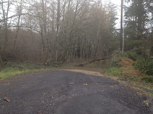
And then it started raining.  And raining.  And flooding.  Susan spent a very large amount of time visiting all the county (two counties!) flood websites and maps, and came up with a reroute that detoured around every single flooded location.

It was supposed to be rainy and low 40's that night.  Prime hypothermia territory, so I packed extra socks, baselayer, caps, and gloves.  Planned to wear newspaper sacks over my socks (I have still not yet achieved non-leaky foot coverings).  Bought another thermal bottle, so I could have two bottles of hot liquid calories.  Eating with fluffy gloves on is problematic.  Drinking is easier.

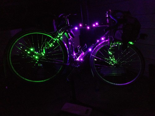
Bought purple and green LED holiday lights and spoke reflectors for the bike.

Festive lighting installed

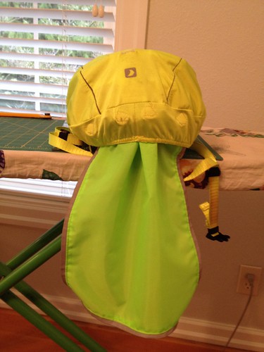
Made a hi-viz reflective neck flap for my helmet cover, so water wouldn't run off the cover and onto my back/neck via my rain jacket collar.

Camera Roll-957

Susan suggested that another rider and I start earlier, because the timing was such that the turnaround food would be ready at 11:30pm, and maybe we wouldn't make it in 5.5 hours.  So we planned to start a half hour before the main group.

I spent the afternoon lying around reading a book.  Almost as good as sleeping.

Arrived at the start (Grand Central Bakery), unloaded the bike and asked Chris W to watch it while I found a place to park the car.  Met some riders I didn't know.  

Interesting conversation with some other patrons - one was French and was curious about the "Randonneur" on so many of our jerseys.  "It means hiker!"  Yes, it does, and also a type of bicyclist.  He'd never heard of PBP.  One of the women was amazed that we were planning to ride through the night.  Yes, we have lights and reflective gear.  Had any of us ever been hit by a car?  Well, yes, that would be me.  The bike was seriously crunched.  I was lucky.  And Susan said: "it wasn't her fault.  The driver wasn't looking."  True that.

"Did you all come down from Seattle to do this?"  Some riders did, but you don't have live in Seattle to get that blue wool jersey.

Admired all the decorated bikes.  Asta's was a work of art, with green lights on the rims.

Susan gave Anita the Tracks of Death warning, but also said that I knew all about them (only 1.5 miles from my house), and I'd not let her go zipping across them.

I'd finished my eggnog latte and pastry (serious meal consumed a couple hours before), It was 5:30, and time for us to depart.  Norm snapped a few pictures of us before we pulled out.

Solstice2015-1
photo by Norm Carr

Anita is not from around here, so she was counting on me to navigate us through the suburbs and small towns for the first 20 or so miles.  No worries on my part, other than it is harder to see navigational signs in the dark.

Our first interesting bit was the Fanno Creek Trail.  I was wondering how that section of the trail had fared in the rain, and, sure enough, we got to a Closed, Detour sign.  Amazingly enough, the detour was signed all the way through the neighborhood!  The last sign was not too well placed, but I realized we'd end up on Scholl's Ferry if we didn't get back on the trail, and, sure enough, there was the sign, placed right where our headlights wouldn't catch it.

Successful navigation of the Tracks of Death, and then traversing through Beaverton south of Farmington Rd, crossing north into Aloha and continuing west on Johnson (wow, nice new pavement!), and finally into Hillsboro, passing by the Intel Ronler Acres fab, and out to North Plains, our first control.

While it was dark, it wasn't raining, and I finally pulled off the warm overgloves and rode with just ratty short finger gloves.  The jacket, jersey, and baselayer were zipped and unzipped as necessary.

Anita said "so, I hear you spin...", which led to a long conversation on spinning and knitting.

We had a brief pause at North Plains, and then headed south.  We were out in the country now, and only had to pass through the small town of Cornelius.  I knew where the right turn after Cornelius was, but Anita had gotten ahead and passed it.  I stopped and yelled.  And yelled.  She finally noticed that my light wasn't following, and came back.

A bit further along, we passed by the Fern Hill wetlands, which were FULL.  The field on the other side of the road was also flooded.  At the corner of Geiger and Fern Hill, the road heading north was flooded and closed, which is why we went through Cornelius, rather than Forest Grove.

The route went all the way down Fern Hill/Spring Hill/North Valley, to Ribbon Ridge.  I pointed out the flooded wetlands to the west, and said we'd probably see cars parked at the road end of the flooded driveways (they have boats for just this eventuality).  It had been raining lightly off and on (mostly off), but we did have a noticeable headwind as soon as we turned south from North Plains.  It was a surprisingly bright night, even though it was cloudy.  Or maybe the purple and green lights on my bike gave me that impression.  Even though I've got a Luxos headlight, it still seemed rather less dark than it should have been.

As we got to the southern end of this leg, I started looking for bike headlights.  I could see a group behind us as we were headed up Ribbon Ridge to Kuehne, and they caught us on Kuehne, so we all rode the last 12 miles sort of together.


No Flash, photo by Graham Ross

Bicycle Headlights, photo by Graham Ross
Asta, Anita and I were so caught up in admiring the decorations in downtown McMinnville that we rode right past the control and had to head back a few blocks.  The locals were delighted by our brightly lit bikes.
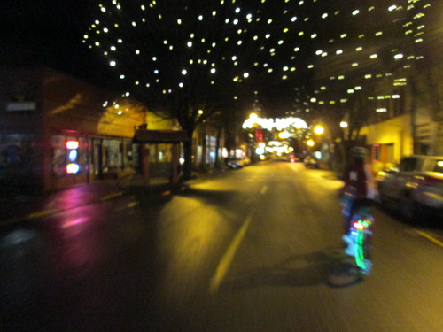
Downtown McMinnville (that's Asta)

We rolled our bikes right into the hotel, where they joined all the twinkly bikes already parked.  One hotel staffer, clearly not in on the program... "you rode all the way from Portland?  Are you going to stay here and ride back tomorrow?"

photo by Norm Carr
I was starting to wobble and shiver, so Susan suggested I put on a dry shirt.  Asta came along, just to make sure I didn't fall over :-)  Dry shirt installed, I drank a lot of water, a gel, a handful of salt, some coffee, and managed to eat a piece of really good pizza.  I wish I'd had the appetite for more (the McMenamins Hood River Pizza), because it was really, really good.  My stomach was unhappy, probably because my sinuses were dripping down my throat the whole way out.

I also changed my socks.  The plastic bags had prevented leakage, but they were soggy from sweat.  Again, if we hadn't had an extended stop, this wouldn't have been an issue.  But if I'm damp, I will get cold on a protracted stop.

So, dry baselayer, dry socks, and a dry cap, damp jersey over that :-) and we all headed out.  Norm had planned to be sweep, so we rode together the whole way back.  There was a cracking tailwind any time we were headed north, which was most of the way to North Plains.  While Norm and I have been on several of the same rides, we really haven't had an opportunity for extended conversation, and it was really nice to finally get to do that.

Still not raining, other than the occasional drizzle.  By now there was absolutely NO ONE on the roads but us.  There was a police car with lights flashing on Ribbon Ridge, but nothing else there, so we singled up and went around.

At one point Norm said "well, it's 2:30 in the morning... "  Me: "don't say that!  I don't want to know!"  But I wasn't getting in the least bit sleepy, which I had worried about, as my night riding track record isn't the best.

Though the wetlands, and up to North Plains, where we found pretty much everyone else.  Jeff L, Michal, and Chris were heading out, but the balance of the riders were sitting around drinking coffee and eating salty snacks.  My stomach was still crabby, so I went for some pretzels.  Norm produced a generic Pepcid, which I took with some hope that it might help.  He also had a collapsible flask of something :-) but found no takers for that.

A store patron (3:40am) "aren't you all up early!" No, no, we haven't gone to sleep.

Now we would be going generally south and east, and would have a headwind for the last 23 miles, as well as various traffic control devices, because we were back within the Urban Growth Boundary.

It was windy.  Heading south was a challenge.  And it finally started to rain.  We slogged our way back through Hillsboro, Aloha, and Beaverton, onto the Fanno Creek Trail, where we did have one navigational question.  Norm: "GPS says go this way."  Ok.  It really was the only way to go; the other turn dumped us onto a street.

As we were headed up the final couple miles (Multnomah Blvd), another cyclist came up.  I thought it might be Jason H, but I wasn't sure.  There was an interesting navigational bit to get us up the hill a couple blocks to the finish (Multnomah/SW Portland, the Bermuda Triangle of the city), and, hey!  We were finished!  Five minutes to spare!  (35 minutes for Norm and Jason)

Finish at Fat City Cafe, photo by Michal Young
Sadly, I couldn't summon up the stomach to eat a real breakfast, so I ordered toast and cottage cheese (a bland protein).  Jason H (it was him!) was in a similar state, so we commiserated and picked at our food.  I did snag a taste of Cyndi's hash, and wished I'd had the appetite to eat more.

Other than the not-eating part, it was a lively breakfast gathering.  Cards were finished and handed back to Susan for transfer to the perm owner.  Stories were told.  Some had been worried that Anita and I would get misplaced on the outgoing Fanno Creek Trail detour.  (Not really.  Not only am I a local, but this is MY local; I ride through the neighborhood fairly often, although not usually on the trail, but I do know where it goes, as well as how to get to the end via the surface streets.)

Cyndi wouldn't hear of my walking the bike down to the car, nor would she and Michal hear of Asta riding home.  So we were all stuffed in the van and I was shuttled down to my car.  My car warms up very quickly, so I didn't freeze on the drive home.

I took a very hot shower and conked out for a nap.  The bike remained in the car until Monday afternoon.
Knowing That An Official Finish Wasn't Likely

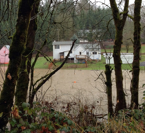
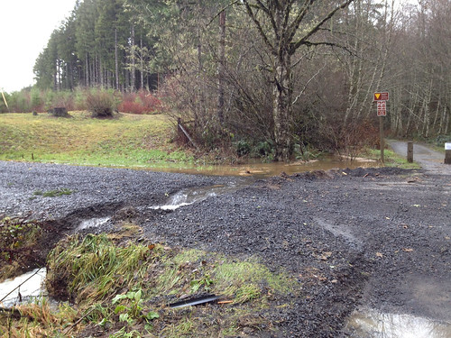
There we sat in Hits the Spot cafe, trying to pick a perm pop which was maybe achievable, given the staggering amount of rain and flooding we'd had the past week.  (For the record, every Oregon perm I own is probably still flooded out.)  North Plains Carlton would take us down Fern Hill Rd, which reliably floods every single heavy rain, as well as floodable stretches on Spring Hill Rd.

North Plains Banks Vernonia runs right along a couple of creeks.  Vernonia was flooded, and all approaches to the town were also flooded.  Roads washed away.  The trail status was "closed from Manning to Vernonia", with no specifics.  More than one of us really wanted to know how the trail was doing, so off we went.

The leg from North Plains to Banks was fine, although we could see where the creeks had flooded and run over the road in several places.

The trail from Banks to Manning had some litter, and, again, we could see where the trail had been flooded.  There were still some underwater bits, but they were neither long nor deep.

Pumpkins bobbing in the flood waters, just north of Banks

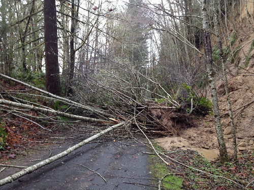
Then the fun began.  There was some litter on the trail, but nothing worth stopping and pitching to the side.  Then, a bit before the Buxton Trestle...

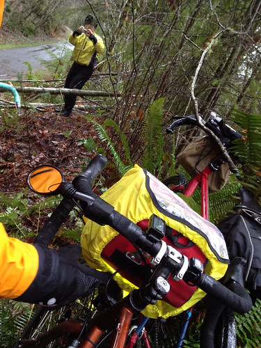
There's something blocking the trail.

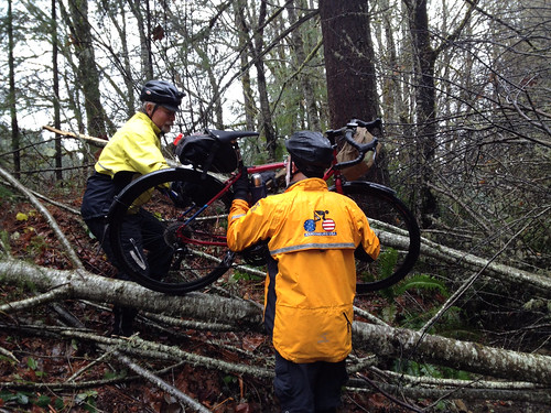
It was thought that maybe we could go around on the right, but, poking the sludge with stick revealed that it had the consistency of quicksand.  Ok,  Let's give up and over on the left a try.  Between the three of us, we were able to relay the bikes around the top of the tree.

Portage

"Only one portage".  Ok, good to know we have limits.

It was raining heavily on and off.  Feet were still good.  Hands were still good.

Proceeding on, we passed a few other runners and cyclists.  Every so often we'd stop and pitch a big branch off to the side.  There was another fallen tree, which was also successfully maneuvered off the trail.

The Nowakowski Rd crossing was clear, but the road up hill was flooded.  Tophill was uneventful, and the trail was pretty clear heading down towards Vernonia, but at the McDonald Rd crossing, the Trail Closed signage stepped up a notch.  Perhaps we should head back.  One rider: "I didn't think we'd get this far!"

Downhill, Nowakowski Rd

Uphill, Nowakowski Rd

Headed back up.  The descent was less fun than usual, because we were all wet, and it was cold and raining.

Portaged back over the fallen tree, and then stopped to feed someone, who was running low on zip.

Return Portage, documenting

 Quote: "If I wasn't having so much fun, I'd be cold and miserable!".

We thought about stopping for coffee in Banks, but by then we'd stopped descending, added another layer or two, and were warmed up, so we headed all the way back to North Plains.

The berry fields were spectacular

The guys loaded up and went right on home; I went back into the cafe with my towel and dry shoes (what, you don't carry a towel in your car?), and drank several cups of coffee!

Wednesday, December 2, 2015

Wind Direction is Key

We are fortunate to have a pair of one-way 200k perms between Portland and Eugene, and Amtrak connecting the two cities.  Michal lives in Eugene, I live out the western outskirts of Portland, and we often ride one or the other, typically heading south in the summer, and north in the winter, to take advantage of the prevailing winds.  Sometimes, the wind doesn't pay attention to the weather forecast, or might have a headwind until halfway, and then it will switch.

Trees in profile; Peoria Rd

So, needing a November 200k, I rounded up Michal for, originally, Eugene to Beaverton.  Obsessive monitoring of the long term forecast predicted an unseasonal NORTH wind that day.  Cold and dry.  As we hadn't yet actually registered, it was easy enough to change plans to Donuts to Total Domination.  (Who doesn't love a route which starts at a donut shop and finishes at a brewery?)

Susan joined in; she figured riding with people would be more fun than the solo perm she'd been contemplating.  We procured train tickets.  Amtrak was even having a sale!

We unexpectedly ended up babysitting our grandson Thursday and Friday, so prep time evaporated. My bike got a very thorough (and overdue) bath/lube and a new brake pad during nap time, but a new front brake cable was indicated, and that didn't happen until Friday evening, with perhaps not a small degree of frustration, and finally soldering the cable end so I could feed it through and it wouldn't fray.

Michal and Cyndi showed up later on Friday, both coughing from whatever virus they'd picked up.  After sighing over Time to Get Up (5am), and doing some final organizing on my part, we all conked out.

Breakfast was salami and eggs; my mom having unexpectedly delivered a 2 lb Hebrew National salami from Florida from their last trip.  "You can't get it here." Susan arrived, we gave our bags to Cyndi to shuttle back south, and the three of us set out in the predawn light heading to Sesame Donuts.  Temperature was in the mid-30's, but would rise somewhat during the day.

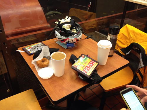
Donuts and coffee at the start

Mmm.  Donuts and more coffee, and off we went.  After passing through Wilsonville (14 miles along), there isn't anything, really, until Keizer, just north of Salem.  The Broadacres Store, if one desperately needs to get food or beverage, but that's it.  We did pull over in Donald to de-layer.  Susan took a picture of the steam pouring off me :-)

photo by Susan Otcenas
So, by the time we got to Keizer, we started looking for a place for a quick stop.  I hadn't paid attention during previous rides, knowing that there was a c-store on the way out of Salem.  Lots of places on the right - we pulled over at a Subway, but should have held out for the Starbucks a little further along.

From there we continued without further stops until the first control in Independence.  It was a beautiful day, and, yes, we did have a consistent tailwind.  The landslide has long been cleared away.  Salem keeps creeping out further on River Rd.  Longer stretches of bike lane, but also more traffic.

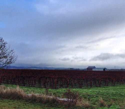
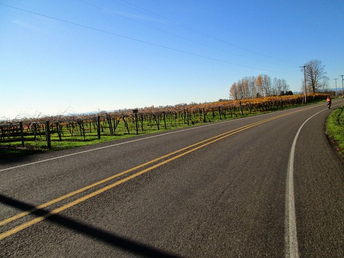
Vineyard on River Rd, not far from the Willamette River bridge

As we got closer to Independence, Susan asked if we'd consider a stop other than the convenience store.  "Did you know there is a BAKERY in Independence?"  Sign us up!  Wonderful pause at the Ovenbird Bakery.  They had great soup and bread.  Some folks had quiche.  Food was eaten and bottles refilled. A local was telling us all about the trails in the area and places we could ride.  Must have been the Seattle jerseys. :-)

Off to the hilly part of the ride.  Michal and Susan got some breaks; I kept plugging along.  Nice views of Mt Hood and Mt Jefferson.

Corvallis Rd; Mt Hood on the left, Mt Jefferson on the right

Finally the turn onto Buena Vista, and downhill for awhile, then rolling SE into Albany.

Conversation on Spring Hill Rd, a few miles before Albany

Last time Michal and I rode this, we stopped at First Burger in Albany, and we all decided to repeat that stop.  Not a control, but quick service and really good burgers and fries.

I rehydrated with a cola beverage.  Michal shoved the salt shaker over. "What, do I look salty?"  Michal and Susan: YES!

On our way out, a woman wanted to know where I got my bike and especially in that color.  So I told her - it was built in Portland, and it is a custom bike, so I could pick any color I wanted.  She said she took a picture of it, was that ok?  Oh totally!

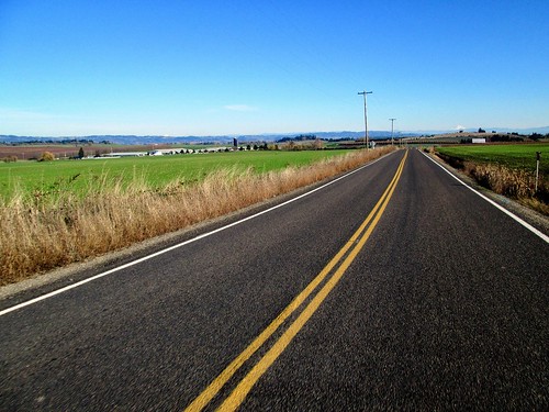
We then meandered out of Albany to the info control, then more meandering to Hwy 34, where we discovered a new paved path on the north side of the road.  Nice.  There was even a spur over to Hwy 34 where we crossed over to White Oak Rd, which leads to Peoria Rd, the longest, flattest, tending toward monotonous stretch of the route.  Good thing we had that tailwind, and that it wasn't hot.

Michal on Peoria Rd

Pause at Peoria Park.  Peoria used to be the furthest south navigable point of the Willamette; lots of agricultural shipping north to Portland, nothing remains but the park, and a few houses.  The bathrooms are locked; there is a porta-potty.  So don't count on water there.

Susan taking a picture of Michal on Peoria Rd

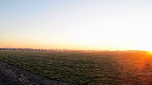
I parked myself on Susan's wheel; she's got a wonderfully consistent pace.  The sun was setting; we had some nice views of the Three Sisters to the east.

Moon and the Three Sisters to the east, Peoria Rd

Sunset, Peoria Rd

Pulled into Harrisburg right around sunset; I ate half an egg salad sandwich and refilled the bottles.  Lots of traffic headed north on Hwy 99; the (football) game must have finished.  We crossed over the Willamette River (for the fourth time out of six crossings total) and eventually got onto a MUCH quieter road.  There was some concern about the railroad underpass being flooded, but it was fine.

After a few miles of this, we ended up on River Rd (lots of River Rds on this route), which would eventually take us into Eugene.  Eventually.  It was dark.  Nothing to see but the occasional mile marker.  We passed marker 3, and, some eternity later, another marker came into view.  4.  Wow. I commented that that was the longest mile ever.  Susan said she was thinking the same thing.  This was kind of a low point for me.  Would we ever get to Eugene?  Couldn't see my bike computer without slowing and dropping off the wheel, so I had no idea how much further to go.  Less than 10 miles, but that was it.

Then, like flipping a switch, we were in North Eugene.  Whew.  Didn't matter how far we had to go now, we were "somewhere".  (Is this the woman writing who rode the last 100k of a 300k last February solo in the dark?  Yes, but I knew where I was!)

Under the highway, then a left onto a street which dumped us onto Eugene's extensive network of trails. They are fun riding.

And then, shortly after one last info control, we were back on the surface streets for the last few blocks to the Ninkasi Brewery.  Susan: "can we take our bikes in?"  Oh yeah.  We wheeled them into the patio (postgame crowd had moved on; many open tables).  Michal: "I'll call Cyndi.  Eventually."

Walking in, I announced to the bartender that we had ridden all the way from Portland for this beer.  Prior research* had suggested I'd enjoy the Noir Milk Stout, also collecting a rubber stamp and signature for my card.  Michal had his usual Oatis Stout.  Susan watched.

Photo by Michal Young
photo by Susan Otcenas
Our time did not totally suck, for me, anyway - 11:43 elapsed.  Not my fastest, but certainly not the slowest.

Cyndi appeared, and we loaded up the van.  Yummy dinner.  Michal thought we might like a cappucino (he has a shiny new machine to replace the old one) as well.

Michal is getting used to his new espresso machine

And, wonder of wonders, Amtrak changed the schedule, so the am northbound train leaves at 9am, rather than 5:30am.  Probably the first time I've ridden the entire stretch in daylight.

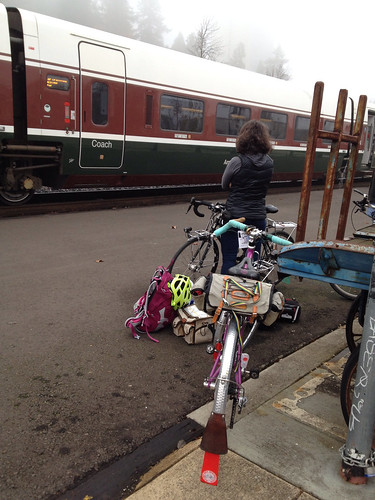
Waiting to board in Eugene

* Spouse talked me into a Beer Appreciation class with friends of ours this fall term through the local community college (class was held at a brewery :-) ).  I had thought I didn't like beer.  Turns out what I don't like are IPAs and those other hop-forward/bitter beers.  Except fresh/wet hop IPAs, go figure.  But, it turns out there are a wide variety of beer styles, and I like many of them.  Now, if Ninkasi would only brew a proper brown ale...