
The Kramer's annual fall 200km romp on the dry side of the Cascades (mostly). This year's route was similar to the 2007 route, except, rather than taking SR 14 east to Hwy 97, and then north into Goldendale, we cut off SR 14 at Lyle, and went to Goldendale via Centerville. Longer climb, but probably not quite as steep.
High Points:
I finished before sunset! (she says, jumping up and down)
Riding average of 13.7mph
Total ride time of 10:49. I'm making these sub 11hr 200km rides a habit :-)
Did NOT, repeat did NOT finish last. Far from it, even.
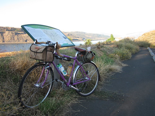
The ride details here.
Susan O and I thought we'd ride it together. She even offered to drive (yay!), and arrived at my house at 5:30am. Loaded up the bike, and we were off. I had gotten all my food and spare clothes and such ready the night before.
Finally found some coffee for Susan in Hood River, then headed across the bridge to find the start point. Lots of checking in, milling around, and then we were off at 7:30am.
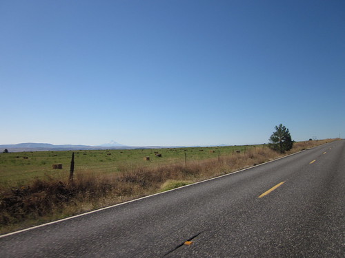
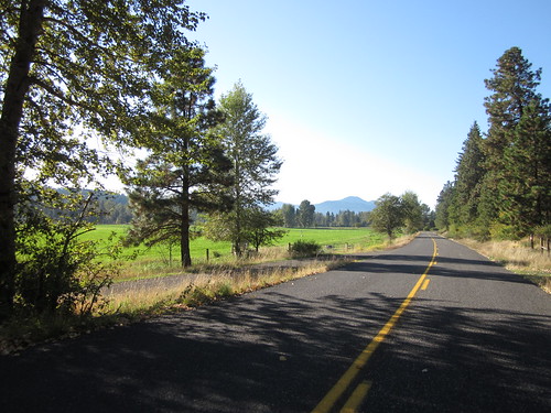
The first 6 miles on SR 14 went quite quickly, then off the highway for 3.3 miles on Old Highway 8. Pretty. Nice views of the Columbia River; maybe 500 feet of climbing.
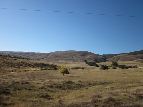
Back down to the river at Lyle, and immediately back up, for the major climb of the day. 2000 vertical feet over 8-10 miles. Mostly 4-6% grade. I had ditched my jacket on the previous climb. It wasn't even 60 degrees yet, and I was very very hot - sweat running down my face! Pulled over to lose the armwarmers and find a bandanna for my head. This was one of those climbs where you THINK the top might be JUST around the corner, and you get to that corner and....no. I decided it was time to eat something, and started working on my TJ's Sesame Crepe while riding along. Ate almost the entire thing (half of one. 500 calories). That was really yummy. More climbing. We were on the dry side of the Cascades, so rounded golden hill after rounded golden hill, inching upward... Susan was long out of sight by now. I thought I might be at the tail end of the ride.
Finally, came up and around a corner and saw... a valley. Thank you Lord! (those were the exact thoughts in my head). Down.... found Susan and the Hughart brothers, Holden and David. We headed off through the valley to Centerville (the grain silo was visible long before we actually arrived). Nice views of Mt Adams to the north, cattle grazing, ...
Admired Holden's new International Orange Bike Friday. He admired my new Sweetpea. When we last rode together at the Birkie 200km, we were both getting new bikes, but didn't have them yet. Susan and David were up ahead a bit.

Eventually found ourselves in Centerville (population -5, or something like that) at our turn, where Susan and David were having a snack. So we joined them. Someone was walking down the road...turned out to be John, and did we need more water; his car was just up the road. We relocated and topped off our water bottles.
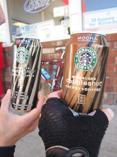
Off again - I could see signs of greater population up ahead, and eventually found myself in the outskirts of Goldendale. We were directed to the combination DQ/Subway/Gas station/Convenience Store as the control (44.6 mi). Long lines for the food, but I didn't want any of that - bought a Gatorade and a Starbucks Mocha Doubleshot (the darkside claims Lynne), and went outside to eat my sandwich.
Many other riders showed up as we were eating. Guess we weren't at the end after all :-) Topped off my Gatorade and water, and left the extra Gatorade for the following riders. (On a rando ride, if one arrives at a control, there will often be a partial gallon of water or other beverage left for the next group of riders. This is a nice convention.)
Passed through Goldendale, and very soon, Susan and I were back out on range land. Cattle could conceivably be roaming around unfenced... We didn't see any. Lots of great views of Mt Adams and Mt Hood and lots of wide open space.
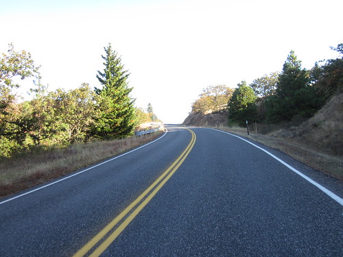
After 10 miles of this, we turned onto the Glenwood Highway. I was anticipating the drop into the Klickitat River canyon, but we had a few more miles to ride, and about 500 more feet of climbing before that happened.
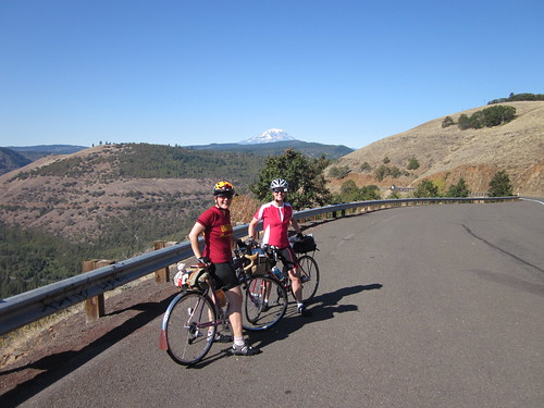
The Klickitat River canyon is, for me, the major highlight of this ride. Riding along, stair-step climbing up, and then, the sign... Truck on a Triangle. The scenery is breathtaking. I told Susan I was planning to stop at the scenic overlook. We started the descent, and maybe a mile into it, pulled over for pictures. A group of motorcyclists was also out enjoying the day, and one volunteered to get pictures of us.
Pictures accomplished, we continued on down. It goes on for seemingly MILES and is just gorgeous scenery - oak trees, a bit of fall color, sunshine, the canyon walls... Then we did a hard turn right, descended a bit more, crossed the river, and it was time to ride back up. The first mile is a bit special, but then it turns into a gentle stair-step climb. Brief stop for clothing adjustment (my Carradice bag started out the day with lots of empty space, was now filled with windbreaker, long finger gloves, armwarmers, kneewarmers and toecovers).
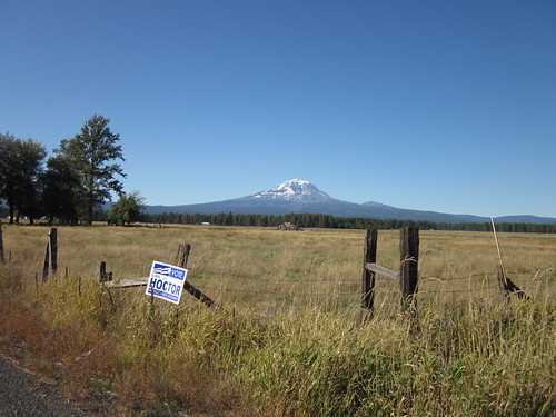
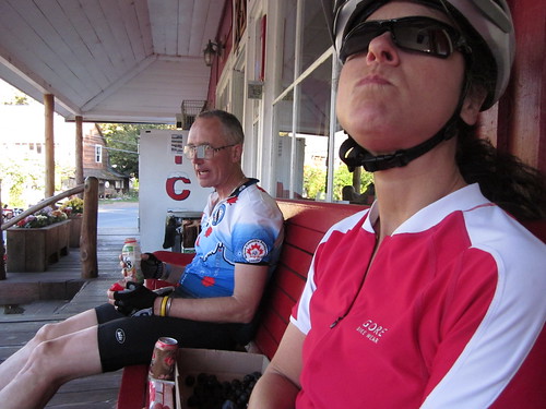
Eventually it leveled off (in reality, we were still climbing) outside of Glenwood, past the pond, the great view of Mt Adams, and finally, the Glenwood General Store (80 miles).
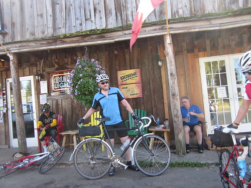
A few cyclists were there, more showed up as we were sitting and eating (sandwich and banana). Even Bill A, who I did not know was on this ride! (He got to the start shortly after we all had departed). Susan, Scott P, Bill A and I started out, moving at a very brisk pace. After about 6 or 7 miles, I couldn't hold on, and they slowly pulled away. Especially since we were starting the last climbing stretch (700 ft) over the hills to get to Trout Lake. Several false summits, and then the very nice descent. The view of the valley is wonderful, but I couldn't bring myself to stop and take a picture - flat, green, farms...
Working my way west to the Trout Lake control, I could sometimes see Scott P up ahead. I found them at the intersection with Mt Adams road, but I kept on going to the control at the RV park. A very quick pause to answer the question, and back to the Trout Lake store. No doubleshots, so I had to console myself with a frappucino and bag of Fritos. Susan offered to help if I thought the bag was too big. Which it was, but that was the smallest bag they had.
Bill and Scott left a bit before we did. We were hoping there would be no headwind back down to the start (24 miles, 2000 ft total drop with an annoying 400 ft uptick a few miles before the end), so we could enjoy it. No headwind. We were riding between 18-25mph all the way to Husum (the uptick). One brief stop to turn on the rear blinkies. Scott got a flat outside Husum - there was a fair amount of broken glass on the shoulders.
Our goal was to finish before 6:30, which would make an 11 hr ride. A secondary goal was to finish before dark - the last time I finished this ride, it was downright scary dropping through White Salmon and Bingen with the lighting I had at the time. I think I bought my SON28 and IQ Fly right after that! Turned on the headlight just outside White Salmon, just to alert oncoming vehicles.
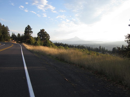
Racing the sun to the finish, but I did stop to take a picture of Mt Hood. The stretch from Husum to White Salmon seemed WAY too long, but eventually I found the drop through town (yes, at or exceeding the 35 mph speed limit, and then reefing on the brakes to get down to 25 mph). Last info control in Bingen (I didn't write it down), then west on SR 14 for just over a mile to get to the finish. In daylight. Not at the tail end of the group.
Changed out of the cycling gear, enjoyed snacks, and then Susan and I got a recommendation for a place to get some dinner in Hood River. Off to Ixtapa. Yum.
http://www.flickr.com/photos/lynnefitz/sets/72157624962567337/with/5047801515/

2 comments:
Woooowwww. What a gorgeous ride you had.
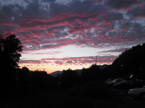
Even if you did somehow finish last, the scenery alone might be worth it. Especially that sunset.
(must drool now, excuse me.)
Coffee ride soon? Email me.
Great report, thanks for writing it up. I enjoyed our (brief) chats on the ride. This was my first ever brevet- or rando event of any kind- and I think I'm hooked! I think in the future I might actually train first- I hadn't ridden over 55 miles for many years before Saturday, so I was hurting for a while and wasn't sure I'd finish. But it was great, and your pictures brought back fun memories.
Ryan (aka "Guy on Bike")
Post a Comment