Bill lives just over a mile from me, so I offered to drive us to the start - he knew where it was, and I was a bit fuzzy on the St John's neighborhood.
The weather was earlier forecasted to be not raining (that's the best we can hope for here after October :-) ), but that changed. I suffered a severe perceived wardrobe inadequacy. Fortunately, Team Estrogen was here for me, and I bought new gloves, tights, booties, and they tossed in a hat.
Bill appeared, we loaded up the van, and headed over. Found Ed G, Adam G, and David P. waiting in the St John's Starbucks, along with Amy, who was there to see us off.
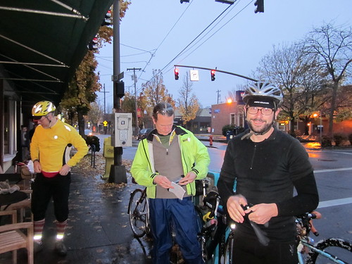
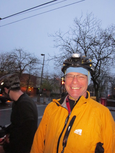
Official start was 7am. We started at 7:24am. Across the St John's Bridge in the grey, persistent drizzle, then south and up through Washington Park. I'd pedal, then swipe my glasses so I could see. This pattern would continue for the entire ride...
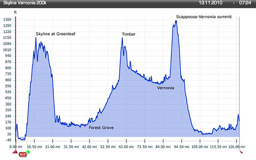
Up through the park, up Fairview, brief pause at the corner of Skyline for the info control, then continuing up on Skyline until the top of that climb at Greenleaf. Normally, at this point, I'd bomb on down, get to a stop sign, do a short climb up, and bomb on down again. Skyline is fun that way. Not this day. It was very foggy and drizzling. I was muffled - couldn't see the road well enough to go as fast as I wanted to. Pulled over at Skyline School for a snack and regroup, then down Old Cornelius Pass (another fun descent curtailed) onto the flat part of the ride. David P and I spent some time grumbling about the fog in the hills. :-) I was actually starting to worry about missing the control time in Forest Grove, but we picked up the pace on the flats. Once I averaged over 10 miles covered per hour, I relaxed.
South and west to Forest Grove. I could see Adam, Ed, and David up ahead, but when I got to the corner of Gordon and Harrington, they entered some space-time warp, and I didn't see them again until Maggie's Buns in Forest Grove (42 miles). They said they had just gotten there, and indeed, were parking their bikes. Okay. I had a hot cocoa and ate my sandwich and banana; everyone else ordered something more substantial.
Bill and I left ahead of the others. Bill slowly dropped behind on Gales Creek Rd. I stopped at Glenwood for a brief pause, and headed out again. Didn't see anyone else. Was I riding THAT fast? I didn't think so, but I hadn't seen anyone behind me (we were all running our headlights all day). Almost up to Timber, where I found everyone. Ed wanted to know if I was happy with my job. Well, yeah... Turned out there was an ATM dumped by the roadside. Adam was calling it in - the person at the other end said (and I quote) "it's cheaper to buy a new one... you can have it."
So Ed and Adam were trying to determine if there was anything still in it! I eventually left them to it (I am used to being slow and last, and have gotten into the habit of trying to limit my stops) and proceeded down through Timber and off to Vernonia. They caught up somewhere along the deadly dull boring 11 mile stretch from Hwy 26 to Vernonia. David and I rode along for quite some time, chatting the whole time, which made that deadly dull stretch go by much faster!
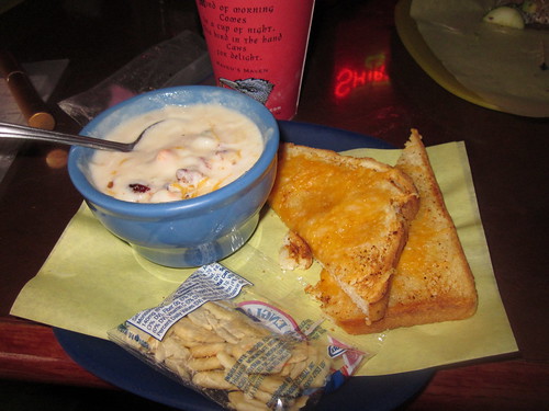
We planned to regroup at Black Bear Coffee in Vernonia (77 miles), where I had my other sandwich, and a bowl of wonderful soup, amazing buttery, spicy cheese toast and coffee. And some more Advil. It had ceased drizzling when we arrived. Sadly, when we left, the drizzle was back.
I squeezed a lot of water out of my gloves, but they were keeping my hands warm, for all that. My hands weren't getting wet - they'd sweat, but nothing came in from the outside. They are definitely keepers!
Off again, and time for the major climb of the day. The Scappoose-Vernonia Road. Starts out innocuously enough, then starts gently up. Then not so gently up. 4.4mph is a speed. You can see clear air up ahead, and think, ah, that's the top. No. The grade ranged from 7% to 9% for a couple of miles. David and I ground our way along, eventually summiting in the clearcut between mileposts 9 and 10. I just wanted to be down the other side before it got dark. It was definitely gloomy (and still persistently drizzling). The first 2 or 3 miles of the downhill is over bad road, but then the road gets much better. You'd THINK, that coming into Scappoose you'd see something resembling civilization. Nope. Pretty much nothing but managed forest for miles and miles and miles and miles and miles. FINALLY, we could see the Hwy 30 traffic light ahead (and Scappoose). Bill had stopped awhile back and caught up with us; we crossed Hwy 30 to do our tour of the Scappoose Dike Roads.
Now, this is a loop added in to make the distance right. I am sure there is something to see, in the daylight. By now it was very, very dark. Nothing to see but pavement, and Bill and David's lights. And drizzle. There was an info control, and we stopped there, but could not make a perfect determination of the answer.
Back onto Hwy 30, and a stop at a Texaco mini-mart. Hot coffee, plumbing, a Sweet Salty Peanut bar and gel with 2x caffeine... I squeezed more water out of my gloves (hands still just fine). Ed found us there. No Adam... After enough dawdling there (took some Excedrin this time; my lower back and left hip were just not happy all day), time to finish off the ride.
Thus began the most epic (or hellish, your choice) part of the ride. Hwy 30 has a nice wide shoulder. But it was dark and raining. My glasses would get wet, and the taillights of the bikes in front of me would flare, and I couldn't see. So I dropped back a bit, which helped, but the shoulder line would go away at the cross streets (not many, but enough). I wanted a drink, but I also did not want to take my hands off the handlebars. I can do dark, and I can do rain, but I really prefer to not do them at the same time.
Passed the Cornelius Pass interchange. Passed the Sauvie Island bridge interchange... Getting closer. Caught up and rode by Ed for awhile. Finally got to Linnton and street lights! Whew. Sort of. Bill had a squashy tire and dropped back. Ed, David and I crossed the St Johns Bridge in a pack, taking up a lane. Coasted down, and we were done. Whew.
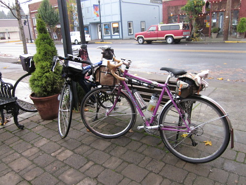
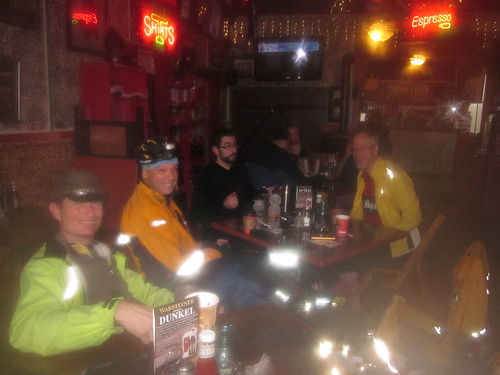
Leaned the bikes outside (very brave, doing that in Portland), went in, dumped all the wet stuff on a table and ordered a Pumpkin Spice Latte. I earned it. We had a nice celebratory post-ride round of coffee drinks, and a nice patron took our picture.
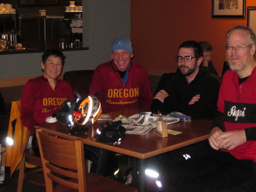
Finished in 12:35. We'd get to a control with 45 minutes in the bank, faff it away, then get up another 45 minutes before the next control. I wasn't having any trouble keeping up, except on the last climb. Delightful ride with the guys.
Clothing review - Sugoi Firewall Booties are definitely keepers. Feet did well. Sugoi Firewall Z gloves, also keepers. It rained the entire time, and I wore the same gloves the entire time. Hands were NOT cold. Sugoi Firewall 220 tight - mostly good. As long as I was moving they were excellent. The rain did not get in. My knees would be a bit chilly on startup, but they'd warm up. I wore them over my booties.
What else did I wear? Long sleeved wool OrRando jersey (no base layer, just the jersey), Showers Pass Elite jacket, Smartwool socks, PI X-Alp shoes, and some Shebeest shorts. I wish I had been wearing wool shorts. As soon as the chamois transplant is complete (in process, Smartwool Ewetopia shorts, and a Shebeest chamois), I will have some.
The new saddle was a wonder - no platform issues on this ride at all.
Sweetpea rolled over 1000 miles :-) 127.59 miles, 12.73 riding average. 6600 vertical feet (claims my cyclocomputer)
I did not take pictures during the ride, because I did not have easily accessible fingers. What pictures I did take are here.
Bill took several, but they aren't up yet.

No comments:
Post a Comment