UPDATED 24 Nov 2018
the route (ride with gps)
cue sheet, and
the reg form
Route availability:
24 Nov 2018 All the roads and trails have reopened! The Washington Park section of the route is also open.
17 Feb 2018 sadly, this permanent is currently not available due to the Eagle Creek Fire.
News Flash (12/15/2016)! The Washington Park Reservoirs are under construction, totally changing the route through the park on the outbound. I'll update the cue sheet when someone wants to ride the route, because it may change between now and then. Here's the current park map: http://www.portlandoregon.gov/water/article/586276
News Flash! Toll for bicycles on the bridge is 0.50. Back after several years of no toll for bikes.
pretty much guaranteed May-October. Outside of that, I'll be checking the weather before I accept your registration. The Columbia River Gorge can be very dangerous in the winter.
Starting in Beaverton (again, one block from the Beaverton Transit Center), you'll head north and east, uphill through a quiet neighborhood and onto the Sunset Highway Multi-use Path (or, as I call it, the Bicycle Freeway). Then down through Washington Park (CHECK THE PARK MAP), and your first info control.
From there, you proceed through downtown Portland, crossing the Willamette on the Steel Bridge, then heading north and east (another info control in there...) to the I-205 Bike Path, and the Glen L Jackson bridge across the Columbia River into Washington. Looping off the bridge, you'll follow the Old Evergreen Highway east into Camas, for the first timed control. I myself am partial to the Burgerville :-) There are also gas stations and coffee shops and such in Historic Camas.
Exiting Camas, what used to be a simple left turn onto SR-14 has now become many traffic circles. Not to worry, just keep following the signs for SR-14 East, Kennewick, and you will get there.
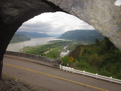
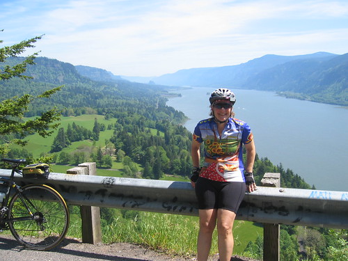
Then, onto SR-14, climbing up to Cape Horn, for an amazing view to the east.
Proceeding east, and DOWN, you'll proceed past Skamania (store/food), Beacon Rock (water, restrooms, scenery), North Bonneville (see the dam!), and past the Bridge of the Gods into Stevenson, for your next timed control. Grocery on the left, plus coffee shops and restaurants.
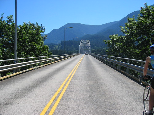
Back to Bridge of the Gods, where you'll cross into Oregon. If it is your first trip across, maybe you don't want to look down. Metal grating, exercise caution.
Looping off the bridge (0.50 toll for bicycles, be prepared), you enter Cascade Locks.
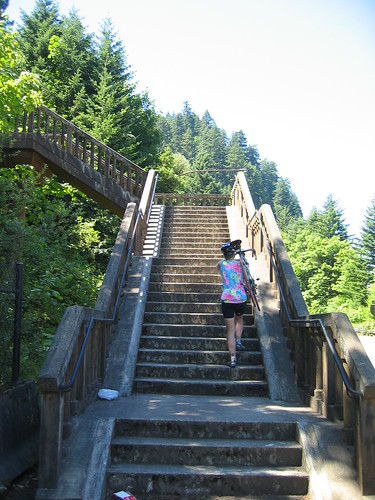
The bike path entrance is just to the right of the westbound freeway on-ramp. Welcome to Middle-Earth. You'll go under the freeway (tunnel), up to the fish hatchery, getting back on the trail by proceeding the wrong way on the left side of the freeway off-ramp (only for a bit). Then up some stairs, eventually ending up at a campground. Turn right, cross the campground entry road, and you are back on the path again.
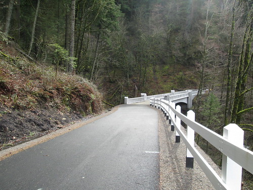
Under the freeway, up some switchbacks (another great view of Bonneville Dam), then follow along next to the freeway. Now you will be riding on the new part of the trail, across Moffett Creek, up some switchbacks, and then over McCord Creek.
Great views of the river and the Washington side from here. Then you pop out into a parking lot/trailhead, turn R, turn L onto the frontage road, and you will soon find yourself on the scenic highway.
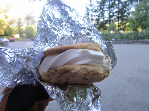
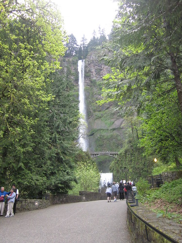
Pass campgrounds (Ainsworth), a waterfall (Horsetail Falls) and tunnels (Oneonta tunnel; be sure to ride through it), eventually arriving at Multnomah Falls. While not a control, there are restrooms and food. And really nice ice cream sandwiches and coffee.
Continuing westward, passing many more waterfalls, at Latourell Falls, the road winds up to Vista House at Crown Point. More amazing views, also restrooms and a small snack bar, both downstairs.
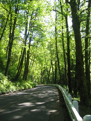
Then the last bit up, and on to the best descent ever. (Optional scenic possibility - Women's Forum State Park on the right) Be sure to enjoy Bell Rd!
Then along the Sandy River, cross over at the bridge, and you are in Troutdale. Park on the left right over the bridge has restrooms and water. Troutdale offers ice cream, coffee, restaurants, and a convenience store (great for popsicles on a really hot day).
Turn right, go under the freeway, loop around the back side of the airport, then on to Marine Drive all the way to I-205. Just before I-205, turn left over Marine Drive, and follow the path to NE Alderwood.
The next timed control at NE 47th and NE Columbia offers a 7-11, a Dutch Bros coffee, and a Subway. The balance of the ride is through town, and can be slow going, so don't linger too long here.
From here, proceed west and south through NE Portland, down to and across the Broadway Bridge, then up through NW Portland, crossing Burnside to enter Washington Park. You'll ride up Stearns Way, which is not signed, and is paved (freshly-remodeled park entrance trail). It switchbacks up, popping out just below the entry to the Rose Garden. Info control at the corner of SW Rose Park, right behind the bus stop.
Up through Washington Park, pass the Rose Garden, archery area, and the zoo, then up on SW Canyon Ct and the Sunset Bike Path to the Sylvan summit. Starbucks on your right.
Pretty much downhill all the way from here, back the way you came. The Starbucks at the finish closes at 7pm, but there are many receipt opportunities at the corner of SW 117th and SW Canyon Rd. There is another Starbucks at the Fred Meyer across the street, by the grocery at the SW corner of the store complex. There is also a Jackson's gas station c-store, across SW Canyon, one block to the west.

2 comments:
Looks like a beautiful route. Enjoyed the photos!
Inspiring. I've had my eye on the BOG for many years. Never been across it though. Perhaps this will be my year. Not sure I'll head west to head east (I'm in SE PDX) to complete the whole brevet, but everything from 205 eastward is calling to me.
Post a Comment