We started right at 8am. We saw riders starting earlier (the course did not open until 8), but didn't know why.
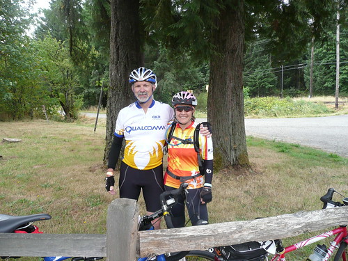
So. South out of Forest Grove to loop through the wetlands, up through Cornelius, and into Verboort, for the first rest stop (this route had rest stops averaging 7 miles apart...). Off again, beating against the headwinds north on Hwy 47, merging onto Hwy 26 westbound. Next rest stop at the Manning trailhead of the Banks-Vernonia trail. Bruce tried to give me another water bottle, but I settled for some lube on the chain, and him taking a picture of us.
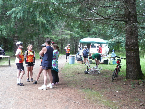
At this point, the route got...challenging. Instead of heading to where 47 goes north to Vernonia (our northernmost point), we turned on Fisher Road to go to Buxton. Now I've never been there before, but the road goes UP. Then down, back onto 47, where eventually the road starting going UP again, climbing to Tophill. A long grinder of a climb, then down, to the next rest stop at Lee's U-Catch (mile 33). Yummy snacks and conversations with other riders, mostly about the grade of Tophill. Apparently it goes double digits briefly. Also conversation about the upcoming climb, the only one they warned us about.
Yes, right on McDonald. Never done this one before. UP for .9 mile. Steeply up. There was a really nice house with some excellent raised beds near what I thought was the top. Turned a corner and... more hill. Not too much, though, then a long rolling descent. Large roadkill spotting as well. It had been there for quite awhile, and was still in the middle of the road. You'd think there would be some agency that would remove them. Even Bear Grilles wouldn't recommend snacking on this one.
Eventually we came to Vernonia - from the north! I was wondering if we'd ever get there. Rode through - the town was having a major festival, and traffic was at a standstill (I can hear some of you thinking - "traffic jam? Vernonia?"). Then out of town and south on 47, to the Timber Rd turn; another rest stop. Fitz had been ahead of me all day, and was waiting there for me.
Admired the speaker setup for an iPod on a tandem (the stoker looked to be about 10 years old; entertainment needed). Off again, heading for the Hwy 26 crossing. This stretch is over 10 miles, through forests and the occasional farm. No real indication that you are making progress at all. The crossing was uneventful; we didn't have to wait too long. This crossing has no refuge lane; you've got to get across 4 lanes of 55mph traffic (main route to the coast) in one go.
Then through the clearcuts and initial climb to Timber. Fitz: "Is this the Timber climb?". "No, this is the preliminary Timber climb." It must be really hard for those Ford F-250s to make it up the grade, too, considering the number of beer cans, liquor bottles and fast food wrappers they had to throw out to lighten their load.
Then another rest stop just before Timber, at a timber farm :-) I was listening to a couple of women chatting, and one of them is talking about her in-laws from {European country} visiting for a month and her husband {co-worker of mine from European country}. At which point I asked who she was! Turns out she's co-worker's wife, and we had a nice little visit. Small world!
Then off again (any plans of sticking to the 12 miles per hour were long gone by now), and the Real Timber Climb. Fitz had never been to Timber, so he got to see the tiny post office and teeny fire station, all perched on the hillside of the 3 switchbacks that are Timber. Through the clearcut, DOWN (Lynne burns off more brakepads here), then heading to the turn onto Hwy 6. Another longish stretch with no indication of progress and lots of deep NW forest.
Rest stop right after the turn. We had a few more snacks (goldfish looked good), then the 3 mile stretch on the Hwy 6 shoulder. Perhaps not the best route, but unfortunately, the ONLY route. It is only 3 feet wide heading east, with no place to go on the sides. I dislike RVs as much as I dislike hay trucks. They take up the entire lane, have a huge draft, and are driven by people who are not professionals. eeep. Finally the road opened up a bit, and we had more room.
Right onto Gales Creek Rd. Now, the KIND thing to have done, would be to route us into Forest Grove all the way on Gales Creek. But NO. We turned left onto Clapshaw Hill Rd. Clapshaw Hill is one of those in a special category. Hors Category, I think they call it in the Tour de France. It is incredibly steep. Fitz needed one more cog on his bike. I had that cog, but I wasn't sharing. Ouch. Ouch. Ouch. Then the top, and another brake pad burner down to Hillside, for the last rest stop (M&Ms).
Then the wonderful drop on Hillside (the one place where I will let the bike GO), then the rollers, which are just not spaced well for surfing. South on Thatcher, picking up Gales Creek again in Forest Grove, a brief pass through some neighborhoods, and we were DONE!
More wild cheering and a finish medal. It was 3;38, and we'd started at 8am. Jennifer, the coordinator suggested we get beer NOW if we wanted it. Fitz headed off directly to secure beer and a table; I got my meal and some iced tea. We sat and visited and ate for awhile. That's why the riders started before 8 - they wanted to make sure there was beer when they got back!
As we had to be out of our dorm room by 5, we then headed over and put our bikes in the van, took our showers and checked out. Then we took down the Qualcomm tent (we were just about the very last folks to leave the camping area), and headed home...
And Fitz did the whole thing, too! I think he can do a century, if he can do a 73 mile ride with over 5000 vertical feet!

No comments:
Post a Comment