The weather for Monday was supposed to be much better than Saturday, or Sunday. 10% chance of precipitation, mostly sunny, high of 51, even in Timber. Sure.
Sunday I did have a party for co-workers who got married, which, in the style of our little group, involved a lot of really elaborate food, with a Central European/Middle Eastern/Vietnamese flavor. Yum. So, calorie-loading for Monday accomplished.
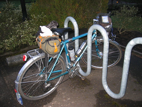
Came home, organized my food supply for the next day (2 brie-jam sandwiches, 2 bananas, a couple of Sweet Salty Peanut bars, some gel packets, thermos of Gatorade-Tea and a packet of powder and a teabag for a second helping), my clothes (wool figured prominently, with the Showers Pass Jacket and Pearl Izumi AmFib tights as the outer layers), and the bike (Bleriot ducks into a phone booth and changes from Commuter Bike to Rando Bike!).
Collected Jason at 6am; got to the Grand Lodge at 6:30, and managed to faff away that half hour with amazing ease. Then Jason couldn't get his heart rate monitor to register that he had a heartbeat, so lost another 10 minutes there.
Official start, 7am, but I think we left about 7:15. Anyway. Nice ride out Gales Creek Rd. Sun is rising; a few clouds, yes, this could be a pleasant day for a bike ride. Brief stop at the Shell Station just after the turn onto Hwy 6. The bathroom was clean, well-lit, and didn't smell funny, so perhaps it was cleaned after Cecil and Andrew came through Sunday evening.

Lots of gravel on the Hwy 6 shoulder. Skinny tires, take note. The Timber Rd turnoff is right around mile 15-something; about a mile further than the current version on the cue sheet indicates.
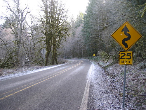
The initial climb off Hwy 6 levels off quickly. Count the discarded liquor bottles by the roadside as you head up. A few miles of level to slightly rolling, then the steep switchbacks up to Timber. Well, the switchbacks, then a gradual climb. Nice views to the west. Snow by the side of the road, and that wonderfully crunchy frost on the road surface.

Take care descending through Timber - 3 switchbacks with hairpin turns, and gravel. Lots of gravel, especially around the railroad tracks. A brief uphill out of Timber, then level and downhill to Hwy 26. Cross carefully!
Then a long on Timber Road (farms, forest). It feels pretty remote out there. We rode in a blinding snowstorm for a couple of miles.

Eventually you'll pass the Vernonia Golf Course, and at the T, turn left onto Hwy 47 for the last couple miles to Vernonia.
The right turn on Umatilla is very subtle. For one thing, it doesn't look like a road! More like a very badly kept up, big sharp chunks of rock and mud parking lot, with massive potholes. It is right after the big Welcome to Vernonia sign just over the bridge. You want to hop onto the bike path immediately to the right of the road as soon as possible. The bike path isn't labeled, but it is the northern terminus of the Banks-Vernonia Linear Park. You'll probably see a bunch of RVs parked in about a block or two; that is Anderson Park, the first control. We'll be in the covered picnic area.
As there was no well-catered control waiting for us, we stopped at the Sentry Market and had candy bars. I also ate my first sandwich and banana of the day. It would show up later in the afternoon that I had waited too long (40 miles) to start eating.
The out-and-back on Keasey Road was fun. It does roll quite a bit, and offers nice views of the Nehalem River (you'll be seeing a lot of that) to the left. Arrived at the info control, answered the question (new question this year, AND last's years answer would be incorrect, as the house has new siding and is two colors). Rolling back, then left on Stoney Pt road. Some climbing required here.
Just after the summit, the first of the loose dogs found us. A determined little black and tan thing. Fortunately, this was a downhill; so it was easily outrun. Further along, I found Jason standing by the side of the road with a big black dog waiting to chase me. Jason said that one was pretty aggressive.
Then left on Hwy 47 again, heading north to Mist, following the Nehalem river. Look for flood debris on the banks and in the tree branches. Lots of farms and ranches. I felt sorry for the livestock standing around in the muddy fields.
This stretch goes on longer than the current version of the cue sheet indicates. The pavement is adequate, and in some places, truly outstanding. At 50 miles is an intersection not on your cue sheet, stay left. Around 60 miles you are wondering where is the turn onto 202, exactly? It shows up around mile 62. You won't miss it; there is no other place to go, but at this point, I was ready to make the turn.
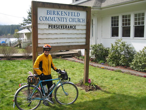
Turning left, up and down the rollers, past the Fishhawk Lake turn, then into Birkenfeld, past the church, a couple of houses, and we arrived at the store.
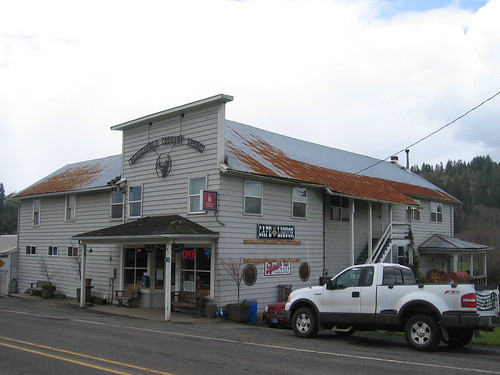
The proprietor was happy to see us, and cheerfully signed our cards. He is looking forward to seeing you all on Saturday. I ordered a grilled cheese sandwich and fries from the cafe and we sat at one of the tables and enjoyed our lunch. I also got my right thumb to finally defrost. Chatted with the proprietor and grill cook, made another batch of Gatorade Tea, topped off the water bottles, and it was time to turn around.
Last year we had a lovely tailwind. Not this year. Darn. I think there was a bit of hail somewhere on the way back to Vernonia, and it is slightly uphill. Past the Keasey Road intersection, just before getting into Vernonia, three dogs came running out at us from the right, but did not leave their yard. I think.
The turn onto Bridge St is really the main road turning right; you won't necessarily see a sign. Cross the bridge, and start looking for a place to sign your card. We stopped at the Shell station on the right. A couple of women sitting inside (minimart plus place to sit down and eat it) were amused by Little Pink Bear. I ate my third sandwich of the day, along with a banana and a cup of coffee (65 cents!)
Then off for the interminable 10+ miles back to the Hwy 26 crossing. I had been dragging since Birkenfeld (see earlier comment about not eating anything in the first 40 miles), and did not perk up until we crossed Hwy 26.
It is only about 3 miles to Timber after the crossing, going up the fun curves we rode down earlier in the day, the long fairly flat stretch, then the three switchbacks up. Easier than the climb from the other side, really. This was the refrigerated portion of the ride.
Most of the gravel on the south side had been swept during the day, but I would still exercise caution on the descent - check for gravel as you are climbing it in the morning.
Another medium-long stretch, vaguely downhill towards Hwy 6. It might be a good idea to turn on all your rear lights before turning onto Hwy 6. The shoulder is gravel-strewn, sometimes a bit narrow in the dark, shaded spots, and has that rumble strip right on the white line.
You can pull over at the Glenwood Store, which you can just about see from the Timber Road entrance, or elect to go a couple miles further and stop at the Shell station.
Then a right turn onto Gales Creek Road, and with any luck, you'll have a tailwind, and get to feel like a racer as you fly the last 12 miles back to Forest Grove. There are a few rollers and a climb up into Forest Grove.
Also, some chasing dogs coming in from the left. They almost got theirs however - they started chasing us, not noticing the cars coming in from the other direction. The first car braked, the second car, perhaps following a little closely, had to really brake and honk, and we just kept riding. This is why dog owners should properly restrain their animals :-)
Through Forest Grove (count the churches and signs pointing you to other churches), then left on Quince and we are done. 7:15pm Whew.
We had bludgeoned our respective spouses to join us for dinner. Since we did not finish as speedily as last year, we decided to forgo the soaking pool and just get hot showers before dinner.

No comments:
Post a Comment