Actually the ride started the day before, with Cecil and I exchanging clothing thoughts. She thought I was bringing too much; I countered that I could always leave it in the car. Made sandwiches, gathered accessory food. This is a ride with about 80 miles between food availability. And if you are later or earlier than the store hours, figure 100 miles between food availability.
Food: 2 brie and apricot jam sandwiches on Dave's Killer Bread, 2 Sweet Salty Peanut Bars, 2 Espresso gels, 2 bananas, water bottle, Gatorade bottle, 2 Heed packets (I was experimenting).
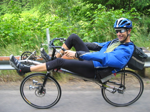
Michael was still finishing up getting ready when we arrived, so we admired his cookbook collection and bulletin board with the medals and ribbons. Way cool. After a little wheel removal, we had all three bikes in the van. Recumbents are different than tandems.
Michael entertained us with his story of the Cascade 1200 ride on the drive out.
Arrived at Faraday, did the pre-ride assembly (hmm. chilly and damp. knee warmers, wool arm warmers, light wool gloves over the shortfinger gloves, and my blue Nike jacket that converts to a vest, is reasonably water-resistant and breathable and folds up to nothing.
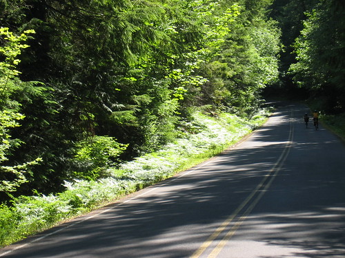
An enjoyable ride on the private road, with a brief glance at the site of the landslide ("nothing to see here. Move along. No stopping"), then onto Hwy 224, with a quick stop at the Promontory Point store and flush toilet. One young man, waiting to go boating with his family, was absolutely FASCINATED by Michael's bike. We told him it was much faster than our bikes, especially on downhills.

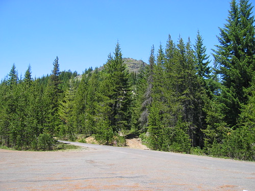
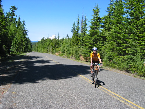
Up 224, riding, chatting, taking pictures... Every other time I've ridden this stretch, there was never a camera along.
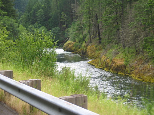
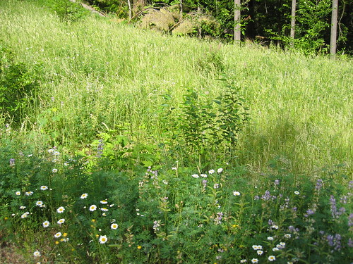
The ride is easy and scenic at this point, but for the 7% grade right by Indian Henry campground. It isn't that bad, and less than a mile long. You can take the extra time to admire the wildflowers blooming by the side of the road.
Some rollers, then we arrived at the Ripplebrook Ranger Station. The store is open from 9-5. Cookies, coffee, soda, other junky food. Hose bib to the left of the door in a nice thick hedge with a narrow open spot. Pit toilet in the parking lot. Good place to put on sunscreen, eat a banana and half a sandwich. I've been up here on really hot days, when they have been watering the lawn, and also a group of hot, sticky cyclists :-) Today I just took off the jacket.
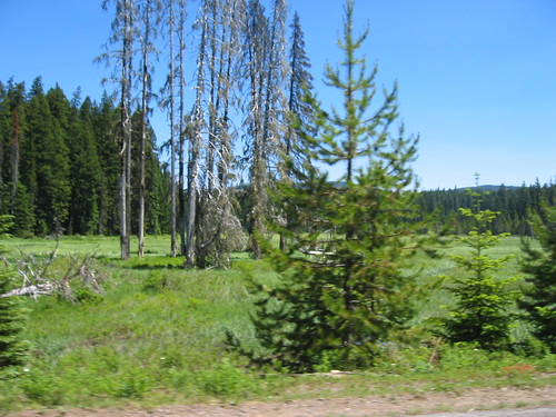
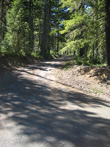
Beyond this point, all new road for me. More rollers through the forest, and a few miles of climb for a couple of miles, past the now-repaired road washout. I asked Michael if this was the start of THE climb. He was positively gleeful in assuring me it wasn't.
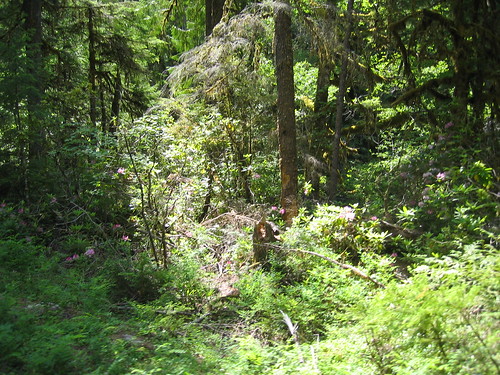
Eventually we arrived at the turn onto NFD 58. Or, to quote Michael: "Now we're going to have some fun!". Approximately 7 miles of it. The climb varied from not really steep at all to, well, steep. The forest cover decreases as you climb. Lots of wildflowers growing by the road, occasional National Forest signs, and pointers to trailheads.
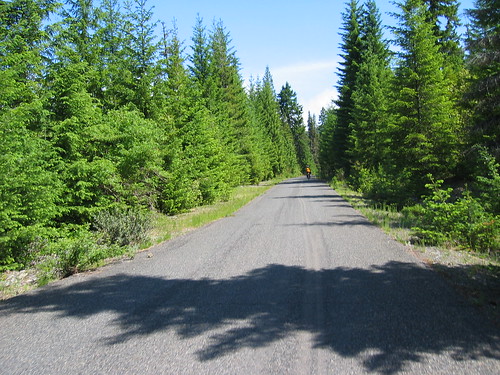
Also, happy faces painted on the road, and some Dan Henrys. I think the Portland Wheelmen Mt Hood Hoo-Haw uses this as part of their route. The road kept going up - it would look like maybe it would let up just over the next rise, or around the next bend, but no. Then it really looked like the top - lots of sky, no taller trees... before it took a sharp turn left and went up some more, and with more enthusiasm.
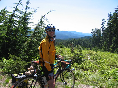
At the top of this, we found Michael chatting with a couple of cyclists. We visited a bit, then ate again. I pulled my jacket back on for the descent (the armwarmers had come off some time ago), and we rollered our way along. Great view of Mt Jefferson to the south! It isn't all downhill for the first part, but then it really does drop. Nice lines of sight, and the pavement LOOKS smooth, but it really isn't. It was chilly up there, with the snow by the road. It will probably be much diminshed for the riders on the day of the brevet.
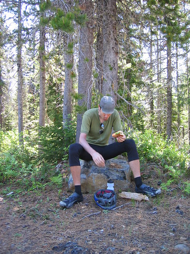
Found Michael and Cecil by Little Crater campground. There should be water there, if you need it. A bit further along, the right turn to head to our first control. More rollers for a few miles and then the most amazing meadow, with the Historic Clackamas Lake Ranger Station just a bit further along. Check out the displays, water fountain, and flush toilet. Refilled our water bottles, ate a bit, mixed up a bottle of HEED, applied more sunscreen (much warmer now) and headed off.
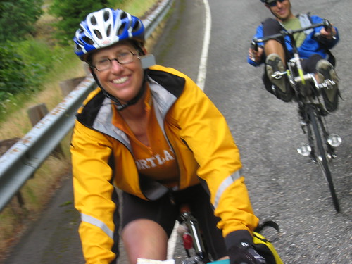
We are riding through forest now, with a long grinder of a climb. Cecil was waiting to take a picture of me, except I was just the accessory - turn around and get a great view of Mt Hood! She needed a picture, too, so a quick re-enactment was in order.
We arrived at Peavine Rd, to find that Michael had done some investigating and decided it was a no-go. It certainly didn't look particularly inviting, unless your first name is David or Joel or John...
I was sucking down the HEED. Nice flavor, actually, not too sweet. Cecil: "HEED makes me barf". Michael was somewhat more graphic ("hurl"); it doesn't work for him, either. I was beginning to wonder if I'd survive the balance of the ride. However, for the record, HEED does not upset MY stomach. It will be nice to have a change from Gatorade, which works, but it is really, really sweet.
Michael said we could continue to follow NFD 42 until Clackamas River Road, which we would have picked up at the other end of Peavine, and just shorten the out-and-back to Bagby Hotsprings. The road got narrower - I'd say lane and a half?, and there was really no traffic to speak of. There was a roller-coaster section (way fun!) and then a truly wonderful downhill. Mostly clear sight lines, perfect pavement and great scenery. I enjoyed myself all the way down. My idea of a great downhill is one where I'm not always reefing on the brakes. I should point out that my "need to slow down NOW" threshold is much lower than most folks...

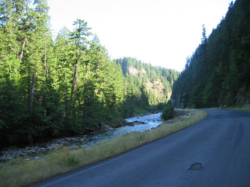
Found Cecil and Michael at the intersection with Clackamas River Rd. We turned right, and kept going downhill. Pretty much the story for the rest of the ride - a few rollers, a few flat spots, but mostly downhill :-) Michael, being on a recumbent, went downhill much faster, so he'd stop and wait from time to time, we'd meet up, and take off again. Eventually we arrived at NFD 63, Collowash River Rd - just after the Two Rivers campground sign. After some calculations of how much out and back we'd need, we headed on in. Relatively flat, and very, very pretty. Trees, rock walls, river... Arrived at the turnaround and cast about for an info control question. That managed (we decided "how many big rocks...." was subject to misinterpretation; that was discarded), we turned around; Cecil and I stopping for some pictures on the bridge over the river.

More rollers, nothing exciting, then we were back at the Ripplebrook Ranger Station and Store (sadly, closed). Topped off our water, ate a bit more, at least I did. Then down, down the 7% grade (headwind, darn), down, down, down,.... I realized I was descending faster than Cecil; not the usual state of affairs. I waited for her to catch up, and offered food. Down, down, down... While it was not dark, the sun was getting low, so we were in the shade for much of the descent.
We found Michael at the Promontory Point store, which was still open. We scored the last two pints of chocolate milk and Cecil got a bag of Smartfood. We parked ourselves outside the store and did some concentrated eating and drinking. Then the last bit up to the turn on Faraday. We spent the 4+ miles on Faraday figuring out how to add a couple more miles. There is that brewpub in Estacada... Continued on into Estacada (easy), officially finished the ride at Fearless Brewing, rode back to the car, loaded up, and returned for DINNER!
After an enjoyable meal, we drove back. I dropped everyone off, returning home at 10:45pm...
All my pics here
Cecil's pics here

1 comment:
Glad to see the Heed works for you. It sure didn't for me.
It sounds like a beautiful ride and I'm sorry I won't be there. Hopefully next year?
Post a Comment