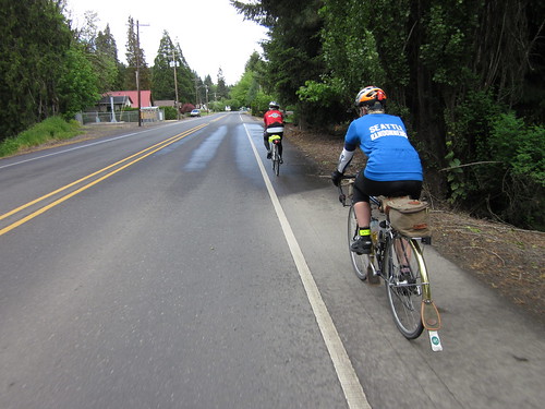
Sunday, June 27, 2010

Mostly, I do this ride for the ice cream...

While deciding where to ride this weekend (that I'm riding is rarely questioned), Cecil proposed a ride out to Multnomah Falls. We'd meet up at the Kettleman's Bagels close to her house. Other persons were planning to also ride out to the Falls, but starting later in the day.

Following my practice of doing as much preparation the night before, I made a couple of sandwiches (smoked turkey, cream cheese, cranberry chutney in a pita), set out the water bottles, 2 bananas and a couple of bars, picked out riding gear, pumped up the tires (better to find the potential flat the night before), made sure the right stuff was on the Lemond (bike of choice for the day), and conked out.

Up at 5:30am, out the door by 6:40am (it somehow always takes me almost 30 minutes to make it from the bed to the kitchen). Nice ride over the hill, again going by way of Skyline/Fairview Blvd. Much more fun descending Fairview when it isn't pouring! Arrived at Kettleman's Bagels right at 7:30. Didn't see Cecil's bike. But I did see her inside, and as her bike was inside as well, mine went in to keep it company.

First stop, bagels at Kettleman's

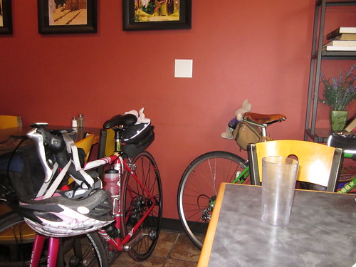
Everything bagel, lox cream cheese, coffee. This is a plan. We should consider this for a good am ride meetup point!

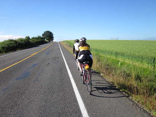
As we were not meeting anyone at Edgefield, we took the I-205 bike path north to Marine Drive, then into Troutdale from there. There was some wind assistance. Not much, but a real plus over wind harassment.

Brief pause at Troutdale City Park. There was a large group of Portland Wheelmen, who were still hanging around when we left. We figured they'd catch us at some point, but I am not sure they really ever did. By this point I'd already ridden about 30 miles.

Stripey fields climbing up from Troutdale

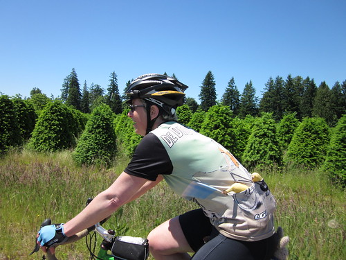
Climbing up to the summit, and down to Vista House. Pause for the view and a sandwich and banana (third meal of the day :-) ). A cute young Japanese tourist was carefully inspecting and documenting the bike rack (donated by the Portland Wheelmen. Sadly, very poorly engineered; no one actually puts their bikes in it) and taking pictures of the crazy American cyclist eating her sandwich. Then down (me to Cecil - wait for me at the bottom). The road surface is starting to deteriorate some - holes, cracks... With the contrasty light/shadow, I had to exhibit a bit more caution than I would have. Still, a fun descent, if a bit chilly.

Rejoining Cecil at Latourelle Falls, we zipped eastward to Multnomah Falls. Seemed like the fastest trip to the Falls ever. It was Family Day, with the Forest Service booths (dead animals, skulls, fire prevention), Native American crafts, good music... And, of course, the reason *I* ride to Multnomah Falls - ice cream! Now, the last time I rode out here, the conditions did not suggest ice cream, and I passed on it. Today, however, it was bright and sunny, warming up, and the Forest Service smokejumper guys were watching our bikes.

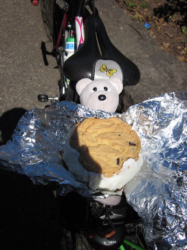
The homemade ice cream sandwich is wonderful - two sugar cookies with ice cream in the center. It seems to have grown in size since I last bought one. Didn't matter. I still ate the whole thing. It lasted all the way back to Troutdale, too.

Actual Size

The Forest Service guys had a prize wheel where they were giving away Smokey the Bear items if you could answer their question correctly on fire safety. Now, I didn't want a Smokey the Bear[pencil, plastic hat, key ring,....] No, I wanted the historical reproduction Smokey the Bear bandanna. Stan the smokejumper was chatting up Cecil (we need to get her a more blatant wedding ring :-) ), so I took advantage of that. After slowly remembering the 3 parts of the fire triangle, I had a bandanna. (pictures for my friends at Archival Clothing to follow; it is currently in the wash)

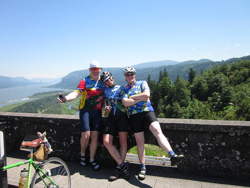
As we were heading back west, we saw what might have been the Wheelmen arriving. Again, a shorter ride back to the base of the climb than I remember, then up. I knew I'd find Cecil at Vista House. For all I knew, she was already there. Did about ten 30-30's (ow. they'd better pay off in the long run), wound around the last curves, and heard more than one cyclist cheering me on from the Vista House overlook. Behold! Dave and Edna, on their way TO the Falls.

Dave, Cecil and Edna at Crown Point

After much chatting we went our separate ways. Up the last mile, then down one of my favorite descents. Pause at the Troutdale gas station for liquid input/output, then back out to Marine Drive. We thought we'd take Cornfoot south of the airport and head home by way of North Portland.

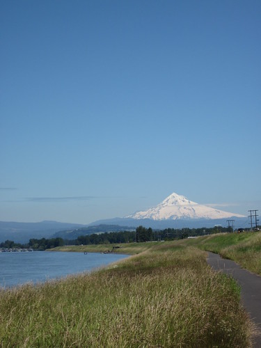
Mt Hood from Marine Drive

The wind was not that bad on Marine Drive, although Cecil said it was picking up. We stopped at the Cascades area Starbucks by the airport for liquids and snacks. They had such an array of vegan options that it took Cecil some time to pick something out :-) Watched no fewer than three Southwest planes land.

South on 47th ("closed!" Cecil-"there's closed and there's closed"), onto the sidewalk, across Columbia, then climbing up the ridge. Did I mention that it was getting into really hot territory? We saw what we thought was a lemonade stand and stopped. It was shave ice, but they offered up ice and syrup in our water bottles. As I had another 15+ miles and a big hill to go, I went for it.

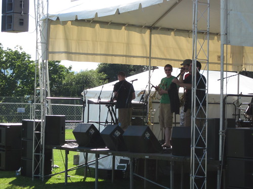
Back to Cecil's, then off to go home. At the corner, checked my phone for messages, just in case. Sure enough, husband - meet me at Overlook Park? Back to Cecil's to get directions (all of 3 blocks), then off again, north on the Esplanade, north on Interstate, and there it was, the Organic Brewer's Festival, with a local band we follow playing at 5pm. Husband showed up shortly thereafter.

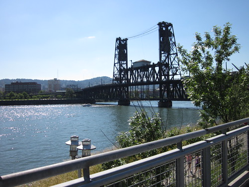
Steel Bridge from the Esplanade

Listened to the band while consuming a huge cup of lemonade, visited with the trumpet player afterward, visited with daughter and partner (hey, where'd THEY come from?), got dinner, tasted 2 of the 3 ciders and a beer, chatted with friends. Then, finally got home.

Target for Tomorrow playing at the Organic Brewers' Festival

Where I had to eat MORE ice cream, with fresh Oregon strawberries.

I had hoped to put in a least 100 miles, but the diversion at the end had it right at 95.
Tuesday, June 15, 2010

Scheming Away on Color Schemes

Best Framebuilder in the World tells me that the frame, fork and front rack are on their way to paint, and gently suggested that I settle on the final colors :-)

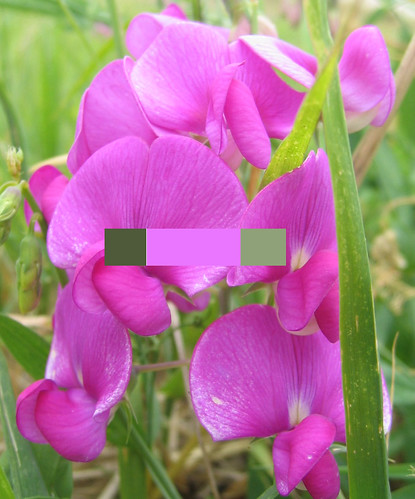
I've been saying Signal Violet, with a darker and lighter sage green sort of color for the logo, and the darker sage green for the rack.

Rummaged around the house for our extensive collection of colored pencils and crayons. You'd think a box of 96 crayons would have the right green, but no.

Color selection process #1

Then remembered that I used kuler at Adobe to pick out colors for my XHTML/CSS class this past term (for which I received a perfect grade). That worked. I pulled in the picture which was my original inspiration and went from there.

Sweetpea colors with the inspiration

So here we are. Getting closer!


Saturday, June 12, 2010

Three Prairies 200km Permanent or There's a Lot to be Said for Being Healthy

Friend Susan has been bitten by the R-12 bug, and she needed a ride for June. She recruited Cecil and me, and after Cecil suggested that we DON'T ride the Scio Covered Bridges Perm (I was going to make the same suggestion, but kept my mouth shut), we settled on the tried-and-true, never disappoints Three Prairies route. Two loops - a longer one to Dallas from Newberg, and then a shorter one to Mount Angel from Newberg. All the hills are pretty much concentrated on the first loop, on Perrydale Rd into Dallas. 4000 vertical feet. Scenery.

After cleaning the bikes, turned my attention to what to wear. No raingear needed. No warm clothes needed. Sunscreen needed. I narrowed it down to 2 jerseys and decided the morning of (Sheila Moon). At the last minute I tossed in my convertible windbreaker and arm warmers - it was 48 degrees. Just in case.

Found Cecil and Susan in the parking lot in Newberg. They were going for armwarmers. Susan and I also added a windvest. Cecil's comment on my jersey - "you know, I almost wore my sleeveless one like that, but I thought you might be wearing yours" :-)

They were riding their Sweetpea bicycles, and I was riding my Lemond (and wishing it was my Sweetpea. Soon. Soon.)

Over to the Thriftway for a starting receipt, and we were off. Through Newberg and Dundee, and that horrible excuse for a bike lane, then into Dayton. The vest came off. The long stretch to Amity (we pass at least 2 signs that say "Amity 5 miles". Oh, tailwind!

Heading south on 99W from Amity

Brief pause in Amity, then south on 99W, Bethel, and then Perrydale Roads. I pushed the armwarmers down, and removed them altogether in Dallas.

We were moving right along - I kept up, as long as there was not climbing, then I'd fall back some.

Substantial snack in Dallas, then off to Rickreall and back up Hwy 99W to Amity (headwind - paceline!), then to Dayton and Newberg. 70 miles done, and I had a moving average of 16mph. Wow.

Another substantial snack, call from the son - he just bought his very own car, so excited :-), picture taking, and off again, headed for Mt Angel. More tailwind bopping down French Prairie Rd, I set a nice pace. I wanted to protect that 16mph moving average. I'm not sure when the last time was that I saw numbers like that on my bike computer. 2006? Maybe? Clearly there is a lot to be said for being healthy.

Susan is getting into the spirit here!

Turned east, and had a slight headwind. Over I-5, through Gervais, on to Mt Angel. Susan wanted to stop at a coffee shop that was on the cue sheet. The cue sheet is pretty old; we were dubious. But there it was. Unfortunately, closed on weekends (!) So off to the public restrooms and the Mount Angle (hey, that's what the receipt says) Market. More Pepsi. I drank more sodas on this ride than I ever do. I drank a LOT, and still have a post-ride headache.

Then back. Darn it. There was that headwind. Windy, hot, humid. Part of my brain was wanting a refreshing drizzle, or, at least some hits from the field sprinklers.

Surprised Cecil and Susan on one of the rollers outside of Mt Angel - they were ahead of me, and I built up a head of speed on the downhill, and zipped by them on the uphill. Paid for it later :-)

A Two-Fisted Consumer of Bananas

By the time we hit Champoeg, I had it in my head that it was 9 miles more, so making it in less than 10 hours would be iffy. We stopped for soda, chips, and shade. I then discovered it was only 6 miles more. Oh well. I've got to say that riding back to Newberg from there is much shorter in the daylight.

125.2 miles, 10:15 total riding time, 12.22 total avg mph. Riding average 15.5mph (the headwinds back from Mt Angel did me in, there). The 10:15 is a personal best for 200km.

Reviewing the archives reveals that I have not ridden that kind of distance at that pace since 2006. I hope it is a trend.

Three 100+ mile rides in the past 4 weeks :-)

What worked:
  • eating. eating. eating. I carry most of my own food**, and try to make it something tempting. This day it was 4 well-buttered Rye-Molasses muffins*, a couple of hard boiled eggs, bars and a gel. I ate 3 of the muffins, both eggs, 2 bananas, and 1 bar. And some roasted, salted sunflower seeds, some of Cecil's lime-chile roasted almonds and a generous portion of Susan's big bag of Fritos. Two bottles of Gatorade, water, and 3 colas. Some food is just too much trouble to eat, and then I don't eat, and we all know what happens then. Or I'll think that I'm delaying folks by needing to eat, and I won't eat and...
  • Wonderful riding companions. Really wonderful.
  • Lantiseptic. Some of the, um, discomfort I've been having was alleviated. Not all, but most of it. Just because it has the consistency of spackle... yeah, well.

* a few years ago, I was sharing with my then walking and running companions at work what I would eat on a ride. "But that is so UNHEALTHY!" was the general reply. My counter: "I'd have to eat sticks of butter to keep up with the calorie expenditure". The muffins have a nice little slab of real butter tucked into each one.
** carrying food - I don't have to depend on finding something I'd like to eat in the convenience store. Plus I spend too much time staring at the offerings. Removing decisions conserves time.

Friday, June 11, 2010

frack.

why is it that everything needs replacing at the same time? why?

Rear rim on Bleriot:

Time to replace the rear wheel

8400 miles, often riding in wet and gritty conditions.

Phone call into Rivendell, one rim, one rear cassette (time for a new one of those, too), some 650B tubes headed my way. Someone here can dismantle the old wheel and rebuild it with the new rim. Someone with a Park spoke cutter...

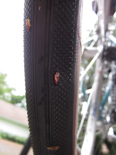
Needs a replacement tire as well. Michelin Axial Raids are no longer manufactured, and I am not, at this moment, inclined to spend big $$ on a new tire. There is a Nifty Swifty hanging around the garage that is barely used; I'll put it on.

Time to replace it, I think

This would not be as completely annoying as it is, except I think one more saddle needs replacing, and there is that shiny NEW bike still to be paid for.

This came about while cleaning up the Bleriot and Lemond. Lemond's rear wheel had a really loose spoke, which I've since remedied.

Sigh. At least both bikes are clean.

Thursday, June 10, 2010

Portland Rivendell Ride

Beth organized a Riv ride for this past Sunday. I reinstalled the front rack and canvas front bag, after all, the ride called for Full Formal Dress, for the bike anyway.

Awoke to...rain... Copious amounts of...rain...

Oooh, GREAT day to ride.

I was riding to the start, about 12 miles, with a big hill and downtown Portland in the middle. Google maps (bicycle directions) helped out, except I modified the route to use Cecil's preferred stretch up and down the east side of the hill - Fairview Dr. She said it was nicer than Washington Park, so I thought I'd check it out.

Raining less as I started out, then heavier as I headed up to Sylvan and up further to Fairview. I must say, descending Fairview in a downpour is...interesting. The importance of working brake pads cannot be overestimated. Down Stearns Way, through NW PDX to the Broadway Bridge, then north. I missed an obscure turn somewhere off Mississippi, but after realizing I was lost, asking directions got me where I was going (Peninsula Park Rose Garden).

Beth was there, of course. And eventually, another rider showed up (Cal from North Bend). Ritualistic admiring and photographing of bicycles ensued - actually Beth and I admired Cal's Saluki with the Sackville seat bag and Pacenti Pari-Moto tires (Beth was outnumbered by 650B bicycles, 2 to 1 :-) ) and Cal admired our bikes. Beth and I see each other's bikes all the time.

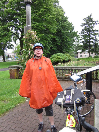
Beth

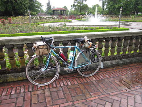
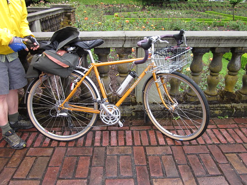
Bleriot among the roses and fountain

Cal's Saluki

The rain had turned to a gentle drizzle by this time. No other riders (!), so off we went. I can't say much about where exactly, but all around N and NE Portland, then into SE Portland, admiring the blooming roses and other flora. Spring in Portland is really, really pretty, and made possible by all that rain. We also admired the houses and the one with the cool little birdhouses on each fencepost. There was a short non-paved portion or two, not that we cared.

Ended up at Palio, in Ladd's Addition, but it was full, so we adjourned to the Lucky Lab, a couple blocks away. Lots of room to sit there. Tasty bento and hot chocolate for me. Just chicken on the bento. I wanted veggies, but "they take 20 minutes to cook". Not exactly sure what they are doing that they take THAT LONG to cook, but I passed.

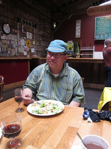
Cal, eating lunch post-ride

We all then went our separate ways - Cal and Beth back to locations in North Portland, me across the Hawthorne Bridge, up Jefferson, up Fairview, and then down, all the way home. My feet were sopping wet, but the rest of me was fine. Should have changed socks at the Lucky Lab. Oh well.

It really quit raining as I was starting the climb back up Fairview, and I was getting very warm. Fortunately, the Carradice Barley can carry all the discarded outerwear.

Last climb, I was getting kind of warm

Here's to the next Riv Ride in Portland, with perhaps larger attendance. 33+ miles, of which approximately 24 was riding to and from.

Tuesday, June 1, 2010

Almost 200km

Wondered if Cecil wanted to ride somewhere this weekend (this is a totally dumb question, but has to be asked).

She did, and had this route in mind. Just over 4 miles from my house, maybe a bit further from hers.

There was some conversation about "if it is going to rain, maybe not". Possibly understandable, given last weekend. The forecast settled on 60% chance of showers. We were riding anyway.

However, this time we were PREPARED for it to be raining. Rando bikes (fenders, lighting, luggage with extra clothing in it...), proper rain jackets, and, in Cecil's case, rain pants and enveloping booties. Wool jerseys. Extra gloves.

And it was raining when I got up. Drizzling, when I left the house at 7:20am for our planned 8am meetup. (Uphill all the way). Or, as Cecil said "whatever we are wearing is probably wrong". At least it wasn't cold.

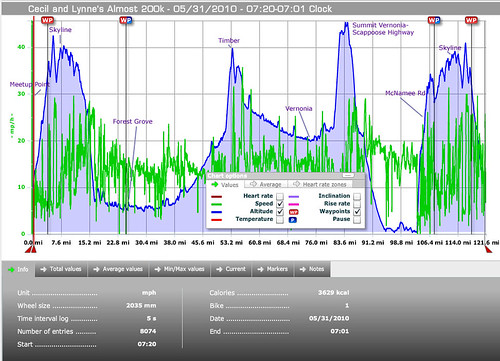
Route Elevations

Start: Multnomah County, corner of SW Fairview and SW Barnes to Forest Grove
  • a fun westbound romp along Skyline. Skyline is ALWAYS fun.
  • In Washington County
  • descended Old Cornelius Pass to Phillips, then across the flats to North Plains
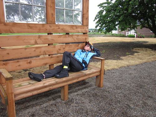
  • stopped at the Lavender Farm to admire their garden bench

Demonstrating bench usage


Oooh!  Blue sky!

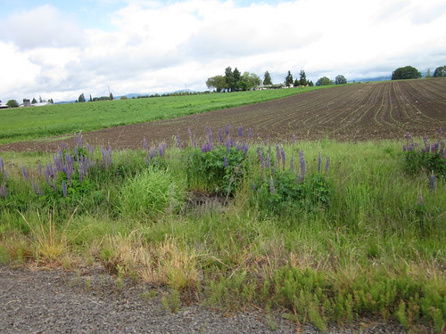
Lupines just outside Verboort

  • Pulled my jacket off WHILE RIDING on SW Porter Rd. Cecil was impressed. I told her the true test would be if I could put it away in my front bag (zipper closing) while continuing to ride.
  • No stopping of consequence in Forest Grove (a first)
  • This was the end of the rain, but for a couple of inconsequential bits of very light drizzle.

Forest Grove to Vernonia
  • quartering tailwind

Heading to Timber

The Timber Climb after the grade slacks off a bit

  • no snow on Timber summit.
  • warm on Timber summit Cecil: "you know, a little refreshing drizzle would be nice about here"
  • drizzle on Timber descent (Cecil!)
  • exiting Timber, passed about a half mile of houses, all with barking Australian Shepherd dogs. Must have been in the deed restrictions
  • entered Columbia Country around here somewhere
  • descending to Hwy 26, found myself matching Cecil's line and speed on the curves. Yes, boys and girls, Lynne descended curves at 28mph. Cecil: "wasn't that FUN?!" Aberration, to say the least.
  • EZ crossing of Hwy 26. Must have been in between waves of traffic
  • 11 miles to Vernonia - Cecil: "not my favorite stretch" me: "yes, longest 11 miles ever"
  • Rear flat while entering Anderson Park. If one is getting a flat tire, this is the place to do it. (Randos - site of the Birkie 200 Vernonia control). Picnic tables, covered area, running water (to wash dirty hands). Nice gash, booted it with USPS tyvek material. Didn't make me ride like Lance, darn.

Vernonia to Scappoose
  • Dave E found us heading out of Vernonia as he was heading in (this was apparently planned)

Cecil and Dave heading out of Vernonia

  • The climb started out easy, but it didn't stay that way. I plugged along, falling to the rear.
  • Summit: Cecil: "This is a really fun descent". And it was once we got past the suboptimal pavement bits at the top.
  • The Hubcap House. Didn't see the one I needed for my minivan.

Scappoose to McNamee Rd
  • Dave E heads west to his house, we go east
  • Dirty shoulder on Hwy 30 through Scappoose
  • Many red lights
  • Shades of STP :-)

Bombing along Hwy 30

  • Tailwind
  • Multnomah County

McNamee to Skyline
  • Cecil turned off on McNamee. I had been lobbying for it instead of Newberry - twice as long, not as steep. I didn't think she'd GO for it. It is still a 900+ foot climb over 4 miles.
  • McNamee killed us.
  • Nice gentleman in his yard filled up Cecil's empty water bottle, we had a nice visit
  • McNamee killed us.
  • Stopped at an open area with a vista and a collection of big sittable rocks for a snack... "at least the view is OUR side of the hill"
  • McNamee killed us.
  • Skyline, finally.

Skyline to Thompson
  • Cecil: "you mind if I turn off on Thompson, and go home that way?" Me: "no"
  • (Up down) repeat many many times. More fun when one is going west and is fresh, like, say, in the morning
  • Said goodbye to Cecil, recommended she turn on her Spidey Sense. Thompson is a great descent, but one's attention should not wander.
  • Wandering in and out of Multnomah and Washington counties

Thompson to Burnside/Skyline
  • (Up down) repeat
  • REALLY up.
  • Called spouse ("between Cornell and Burnside, home soon")
  • Finally at the top, then down to Burnside
  • Right onto Skyline again

Burnside/Skyline to home
  • UP to Skyline/Fairview (Cecil wasn't kidding, but it wasn't as bad as the climb to Burnside)
  • Washington County
  • Down to Hwy 26, west on the MUP.
  • Off the MUP, downhill to home. 7:01pm

Brilliant husband had a steak defrosting.
Cecil and I exchanged "home safe!"

What went well
  • clothing, bicycle and accessories more than sufficient for the conditions
  • I ate enough (3 Rye-Molasses muffins, each with a generous pat of real butter, 2 hard boiled eggs, 2 bananas, 2 bars, some of Cecil's Inca corn)
Stats
121.64 miles, 12mph avg, 6792 vertical feet, steepest grade 14%
Which finishes May with 457.29 miles, 16 more than April :-)