Sunday, September 29, 2013

Scavenger Hunt 200k Pre-Ride Notes

Kevin Lais and I pre-rode the Oct 5 Scavenger Hunt 200k in astoundingly cr@ptastic weather, just so you don't have to.

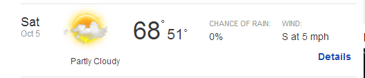
Current Oct 5 forecast

The route is a derivation of my Beaverton-Hagg Lake-Carlton perm.  If you want to see pictures, go here.  It was raining and blowing too hard for me to take any.

But anyway, the ride...

We are starting at Jim and Patty's Coffee in Beaverton on SW 117th.  Please park on the street, if you plan to park at the start, which is not exactly the same as the finish.  More on that later.  Wonderful coffee there, but the service isn't instant.  Get there a bit early if you want to enjoy your Black Tiger Slammahamma with a Pig Newton (available in veggie).  

Black Tiger SlammaHamma

Pig Newton

It should be noted that the Beaverton Transit Center is one block to the west, for those of you in Portland who aren't inclined to climb over the hill that early in the morning.

You will work your way west and north, including a brief bit on the Rock Creek Trail off NW Evergreen.  There is a new signalized crossing at the trail, so it will be easier to find than before.  Shortly after that you'll turn onto NW Cornelius Pass Rd, and turn left onto NW West Union.  The left onto West Union wants you to cut over a right turn only lane well before the light, so be alert there.

Now you are outside the Urban Growth Boundary, and it is all pretty for miles and miles and miles.  I am trying to remember if there is anything special I should tell you here, but there really isn't.  The info control at St Francis also has flush toilets in the building past the church.  There is a donation box for restroom supplies, since every cyclist in the area stops there!

Kevin and I dragged some big storm blow-down off the Hwy 6 shoulder for you.  Of course, there may be more by now.

My recommendation for the Forest Grove open control is Maggie's Buns.  It can get busy, but they often have a day old baked goods bin that is much better than it sounds.  There is also a convenience store.  We stopped at Maggie's, and got our sticky bun (split between the two of us, they are huge) to go, but enjoyed some coffee while waiting for it.

Now off to Hagg Lake.  You'll pass the Lake Stop Store at the corner of Old Hwy 47 and Scoggins Valley Rd, if you forgot anything from Forest Grove.  There is also a portapotty outside.  After suffering your way up the first ramp at the lake, enjoy the ride around it!

You'll pass the Lake Stop Store again on your way back out, just in case...

Construction detour, already on the cue sheet.  Don't be tempted to head south on Old Hwy 47, because, at the moment, there is no bridge over Scoggins Creek.

There is a store in Gaston if you need anything.  Heading east on Main St, we saw a big tree down, but we could easily ride around it, and it will probably be cleared away by Oct 5.

The route to Carlton may be familiar from the Wine Country Populaire.  We were Ever So Happy to get to Carlton, because it is 81 miles into the route, and, for us, it was 81 miles of heavy rain and headwinds.

After Carlton, it is possible there will be no services until mile 116, 36 miles down the road.

From Carlton, you head east, and the road keeps changing names, but eventually you'll end up on Kuehne Rd, and the familiar left turn (caution!) onto Ribbon Ridge.

North on North Valley and Spring Hill, right on Fern Hill, right on Geiger,  and you will pop out on Golf Course Rd, just south of Cornelius.  If you are really desperate for something, you can turn left and get something from the Plaid Pantry, a bit north.  But your route lies the other way, along with more info controls.

At the end of Golf Course, the Forest Hills Golf Club *may* still be open.  They've got a water fountain and a snack bar and bathrooms.  The golf course looked pretty flooded yesterday, so they weren't open.  Continue straight on Tongue Rd.

Crossing Hwy 219 - you'll turn right onto Hwy 219, and take the first left turn.  There is a protected left turn lane.

The next timed control is at SW Borwick and SW Baseline.  I usually stop at the Jackson's convenience store at the gas station, but there is fast food and a grocery store.

Almost done.  East on SW Baseline, turning left onto SW 158th, then right on Walker.

After crossing Murray Rd (really big intersection), you will want to turn left onto SW Park Way, the second left.  There isn't a protected left here, so exercise caution.  Kevin and I had no problems getting across.

After that, it is just following Park Way (with a brief info control stop) to the top of the hill, then right, left, across the Hwy 217 overpass, taking the first right, and dropping down through the neighborhood to my house (the finish).  Black mailbox, white post, on the right, if you start riding past the guardrail, you have gone too far.

I'll try to have some balloons or something on the mailbox.  There will be hot soup, cornbread, some desserty-type thing, great company, and such at my house afterward.

You are welcome to get a shower and change clothes, as well.

Now, if you wanted to park on my street and ride to the start (1.4 miles, all downhill :-) ), that is a really good idea.  Directions from my house to the start:

R
SW 107th Ave
0.2
L
SW Walker Rd
0.0
R
SW 106th Ave
0.0
Immed R
SW Sunnyhill Ln
0.1
R
SW 108th Ave
0.0
L
SW Polsky Rd
0.1
L
SW 110th Ave
0.1
R
SW Cabot St
0.2
L
bc SW 113th Ave
0.1
R
bc SW Center
0.2
L
SW 117th Ave

Caution and good listening skills are useful for the left onto Walker.  Still much safer than turning right, and sitting out there waiting to turn left onto SW 108th, trust me.

Final cue sheet is here.
and map

See you all on the 5th!

Sunday, September 22, 2013

Try the Cinnamon Roll Pancakes at the Block House Cafe...

That was Ken's recommendation.  We (Jeff A, Kevin L, and I) were out riding Ken's Dayton Flier permanent populaire from Forest Grove to Dayton.

Now, you might think, Forest Grove to Dayton, dead easy.  I have done it in my sleep... We didn't go that way.

The weather was damp and drizzly, but not cold enough to consider anything more than toe covers, vest, and wool arm warmers.  We headed west from the Forest Grove Safeway, and out Ritchey Rd, then Stringtown, Dilley, and Old Hwy 47 on the way to the Lake Stop Store, the first control.

Jeff was continuing my education in all things agricultural - he grew up on a farm.  I know what silage is now.

Kevin kept getting calls from his wife and pulling over, and what with starting, mmm, a bit late, we made the control with just a few minutes.  Not that we were worried.

We were meant to continue south on Old Hwy 47, but the road is closed because the bridge over Scoggins Creek is temporarily not there.  I knew this, and we just went east on Scoggins Valley Rd, back onto Hwy 47, and then off it again just north of Gaston.  (Remember this for the upcoming Scavenger Hunt 200.  Same detour).

Ate my way through lox and bagel along here.  Great ride food, I must say!

South on Spring Hill and Laughlin, then east on 240.  Wonderful pavement, but lacking shoulders.  And, on a blind curve...

pic by way of Claire Petersky
a person driving a car chose to pass the three of us.  On a double yellow.  Remember I said blind curve?  With oncoming traffic, which we could see and he couldn't?  I yelled.  They pulled over.  Words were exchanged, mostly me using words like "blind curve" and "double yellow" and "you couldn't see if anything was coming!".  His brilliant response... "it's a goddamn road!"  Mmm.  Didn't get it.  We left, they passed and slowed down; the passenger yelled out the window: "you should be careful who you yell at!".  Jeff had some observations about them, which I will not repeat here.  Kevin was in a bit of shock; he hasn't met that Lynne.

Anyway, we soon turned off onto Stag Hollow, which is a dirt road.  We had to slow down a bit, and pick our line through the washboard, but it wasn't too bad.  And there were other roads which I had not been on before, eventually crossing roads I did recognize, a bit more gravel, a great pedestrian bridge, and we were in Dayton!  How'd that happen?

Pedestrian Bridge, Dayton

The drizzle stopped somewhere along Stag Hollow Rd, not to be seen again for the rest of the ride.

Anyway, we had 20 minutes in the bank and I thought the cinnamon roll pancakes sounded really good.  We got a table quickly, but nothing was quick after that.  We passed the time by getting our cards in order, chatting with the other patrons (Kevin had a great conversation with the little boy at the next table), drinking coffee, and updating our followers :-)  The cinnamon roll pancakes WERE tasty.  Tip: only order one, they are huge.  And, an hour later, we were headed back.  If you do the math, we had 2:45 to cover 32 miles.

Cinnamon Roll pancakes. Block House Cafe, Dayton

Oooh.  I was inspired.  We exited the Dayton the way we came in, but the return was not the same.  Ken found more dirt roads for us to ride on.  When we summited the last one, it turned back to pavement and a fun descent to 240.  We then turned north on Laughlin and worked with the tailwind to get back as quickly as possible.  From here, it was back the way we came.

I am very sure that ditching my venerable multitool (a Trek-branded one from 2003) for the Topeak Rachet Rocket, saving me a whole 5oz, contributed to my ability to keep pushing it.

I kept watching the clock and odometer, and getting a little bit tense.  And pedaling.  Up the three big rollers on Spring Hill, into Gaston, up Hwy 47 to Scoggins Valley Rd.  A flying pass through the Lake Stop store.  Same cashier as the morning, she was highly amused.  A couple more big rollers on Old Hwy 47, a few more miles (still looking at the clock!) and the last climb up Ritchey Rd into Forest Grove.  We had 10 minutes left.  And I relaxed, because all we had to do was get to the other side of town.

Finished with 5 minutes to spare.  The closing receipt was the most expedient I could think of - Diet Pepsi at the checkout stand!

Finish, rando style

We did the rando-style finish, sitting on the pavement outside filling out cards.  Kevin said I made him hurt on the hills.  Hey, I wasn't stopping or slowing, we needed to get done!

Total time: 6:43
Riding average: 13.6 mph
Miles: 64.3

Tuesday, September 17, 2013

Mill City Coffee Run with Friends

Susan O needed an August 200k.  That ride she did in the UK doesn't count for RUSA awards.  She rounded up a nice-sized crew for the Mill City Coffee Run ("flattest perm there is") - herself, Asta, me, Kevin L, Greg P (Kevin's friend), Bill A, Jeff A, Paul W, and a last minute rider, Ken M, the perm owner.  He said it sounded like too much fun to miss.  Or something like that.

Shadows and Queen Anne's Lace

We planned for a 7am meeting, to allow for visiting, coffee and faffing before the 7:30am start.  I collected Bill A, we headed south, and found everyone there.  Paperwork exchanged, coffee and snacks consumed, day-glo vests installed, and off we went.

At the start in Wilsonville

There was the usual "fun" riding over the Willamette River on I-5, but we were quickly off the freeway and into the country.  All the wheatfields we had seen a month ago were harvested.  The corn was still there, and it smelled wonderful.

Howell Prairie Rd

the peloton

This was a "stick together" ride, and that is mostly what we did.  Stopped at Roth's in Stayton - the first control.  As usual, we were too early for the BBQ they set up outside, but we got drinks and things to eat.  Asta recharged and eventually Susan got us all back on the road again :-)

Asta recharging in Stayton

After leaving Stayton, Michal and I went ahead.  I was feeling pretty good.  We zipped up through Lyons and on to Mill City.  I was probably writing checks I couldn't cash, but hey...

Randos swarming Rosie's Mountain Coffee Shop (the turnaround)

We got to the turnaround at Rosie's; everyone else arrived a few minutes later.  Fortunately, we beat the rush.  I ordered a sandwich and a mango smoothie.  Ate the entire sandwich, but the smoothie was just too cold.  Poured it into my insulated bottle.  After about a half hour, Susan O evicted us again :-)  For someone recovering from a 1500k, she had entirely too much energy.

Kevin on the bridge in Mill City

Perfect shadows

Paul, headed back to Lyons

Santiam River

Anyway, we headed back down to Stayton and paused again.  My bike computer kept trying to leave me by jumping out of its mount.  I secured it (sort of) with some duct tape from Asta.  Green, naturally.

That's rando!

Mostly we drank cold things, and lusted after Susan O's teeny little rachet toolkit.  Something about a cleat bolt going AWOL.

Susan's cool little multitool

The group

Michal

After that, we continued north on Howell Prairie Rd.  The wind, while not favorable, was not entirely unfavorable either.  But it was hot.  Really hot.  We stopped at the gas station with the blue room at Howell Prairie and Silverton Rd.  Michal suggested I not wear my cap - it is constructed of some poly cotton fleece blend, and he dumped some water on my back.  Both those suggestions helped.

photo by Asta Chastain


We rode as a fairly tight group all the way to Gervais, with another stop for cold wet beverages and getting our feet out of our shoes for a bit.  Other than the heat, it was lots of fun.

Gervais mural and line of bikes

More pack riding all the way to the I-5 stretch on the Boone Bridge, where we all endeavored to just get across and off the freeway!

As Ken (the route owner) was with us, we all officially finished, then adjourned across the street to the McMenamins pub.  Got a table outside in the shade, and had a wonderful post-ride social and dinner hour.

Post-ride socializing

Kevin VanDyke saw on FB that we were there, so he dropped by for a few minutes.

Paul W finished his first 200 in over a year!  Yay!

Riding average 15.1 mph (!!!!!!)
126.2 mi, elapsed time 10:54, my fastest time on this route
All my pictures here
Michal's pictures here