Wednesday, April 30, 2014

Something Relatively Benign

The West County 100km.  Riding with the Usual Suspects (Ray and Kevin L).  This one starts 7 easy miles from my house, so I did not need to use my car, and the spouse would have something to drive.  Being Oregon in the Spring, rain was expected.  And headwinds for the first 42 miles.

Left the house right after 8, for a 9am start.  Arrived; went to the convenience store.  No other riders there.  Bought something, and then, with 10 minutes before, thought I'd tour the parking lot.  Found them over at Subway.  Which is apparently now open for breakfast.  Good to know.

Off we went, heading towards Banks.  I was already wearing the rain gear, since it was inevitable.  And it did, indeed, start raining lightly.  Through Banks, out Cedar Canyon (info control!), then west on Hwy 6, for the only real climb of the ride.

Matching

Riding by the mustard

Ray would get going, and move right along.  Kevin calls this his "Robo Ray" mode.  After the control at the Shell Station, we headed back west and then south on Gales Creek.  Me to Ray: "something is wrong here".  Ray: "yes".  Tailwind!  For a while anyway.  Then it turned around and started hitting us in the face, with more rain.  Fairly insistent rain sometimes.

Almost to Gaston - look at those clouds!

But since we ride this so often, my brain doesn't stress over it.  Shell Station to Stringtown Rd.  Stringtown Rd to Dilley Rd and Hwy 47.  Old Hwy 47 past The Lake Store and south a few more miles to Gaston.

The Gaston Store is great.  They've got a nice selection of cyclist friendly food, including bananas.  Friendly staff and customers. Really good chocolate bars.  A bathroom.  Wonderful soundtrack.  And an awning outside.

Did I mention awning?  As we were getting ready to depart, Kevin looked down at his rear wheel.  So we had a pause and I ate more things.  The puncture was caused by a wire.  All things considered, a good place to have to fix a flat.

Kevin fixes a flat

One goal of this ride was to check out my new shoes - men's Sidi Dominators.  I would wear the smallest size.  My women's Dominators just didn't have the volume needed.

The other goal was to give my new saddle one last chance, although careful measurements, of both me and the saddle were not indicating probable success.  I think 1500k is probably enough riding to know if it will work out.

So, by now, I decided the shoes were keepers.  Finally, some shoes that work!

And now the last 20+ miles, again, very familiar territory.  We pulled into the Subway, ordered lunch, and visited for awhile.  I changed into my dry socks.  Ahh.

Then I got the message that I was going out to dinner with the parents, so prepared to depart.  I could see some nasty clouds to the SW, and aimed to beat them home.  Which I did.

I have given up on the saddle; it will go back.  Not naming names, because the concept is great, and if it was wider, I'd be really happy.  Pulled my most recent saddle out of the closet.  I still will not be comfortable on the flèche, but it will be differently uncomfortable.  I am sure there will be a perfect saddle for me someday.

Total miles for the day 77+

Wednesday, April 23, 2014

This 300k Was Just a Bit Too Epic

Next up, the 300k.  The Oregon Randonneurs classic route, the Three Capes.  Not, of course, without some route planning excitement.

some bikes at Anderson Viewpoint

I didn't do the pre-ride or any of that.  But when John Henry posted that he had done the pre-ride, and I looked at his distance, rather MORE than 300k, I delicately inquired of the RBA what route changes were in store.

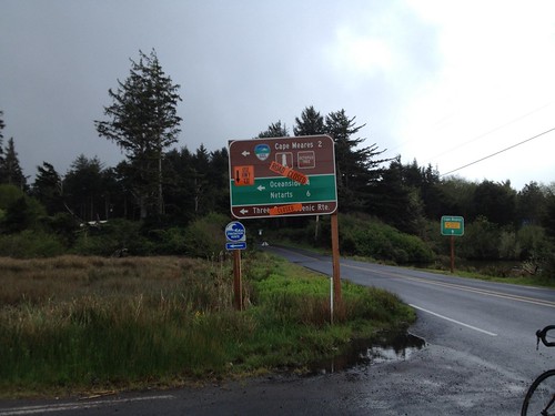
The Little Nestucca Highway was closed - all those quaint, narrow, single lane bridges were shrink-wrapped for repainting.  Something about lead.

We tossed around various reroute options to get back to 300k.  We successfully removed the Timber Road out and back (not my favorite).  And eventually, with judicious tweaks, got it right there.  And you wonder why you were sent out of Forest Grove on B Street. .02 miles, that's why.

Now, toss in the additional quirk of Cape Meares Drive is sliding down the hill, and that road is closed to traffic.  Navigable by bike, but closed.  Easy route around that, only 1.5 miles additional, plus, well, it skips climbing Cape Meares.  I was crushed. (not).

Not going that way today.

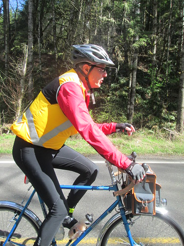
Two of my fleche teammates were coming down from Seattle to ride, and Narayan proposed that we ride together.  Neither he nor Geoff H had ridden this before, so they had the added bonus of someone who knew exactly where she was going.

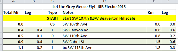
I made myself an updated cue sheet with all the detour options I was choosing to take, because I wanted to verify the calibration on my bike computer.

The ride took place during Passover, making my on-route food options vanishingly small.  Bananas.  Things to drink.  French fries.  I made up a variety of rice cakes, probably way too many. (I eat rice and legumes during Passover.  Check out the Kitniyot Liberation Front :-) )

Oh, and the weather was going to be probably the worst of any of the years I have done this route.

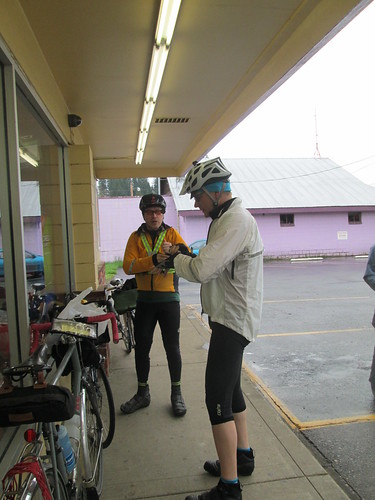
Geoff and Narayan appeared on Friday night.  We planned on a 4am wakeup, which would get us out the door at 5, arriving in Forest Grove with plenty of time to check in, faff, and socialize.  Which we did :-)

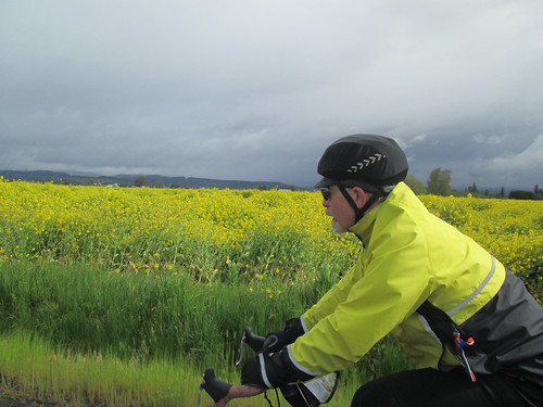
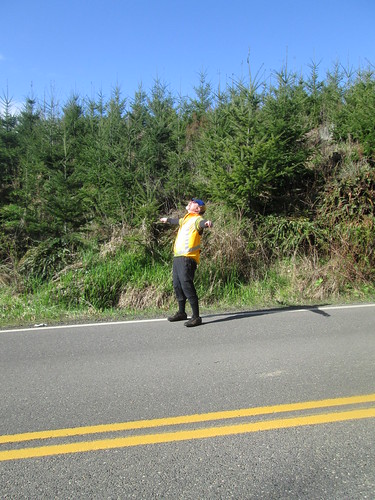
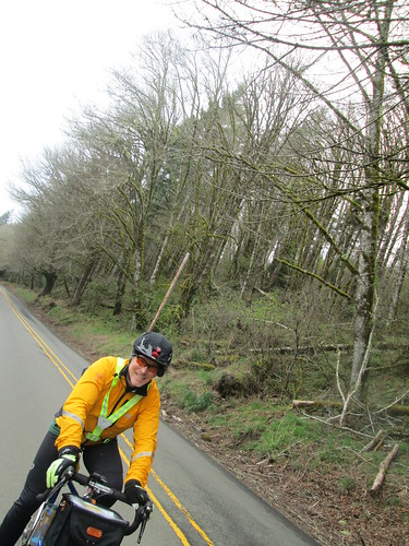
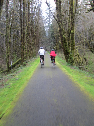
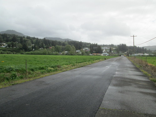
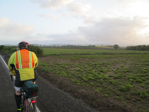
Not raining at the start.  We saw many riders on the out and back on Carpenter Creek.  Then NW on Stringtown, Gales Creek, Hwy 6...  Over the top, and the long descent into Tillamook.  It was windy, in a headwindy sort of way, but very light traffic.  And then it started to rain.  After awhile, I figured that I would not make the 10-12 miles remaining to the control in any sort of not sopping wet state, so we pulled over under some trees and donned raingear.  Ah, better.

Tried to make it quick at the Safeway, after all, I wasn't buying anything complicated.  Hah.  And then, as we were pulling out, I realized, while I had bought things, there was no signature and no receipt.  (How long have you been doing this, Lynne?) Quick trip back into the store for a sig from the Starbucks counter.

Bayocean Rd, past Tillamook

Geoff, Narayan and Gary, on Bayocean Rd

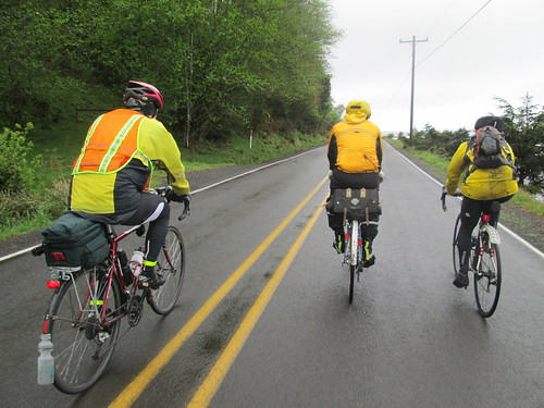
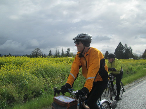
Now for the Bayocean out and back, plus a little convincing to Narayan that we were indeed on the route.  Again, saw riders headed back; waved at Michal.  He was 11-12 miles ahead at this point.  We picked up Gary Smith, and the four of us rode out to the control turnaround.

On the way back (tailwind!), Geoff pulled over, and we continued, figuring he'd catch up again before long.  Turned south, into a serious headwind.  This was the detour, and a new road to me.  I knew it was fairly benign until the last pitch before dropping down to Netarts Bay.  The climb in the headwind was pretty special.  A bit more traffic, because it is the main route to Netarts and Oceanside.  Some driving in an entitled, privileged sort of way, as I was trying to not get blown across their path.

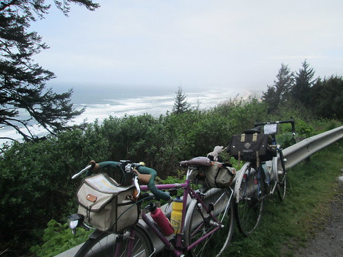
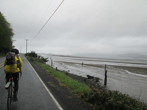
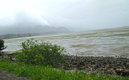
Finally down to Netarts Bay, one of my favorite stretches of the route.

Netarts Bay, with Cape Lookout looming

And then up Cape Lookout.  Every year I forget how very steep it gets.  There I am, chugging along, and suddenly it is painfully steep.  And then there is Anderson Viewpoint, a very good place to stop, take pictures, and loiter around waiting for Geoff.  Another rider came up (Gary? Mike?) and said Geoff would be right along, so we waited, and, indeed, he was right along.  There were serious headwinds from the south this entire leg.

Narayan at Anderson Viewpoint

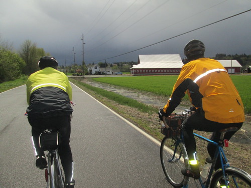
The final push to the top, chatting with Jason H on the amazing availability of coffee drinks at his place of employ, and then down and another intense cloudburst.  I am not sure if there was hail, but I'd put money on sleet.  So, the descent was a bit less fun than planned.  There was another rain hit on Sandlake Rd, then a couple of gentle climbs and we were in Pacific City.

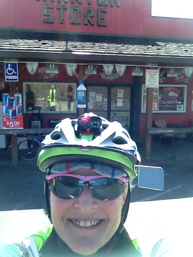
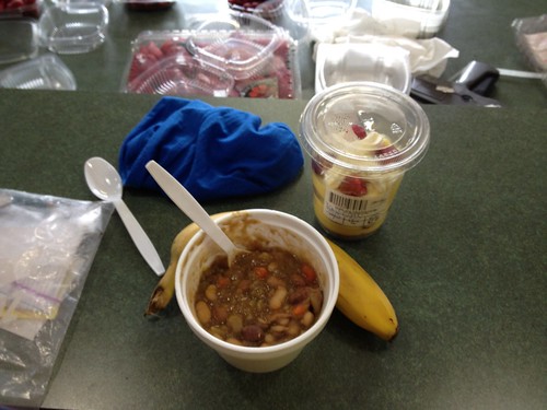
I lobbied for the Cape Kiwanda RV Park store - sandwiches and food for those ordering, and a mini-grocery for those not.  One bathroom.  Not a relaxing stop for me, filling up bottles, waiting in line to buy things, and such.  I really wanted to sit down, too.  Kevin and Jeff were there at some point, along with other riders.  Ray, Lesli, and Peg were probably way ahead somewhere.

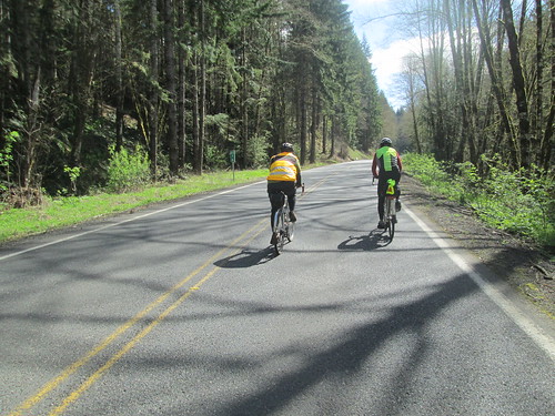
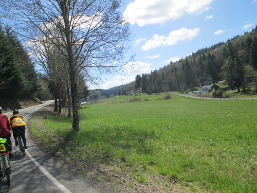
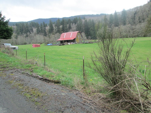
Finally, turning inland!  We went north through Pacific City, out on Old Woods Rd to pick up Hwy 101 at Cloverdale.  Another new stretch of road, gently rolling, lots of farms, and very green.  Cloverdale to Hebo wasn't bad at all.  The shoulder wasn't very wide, but it was clean, and drivers were generally courteous.  Mike R and I chatted about 650B tires.  Now, if there was a Compass 34mm width tire, I'd be all over it.

Cloverdale up ahead, from Gist Rd

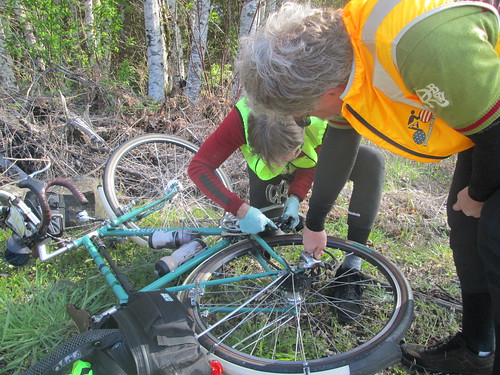
Then left onto Hwy 22.  I had ridden it in the other direction, on a very wet perm, back in 2011.  We (we now comprised of Lynne, Geoff, Narayan and Mike), paused to reconfigure clothing, as it looked like the rain had given it up for the day.  Geoff was also trying to lose his mudflap, so I produced a ziptie for an on-road repair.

Three Rivers Hwy, headed to the summit and Grand Ronde

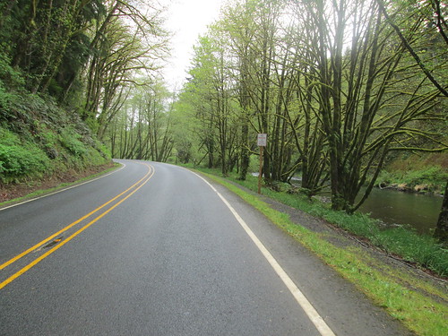
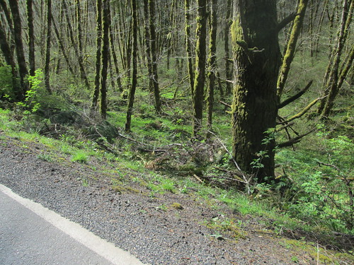
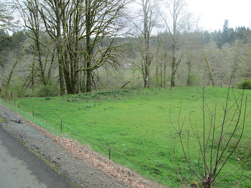
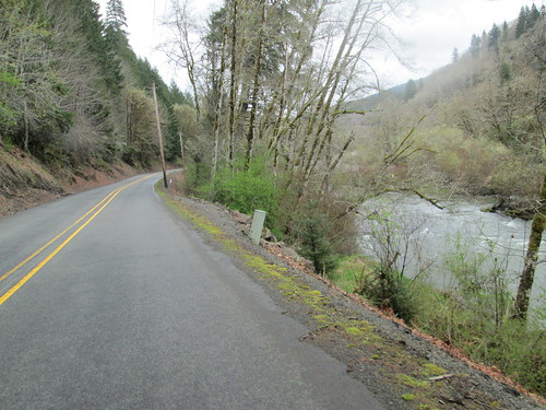
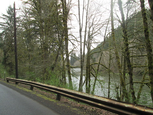
Very, very gentle grade along the Nestucca River, for miles and miles.  Passed Dolph Junction, where the Little Nestucca Rd joins in.  Bit more of a grade, not much, wonderfully mossy trees, and... Sourgrass Summit!
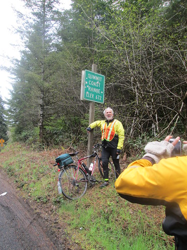
Geoff at the summit (Narayan's elbow)

Mike Richeson

Narayan

Pause for pictures.

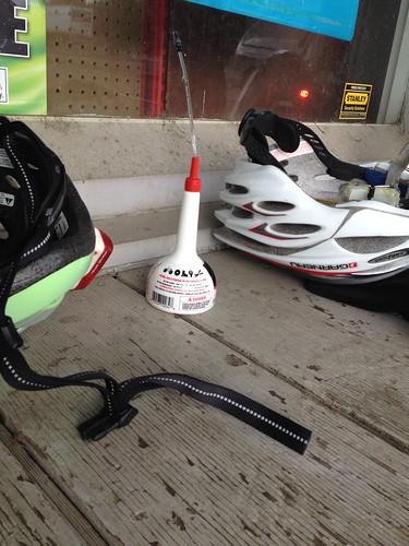
And then downhill, with the expected tailwind.  Into Grand Ronde, stopping at the store on the corner.  I announced that I was taking a few minutes, and sat.  Ate something.  A very courteous rider had purchased and left a can of 3-in-1 oil.  More than a few of us had squeaky chains, so we put it to good use.

Useful gift from faster riders.  Grand Ronde.

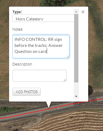
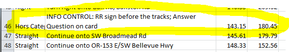
More tailwind along Hwy 18, Yamhill River Rd, Willamina (beware, Tracks of Death!), Sheridan, and then our last on-course control in Ballston.

Colorful fields ahead to the left, and Geoff, headed for Ballston

It was not yet dark when we arrived in Amity.  Narayan and Mike had fallen off a bit (I was happily sitting on Geoff's wheel and enjoying the tailwind), so we paused to regroup.  Off to Dayton.  By now, in complete and total autopilot.  And we arrived at the Dayton Center Market and... bonk.

Ate a gel.  Drank something else.  Took some Endurolytes. Pulled on my jacket, because I was shaking, and sat inside for a bit.  After awhile, we all took off again, at a somewhat less ambitious pace.  Got to the Trappist Abbey on Abbey Rd, and needed to sit down again.  I really really wanted to quit here (didn't help that we had started up on the Abbey Rd hill, and, while not long, can be a bit painful late in a ride).  Tried to quit.  Called Cyndi, but she basically told me to suck it up and finish.  Ate something.  Took some more Endurolytes; put some Fizz tablets in the sports drink bottle.  Onward.  My stomach would say eat something, I'd take a bite, and it would get crabby for awhile.  The guys all stayed with me.

Our pace picked up to 11-13mph, so I kept muttering "less than an hour", then "less than 30 minutes".  And so on.  Turned onto Fern Hill.  Less than 5 miles to go.  Finally rolled into the parking lot and walked into the Grand Lodge at 12:17am.

Cyndi and Michal had hung out to see me finish (oh THANK YOU!)  I was shaking again, so Cyndi got me a Coke, which helped.

Nothing like a bonk to take your mind off the fact that you and your new saddle are still not good friends.  And, strangely enough, my triceps hurt.  This has not happened in YEARS.  Wrestling with the crosswinds?  Too much weight in the front bag?  Dunno.

After sitting and visiting with them and Susan F, and watching the shaking subside, we headed on back home.

Well, it was faster than last year's hypothermia-fest out of Tumwater.  I was riding the entire time in a group of riders, which, for me, on a brevet is a rarity; at most I am riding with one other person.  And it was very, very nice.

18:17 total time, with a riding average of 12.29 mph.

I was delighted that the distance on my bike computer was only .3 mi difference over the 187.9 miles on my cue sheet.  This can be easily accounted for by pullouts at controls and Anderson Viewpoint.

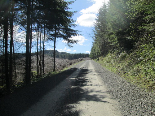
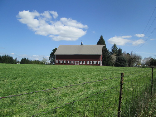
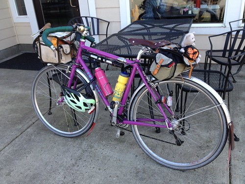
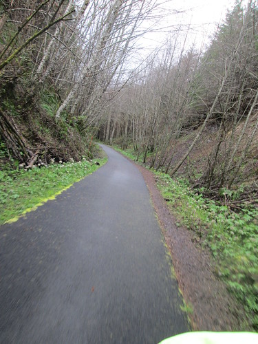
All the pictures here.  More mossy trees and scenery.

Monday, April 21, 2014

The Making of a Cue Sheet, Feedback

The post on how to create a cue sheet generated some feedback, some of which I'd like to share with you.

First, from Susan Otcenas:
"Had a conversation about cue sheets with some Canadian and US riders. One small item they seemed to feel differently about from your procedure. General consensus was that they want cue sheets to read left to right. As in Proceed 0.1 miles to mile 159 and turn right at River Rd."

So I thought about it, and modified my copy of cue sheet for the upcoming brevet.  Now, for ME, the most important thing on the cue sheet is total distance, because that is what is displayed on my bike computer as well!  Given that, I had the leg distance first, but in a slightly smaller font, and the total distance boldface font, same font size as everything else.  That way, I could quickly focus on total distance.  Looked like this:

Leg distance given first
Worked out well, so I will carry this format forward

Additionally, from Mark Thomas:
"FYI. I've had pretty good luck with a slight variation of this method. I put additional information (like your 10a stuff) into the cue sheet entries in RwGPS. It ends up in the same place after you do the CSV export / open in Excel, but then you have the information available in the RwGPS file as well."

The way to do this is to select the Add to Cuesheet option over on the right side, then click on the route where you want the control.  Then type in any information you want for the cues sheet CSV export.
Add to Cuesheet dialog box

Your notes added to the cues for the route, plus the mileage; nice!
When you export, there it is:
Already in your preliminary cuesheet
The only drawback I see to this is that the cues you add to the route do not show up as icons on the route map.  You would still need to add a POI (Point of Interest) for the viewer to see them called out on the map.

(Updated after more feedback from Mark) As well as adding cues for controls, this also works for useful bits of information such as summits, dangerous railroad tracks, or other.  In addition, existing cues can be improved with clearer navigation information, and adding SS and/or T (stop sign, t-intersection) or any other useful navigational aids.  And this is all stored in the RWGPS file, so you don't have to re-add it should you need to regenerate the cue sheet, and others have access to the information from the RWGPS link.

Wednesday, April 16, 2014

Found Yankton Again!

Ray was prospecting for ride partners.  He pointed out that this would be a good tune-up for the upcoming 300k, what with all the climbing.  The weather was going to be amazingly nice.

Mt St Helens

Found Ray and Kevin at the Scappoose Library, followed shortly by RB.  We headed over to the little market for starting receipts, and cleaned them out of bananas.  Not any chances to restock on this ride, until 10 miles from the finish.

Out of Scappoose, and we promptly started climbing the Scappoose Vernonia Hwy.  Ten miles up, pretty gradual until the last couple miles.

Farm and cows on the Scappoose-Vernonia Highway

Ray and RB pulled ahead; Kevin and I came around a corner to find RB working on his bike, and Ray asking if I had a quick link.  Which I did, and RB was resolving a chain suck issue, but he was just going to shorten his chain, and didn't want the quick link.  Ray checked out the sun, and then went to hold something for RB.  Well, ok, we were stopped.  So I ate one of the bananas.  Pointed comments about Luddites may have been shared.

Ray basking in the sun

You know, if you used my quick link, we'd be (long) done by now

Off again, and shortly heading down to Hwy 47, then over to the Big Eddy Campground, info control and rest stop :-)  I took off, knowing they'd catch me.  And eventually they did, a few miles after the turn onto Apiary.

Ray and RB on Apiary Rd

Kevin.  "You know, my saddle feels better today. And I LOVE these tires."

Coast Range forest

Didn't remember Apiary being challenging last time.  Of course, we had a headwind this time, which pretty much followed us around the entire route, but for the last drop to the end.  So, up to Camp Wilkerson and down, then a rolling stretch, which eventually took us to a turn onto the expected 3 uphill miles of gravel.  Mostly dirt-type gravel, but there were also stretches of loose gravel.

Gravel.  And uphill.

And loose dogs.  Many loose dogs.  The scariest was a very determined miniature pinscher type who chased me the last part of the gravel, where I really couldn't accelerate and kept yelling "go home!  bad dog!".  I kept expecting sharp pointy teeth to do something painful to my calf or ankle.  The dog's owner had yelled something half-hearted as I passed their place, but didn't follow up. :-(  Got to where the other three were waiting at the intersection; Kevin chased it back.

Coast Range valley above Scappoose

So, adrenalin up, we then went to finally find Yankton.  Rolling terrain again, alongside a scenic valley, then up (dang, another dog, but it just sat there) and down into Yankton.  We stopped at the store long enough to buy something to drink, and for me, a packet of Oreos, which I happily wolfed down on the porch.

Found it!

Long discussion on breaking in leather saddles (between the four of us we had a Velo Orange, a Berthoud, a Selle Anatomica, and a Rivet).  RB's considered opinion after looking at my saddle, was that it was awfully hard (yes indeed, and 1100km hasn't softened it up appreciably).  He recommended I loosen it a bit.

Photogenic Red Barn

Last bits of up (one slightly egregious wall), then winding around some farms and houses, and the last drop down to Hwy 30.  Then a bit of Hwy 30, a protected left across, and a few quiet miles back to the start.  Kevin had been saying that if we pushed it we'd finish in less than 5 hours.  Now, we were at 5 hours at Yankton, so I was not sure what clock he was using, but anyway.  We rolled in just after 6 hours, and there were a few more minutes before we could get a receipt.

Finished!

Post-ride refueling

Last time, we finished, and it started pouring, and there was no place but the market.  Now there is Bert's, a wonderful little place which serves breakfast ALL DAY.  My kind of stop.

6:10 elapsed, my bike computer records 4220 vertical feet.

Monday, April 14, 2014

The Making of a Cue Sheet

Update: I received feedback on this, and ended up with an even more usable cue sheet layout.  So read this for the study and conclusions, and then read this posting for my preferred cue sheet layout.

About 5 years ago, I did a survey on what riders considered the most usable cue sheet format.

Basically, the most important bits of information were:

  • Turn
  • Road (description)
  • Cumulative distance, and
  • Leg distance

Everything else was less important, and, indeed in some respondents' eyes, "too much information".  That can be interpreted as distraction, or hiding the important information in too much text and numbers.

Not to mention that the cue sheet should be accurate!

Note: it is considerably harder to describe this process than to actually do it.

My process to generate a cue sheet for randonneuring is as follows:

Prerequisites: working knowledge of Excel or similar spreadsheet program

1) at least have ridden on the roads in question.  Mostly.  Or gather information from those who have.

2) map it out in Ride With GPS.  I like this mapping program best.  It is free, uses Google Maps data (which seemingly the entire world is buying into), and generates a wonderful starting point for the cue sheet.  I also find it easiest to use of all the programs out there.  I like it so much that I have calibrated my bike computer to match up with it.  If there is going to be a One True Distance, might as well be the one most people use and have easy access to. Yes, I know there are many truths, but if my bike computer and the cue sheet agree, that is a truth I buy into.

3) Verify that map.  Sometimes little side turns sneak in when plotting.  Edit them out (drag the route). Make sure the distance is what it needs to be.  Sucks to have to find a couple hundredths of a mile to get the route to the required distance later on.

4) Save the route, then export it to .csv format.  Looks like this:

Ride With GPS .csv output

5) The distance is way over on the right, so I move that column to be the first column. 

6) Best now to make a copy of this worksheet, so you will have the original handy.  Delete the elevations column if you don't want them.

7) Now, go through that cue sheet with the map handy, and tidy it up.  There will be extra turns in the original that don't apply in real life; delete them.  In addition, maybe a turn is missing, because the plotting program didn't think it needed to be included.  Also verify that all the rights and lefts are correct.  Save your file :-)

8) Now, remove all the extraneous text.  I make use of the Excel Replace All function, doing things like replacing "Turn right onto " with nothing, and so on.  Actually, I got tired of doing it over and over, and created a macro* to do it all for me.  After I clean up all the descriptions, I then replace all the "Right" with "R", "Left" with "L" and "Straight" with "CS".  After all that, I scan through the cue sheet again, manually fixing the ones that weren't zapped by the macro.
  • Don't forget to include the trailing space when replacing the text!
The Excel CTRL-H function.  Removing the trailing space makes the cue sheet look nicer.
9) Starting to look like a usable cue sheet!

10) Put in all the controls.  For controls where the rider just stops along the route and continues, I preface them in the Turn column with Stop.  If they are to turn around and go back, the Turn column contains "U" (U-turn).  You can find the exact mileage for the control, if it isn't at a turn, by putting your cursor on the exact spot on the map, and seeing the distance readout below in the elevation graph.
  • If you need to add a row, use the "Insert Row" function in Excel.  Newer versions let you choose to add a row above or below the currently selected row.
  • Tell the rider what to do AFTER the control.
10a) Add in useful information, like what town the location is in, and where convenience stores, food places, and groceries are located.  Also things like SS (stop sign), SL/TL (stop/traffic light), T (T intersection), are really nice; gives the rider another hint about the turn.
  • ex: "Netarts, groceries, taco truck, 3 Capes Café, Schooner Inn".  I italicize information that is useful, but not needed for route navigation
  • If a road changes names, I put that on a single line if there are no turns: "Bridge St, bc NE Abbey Rd"
11) now that you know the distance for all your controls (I work in miles; others choose to start in km), you can get the control times from the proper RUSA calculator.  RUSA certified events have different time windows than ACP certified events...
  • ex: "OPEN CONTROL: Tillamook, Main St (US 101)    Open/Close (8:44/12:12)"
12) are you happy with the cue sheet?  All turns correct?  Controls added?  Time to add the intermediate distances (legs), distance in the other (km or mi) reckoning, and format it!

13) insert a column between the total distance and the turn.  This is your Leg column.  The convention here is to have the Leg distance be how far one has to go before the turn (yeah, weird, but we are used to it), so, the entry in the row is the total distance in that row minus the total distance in the previous row.  You could just as easily do it the other way, next row minus this row.  But make sure everyone understands what is going on, although a quick glance at the cue sheet would make that clear.  So, do the formula and fill the column with that formula.  If there is a total distance in every row in the Total Distance column, all will be good.  If not, there will some funny numbers, so please go through and verify.  Save the file.
  • Leg formula, assuming Column A is Total Distance and Column B is Leg Distance, filling in row 3: "=A3-A2".  Copying this down will make the correct formula for each row.
  • Why I start with Total Distance and calculate Leg Distance - the imprecision of each Leg Distance will lead to Total Distance inaccuracies which compound through the cue sheet.  Using Ride With GPS, I can always find the total distance at any point, if things change.
14) now for the other distance reckoning.  I put those over on the right side.  Too many columns of numbers all clustered together is a recipe for a rider to read the wrong one at night when they are tired.  Make two columns, Km and Leg.
  • Total Km formula is: Miles*1.609344
  • Leg Km formula is the Leg Miles *1.609344
Again, create the first formulas, then drag down to fill the columns.

15) Formatting.  I understand some of this is regional preference, but this is how I do it:
  • Now is the time to reduce the number of digits to the right of the decimal point to just one.  Excel has a handy little control to do just that.  Note that this changes the DISPLAY FORMAT of the number, but not the underlying value.  This is a good thing.

    Reducing displayed decimal places
  • Font is something easy to read, Arial, Calibri.  NOT Times New Roman or Comic Sans!
  • Starting font size is 11, but I always save my cue sheets such that riders can download and edit them for their preferences.  Like bigger font :-) if they need it.
  • Control rows are boldface text and yellow background
  • The Turn column is centered and boldface text
  • The Total Distance column is sometimes boldface text.  I am liking that and will probably adopt it.
  • Borders - the outside borders and the horizontal (row) borders are black.  The internal vertical (column) borders are Darker 35% Gray.  Subtle, but the eye will track across a single row better, if some divisions are less emphasized.
  • All those useful bits, like a legend to the abbreviations, and who to call if you abandon should be added at the bottom.
  • Legend I use: L (left), R (right), CS (continue straight), VL/VR (veer left/right), X (cross), U (u-turn), Stop (stop), Immed (Immediate, like Immediate L or R)
  • Most of us use the front bags with map holder, which fits 8.5" width paper, so I don't do anything special, except to ensure that the cue sheet will fit to 8.5" printout.
16) Save it.  Now, follow it on the map one more time.  With any luck, you are all there, and can relax.  Or submit the route to the appropriate group for approval.

17) an option:  Remember "green bar" paper?  Easier to track across a line.  For my own use, I "green bar" my cue sheets, using the Excel table formatting function, with a very light green background on alternating lines.
Green Bar formatting

*macro - basically a recording of what you have done.  Start recording, go through all the Replace Alls, then stop it and save it.  You have to have "Developer" enabled in Excel, and you can find out how to do that online.  Out of scope for this posting.

Acknowledgement: my cue sheet formatting is based largely on the style developed by Susan France, Oregon Randonneurs RBA, with some additions.

Thursday, April 10, 2014

Banks - Elsie 200k, With Different Weather

Everything else was much like last year.

Michal, Lesli and Cyndi came up the night before.  Always fun.  I thought I'd try something different for breakfast, and so made a smoked salmon goat cheese quiche for breakfast.  With a full butter crust.  I thought it turned out pretty well!  Lesli doesn't eat fish, so she cooked up some eggs.

The weather was not going to be as amazingly wonderful as last year.  Didn't rain for quite some time, but it wasn't really warm, either.

Made it to Vernonia in good time.  We elected for the more expedient stop at the Shell station convenience store.  They had deviled eggs in their refrigerated case.  Michal and I each bought some.  One time we bought some to share, and I ate half a deviled egg and then looked down to get another and they were all gone...  Yes. So.

Michal and Jeff try to make it an expedient stop

Everything was quite green, what with it being spring and kind of damp.  We did not stop at Birkenfeld, but kept plugging along.  I was paying close attention, because, while I have ridden out this way before several times, I needed to fix in my head details for the upcoming fleche.

I sat on Lesli and Jason's wheels for awhile, chatting with David B, but then he got a flat, and Lesli went ahead, and I was keeping myself company for a few miles.  Then I heard a bell jingle, and Michal rode up.  I thought he had gone ahead, but no.

Michal

Long conversation about rivers and why we go up and down and why aren't the roads by the rivers?  We actually do cross over a drainage on the Banks Vernonia trail, which is why we don't see the Nehalem River until after Vernonia.  Then we we see an awful lot of it.

The control was at the Elk Refuge.  Pausing to get the answer and try to make my seat comfortable.  Still don't have it right :-(  May have headed in the wrong direction with the last adjustment.

Fleche note: 30 miles and another Coast Range summit to Astoria.

Daffodils, Hwy 103

Then back and south on Hwy 103 (in a headwind) to the Baker's General Store on Hwy 26.  It wasn't Passover this time, and I greatly enjoyed a bowl of bean soup and some trifle, with some beverages and a banana for later.

Bean soup and trifle.  Good lunch

Pastries at Bakers General Store

We chatted up the cook while we were eating.  They have a wonderful bakery counter.

Nehalem River, Hwy 103

Farm in a Coast Range valley

Tailwind back to Hwy 202, then a spatter of rain.  I didn't think it was enough to pull on all the raingear.  Then a few miles along I did pull over.  Of course, after the RainLegs, booties, and jacket were installed, it had quit raining, but it started up again soon thereafter.

Michal: "this doesn't feel like a tailwind." No.  Stupid valleys mess with the prevailing winds.  The wind was so changeable that I could not find the sweet spot on Michal's wheel.  Made the 40 miles back to Vernonia kind of the low point in the ride for me.  Neither of us felt lunch kicking in, either.  Plus my butt hurt.

Nehalem River

We found Lesli, Jeff, and Sean (others, too, I think) in Black Bear Coffee.  They were finishing up, but stuck around while we got coffee and pastries.  I called Fitz to tell him we'd be home in 2+ hours.

The moss is glowing

Last climb.  The climb out of Vernonia is about half of the climb from the Banks side, and it is gentler, not that the other way is at all difficult!  Michal went on ahead; I could see Lesli and Jeff's lights up in front, until the very last pitch up Tophill (which is steep).  Very soon after that I passed over the summit, and settled in to enjoying the descent.

The summit is JUST around the corner

I was passed by another rider who yelled On Your Left and blew by, and then found Lesli and Jeff.  They were stopped, and the rider zipped between the two of them.

We finished off the last 3 miles to the end of the trail, then the last mile to the pizza parlor, where we found many riders, and Ray and Barb checking us in.  Much visiting while we waited for Cyndi  to collect us.  Admired Maria's socks, which were under two pairs of booties and plastic bags.

Maria's Humping Rabbit socks

Elapsed time 11:39.  Oh. wow.  Quicker than last year.  Immediately feeling better about that!

Sunday, April 6, 2014

Technical Aside: Calibrating The Bike Computer Mathematically

Following a cue sheet depends somewhat on a reasonably accurate bike computer, especially in urban areas, where all one seems to do is turn every block.  A reasonably accurate bike computer ALSO means you don't have to wonder where the next town is, when you've already ridden further than the leg distance indicates!

I mean, yeah, you can figure out the difference between your computer and the cue sheet at the next turn and spend the rest of the ride doing math, but...

There are the tried and true methods of 1) using the tire measurement that came in the instructions with your bike computer (usually in 2 point font), and 2) the rollout method.

As I use a less common tire size, my purported tire dimension is never in the instructions.  And the rollout method wants one to ride in a straight line, involves chalk, and a measuring tape to measure in mm.  Can you imagine the inaccuracy that comes from that?

I am lazy.  Why do that when the awesome power of mathematics and spreadsheets are at my command?  Plus, so many cue sheets are generated from online mapping programs (Ride With GPS, Bike Route Toaster, etc), that I would really prefer that my computer match their distances.

Process is as follows:
Go for a bike ride.  The longer, the better.
Map that exact same route out on your preferred mapping program.  I recommend Ride With GPS.

You need to start with a couple of numbers:
1) your bike computer readout from your ride
2) the mapped distance for that ride
3) your current bike computer wheel circumference setting.  Mine is in mm.

First, solve for the number of rotations your wheel made on the ride.  Everything has to be in the same units, in this case, mm.  The formula below converts the bike computer distance in miles, to mm.  If your bike computer reads out in km, well, you'd just add 6 zeros :-)

rotations = (bike computer readout*1609344)/current wheel circumference

The 1609344 is mm in a mile.  If you were solving for cm, you would use 160934.4

You really want to do it with a spreadsheet, to preserve the precision through the calculations.  Of course, I remember doing similar calculations in HS Chemistry, with nothing but a Post Versalog slide rule.  Spreadsheets are better.

Now, the number of rotations will not change for the same distance, so, with the value of rotations firmly in hand, we can now solve for the desired wheel circumference:

desired circumference = (mapped distance*1609344)/rotations

Now the hard part for some, plugging the new circumference value back into your bike computer.

On your next ride, again check the bike computer readout against the online mapped distance.  You might need to adjust, but you will be much closer.

Quicker, alternative method, suggested by my husband:
desired circumference = current circumference*(mapped distance/bike computer distance)

I ran it both ways; the results were within a millimeter.