It didn't look good in Willamina. I was on the verge of bonking. It would be an 80+ mile drive for someone to retrieve me, and I didn't want that to happen either. But we are getting ahead of ourselves.
Ray proposed his Dayton-Beaver 210k permanent. I was pretty sure my engine wasn't yet rated for the initial climb, but he thought I'd make it. Susan and Keith also joined in.
While preparing the food (Fig Newtons, furikake hard-boiled eggs, rice pudding, Kind bars, some gels, Brookside chocolate-fruit gel thingies, chocolate bars), I came to the realization that my massive jug of Carbo-Pro maltodextrin was empty. I went to two local bike shops and came up empty. Then I remembered! The homebrew place out west in Hillsboro has maltodextrin! Drove out there, and learned that most of the maltodextrin they sell is to folks like me :-) Really good value, too. Might go back and buy a 10 pound bag.
It wasn't supposed to rain, but the "mist" was pretty darn persistent on the drive out to Dayton (like Newberg, only 10 miles further along...). I had my "it might raincoat" along. Susan had a windbreaker. Keith, in his recumbent, had a fairing and sock. I don't think Ray had a rain jacket. Fortunately, that was it; no more rain the rest of the day.
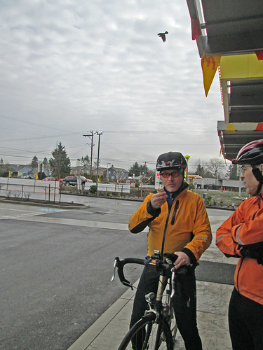
We met up at the parking lot across from the high school, and rode into the center of town, to take advantage of the public facilities and covered area for the pre-ride rituals.
Susan and I had ridden the earlier version of this route, in reverse, in pouring rain, 6 years ago. I had never climbed up from the Carlton side, and, honestly, wasn't sure I ever wanted to. But here I was.
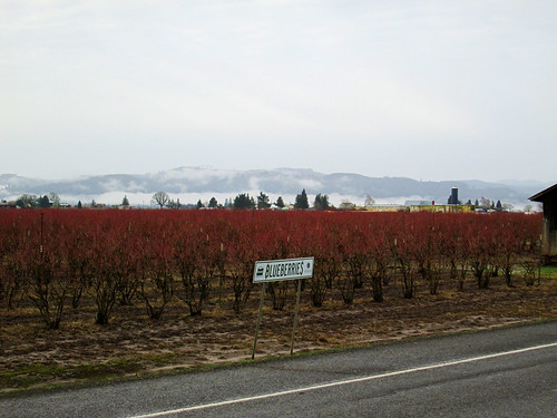
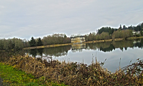
The first 10 miles were reasonably flat as we rode to, and through Carlton, out Meadowlake Rd, which becomes the Nestucca Access Rd, and then the Nestucca River Rd. The road wandered around through the foothills, where there were farms, then more trees, and at about mile 14, we started the Real Climb. It was pretty. I got to admire some parts of it at greater length, because there was some walking. The other three riders would regroup and wait for me, or sometimes ride along. Eventually I found them at the reservoir, which is the first summit. All the clothing I took off was restored. The climb summits at 1999 feet, drops about 200 feet, then regains it over a short distance.
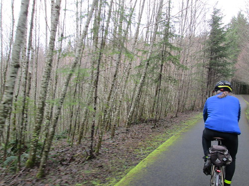
Then we had a beautiful, gorgeous descent along the Nestucca River, which went on seemingly forever (really, 35 miles), eventually dropping through the Siuslaw National Forest to Blaine, and then Beaver. There was a couple miles of gravel, but it was well-packed, and not an issue. Once I popped out of the forest near Blaine, I could every so often see the others up ahead, but didn't catch them until the control at Beaver.
I had finished both my bottles, so dealt with refilling them (one Gatorade-maltodextrin, the other plain water), and bought a couple of Payday bars, for variety. I'd been munching pretty steadily on the other food in my bag all along.
We then headed south on Hwy 101 to Hebo, where we'd turn back inland on Hwy 22. Not that we were on the Pacific Ocean; that was still a few miles further west. Hwy 22 climbs up to Sourgrass Summit, possibly the lowest (679 feet) pass over the Coast Range. By now we had a tailwind, it was sunny, with lots of shade, and the climb was very gentle. Easiest 15 mile climb ever.
From there we enjoyed the descent to Grande Ronde, passing through, but not stopping. While we were riding on Hwy 18/22, a couple of riders went by, one with a very small backpack and a teeny bit of luggage on his bike, the other with possibly less stuff. I didn't get a chance to chat with them, but the others did - they were participating in the Trans-Am Bike Race, which had started in Astoria. Obviously on a mission.
We, on the other hand, as soon as we crossed the bridge by Fort Hill, turned off the road onto a dirt path, and continued on Yamhill River Road, which is ever so much nicer and quieter than Hwy 18/22.
Shortly thereafter,we were in Willamina (I could almost hear Susan thinking: "I could turn left here and be home in 3 miles!"), at the shiny new gas station/c-store. I had sucked down a mouthful of straight salt a little while back, but it didn't seem to be taking effect. Took a couple of ibuprofen. I then wandered aimlessly around the store, picking up a Coke, a banana, and some jojos. Susan said she had an antacid, because there didn't seem to be any for sale. So I sat there and shook, ate the banana, sipped the Coke ("ah", said Susan. "You've got the red ambulance!"), and contemplated my options. Tried a jojo and decided they weren't a good choice at this point. I think Ray ate them all :-) Asked Ray to get my wind vest for me (no, it wasn't cold. I knew very well what was happening.) Took off my shoes.
And then, miraculously, I suddenly felt much better. I need to remember this combination of potions.
We then headed east, but not to Amity. There was a tailwind, even. Rather than taking the traditional route to Amity, and then a short 9 miles to Dayton, Ray routed us down to Perrydale (shades of the Hillsboro Dallas perm), and across the valley to Zena Rd. I had a brief moment of shock in Perrydale, when I noticed that the old fire engine was gone and its structure torn down. Darn.
The pollen count was pretty high. I was enjoying the scent of wheat and grass. Susan, not so much. She was sneezing her head off.
Last climb coming up. I had bad memories of this particular climb on a very hot day a few years ago. A bit more walking, then a fabulous descent to the Lincoln Store. Keith was there when we arrived; he said the store closed just as he rode up. We figured we all had enough for the last 14 miles. I ate my last rice pudding, and we headed out. Three more rollers before Hopewell Road flattened out, and then we were on Webfoot Road, the last stretch. Parts of it seemed longer than they should have, but I finally crested the only big dip, and the Center Market in Dayton was right up the other side.
As we were now FINISHED, we bought unsuitable snacks (big ice cream bar for me), loafed on the front stoop, and finished filling out our cards. 210km, and under 13 hours.
Showing posts with label oregon. Show all posts
Showing posts with label oregon. Show all posts
Tuesday, June 6, 2017

Tuesday, April 4, 2017
Birkie 200k Brevet Success!
So, the last 200k was unsuccessful. Darn. Try again.
The ORRando Birkie 200k was this past Saturday. This was my very first 200k, back in 2007. The route has changed slightly - rather than the out and back from Vernonia, the route heads from Forest Grove to Vernonia via Gales Creek/Hwy 6/Timber Rd/Hwy 47, and then continues on Hwy 47 to Hwy 202. To make up the missing distance, the route continues 7 miles past The Birk (formerly the Birkenfeld Store, now a cafe and music venue with irregular hours) to an info control. The return is back to Vernonia, then taking the Banks Vernonia Trail to (natch) Banks, and heading south to Forest Grove.
Now that we've got all that straight...
Friday afternoon was spent giving Sweetpea the first bath of the year. So very dirty, with lots of stuff stuck under the fenders.
Friday night was Rando Slumber Party at the Fitzsimmons Home for Wayward Randonneurs - Lesli, Ruth (who I finally got to meet in person), Michal and Cyndi all showed up, and we had a couple hours of social time before the 9pm bedtime.
Michal was returning a bike which was borrowed for the express purpose of loaning a bike to Bill Walton to ride. He thought it would be fun to get a picture comparing it to my bike.

Everyone was up at 5. Breakfast was coffee, eggs, bacon, Rye Molasses muffins, and bread which Michal baked. He also provided the home-roasted coffee. The kitchen was slightly over peak capacity, what with riders organizing their food and cooking breakfast :-)
Lesli and Ruth thought I'd be riding with them, but after a reveal of their planned pace... Yeah, no. I'm not there yet. Michal was going for time, so he'd be off as well. But there in the parking lot I found Ray. :-) We have been known to ride together.
Signed in. The RBA assured me it wasn't going to rain. She wanted to get out and do a few hours riding herself, hence the optimism.

And, at 7am, away we went. We did see Lesli and Ruth, and I almost caught them at the stoplight in Gales Creek, but it turned green, they went, and then red again by the time I got there. Last I saw of them all day.
Deidre from Vancouver passed me on the climb. I would have thought she'd be ahead, maybe she got started a bit after everyone else.
The Timber climb was accomplished with no stress. I wasn't fast, but I didn't care. The RBA was lurking after the second switchback, we chatted a bit as I slowly pedaled by. Found Ray at the top (he gets ahead and waits and drinks coffee); we dropped into Timber and up the other side, admiring the two properties which are infested with lively barking Aussies.
Had great fun dropping through the curves to Hwy 26, and Ray and I had the gift of a no-wait crossing.
It had been drizzling off and on. I was wearing two wool jerseys, a vest, wool knickers, long socks and a wool cap. I had wool overgloves which never stayed on longer than three miles. Left the booties in Michal's car. I did have an "it might rain" jacket and Rainlegs, but never pulled them on.
I can't think of a time I rode the stretch from Hwy 26 to Vernonia as fun. Usually raining with a headwind, or trying to keep up with the group. I had fun this day. Came up on Ray (our riding style is best described as "leapfrog"); he'd decided it really was raining. Kept on going; he found me just before Vernonia. We stopped at Black Bear Coffee (another punch for my card!), and found RB, who was riding Ray's perm pop and hanging out.
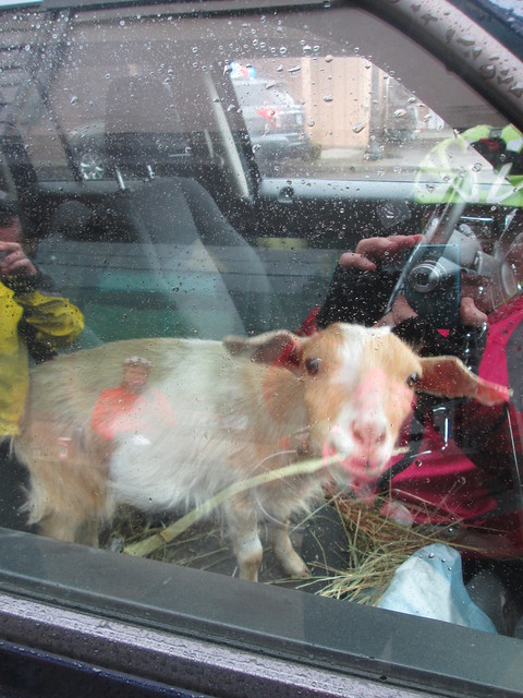
Of great interest in Vernonia was the goat in the truck. Inside the truck. On the front seat.
After a bottle refill (no guaranteed food/water for the next 100k), some coffee, and a substantial snack, I headed out. Ray wasn't quite ready. I had fun riding along here as well. Ray found me around Mist, and then stopped again. I got to Birkenfeld and pulled over to eat some rice pudding and a hard boiled egg, and we set out to find the info control.
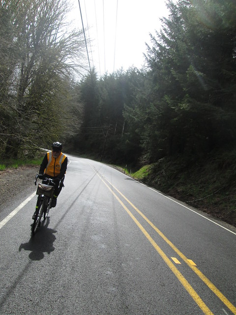
By this point, 5 or so riders had passed us heading back. Once past Birkenfeld, Hwy 202 gets hilly - short, abrupt ups and downs, with many crossings of the Nehalem River. The first 4 miles went quickly, the last 3, not so much. Found Ray at the control. Holden arrived just as we were turning back.

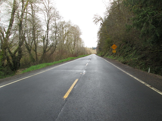
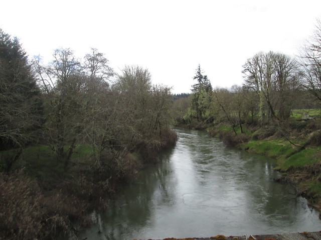
Back to Birkenfeld - The Birk wasn't technically open, but Ray's bike was there. So I went in and the proprietor grabbed my water bottle and filled it (he's nice that way), took care of some other business, and we headed back to Vernonia.
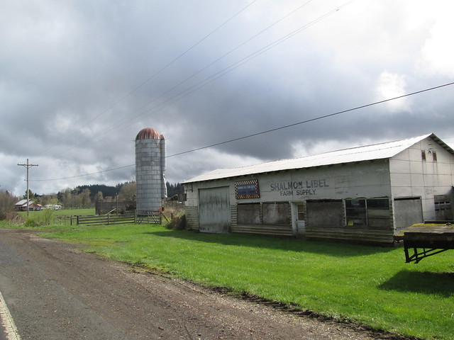
We were supposed to have a tailwind. Not so much. So it was rather more of a slog than I had thought it might be, and kept checking my odometer more than necessary. But we kept at it, and held a reasonably steady pace, and got to Vernonia in good time. Fine dining at the Shell Station (deviled eggs!) which we took over to Anderson Park, which has restrooms with no line, and running water.

So, now we were in Vernonia, and, as Ray put it, "heck, we are already done". Well, 30 miles to go, but we know them so very well. Ten miles of easy climb, ten miles of perfect descent, and ten miles of flat surface streets.
We were now on the Banks Vernonia Trail. Yay. No drivers, no idiots in pickups either coal-rolling or close passing (with much laying on of horn). Aside: the only driver I signaled not to pass because I could see oncoming traffic, who started to edge out to pass, then saw the car and dropped back, was a police officer.
So, on the trail. I could tell I was tired; not ascending at my usual pace. But it was now sunny, and we had tons of time, and the shared goal of finishing in 12 hours would be nice (Ray's first 200k in 18 months). We got to Tophill, and I gave it up and walked the last two switchbacks. It was either that or fall over. I found Ray at the Stub Stewart road crossing, and we then happily bombed on down.

There was a picture pause for a clump of blooming trilliums, and then, when passing by Wingham Farms (cool, they have a website! Go visit!), we stopped to talk with Julie (the farmer), who said she really needed a t-shirt that identified her as Romulus and Remus' mother. Long discussion about their farm.
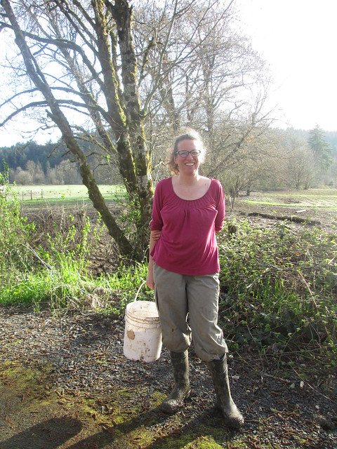
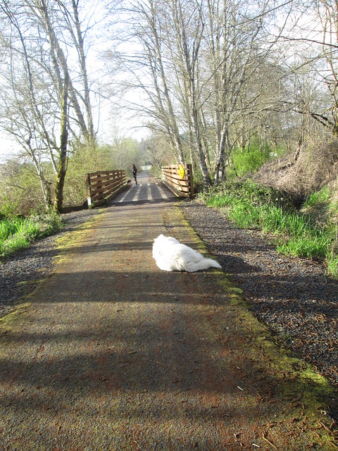
We had gotten to which sheep her neighbor was raising (Texel - a Dutch down breed - meat sheep, but quality fleece), when Holden arrived. His wife is also into fibers, so the conversation might have gotten a bit fiber-geeky.
So. Time is slipping by. Gotta go. After a brief stop at the trailhead, we headed out for the last 9 miles. When we got to the turn onto Roy Road, Ray went straight. Clearly autopiloting back to North Plains. Holden followed right along :-) I yelled, they came back.
Ray got ahead at the first traffic circle, and finished just before us. But our official time was 11:59 elapsed. Good enough for me.

The ORRando Birkie 200k was this past Saturday. This was my very first 200k, back in 2007. The route has changed slightly - rather than the out and back from Vernonia, the route heads from Forest Grove to Vernonia via Gales Creek/Hwy 6/Timber Rd/Hwy 47, and then continues on Hwy 47 to Hwy 202. To make up the missing distance, the route continues 7 miles past The Birk (formerly the Birkenfeld Store, now a cafe and music venue with irregular hours) to an info control. The return is back to Vernonia, then taking the Banks Vernonia Trail to (natch) Banks, and heading south to Forest Grove.
Now that we've got all that straight...
Friday afternoon was spent giving Sweetpea the first bath of the year. So very dirty, with lots of stuff stuck under the fenders.
Friday night was Rando Slumber Party at the Fitzsimmons Home for Wayward Randonneurs - Lesli, Ruth (who I finally got to meet in person), Michal and Cyndi all showed up, and we had a couple hours of social time before the 9pm bedtime.
Michal was returning a bike which was borrowed for the express purpose of loaning a bike to Bill Walton to ride. He thought it would be fun to get a picture comparing it to my bike.

Everyone was up at 5. Breakfast was coffee, eggs, bacon, Rye Molasses muffins, and bread which Michal baked. He also provided the home-roasted coffee. The kitchen was slightly over peak capacity, what with riders organizing their food and cooking breakfast :-)
Lesli and Ruth thought I'd be riding with them, but after a reveal of their planned pace... Yeah, no. I'm not there yet. Michal was going for time, so he'd be off as well. But there in the parking lot I found Ray. :-) We have been known to ride together.
Signed in. The RBA assured me it wasn't going to rain. She wanted to get out and do a few hours riding herself, hence the optimism.

(That's me in the pink vest. Pic by Cyndi Wenks)
And, at 7am, away we went. We did see Lesli and Ruth, and I almost caught them at the stoplight in Gales Creek, but it turned green, they went, and then red again by the time I got there. Last I saw of them all day.
Deidre from Vancouver passed me on the climb. I would have thought she'd be ahead, maybe she got started a bit after everyone else.
The Timber climb was accomplished with no stress. I wasn't fast, but I didn't care. The RBA was lurking after the second switchback, we chatted a bit as I slowly pedaled by. Found Ray at the top (he gets ahead and waits and drinks coffee); we dropped into Timber and up the other side, admiring the two properties which are infested with lively barking Aussies.
Had great fun dropping through the curves to Hwy 26, and Ray and I had the gift of a no-wait crossing.
It had been drizzling off and on. I was wearing two wool jerseys, a vest, wool knickers, long socks and a wool cap. I had wool overgloves which never stayed on longer than three miles. Left the booties in Michal's car. I did have an "it might rain" jacket and Rainlegs, but never pulled them on.
I can't think of a time I rode the stretch from Hwy 26 to Vernonia as fun. Usually raining with a headwind, or trying to keep up with the group. I had fun this day. Came up on Ray (our riding style is best described as "leapfrog"); he'd decided it really was raining. Kept on going; he found me just before Vernonia. We stopped at Black Bear Coffee (another punch for my card!), and found RB, who was riding Ray's perm pop and hanging out.
Of great interest in Vernonia was the goat in the truck. Inside the truck. On the front seat.
After a bottle refill (no guaranteed food/water for the next 100k), some coffee, and a substantial snack, I headed out. Ray wasn't quite ready. I had fun riding along here as well. Ray found me around Mist, and then stopped again. I got to Birkenfeld and pulled over to eat some rice pudding and a hard boiled egg, and we set out to find the info control.
By this point, 5 or so riders had passed us heading back. Once past Birkenfeld, Hwy 202 gets hilly - short, abrupt ups and downs, with many crossings of the Nehalem River. The first 4 miles went quickly, the last 3, not so much. Found Ray at the control. Holden arrived just as we were turning back.

Back to Birkenfeld - The Birk wasn't technically open, but Ray's bike was there. So I went in and the proprietor grabbed my water bottle and filled it (he's nice that way), took care of some other business, and we headed back to Vernonia.
We were supposed to have a tailwind. Not so much. So it was rather more of a slog than I had thought it might be, and kept checking my odometer more than necessary. But we kept at it, and held a reasonably steady pace, and got to Vernonia in good time. Fine dining at the Shell Station (deviled eggs!) which we took over to Anderson Park, which has restrooms with no line, and running water.

So, now we were in Vernonia, and, as Ray put it, "heck, we are already done". Well, 30 miles to go, but we know them so very well. Ten miles of easy climb, ten miles of perfect descent, and ten miles of flat surface streets.
We were now on the Banks Vernonia Trail. Yay. No drivers, no idiots in pickups either coal-rolling or close passing (with much laying on of horn). Aside: the only driver I signaled not to pass because I could see oncoming traffic, who started to edge out to pass, then saw the car and dropped back, was a police officer.
So, on the trail. I could tell I was tired; not ascending at my usual pace. But it was now sunny, and we had tons of time, and the shared goal of finishing in 12 hours would be nice (Ray's first 200k in 18 months). We got to Tophill, and I gave it up and walked the last two switchbacks. It was either that or fall over. I found Ray at the Stub Stewart road crossing, and we then happily bombed on down.

There was a picture pause for a clump of blooming trilliums, and then, when passing by Wingham Farms (cool, they have a website! Go visit!), we stopped to talk with Julie (the farmer), who said she really needed a t-shirt that identified her as Romulus and Remus' mother. Long discussion about their farm.
We had gotten to which sheep her neighbor was raising (Texel - a Dutch down breed - meat sheep, but quality fleece), when Holden arrived. His wife is also into fibers, so the conversation might have gotten a bit fiber-geeky.
So. Time is slipping by. Gotta go. After a brief stop at the trailhead, we headed out for the last 9 miles. When we got to the turn onto Roy Road, Ray went straight. Clearly autopiloting back to North Plains. Holden followed right along :-) I yelled, they came back.
Ray got ahead at the first traffic circle, and finished just before us. But our official time was 11:59 elapsed. Good enough for me.
(Ray and I at the finish. Pic by Cyndi Wenks)
Michal and Cyndi were hanging around, because they were going to drop me back home, but Fitz texted that he was on his way over. So they stuck around long enough to say hi, and then started their long drive down south.

The RBA wanted to know if she'd see me in 2 weeks for the 300k. Mmm. Not this year. Not ready. I hurt in places that have never hurt before. The 200ks will have to be a little more routine before I make the distance jump.
Fitz and I got dinner there, poked our head back in to say goodbye to the RBA (there had been still one rider out; he finished while we were eating), and headed home ourselves.
What went well:
Michal and Cyndi were hanging around, because they were going to drop me back home, but Fitz texted that he was on his way over. So they stuck around long enough to say hi, and then started their long drive down south.

The RBA wanted to know if she'd see me in 2 weeks for the 300k. Mmm. Not this year. Not ready. I hurt in places that have never hurt before. The 200ks will have to be a little more routine before I make the distance jump.
Fitz and I got dinner there, poked our head back in to say goodbye to the RBA (there had been still one rider out; he finished while we were eating), and headed home ourselves.
What went well:
- I never put on the rain jacket. It just wasn't raining hard enough, and, midafternoon, cleared off for good. I think my shoes are waterproof for persistent mist/drizzle.
- I kept up on the food. This trip the food offerings brought along were: 2 packets of Gatorade/maltodextrin (and one in the bottle), hard boiled eggs, two containers of rice pudding, two Rye Molasses muffins with butter, random Kind bars, a Payday bar, and some other little things (gels and chocolate) which I didn't break into. Ate all the things I listed specifically, but for one muffin. Plus a deviled egg (two halves) in Vernonia on the return. Convinced Ray he wanted the other two.
Wednesday, March 22, 2017
Success on the North Plains - Banks Vernonia Trail Perm Pop
The last time I had a successful through ride on the trail was the Verboort Populaire in November. Since then we've had snow, ice, biblical quantities of rain, and so on. We've tried to ride the trail twice, and been turned back both times.
Surely the trail would be open. I recruited Ray by promising no thunderstorms (hey, it's his perm pop!), and we set out at 8am-ish this morning.
Epic Ride Weather's take on the day:

It wasn't raining when we started out. No rain jackets. I had a wool base layer, jersey, and neon wind vest. Skipped the waterproof socks; living dangerously. We passed through Banks (ugh, school traffic; Banks has one street. Maybe it has more, but only one major one.) and onto the trail.
There was a picture pause at Wingham Farms (home of Romulus and Remus, the herding dogs), because they'd moved the chickens into the cow pasture, and had the cows in the chicken space. They also have cute baby goats.


Onward. The sun came and went. Upward (railroad grade). We got to the Stub Stewart Park road crossing, and... there was a sign - "Trail Closed 1 Mile Ahead".
As we say, there's closed and there's closed. Nothing at a mile. We kept going. There might have been a landslide, but nothing on the trail. Eventually we starting seeing staggering numbers of alder trees broken off and on the ground, although the trail was clear. Closer to the summit, we came across some trail workers. After a conversation, where they said the trail was usable at least as far as the summit, we went on.


Lots of alders down, although the trail was clear, except for some silt from the rain. The pictures don't really do it justice.
Past Tophill, there was a lot more small litter on the trail. We found one branch to move off, some short areas of deep silt and gravel, and, closer in to Vernonia, one downed tree with branches across the trail - easily managed. By now we had a fairly persistent light drizzle, not enough to dig out our jackets.
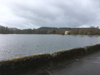
Beaver Creek and the Nehalem River were running fast and high, but not flooding. Heading out the the lake, we finally had to concede that it was, in fact, raining, and quickly donned our jackets. We looped around the lake and decided we did have enough time for some coffee.
Off to Black Bear Coffee. We walked in the door and... "where's your case of pastries?" They'd moved the coffee/pastry operation to the far north end of the building! They now also have a punch card - we are both there often enough to make it worth our while, so, yes, we each snagged one. Mine will stay in my rando wallet, so as to always be at the ready. The one cinnamon bun left was so very large that Ray and I elected to split it.


We were fairly expedient and headed back out, still wearing our jackets. Not very far along, we pulled them off, and I went on, figuring Ray would catch up soon. He found me before Tophill.
Down, and up. Tophill is the only steep section of the trail. I stress about the climb on the return, but found myself almost all the way up before realizing that I was past the steepest switchback and hadn't been thinking about it at all. Nice.
We then enjoyed the descent (as always!), realized we had over an hour and only 8 miles to go in Banks, and finished up.
Fancy pic from the bike computer:

6:14 elapsed.


Surely the trail would be open. I recruited Ray by promising no thunderstorms (hey, it's his perm pop!), and we set out at 8am-ish this morning.
Epic Ride Weather's take on the day:

It wasn't raining when we started out. No rain jackets. I had a wool base layer, jersey, and neon wind vest. Skipped the waterproof socks; living dangerously. We passed through Banks (ugh, school traffic; Banks has one street. Maybe it has more, but only one major one.) and onto the trail.
There was a picture pause at Wingham Farms (home of Romulus and Remus, the herding dogs), because they'd moved the chickens into the cow pasture, and had the cows in the chicken space. They also have cute baby goats.


Onward. The sun came and went. Upward (railroad grade). We got to the Stub Stewart Park road crossing, and... there was a sign - "Trail Closed 1 Mile Ahead".
As we say, there's closed and there's closed. Nothing at a mile. We kept going. There might have been a landslide, but nothing on the trail. Eventually we starting seeing staggering numbers of alder trees broken off and on the ground, although the trail was clear. Closer to the summit, we came across some trail workers. After a conversation, where they said the trail was usable at least as far as the summit, we went on.


Lots of alders down, although the trail was clear, except for some silt from the rain. The pictures don't really do it justice.
Past Tophill, there was a lot more small litter on the trail. We found one branch to move off, some short areas of deep silt and gravel, and, closer in to Vernonia, one downed tree with branches across the trail - easily managed. By now we had a fairly persistent light drizzle, not enough to dig out our jackets.
Beaver Creek and the Nehalem River were running fast and high, but not flooding. Heading out the the lake, we finally had to concede that it was, in fact, raining, and quickly donned our jackets. We looped around the lake and decided we did have enough time for some coffee.

Off to Black Bear Coffee. We walked in the door and... "where's your case of pastries?" They'd moved the coffee/pastry operation to the far north end of the building! They now also have a punch card - we are both there often enough to make it worth our while, so, yes, we each snagged one. Mine will stay in my rando wallet, so as to always be at the ready. The one cinnamon bun left was so very large that Ray and I elected to split it.


We were fairly expedient and headed back out, still wearing our jackets. Not very far along, we pulled them off, and I went on, figuring Ray would catch up soon. He found me before Tophill.
Down, and up. Tophill is the only steep section of the trail. I stress about the climb on the return, but found myself almost all the way up before realizing that I was past the steepest switchback and hadn't been thinking about it at all. Nice.
We then enjoyed the descent (as always!), realized we had over an hour and only 8 miles to go in Banks, and finished up.
Fancy pic from the bike computer:

6:14 elapsed.

Gotta mend these! (I was wearing these when I was left-hooked; all the abrasions showed up as ever-growing holes a few months later)

Monday, March 20, 2017
Errandonnee One, Two, and Three
And it was a good thing I had receipts, totally forgot about the picture thing until the last stop!
From there, I would have normally dropped down Dosch to Sunset (mi 5), but both Google Maps and RWGPS suggested I continue up to Fairmount Blvd, and then drop down through the neighborhood side streets. Every road descending from Fairmount is steep. Intellectually I knew that. I did. How bad could it be? 9-10% downgrades, narrow twisty roads, and generally more potholes and grit than pavement. I was never so happy to make it down to Sunset Blvd in my life. Once there, I only had to go another easy mile.
As for the dentist - I will say that N20 makes a dental visit much less stressful. Plus, the dentist decided it was much less work than originally estimated, so it cost me much less as well!
See receipt #1 for documentation.


I could have stopped for coffee, but I was getting tired of locking and unlocking my bike. There is good coffee at home.

March 20, 2017
From home to the dentist - 7.3 miles.
I went the northern route, on the Hwy 26 bike path, then experimented with staying south of Hwy 26 at Camelot Ct (mi 2.4), rather then the usual path continuation to Skyline/Scholl's Ferry with the interesting left turn onto Humphrey/Hewett. Learning there - more steeper climbing that way!From there, I would have normally dropped down Dosch to Sunset (mi 5), but both Google Maps and RWGPS suggested I continue up to Fairmount Blvd, and then drop down through the neighborhood side streets. Every road descending from Fairmount is steep. Intellectually I knew that. I did. How bad could it be? 9-10% downgrades, narrow twisty roads, and generally more potholes and grit than pavement. I was never so happy to make it down to Sunset Blvd in my life. Once there, I only had to go another easy mile.
As for the dentist - I will say that N20 makes a dental visit much less stressful. Plus, the dentist decided it was much less work than originally estimated, so it cost me much less as well!
See receipt #1 for documentation.
From the dentist to the library - 7.6 miles.
The plan from here was to cut between Wilson HS and Rieke Elementary down to SW Vermont, work my way to Multnomah Village (we'll be back here at least once this coming week), and then follow my known route back to Beaverton, except continuing on SW 5th to the library, rather than turning north just before Hwy 217. Really, I only needed supplementary navigation assistance from Fairmount to the dentist, and then from there to Multnomah Village.
The only unknown was would the Fanno Creek Trail be open? There had been some contentious trail closures (Portland Water Bureau has a sewage pump station on the trail OUTSIDE THEIR CITY LIMITS AND OUTSIDE THEIR COUNTY!) for pump station work, and the proposed detour put cyclists on SW Garden Home Rd. Sounds bucolic and all, but that section is a highly traveled, very narrow 2 lane road with ditches right at the fog lines. I myself pestered both our parks district (it is their trail) and the road department, and they did put up Bicycles on Roadway signs. The few times I rode that way, though, I crossed Garden Home and paralleled it through the neighborhoods until SW Oleson Rd.
To make a short story long, I was pleasantly surprised to find the construction finished and the trail open.
Felt a few rain drops along here.
So, right, the library. I was picking up a book which was an interlibrary loan, and, after fruitlessly searching the Hold books racks, I asked where it was - turns out ILL books must be picked up and checked out at the service desk. The book came all the way from Nebraska. Pretty cool.
See receipt #2 for documentation.
From the library to the fabric store - .8 miles.
Nothing to report here. Got to the fabric store, bought my velcro for the Porteur Bag Sewing Project (for flaps to attach the removable lining), had a great conversation with the cashier about the project, as I was adding the velcro to my plastic bag (suboptimal and tacky).
From the fabric store to home - 1.3 miles.
Since I had gone to the fabric store, I continued directly east through the Hall Creek Enhancement to SW 114th. While it is very short, I love riding through there. The creek was very high, and I only saw a couple of Canada geese. Usually there are ducks everywhere.
See receipt #3 for documentation, and I even took a couple of pictures.
Total distance - 17 miles.
Documentation:
Success With Rickey's Populaire
Last weekend was the Oregon Randonneurs Rickey's Populaire. A fun ride. It has two climbs, and much gentle rolling, rural scenery, and finishes at a brewpub. Can't go wrong.
In previous years I have ridden to the start, since it was along my regular work commute, and fairly mindless. Not up to that this year; I was just going for success.
The weather took a sudden turn for the worse, so, of course, I modified the wardrobe. To keep my feet dry, I wear the Showers Pass Waterproof Socks, my Lake boots (if they were waterproof, it didn't last), and some battered Endura shoe covers over that. My feet get damp, but they don't get wet, so I suspect all the liquid is self-generated.
No plans to ride with anyone, but that's ok.
But wait! At the drippy start (riders huddling under RBA Susan France's car hatch), a car pulled up. It was Andrew, who I haven't seen riding in awhile. But the bike... he pulled a lovely Atlantis out of his car, with dual old-style Schmidt E-6 headlamps. Wait. Wait. Wait. "You bought David R's Atlantis! Good deal!" (mystery of why he was selling many bike parts solved; he didn't need them any longer)
He allowed as he had not been riding and it would be slow and lonesome. I was quick to assure him it wouldn't be (lonesome, that is).
His front bag, sadly, was still back in his garage. He had a reusable grocery sack in which to stow items, but no way to attach it. But wait! I had a Rivendell-approved John's Irish Strap in my saddlebag.
At 9am we set out. Given the weather forecast (plug for the Epic Ride Weather app), it wasn't a large crowd.
Andrew, Ray, and I were toward the back, and rode "together" for the entire route. Sometimes they'd get ahead and wait. Sometimes we'd be stopped, and I'd go on and they'd quickly catch up.
So we spent a rainy day chasing colorful zip-ties. I was, of course, slow on the climbs, but I got there. No walking, which might have been a possibility on Plumlee.
The first four hours were continuous rain, but not cold rain. While every single watercourse was full, and the Killin wetlands were really full, and Gales Creek was higher than I've seen it, there was only one very shallow road flood - Gaston Road, where the Tualatin River and Wapato Creek bracket the road.
We were mostly quartering into the wind until somewhere on Gales Creek Rd. Fortunately we turned east just as the wind was racheting up to "really annoying", and enjoyed the push to the end.
From Gaston until the end (20 miles), the rain stopped, which was also enjoyable. We stopped on LaFollette Road to pull of the rain gear and maybe dry out a bit.
Then they smelled the barn and I rode the final 10 miles in solitude. Not that I was unhappy about it. For that matter, no thoughts of gloom and doom at all on the ride.
No pictures, because it was so very wet. Well, pictures were taken of the info controls (with Timestamp Camera, a free app), so I wouldn't have to take my card out to write on it; took care of that at the finish.
Visited with Susan at the finish, and helped her with her basket of tots.
In previous years I have ridden to the start, since it was along my regular work commute, and fairly mindless. Not up to that this year; I was just going for success.
The weather took a sudden turn for the worse, so, of course, I modified the wardrobe. To keep my feet dry, I wear the Showers Pass Waterproof Socks, my Lake boots (if they were waterproof, it didn't last), and some battered Endura shoe covers over that. My feet get damp, but they don't get wet, so I suspect all the liquid is self-generated.
No plans to ride with anyone, but that's ok.
But wait! At the drippy start (riders huddling under RBA Susan France's car hatch), a car pulled up. It was Andrew, who I haven't seen riding in awhile. But the bike... he pulled a lovely Atlantis out of his car, with dual old-style Schmidt E-6 headlamps. Wait. Wait. Wait. "You bought David R's Atlantis! Good deal!" (mystery of why he was selling many bike parts solved; he didn't need them any longer)
He allowed as he had not been riding and it would be slow and lonesome. I was quick to assure him it wouldn't be (lonesome, that is).
His front bag, sadly, was still back in his garage. He had a reusable grocery sack in which to stow items, but no way to attach it. But wait! I had a Rivendell-approved John's Irish Strap in my saddlebag.
At 9am we set out. Given the weather forecast (plug for the Epic Ride Weather app), it wasn't a large crowd.
Andrew, Ray, and I were toward the back, and rode "together" for the entire route. Sometimes they'd get ahead and wait. Sometimes we'd be stopped, and I'd go on and they'd quickly catch up.
So we spent a rainy day chasing colorful zip-ties. I was, of course, slow on the climbs, but I got there. No walking, which might have been a possibility on Plumlee.
The first four hours were continuous rain, but not cold rain. While every single watercourse was full, and the Killin wetlands were really full, and Gales Creek was higher than I've seen it, there was only one very shallow road flood - Gaston Road, where the Tualatin River and Wapato Creek bracket the road.
We were mostly quartering into the wind until somewhere on Gales Creek Rd. Fortunately we turned east just as the wind was racheting up to "really annoying", and enjoyed the push to the end.
From Gaston until the end (20 miles), the rain stopped, which was also enjoyable. We stopped on LaFollette Road to pull of the rain gear and maybe dry out a bit.
Then they smelled the barn and I rode the final 10 miles in solitude. Not that I was unhappy about it. For that matter, no thoughts of gloom and doom at all on the ride.
No pictures, because it was so very wet. Well, pictures were taken of the info controls (with Timestamp Camera, a free app), so I wouldn't have to take my card out to write on it; took care of that at the finish.
Visited with Susan at the finish, and helped her with her basket of tots.
Friday, December 2, 2016
First 200k In 11 Months
And, oddly enough, our it seems to be annual "Ride a 200k on Civil War Day", the civil war in question is the Oregon State - University of Oregon football game.
I took the Coast Starlight from PDX to Eugene, given as how they've now got bicycle service AND a better schedule than the Cascades.
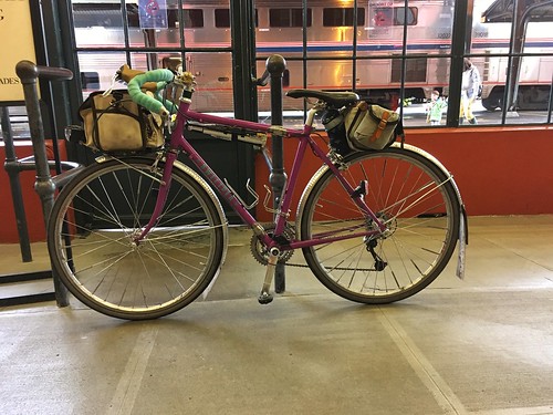
Pro: better schedule and cushier seats
Con: coach passengers sit in the very tail end of the train, baggage car is right behind the locomotive. It is a very long train and "the stop in Eugene is 4 minutes!". No wifi, and the water dispenser in the car was empty. And the lighting was dim.
But with all that, I made good progress knitting on my sock, to the point of finishing it, but not weaving in the ends; I wanted better lighting!
First off the train, and scampered up to the front (as the conductor was announcing Last Call!), to find Michal holding my bike, waiting for me to show up with the claim ticket. Whew.
Our route was Bill Alsup's Perm #1177: Eugene to Beaverton.
And so, up at 5am for the 7am start. The drop down Michal's hill was kind of scary in the dark, like it always is, but I didn't work up to the whole bike shaking, like has happened before. We found Chris at the coffee shop, and got ourselves some coffee as well.
Sunrise wasn't until 7:25am, so we got to enjoy heading north out of Eugene in the dawn. All the coffee for breakfast and at the start meant that the customary pause at Armitage State Park was again observed. We also decided that it wouldn't be raining any time soon, and ditched our rain jackets. Once over the McKenzie River and through Coburg, we were out in the rural Willamette Valley for most of the day. Not that we could SEE anything, because there was a persistent fog, which stayed with us until we started the climb on Gap Rd (mile 22 or thereabouts). We then dropped into Brownsville, pausing at the Chevron c-store, where I discovered PayDay bites, a convenient form factor presentation of the PayDay bar.
North through Brownsville, re-enacting the final scene in Stand By Me, then out the other side, eventually arriving at a road blockage. Now, there's nothing OUT there, but looking ahead, we could see a small herd of cattle on the road. It turned out to be the annual moving of the bulls from one field to another, and we watched them being herded by several guys on ATVs and an SUV bringing up the rear.
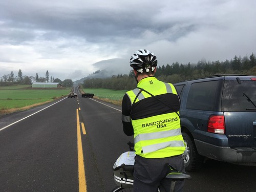
That settled, we continued on north. Now, it was supposed to be raining most of the day, but we hadn't seen any rain to this point, and the skies looked like we wouldn't, for awhile anyway. There were even bits of sunlight!
Passed through Lebanon, and Crabtree, on to our first control at the Hoffman Covered Bridge. Although, the info control answer was found at the corner of Crabtree Drive and Hungry Hill Rd, rather than at the bridge, 1.6 miles further along.
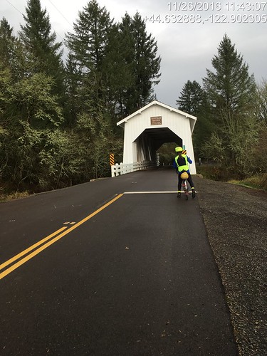
After the bridge, a driver stopped to warn us that there was a chaser dog up ahead "on one of the downhills". We did not find the chaser dog, but I did find a shard of glass, so there was a pause to fix the flat. I just swapped in a fresh tube.
A few more ups and downs, and we found Chris waiting for us in Scio. It wasn't a control, so we kept going, encountering the Leffler Grade. I didn't know if I'd be riding up it or walking it; maybe a third of the way up, walking all of a sudden became a very attractive option. Once at the top, we rolled along the ridgeline, finally dropping back down and entering Stayton (67 miles), our first open control. On this route, the preferred stop is the Safeway; for other routes, the Roth's Market. Drank down a half teaspoon of salt before going in.
I got a rice bowl with orange chicken, and Michal and Chris cheerfully refilled my bottles (one with plain water, the other needed hot water for the Gatorade-Tea-Maltodextrin beverage). I ate about half of the orange chicken and rice. I really like orange chicken, and white rice seemed to be a good thing for my stomach. Michal thought he'd have a taste, and proceeded to make serious inroads on the leftovers.
And with that, my stomach was all of a sudden very much happier, and we had a tailwind to Aumsville, and all was right with the world. It looked like it might start raining at the corner of Shaw Hwy and Hwy 214, so Chris pulled on his rain jacket. Michal and I didn't bother; we couldn't see where it would get any worse than a bit of drizzle. And, indeed, it cleared right up.
We also had a helpful tailwind on all 18+ miles of Howell Prairie Rd, and the first 2+ miles of gentle uphill didn't seem burdensome at all. There's not much to say about Howell Prairie - the berry bushes are pretty with their fall coloring, lots of wide open space, the elevators at the Pratum Co-op. Once you cross the Little Pudding River, there are more trees.
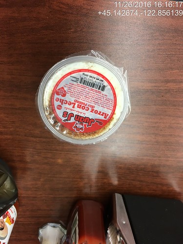
At the northern terminus we crossed Hwy 99E, turned into the wind for a bit, and then picked up Boones Ferry Rd (we'd see a lot of this road off and on for awhile), and ended up in downtown Woodburn, our next control. We usually stop at the Del Sol market and get tacos or tamales. We both ordered tacos, and I am pleased to report that I managed my entire transaction in Spanish (and yes, there was an actual conversation), then foraged around the store for other things. I found Arroz con Leche (rice pudding!) in the refrigerated case, in a single serving container, and promptly snapped it up. It was much better than the tacos - I had ordered Asada tacos, and they were dry and bland; I kind of expect Carne Asada to be moist and flavorful. We never found Chris; he had gone ahead.
Michal noted that the cars passing by had their windshield wipers on. Darn. On with the rain jackets and rain legs. I was already wearing my Showers Pass waterproof socks; they'd likely get another trial. I didn't bother to pull on the helmet rain cover.
So now it was dark and raining. My helmet headlight seemed rather uninspired, and the stretch from Hubbard (just north of Woodburn) to Aurora (just south of Wilsonville) was not clear in my mind. Michal had been fiddling with his gps and got it working again, so we'd be ok.
Heading out of Hubbard, we picked up Boones Ferry Rd again. The traffic was rather heavier than in previous years; maybe these were folks headed home from the aforementioned football game. I see now that we just head north on Boones Ferry, cross Ehlen, and then turn right on Keil, cross a very busy road (the rain had gotten much heavier), follow Keil to Airport, and head north to Miley, at which point I no longer need a cue sheet.
Yes. Well. From Miley Rd to get to Wilsonville, there is the small matter of crossing the Willamette River. At this point the only way across is the Boone Bridge shoulder, which is a busy stretch of I-5.
So, dark. Pouring rain. Four lanes of high speed traffic. Lots of debris on the shoulder - wheel parts, shredded tire parts, possibly a departed opossum or two. Good times.
After exiting I-5, turning left onto Wilsonville Rd (there is also the part where one must leave the shoulder and move left two lanes), and onto the relative quiet of Boones Ferry Rd... Whew. We then turned into the industrial park, and I was on my work commute home from my stints at Microsoft in Wilsonville.
After topping out on the small climb on Boones Ferry Rd (there we are again), we dropped down into Tualatin. There is usually a bike lane until there isn't, and the descent is ever so much more fun in the summer evening sunlight. By now I was feeling soaked through, but not too much further to go!
Through Tualatin park, over the river and into Cook Park in Tigard, north on Hall Blvd, left into Old Downtown Tigard, then out the west side, the non-intuitive left onto Greenburg Rd, cross over Hwy 217, and ride up the back side of Washington Square Mall... North on Scholls Ferry, and finally the left turn into the neighborhood before the last bit. We actually got across to the turn lane without having to resort to the crosswalk and sidewalk to get to Elm St.
Through the unmarked and very subtle cut-though (always helps to have a local guide at this point), down 5th Ave (where I just wanted to turn right through the office park and go home!), under Hwy 217, up Griffith, and done. 12:22 elapsed time.
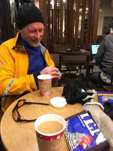
I barricaded my bike with tables and chairs up against the Starbucks window, and went inside to find hot coffee, and Chris A and Chris W (who rode one of my local perms and was planning to meet us at the finish). They had obviously been there awhile, certainly long enough to change into dry clothing :-) They eventually took their respective leaves, we finished our hot drinks, and rode the last mile to my house, where Fitz and Cyndi were awaiting our arrival.
Hot showers first, but Fitz had made an enormous pot of turkey chili and fresh cornbread. With pie for dessert.
I took the Coast Starlight from PDX to Eugene, given as how they've now got bicycle service AND a better schedule than the Cascades.
Pro: better schedule and cushier seats
Con: coach passengers sit in the very tail end of the train, baggage car is right behind the locomotive. It is a very long train and "the stop in Eugene is 4 minutes!". No wifi, and the water dispenser in the car was empty. And the lighting was dim.
But with all that, I made good progress knitting on my sock, to the point of finishing it, but not weaving in the ends; I wanted better lighting!
First off the train, and scampered up to the front (as the conductor was announcing Last Call!), to find Michal holding my bike, waiting for me to show up with the claim ticket. Whew.
Our route was Bill Alsup's Perm #1177: Eugene to Beaverton.
And so, up at 5am for the 7am start. The drop down Michal's hill was kind of scary in the dark, like it always is, but I didn't work up to the whole bike shaking, like has happened before. We found Chris at the coffee shop, and got ourselves some coffee as well.
Sunrise wasn't until 7:25am, so we got to enjoy heading north out of Eugene in the dawn. All the coffee for breakfast and at the start meant that the customary pause at Armitage State Park was again observed. We also decided that it wouldn't be raining any time soon, and ditched our rain jackets. Once over the McKenzie River and through Coburg, we were out in the rural Willamette Valley for most of the day. Not that we could SEE anything, because there was a persistent fog, which stayed with us until we started the climb on Gap Rd (mile 22 or thereabouts). We then dropped into Brownsville, pausing at the Chevron c-store, where I discovered PayDay bites, a convenient form factor presentation of the PayDay bar.
North through Brownsville, re-enacting the final scene in Stand By Me, then out the other side, eventually arriving at a road blockage. Now, there's nothing OUT there, but looking ahead, we could see a small herd of cattle on the road. It turned out to be the annual moving of the bulls from one field to another, and we watched them being herded by several guys on ATVs and an SUV bringing up the rear.
That settled, we continued on north. Now, it was supposed to be raining most of the day, but we hadn't seen any rain to this point, and the skies looked like we wouldn't, for awhile anyway. There were even bits of sunlight!
 |
| pic by Michal Young |
After the bridge, a driver stopped to warn us that there was a chaser dog up ahead "on one of the downhills". We did not find the chaser dog, but I did find a shard of glass, so there was a pause to fix the flat. I just swapped in a fresh tube.
A few more ups and downs, and we found Chris waiting for us in Scio. It wasn't a control, so we kept going, encountering the Leffler Grade. I didn't know if I'd be riding up it or walking it; maybe a third of the way up, walking all of a sudden became a very attractive option. Once at the top, we rolled along the ridgeline, finally dropping back down and entering Stayton (67 miles), our first open control. On this route, the preferred stop is the Safeway; for other routes, the Roth's Market. Drank down a half teaspoon of salt before going in.
I got a rice bowl with orange chicken, and Michal and Chris cheerfully refilled my bottles (one with plain water, the other needed hot water for the Gatorade-Tea-Maltodextrin beverage). I ate about half of the orange chicken and rice. I really like orange chicken, and white rice seemed to be a good thing for my stomach. Michal thought he'd have a taste, and proceeded to make serious inroads on the leftovers.
And with that, my stomach was all of a sudden very much happier, and we had a tailwind to Aumsville, and all was right with the world. It looked like it might start raining at the corner of Shaw Hwy and Hwy 214, so Chris pulled on his rain jacket. Michal and I didn't bother; we couldn't see where it would get any worse than a bit of drizzle. And, indeed, it cleared right up.
 |
| pic by Michal Young |
At the northern terminus we crossed Hwy 99E, turned into the wind for a bit, and then picked up Boones Ferry Rd (we'd see a lot of this road off and on for awhile), and ended up in downtown Woodburn, our next control. We usually stop at the Del Sol market and get tacos or tamales. We both ordered tacos, and I am pleased to report that I managed my entire transaction in Spanish (and yes, there was an actual conversation), then foraged around the store for other things. I found Arroz con Leche (rice pudding!) in the refrigerated case, in a single serving container, and promptly snapped it up. It was much better than the tacos - I had ordered Asada tacos, and they were dry and bland; I kind of expect Carne Asada to be moist and flavorful. We never found Chris; he had gone ahead.
Michal noted that the cars passing by had their windshield wipers on. Darn. On with the rain jackets and rain legs. I was already wearing my Showers Pass waterproof socks; they'd likely get another trial. I didn't bother to pull on the helmet rain cover.
So now it was dark and raining. My helmet headlight seemed rather uninspired, and the stretch from Hubbard (just north of Woodburn) to Aurora (just south of Wilsonville) was not clear in my mind. Michal had been fiddling with his gps and got it working again, so we'd be ok.
Heading out of Hubbard, we picked up Boones Ferry Rd again. The traffic was rather heavier than in previous years; maybe these were folks headed home from the aforementioned football game. I see now that we just head north on Boones Ferry, cross Ehlen, and then turn right on Keil, cross a very busy road (the rain had gotten much heavier), follow Keil to Airport, and head north to Miley, at which point I no longer need a cue sheet.
Yes. Well. From Miley Rd to get to Wilsonville, there is the small matter of crossing the Willamette River. At this point the only way across is the Boone Bridge shoulder, which is a busy stretch of I-5.
So, dark. Pouring rain. Four lanes of high speed traffic. Lots of debris on the shoulder - wheel parts, shredded tire parts, possibly a departed opossum or two. Good times.
After exiting I-5, turning left onto Wilsonville Rd (there is also the part where one must leave the shoulder and move left two lanes), and onto the relative quiet of Boones Ferry Rd... Whew. We then turned into the industrial park, and I was on my work commute home from my stints at Microsoft in Wilsonville.
After topping out on the small climb on Boones Ferry Rd (there we are again), we dropped down into Tualatin. There is usually a bike lane until there isn't, and the descent is ever so much more fun in the summer evening sunlight. By now I was feeling soaked through, but not too much further to go!
Through Tualatin park, over the river and into Cook Park in Tigard, north on Hall Blvd, left into Old Downtown Tigard, then out the west side, the non-intuitive left onto Greenburg Rd, cross over Hwy 217, and ride up the back side of Washington Square Mall... North on Scholls Ferry, and finally the left turn into the neighborhood before the last bit. We actually got across to the turn lane without having to resort to the crosswalk and sidewalk to get to Elm St.
Through the unmarked and very subtle cut-though (always helps to have a local guide at this point), down 5th Ave (where I just wanted to turn right through the office park and go home!), under Hwy 217, up Griffith, and done. 12:22 elapsed time.
I barricaded my bike with tables and chairs up against the Starbucks window, and went inside to find hot coffee, and Chris A and Chris W (who rode one of my local perms and was planning to meet us at the finish). They had obviously been there awhile, certainly long enough to change into dry clothing :-) They eventually took their respective leaves, we finished our hot drinks, and rode the last mile to my house, where Fitz and Cyndi were awaiting our arrival.
Hot showers first, but Fitz had made an enormous pot of turkey chili and fresh cornbread. With pie for dessert.
Monday, November 7, 2016
Verboort Sausage Populaire 2016
As we were sitting at the table in the bingo tent, with sausage, hot cocoa, and a round of bingo cards, the woman across the table asked "wouldn't it be nicer to ride if the weather was better?". Our reply "it would, but bad weather is traditional".
Yeah. The weather forecast was for a dry, sunny day on Friday, another dry, sunny day on Sunday, and an astounding amount of rain on Saturday.
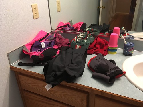
With that in mind, I made sure Sweetpea had the raingear and extra gloves on board. My helmet had its first raincover and neckcover event of the season, and I'd finally get to test out the new Showers Pass Waterproof Socks (wool version).
No plans to ride with anyone, but I did see many familiar names on the signup list, most of whom exercised good judgement and stayed home. However, Anita was there, and we'd ridden the first half of the Solstice permanent together almost a year ago.
It was raining lightly when I arrived at the start, but it slacked off to perhaps a faint mist heading north on Gales Creek Rd. It was so light that I swapped the jacket for a vest. That lasted almost all the way to Hwy 6, where I pulled the jacket back on. At the Hwy 6 turn, I suggested to Anita that she didn't have to wait for me, because she was pulling ahead and then having to wait in the rain.
Hwy 6 was a pleasant surprise - it had been repaved, and all the rumble strips were now buried under a layer of pristine asphalt.
About 3 miles later, the route left Hwy 6 for the delights of Timber Rd. It has a brief initial climb, then rolls along for several miles, then gains 500+ feet in the space of two miles. The rain increased on the climb (of course). Victorious. Nothing going to stop me now.
Then the drop down to Timber itself, another brief climb, some flat, and then another drop down to Hwy 26. I was very lucky, and was able to cross right away.
After crossing Hwy 26, the route continues for another 9 miles through a valley, before joining up with Hwy 47 a mile or so outside of Vernonia. I headed right for Black Bear Coffee Company - there were some cyclists leaving, and Anita sitting inside. She said she hadn't been there long. Consumed the traditional sticky roll and a mocha, refilled my bottle, and we headed back out.
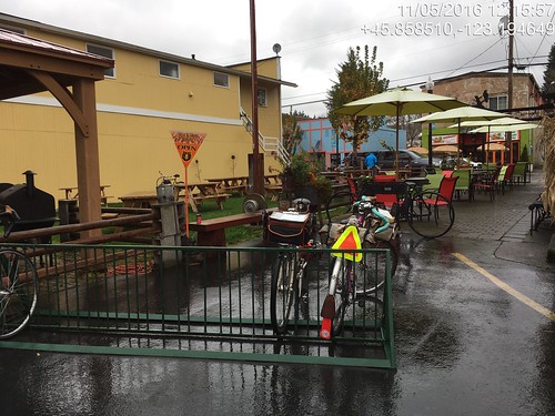
We had a fun ride back along the Banks Vernonia Trail. The muck right at the summit had all been cleared away, and I completely enjoyed the descent.
We spent the final stretch from Banks to Verboort chatting. And yes, it was raining all the way from Vernonia to Verboort.
Michael was lurking by the entrance of the bingo tent, so card rituals were completed, and then we got sausage, and, in my case, some hot chocolate. Michael and I both sprang for a round of bingo, not that we won anything :-)
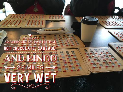
So, finished in 6:18 elapsed, which is quicker than last year. Always good.
Anita and I then rode back the 2.8 miles to the start, in steadily increasing rain. While it had rained the whole ride, it hadn't been heavy. Nowhere near that projected inch of rain. It was trying to make up for that now.
My feet were a bit damp, not unexpected, because they do sweat, but they weren't wet. Nor were my feet cold. I am declaring the socks an initial success.
Yeah. The weather forecast was for a dry, sunny day on Friday, another dry, sunny day on Sunday, and an astounding amount of rain on Saturday.
With that in mind, I made sure Sweetpea had the raingear and extra gloves on board. My helmet had its first raincover and neckcover event of the season, and I'd finally get to test out the new Showers Pass Waterproof Socks (wool version).
No plans to ride with anyone, but I did see many familiar names on the signup list, most of whom exercised good judgement and stayed home. However, Anita was there, and we'd ridden the first half of the Solstice permanent together almost a year ago.
It was raining lightly when I arrived at the start, but it slacked off to perhaps a faint mist heading north on Gales Creek Rd. It was so light that I swapped the jacket for a vest. That lasted almost all the way to Hwy 6, where I pulled the jacket back on. At the Hwy 6 turn, I suggested to Anita that she didn't have to wait for me, because she was pulling ahead and then having to wait in the rain.
Hwy 6 was a pleasant surprise - it had been repaved, and all the rumble strips were now buried under a layer of pristine asphalt.
About 3 miles later, the route left Hwy 6 for the delights of Timber Rd. It has a brief initial climb, then rolls along for several miles, then gains 500+ feet in the space of two miles. The rain increased on the climb (of course). Victorious. Nothing going to stop me now.
Then the drop down to Timber itself, another brief climb, some flat, and then another drop down to Hwy 26. I was very lucky, and was able to cross right away.
After crossing Hwy 26, the route continues for another 9 miles through a valley, before joining up with Hwy 47 a mile or so outside of Vernonia. I headed right for Black Bear Coffee Company - there were some cyclists leaving, and Anita sitting inside. She said she hadn't been there long. Consumed the traditional sticky roll and a mocha, refilled my bottle, and we headed back out.
We had a fun ride back along the Banks Vernonia Trail. The muck right at the summit had all been cleared away, and I completely enjoyed the descent.
We spent the final stretch from Banks to Verboort chatting. And yes, it was raining all the way from Vernonia to Verboort.
 |
| Michael, Lynne, and Anita. Picture by Michael Powell-Parich |
So, finished in 6:18 elapsed, which is quicker than last year. Always good.
Anita and I then rode back the 2.8 miles to the start, in steadily increasing rain. While it had rained the whole ride, it hadn't been heavy. Nowhere near that projected inch of rain. It was trying to make up for that now.
My feet were a bit damp, not unexpected, because they do sweat, but they weren't wet. Nor were my feet cold. I am declaring the socks an initial success.
Monday, May 23, 2016
Navigating through Beaverton - UPDATED August 2017
I live right outside the border of Beaverton, Oregon, and do much of my errands by bicycle or on foot. East/west travel is a bit tedious. No matter which road one chooses north of TV Hwy, one either gets on a rather major road passing large local employers (swoosh!), passes through a heavily trafficked shopping center (bad things happen there), and otherwise end up having to turn because the road doesn't go through, because there's a shopping center, a creek, or just because.

And then there's Millikan Way. It started out as a street bordering the southern edge of the (now much diminished) Tektronix Industrial Park, between Hocken and Murray. All the roads around and through Tektronix are named after famous physicists. Over the years, it was extended to Hall Blvd to the east, and, to the west it went out to the Tualatin Hills Nature Park, and then turned south to intersect with TV Hwy and join SW 160th.
It doesn't have much traffic, and is a fairly straightforward way to ride east and west just north of TV Hwy. Did I mention that TV Hwy is a stroad; not much fun to ride along?
Metro just opened a really nice path along Hall Creek, between SW 117th and SW 114th. You'd think there would be a connection, but Millikan Way dead-ends east of Hall. So there's an unfortunate gap in the route.
One can (and there is a very definite desire path) cut across to SW Lombard from the east end of SW Millikan. There will finally be a road extending Millikan to Lombard, but the project dates are unknown. UPDATE: Aug 2017 - the desire path is now PAVED. With WAYFINDING SIGNS.


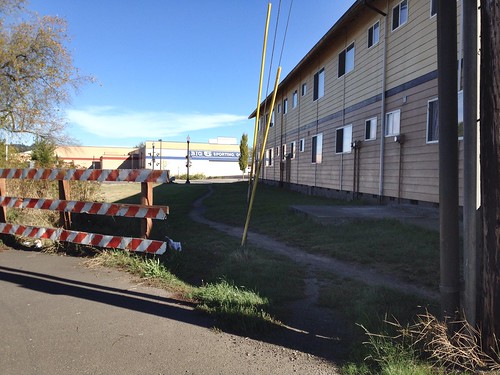
Then, from SW Lombard, one can cross the street and cut through the Transit Center, over a bridge, and into a shopping center with well-behaved traffic. I take the path continuing straight through to SW 117th.
And there we find another gap. The path along Hall Creek is right there across the street. But there is no crosswalk and no curb cuts on either side of SW 117th. Fortunately, another lightly trafficked crossing, and a fun ride (with pauses to watch the ducks) through to SW 114th.
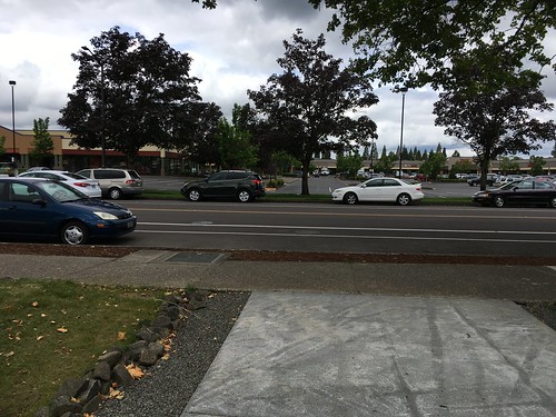
At this point, the route really does come to an end. I typically turn left, and then right on SW Center, so as to cross over Hwy 217 and head home.
Places of interest along the route:
Falk Hardware (Millikan and Cedar Hills) - my favorite hardware store. I need a fastener, they've got it!
Edge Coffee and Cafe Yumm (Millikan west of SW Murray, north side) Cafe Yumm. Nuff said.
Beaverton Bike Gallery (Millikan just east of SW Hall) My LBS.
Portland Clinic - not that I like going there, but it is great that my doctors are so close.
Bogza Coffee in The Round
Tualatin Hills Nature Park
Joann's Fabric, Marinepolis Sushiland, Jim and Patty's Coffee
many useful small businesses south of Millikan and north of TV Hwy, like the Batteries Plus, Tom's Pancake House and the Brickyard Tavern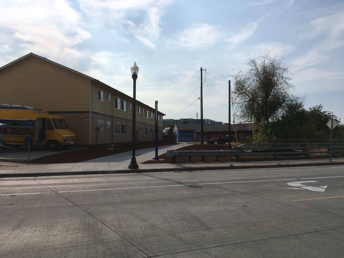

And then there's Millikan Way. It started out as a street bordering the southern edge of the (now much diminished) Tektronix Industrial Park, between Hocken and Murray. All the roads around and through Tektronix are named after famous physicists. Over the years, it was extended to Hall Blvd to the east, and, to the west it went out to the Tualatin Hills Nature Park, and then turned south to intersect with TV Hwy and join SW 160th.
It doesn't have much traffic, and is a fairly straightforward way to ride east and west just north of TV Hwy. Did I mention that TV Hwy is a stroad; not much fun to ride along?
Metro just opened a really nice path along Hall Creek, between SW 117th and SW 114th. You'd think there would be a connection, but Millikan Way dead-ends east of Hall. So there's an unfortunate gap in the route.
One can (and there is a very definite desire path) cut across to SW Lombard from the east end of SW Millikan. There will finally be a road extending Millikan to Lombard, but the project dates are unknown. UPDATE: Aug 2017 - the desire path is now PAVED. With WAYFINDING SIGNS.
Then, from SW Lombard, one can cross the street and cut through the Transit Center, over a bridge, and into a shopping center with well-behaved traffic. I take the path continuing straight through to SW 117th.
And there we find another gap. The path along Hall Creek is right there across the street. But there is no crosswalk and no curb cuts on either side of SW 117th. Fortunately, another lightly trafficked crossing, and a fun ride (with pauses to watch the ducks) through to SW 114th.
At this point, the route really does come to an end. I typically turn left, and then right on SW Center, so as to cross over Hwy 217 and head home.
Places of interest along the route:
Falk Hardware (Millikan and Cedar Hills) - my favorite hardware store. I need a fastener, they've got it!
Edge Coffee and Cafe Yumm (Millikan west of SW Murray, north side) Cafe Yumm. Nuff said.
Beaverton Bike Gallery (Millikan just east of SW Hall) My LBS.
Portland Clinic - not that I like going there, but it is great that my doctors are so close.
Bogza Coffee in The Round
Tualatin Hills Nature Park
Joann's Fabric, Marinepolis Sushiland, Jim and Patty's Coffee
many useful small businesses south of Millikan and north of TV Hwy, like the Batteries Plus, Tom's Pancake House and the Brickyard Tavern
Monday, February 8, 2016
That's a Wrap
So, I have this surgery thing coming up, and I'll be off the bike for however long it takes to recover. The doctor said 4-6 weeks, but I am betting she didn't mean I'd be able to crank out a 200k by then. Given that, I deliberately abandoned my current R-12 run, because otherwise I'd be stressing myself into attempting a 200k before the end of March, which would probably be a bad idea. I did think I might be able to keep the P-12 going.
With that in mind, I rounded up a group of friends to ride Ray's North Plains Banks Vernonia 100k, my very favorite local 100k.
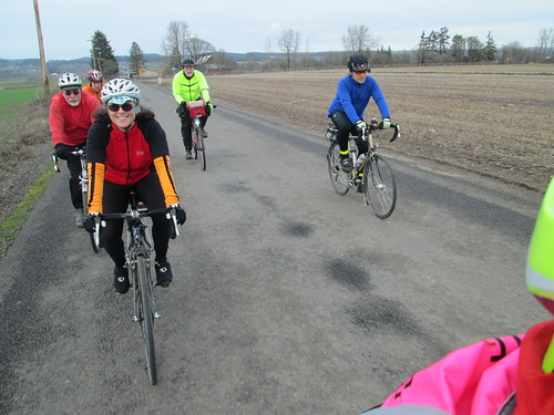
Ray, Susan O, Michal, Graham, and Steve all turned up. The day was cloudy, but not rainy.
As is often the case when I ride with more than one person, the group fragmented. Michal stuck with me the whole stretch to Vernonia. Overall, this was a faster pace than the last outing, as Susan was back on an upright bike.
There was a 5k run in progress, fortunately not too many participants!
We didn't see the others at the lake - when we met up at the Black Bear, they said they'd all taken the Adventure Detour. We took the Road Detour.
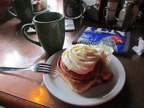
Susan told me my sticky bun with frosting, heated, with butter was already ordered. :-) For that matter EVERYONE ordered one.
Eventually I figured we should head back.
We regrouped at the Banks Trailhead. I was starting to feel done, but we had only 9 more miles to go.
Fitz had been hitting a bucket of balls close by, and joined us at the finish.
Thanks everyone for joining me!
With that in mind, I rounded up a group of friends to ride Ray's North Plains Banks Vernonia 100k, my very favorite local 100k.
Ray, Susan O, Michal, Graham, and Steve all turned up. The day was cloudy, but not rainy.
As is often the case when I ride with more than one person, the group fragmented. Michal stuck with me the whole stretch to Vernonia. Overall, this was a faster pace than the last outing, as Susan was back on an upright bike.
There was a 5k run in progress, fortunately not too many participants!
We didn't see the others at the lake - when we met up at the Black Bear, they said they'd all taken the Adventure Detour. We took the Road Detour.
Susan told me my sticky bun with frosting, heated, with butter was already ordered. :-) For that matter EVERYONE ordered one.
Eventually I figured we should head back.
We regrouped at the Banks Trailhead. I was starting to feel done, but we had only 9 more miles to go.
Fitz had been hitting a bucket of balls close by, and joined us at the finish.
Thanks everyone for joining me!
Subscribe to:
Posts (Atom)