Wednesday, December 24, 2014

The Other Spinning

There is still a wheel involved, except it is attached to my Ashford Traditional spinning wheel.  Back in February, I finally started spinning my Black Currant 80% Merino 20% Silk Top.  I can only reliably spin laceweight, so there we were.

Merino silk top spinning in process

It took FOREVER to spin the first 2 ounces.  There were long period of non-spinning, and, I am not the world's fastest spinner.  I have a choice of speed or consistency.

Merino silk top spinning in process

A month or so ago, I finally started on the last 2 ounces.  Slow progress.  Never to be finished.  BUT!  A Craftsy spinning class was getting a lot of positive chatter on Ravelry.  It would teach me how to spin worsted to long-draw (woolen).

My spinning is mostly self-taught, with a little help from one or two friends, reading, and watching YouTube videos.

The first lesson was on the short forward draw, which wasn't what I was doing.  I switched to that, and immediately got a LOT faster.  I even moved to a smaller whorl on my flyer (for cyclists, it is EXACTLY the same as moving to a smaller cog on the rear cluster.  Lots more twist.) Not only that, but I also gained vocabulary.  A week later, spinning for a few hours in the evenings, I finally finished.

I let the singles rest overnight before I started plying.  I also bought a plying class, but haven't started it.

Six treadles seemed about right.  Maybe.  Maybe not.  I plyed over three evenings, eventually finishing off one bobbin and completely filling the bobbin on the wheel.  Hmm.  Maybe not totally consistent.

merino silk top - laceweight

In a fit of organization, I had weighed my empty bobbins, so I knew how much fiber was on them.  Wound off half the remaining singles onto another bobbin, and continued plying onto another bobbin.

Merino-silk top laceweight

I skeined the second bobbin ; counting the number of turns on the niddy noddy gave me 238 yards.  After letting it sit overnight on the niddy noddy (twisted flat to help relax the twist) and removing the skein, I started skeining that really full bobbin.  About 90 minutes later (Call the Midwife on the tv), I was done.  Counting those turns revealed another 933 yards, so about 1200 yards of two ply laceweight altogether.  I know there will be less after finishing, but that is still way more than I need for the planned project.

I did worry a bit about the wrong amount of plying twist, but letting the singles and then the plyed yarn rest between each stage seems to have taken care of it.  The yarn appears balanced.

Finishing - a soak in gentle wash detergent, a soak in vinegar water, a soak in plain water, squeezing the water out by rolling up in a towel, some snapping, and hanging to dry.

Merino Silk laceweight 1100-1200 yards

Sunday, December 14, 2014

The Chain Gang to the Rescue

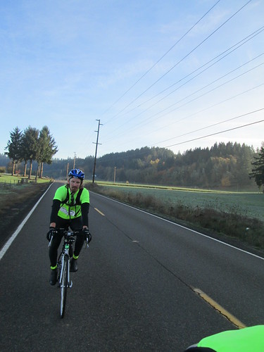
When I showed up in North Plains to ride the North Plains Banks Vernonia 100k, Ray said it would be me, Ken, Steve, and Jeff.  We were also joined by Bill and Adam.

Filling in my card, I realized the date was 12/13/14.  How cool is that?

Some riders started right on time.  Some were a few minutes after that :-)  We could see the first three up ahead, as we were headed for the sawmill on Vadis Rd, but then my rear tire decided to go flat.

Well, foo.  I elected to swap out the tube AND tire, for reasons of expediency.  One, so we wouldn't be so far back, and two, it wasn't warm.  Fastest tire change ever, no parts left behind.

We never did catch the first three, and, after the trailhead in Banks, Ray and Alan went on ahead.  Jeff and I rode together the whole way.

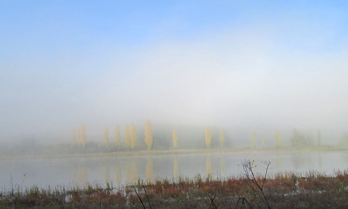
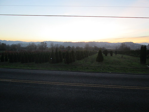
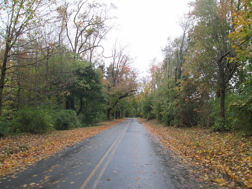
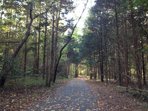
There had been an impressive windstorm earlier this week, and I was wondering what the trail would look like.  All the way from Banks to Tophill, it was immaculate.  Then we started down after Tophill, and, well, not so much.  Jeff and I stopped fairly often to pitch big branches off the trail, and, in my case, to extract the packed pine needles from my fenders.  I was hoping we'd make up some time on the descent, but we didn't, even once we got out from the trees into the flats.

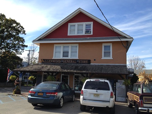
As we headed to the info control at Vernonia Lake (there are no timed on-route controls on this perm pop), we could see a cyclist leaving the lake, but couldn't tell who it was.  Jeff and I had decided to make Vernonia a very expedient stop, because we were right at time.  Heading into the Shell Station convenience store, we saw a couple of cyclists headed back out, and waved.  I think one was Ray, but didn't recognize the other.

I had finished my thermal jug on the way in (Hot tea/Orange Gatorade/Carbo-Pro), and filled it with coffee and hot cocoa.  99 cents.  I also finished off a Payday bar and sucked down a gel, as we were going to be climbing back out.

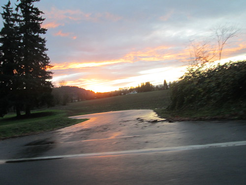
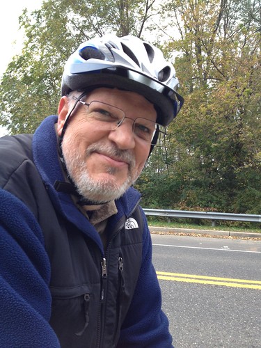
It never got above 45 all day, and except for Vernonia, was foggy/misty, condensing on my jersey.  I was wearing a light wool baselayer, and long sleeved jersey, with the hi-vis reflective vest over, wool knickers, knee socks and a light wool cap.  For most of the day, I managed with just shortfinger gloves, but I did pull on the wool overgloves from time to time.  I'd cool down when we stopped, but would be perfectly fine in a couple of miles.

Jeff had sat down to eat a couple of corndogs, so I tapped on the window to move him along.  I finally left, knowing he'd catch me.

The ride back is always faster than the ride out, but I didn't want to lose any more time.  Seemed faster climbing back up than it did descending in.  We weren't stopping to move any branches this time.

But wait...  Another flat!  I did have another tube, but had to track down the source of the flat, since I was out of spare tires.  It was easy to find; a piece of glass.  Another quick change, but my tire pump quit pumping.  Jeff produced his.  When he learned that my pump was 11 years old, and the only frame pump I had, he was pretty surprised.  And it is fixable, but I am asking for another one, just so I don't have to remember to swap the pump every time I want to ride a different bike.

We reached the summit, and started flying down.  The light had gone to late-afternoon gloomy, and the mist was very thick.  The trail doesn't have any edge lines painted, but the moss was glowing green as a suitable stand-in.  Pretty cool.  We did find several other cyclists (not ours), some horseback riders, families with small children and people walking dogs.  I'd slow down and chat until it was safe to pass, then take off again.

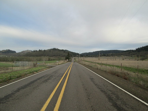
We arrived in Banks with 1:10 still on the clock, and only 9 miles to go.  I relaxed.  There must have been a tailwind, because I was moving east on Wilkesboro Rd at unexpected speed.

We spotted a walking cyclist as we approached the new railroad crossing on Wilkesboro.  It turned out to be Ken, and his chain had broken.  He'd been riding with Bill, who had gone ahead and was going to drive back and get him.  Bill had also told him that Jeff and I were still behind, and "Jeff is very handy".  (for the record, Lynne isn't too bad, either.)  I asked what size chain he was running, and when he said "9 speed", we told him he was in luck.

I pulled out my slightly-used (on Ray's chain) quick link, and Jeff pulled on his latex gloves.  It was determined that the chain didn't need any bits removed, and the quick link was on and the bike was rideable, all within two minutes.  I texted Bill that Ken's bike was fixed; no worries.  Ken had already given up on this 100k, and was planning another one, but now he didn't have to.

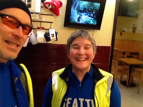
We finished with 19 minutes to spare, and sat around Hits the Spot Cafe in North Plains for a good 40 minutes past that :-)

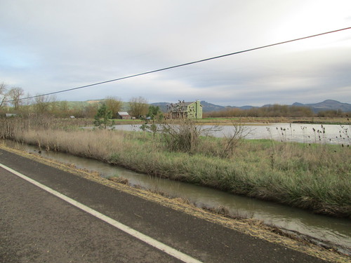
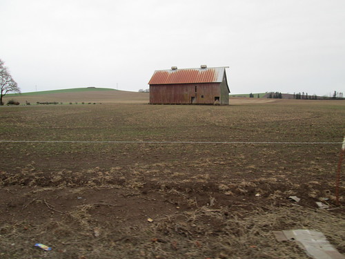
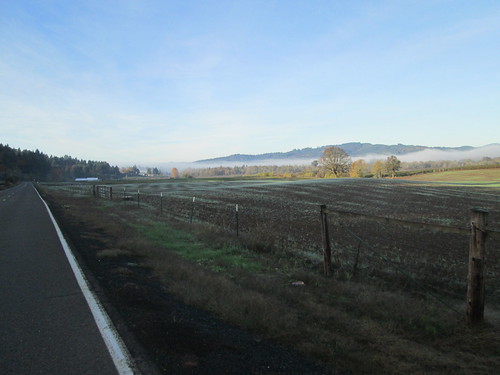
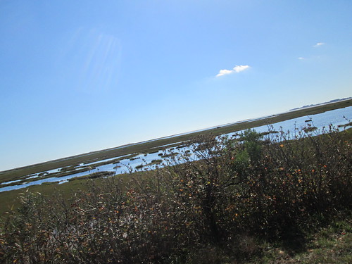
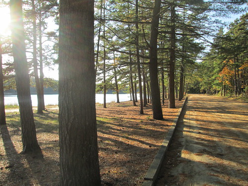
Sorry, no pictures; we were too busy riding, fixing things, or tidying up the trail.

Friday, December 12, 2014

Route Selection is Key

The fall/winter weather pattern in Western Oregon is winds from the south.  They often carry lots of rain, but not always.  Forecast for this past Saturday called for 10-20 mph south winds, high probability of rain in the morning, cloudy in the afternoon.  It seemed like a perfect opportunity to get that December 200k ride accomplished.  One never knows when we'll get a snowstorm that sticks around for the rest of the month. (Note: right now it is raining cats and dogs and we have high wind warnings)

Michal was interested, so we planned to ride Bill's Eugene to Beaverton perm. One-way, heading north.  I took the train down to Eugene on Friday evening, and we were up at 5am the next morning.  Yummy breakfast and coffee, and soon time to plummet down the hill to the start point.  The forecast had called for mid-30's in the morning, warming up to mid 50's later in the day.  It wasn't raining at the moment, but I had all the rain gear along, and a few extra bits in case of extreme soaking (socks, baselayer, extra hat and gloves).

Tense descent (for me) down to the flats, and winding through Eugene to Full City Coffee Roasters.  The bike shakes when I get tense, which adds to it :-) We ordered some hot drinks, took some pictures, and headed north.

Eugene start, Full City Coffee Roasters

I am playing with Adam G's RandoFriend phone app, and had created a ride for this perm.  Nothing to do at the start; it just starts the clock at the provided start time.

Once we got to the outskirts of Eugene, we stopped at Armitage Park, and both of us ended up removing most of our extra layers.  It was already in the 50's!

Sunrise

The tailwind was wonderful - we were blown north all the way to Diamond Hill Rd, at which point we had to ride east for awhile.  That is where we discovered how nice a tailwind we had; it was hard going in the quartering headwind for the next 3+ miles.  We could SEE the turn north, but it was not getting closer quickly enough.

From there we went up Gap Rd, one of the few "major" climbs on this route.  It was nice to have the wind helping.

Gap Rd

House and flooded pond

Down into Brownsville, back up a bit, then more relatively flat terrain all the way to out first control at the Hoffman Bridge.  We then zipped through Scio, around a corner and... Michal: "oh".  I wondered that he didn't remember this from previous rides.  The Leffler Grade.  I made it halfway up and then bailed.  Michal, of course, rode right up.

We followed along the top of the ridge, eventually dropping into Stayton, our first timed control at 67 miles.  I ate a plate of potstickers and noodles; Michal just had potstickers.  I think I like the Chinese food counter there.  Tasty wet salty food with protein and carbs.

Our Seattle Randonneur jerseys were confusing to people :-)  Not that we planned to match, but with our jerseys and Gore Visibility vests, well, there we were.

The only attempt at rain to this point had been a few minutes of very faint drizzle.

From here we headed west and north through Aumsville to Howell Prairie Road, all with that tailwind, which made the first three hilly miles ever so much more pleasant. The next 14 miles were pretty nice, too!

The Red Barn, Howell Prairie Rd

Trees, Howell Prairie Rd

Into Woodburn (perm owner: "I trust, though, that you'll follow Howell Prairie to its end" - the usual route is to follow the MAIN road into Gervais), where we stopped at one of the local Hispanic grocery/taquerias, now apparently owned by Asians.  Adds a 4th language to the existing signage in Woodburn - currently English, Spanish, and Russian.

I had chicken tacos, which, when one removes the onions and cilantro, are just chicken and tortillas.  Basic, but workable with salsa.

After a longish pause and a quick chain lube, we set out for the final 30 miles north.  The route took us north along the railroad tracks to Hubbard, then northwest for our last bit of rural riding, following Boones Ferry north until we cut east to go around the Aurora airport, and hop onto I-5 to cross the Willamette River on the Boone Bridge.  Real darkness fell somewhere alongside the airport.

The I-5 crossing was loud, and there were lots of branches on the shoulder, making it a bit challenging to keep as far right as I wanted to be.  I found Michal waiting just after the turn onto Boones Ferry.

Aside: you know, if the French Prairie Bridge was a reality, we wouldn't have to ride on I-5.

And with that, we were into industrial parks and suburbia.  We didn't stop at the north end of Wilsonville, but kept moving.  After the short climb up on Boones Ferry, we dropped into Tualatin, "enjoying" the non-continuity of the bicycle facilities until the very end, where we went through the park, crossed the Tualatin River, and rode through more meandering park trails (I can see where folks might want to meander, but for transportational uses, meandering is just annoying.  As is lack of lighting and trail delineation) to pop out in Tigard.

This route used to use the Fanno Creek Trail, but navigation is challenging if one isn't a local; also, the trail meanders and has poor sight lines and no lighting.  It can be sketchy after dark.

There was that interesting little maneuver in Tigard to get north of the tracks, and then we were just south of Hwy 217 on Greenburg Rd, and almost done.  Except that Greenburg Rd looked all kinds of closed with flashing lights and emergency vehicles.  Given the location of the accident, we decided to use the sidewalk on the other side of the street for a couple of blocks, and after waiting for too many crossing signals, were again headed north to Hall, and there to Scholls Ferry, through the neighborhoods on the east side of it, a few more turns, and we were done.

After getting a receipt, we headed the 1.5 miles home for dinner.  And maybe a celebratory beverage.

picture by Cyndi
With this ride, I will have exceeded my previous cumulative annual RUSA distance best.

Monday, December 8, 2014

I Think I Have Everything But My Common Sense

"We left that behind a long time ago" - Susan O.

The plan was for a perm pop starting at 6pm, followed by some sleeping and a tasty brunch.  I was all over that.

The weather forecast was lots of rain on Friday (see this post), then colder, drier, and sunny on Saturday.

Corralled my slumber party supplies (sleeping bag and air mattress), and set about finding all my sooper cold riding gear.  It wasn't going to rain, so no need to wear a rain shell and get soggy inside.  I ended up wearing two long sleeved wool baselayers, a wool long sleeved jersey, thermal vest, reflective vest, Smart-Beest wool shorts with the PI Amfib tights over them, my fluffiest wool socks, toe warmers, new Lake Cycling boots, wool cap with brim and earflaps, Smartwool liner gloves and Descente Wombat gloves over that.  And my helmet cover, to keep the warmth in.

Met everyone at the start, signed in, and got my card.  Some who had planned to ride didn't show - car trouble, and too much wood chopping, respectively.  Someone else was not yet there, but we knew she'd catch us.

Four of us (Susan O, Jeff M, Steve B, and myself) headed out in the sub-freezing temperatures and darkness.  We rode north along SW 231st, which has new bike lanes, a raised bike lane (we didn't much like that one, for various reasons), and a bit of construction.  The road was well lit; we were still in Hillsboro, passing by the Intel facility where I used to work.  Then west on Evergreen, and so on, familiar roads to us locals.  The pace was quite comfortable.  There was a headwind, which we would lose after the control at the Gales Creek Shell station.

Once we were off the main roads, we could ride two abreast and chat.  Jeff was checking out two battery powered headlights.  I was enjoying my Luxos U :-)

We passed through Roy, and, a few miles later, arrived in Banks.  Given that EVERYTHING would be closed past Banks, we stopped at the trailhead to refill bottles and such.  I was drinking from the Polar insulated bottle first, because it was boiling hot when I left the house, and now was on the warm side of tepid (Gatorade Tea).  I also crunched down a frozen Payday bar.  Steve pulled on his rain pants; he was getting cold.  I was fine, but didn't want to stand around too long.

Our missing rider hadn't caught us yet.  She had gotten a flat, and would be along.

The four of us headed west on Cedar Canyon Road, which undulates up and down, through wetlands and over bridges.  Yes.  Bridges.  Ice forms first on bridges.  We saw some big patches off to the side.  This road is well-shaded, and likely didn't dry out much during the day.  17 miles in.

Someone had a rare burst of caution and common sense, and we all stopped to discuss turning back.  If we didn't turn back now, the decision to turn back later would make for a more difficult/hazardous return, just because of the roads we'd have to take.  Also, everything was closed; no place to hole up.

Aside: no one wants to be the person who speaks up and says that maybe proceeding wouldn't be a good idea.  I was certainly THINKING about black ice, but, not wanting to be that person...  Props to our rider with the common sense.

Back through Banks, with a pause to scout the Thriftway parking lot for our still missing rider.  No, not there.  We found her a few miles later on Wilkesboro Road, and she reported slippy bits and some fishtailing.  Of course, we weren't riding that fast trying to catch up, although I had noticed a few little squiggles.

So we all returned, electing to take Harrington->Kerkman->Cornelius-Schefflin, rather than Roy Rd, because we'd be off the main road longer.

Once we crossed Glencoe Rd onto Meek, Jeff and I compared headlights :-)  I was still completely and comfortably warm.  My feet were very happy.  My hands were happy.

Once onto Evergreen, we stayed out of the bike lane - it was frozen.  We took over the right lane; much safer.  Same on 231st and Baseline.

Back to the start, where everyone headed over to Susan's, and I loaded up my car and headed that way as well.

We then proceeded to the rando slumber party, eventual sleeping, and the tasty brunch. :-)

Distance: 37mi
Average temperature: 28degF

Sunday, December 7, 2014

Hillsboro Dallas in November

Following my goal of getting in the fall/winter R-12 200k ride early in the month when the weather is decent, I recruited Chris W to ride Hillsboro Dallas with me.  Easy ride, and I don't think anyone really needs the cue sheet any longer.

We met up in the Fred Meyer parking lot.  He lives a couple of blocks from there, which he liked.  Got our starting coffees and headed out.

It was foggy and cold.  We knew both would improve, but the fog sure was pretty.

Frost and fog

Wetlands Fog, second try

Chris

Elevator, Bethel Rd

This was my second ride with Chris, and, as it was just the two of us, we got better acquainted.  His wife was making tamales with her sister, and he was getting tamale updates all day.  He knew what he'd be having for supper when he finished!

Fall foliage Abbey Rd

Autumnal Vineyards, Abbey Rd.

Sunset over the Coast Range foothills


How Hard Could Riding to Gervais Be, Really?

Theo was rounding up company for his push to earn his RUSA K-Hound award over this Thanksgiving weekend.  I figured I could join him on Friday, and we'd ride Ken's Never Nervous in Gervais perm pop.

It was going to be very rainy, and very windy.  I am not sure what I was thinking.  Well, I KNOW what I was thinking - once across the Boone Bridge on I-5 at mile 15, riding to Gervais is a piece of cake.  Many of our rides in the valley pass through it.  It isn't usually control, but there is a convenience store.  The route is pretty much flat and uneventful.  Usually not paying much attention to the distance and... oh, we are in Gervais, does anyone need to stop?

In preparation, I located all the rain gear, packed a turkey sandwich and a banana (we were that non-stressed getting ready to host Thanksgiving for the family :-) ), and left it at that.  Oh, and reminded myself of the cycling route from my house to Grand Central Bakery in Multnomah Village.  6.22 miles.

Up early, as I wanted to be out the door before 8am, to allow for a leisurely pastry and coffee at the bakery.  Gray, sort of damp, but not raining.  I arrived, and didn't see Theo's bike there yet.  Went in and... "Lynne!"  It was the now grown up young woman who grew up next door (and my daughter's very good friend) getting breakfast with her two year old daughter.  I dumped my jacket and helmet there, ordered a mocha and cheese danish, and then we visited.

Hadley and Jordann at Grand Central Bakery

I was starting to wonder where Theo was, when Jordann asked if he was the cyclist who just walked in.  Theo got himself a coffee, and joined us.

So, just a few minutes past the 9am start, off we went.  Still not raining.  There was a nasty steep hill right at the beginning (I thought Ken didn't like climbing), a block of non-pavement (a signature of all Ken's rides - there will be some gravel or dirt), and then the joy of rollering our way south on Boone's Ferry Rd in a stiff headwind.  By the time we made it to north Wilsonville, we both decided we were quite ok without the rain jackets.  For awhile at least.

Through the industrial park (gee, there's traffic there on a weekday), onto I-5, over the bridge and off, where the route now becomes pretty much pancake flat.  With the headwind, which was now stronger.  And bands of downpours.

We plodded south, not very quickly.  The frequent wind gusts were strong, later reported to be 35mph, with a constant wind of 20mph.  Oh, and it rained.  Lots of wheelsucking on my part.  Thank you Theo!

I was wearing my new Lake cycling boots, and my feet, to this point, were neither wet nor cold.

Burrito in Gervais

The turnaround was at the Gervais Market, where I ate my sandwich, and Theo ate his burrito.  Still raining heavily, but it was behind us now, and we had a great push all the way back to Wilsonville.  Then we climbed up Boones Ferry, down and through Tualatin, working our way north and up back to Multnomah Village.  Over the gravel bit (car-swallowing potholes), and then it was time for that last part of the climb.  I admitted defeat and walked the last part - inclinometer shows bits of 14 and 15%.  Too toasted from beating against that headwind earlier, plus my left calf had an interesting pain.

Over the top, and then we zipped down, and right on Multnomah Blvd, to pull into John's Market with 3 minutes to spare.  We celebrated with Pellegrino sodas out under the awning (still raining), and then Theo headed off two miles and a climb east to his house, and I headed west and generally downhill to my house.

Maybe that cold soda wasn't the best idea, coupled with the heavy rain and downhill.  All my clothing, shoes included, gave it up here.  The Fanno Creek Trail portion of the route was underwater in a few places.

But all the wet and wind and cold aside, it is always great to ride with Theo.  He reckoned we earned this 100k :-)  Not going to take a ride to Gervais for granted, ever again.


Sunday, November 23, 2014

Adventure - Epilogue

Or, what I did, what worked, what I'd do differently.

Except for that time when I was a Girl Scout camp counselor, and took a whole crew of kids on a bike overnight (yes, I had NO CLUE what I was doing.  Helmets?  What were those?  And so on.), I had never done any bike touring.  This was to be a credit card tour; the goal was to get to New Jersey, with a bit of sightseeing on the route.

Earlier posts discuss the Banjo Brothers pannier rack bag, and I will say that it worked perfectly.  The new rack (Racktime Fold-it) was also excellent, even if it wasn't silver.

What I carried with me:

  • a single set of cycling clothes - shorts, knee warmers, wool sports bra, short sleeve wool jersey, wool arm warmers, socks, cap, shortfinger gloves, wool overgloves, booties, helmet cover, Showers Pass jacket, Gore Visibility vest, Rainlegs, reflective ankle bands.
  • a single set of off-bike clothes - Mountain Hardwear pants which rolled up to capris, ls Smartwool half-zip shirt, underwear, socks, Timberland Radler camp shoes.  If I needed a jacket, well, the cycling jacket would do.
  • minimal set of toiletries.  I was staying in motels; they'd have soap and towels!
  • all the cue sheets for the entire ride, permanent cards, and addressed, stamped envelopes for the cards after I finished each of the three permanents.
  • plus the usual stuff I carry on any brevet/perm - tools, spare parts, tubes, spare tire, etc.
  • two water bottles
  • big ziploc bags for the clothes, just in case it got very wet.
  • phone and camera chargers.

I didn't need any of the cold weather gear except for the first perm pop - it was raining, but not cold, so I just added arm warmers, and the 200k perm, where I wore everything I had, and only removed the Rainlegs when it stopped raining.

Motels which feed you breakfast are the best kind.  Even though I was staying at Sleep Inns, their breakfasts, while basic, were entirely adequate, by which I mean eggs, meat, cereal, yogurt, coffee, juice, and toast.

Lock - I bought a little Pacsafe lock, which means that if someone wanted to just grab the bike and go, it might hold them up for a little bit.

I should mention, that over the 6 days of riding through Virginia, DC, Maryland, Delaware, New Jersey, and that teeny bit of Pennsylvania, no one menaced me on the road.  No honking, no crowding, no yelling, nothing thrown at me, no rolling coal.  Not once.

What I'd do differently - bring more than one pair of cycling shorts :-)  They were washed once, on the unplanned layover day, but still...

Motel reservations - don't make the kind that are unchangeable and nonrefundable, in case severe weather moves in and you need to wait it out.  I got lucky.


New Jersey - Intermission

Besides having a wonderful time visiting with family, I rode a 200k perm, the Independence Hall 200k, Princeton Start.  I did have someone to ride with me, but she broke her wrist a few days before, and couldn't ride :-(  Other folks thought about it, looked at the weather, and decided to pass. (50% chance of rain, clearing off by noon, NNW wind).  Riding solo again.  This being New Jersey, the cue sheet was 4 pages...

The night before, I had a lot of conversations with myself about riding.  Or not riding.  But it was just about my last chance for my October 200k, plus states nine and ten.  And I did want to see the Liberty Bell.

I was staying with the aunt and uncle who lived reasonably close to the start, and my aunt dropped me off at the start.  As my fellow rider was to be bringing the cards and she couldn't be there, the perm owner left a card in a baggie under a chair outside the coffee shop.  Found it!

The start was the Grover's Mills Coffee Shop, with a heavy alien theme - War of the Worlds, the actual Grover's Mill being right around there.  Coffee and a pastry, and I started out.  It was raining, off and on.  The forecast had me thinking I'd be blown all the way to Philadelphia, and have to work on the way back, but the wind spent the whole morning being undecided.

I had loaded the track into the MapsWithMe app on my phone, which was fortuitous because the gps app I was using decided the route had no cues (yes it DID), and it being wet and gloomy, I ran my light all day, which precluded keeping my phone charged.  I only got misplaced a few times on the way back, it being dark, and all.

So, riding varied from rural to suburban.  Lots of little towns.  Fields.  Suburbs.  Some office parks.  White Pine Rd, and don't go bombing down it, there are some killer potholes.  There was a road closure in Jacksonville, but the fireman blocking the road very kindly told me how to get back on route.

Quiet road

The longest stretch with no turns was Union Mill Rd, leading up to the control at a Wawa Market.  I had gotten quite fond of these on the ride up from Virginia - as long it was one of the gas station stores, there was a consistent selection of the important things in life - chicken nuggets, V-8, soft pretzels, nuts, Fig Newtons, cheese sticks, bananas, and Gatorade.

Shortly after the control, the route turned west, and headed toward Camden, NJ, by way of Cherry Hill.  Lots of riding along the Cooper River, and then I found myself in Camden.  Riding through Camden was slow - not that it was long, but there were lots of traffic lights.  Also lots of police (!)

From Camden, I was to ride over Ben Franklin Bridge to Philadelphia.  This would be fun.  There were steep stairs leading up to the pedestrian/cyclist path.  That wasn't fun.  But then I was heading across the bridge, and it was wonderful.  The roadway is below, and the view was fantastic.

Steep steps on the Camden side

Pedestrian deck, Benjamin Franklin Bridge, Camden to Philadelphia

The bridge dumped me right into old Philadelphia.  Got a drink at the control, and then scooted over to check out the Liberty Bell from the outside of the building.

The Liberty Bell

Also Independence Hall.

Independence Hall selfie

But time was getting short and I needed to get moving.  I was over the bridge, through Camden, and out to Cherry Hill in considerably less time than it took to get through there the first time.  Hmm.  Maybe the wind decided to help out?

The rain had given it up by the time I got back to Camden, not to be seen the rest of the day.  It didn't warm up much, though; I was wearing all the extra riding gear I had carried and not yet used on the trip.

What else?  The route goes by many Shop-Rite markets :-)  Back through all the little towns and suburbs.  Called my aunt at about 26 miles out.  They planned to get dinner at the restaurant right by the finish, and get some takeout for me (another trip goal - east coast Chinese food!).

It started getting dark soon after that, making navigation a rather more challenging.  Traffic had picked up, and the headlights didn't help.  Mercer Park was a wonderfully quiet oasis.  Almost done...

Wait, this road doesn't seem right!  Another visit with MapsWithMe, and I navigated myself back to the route.  Finally pulled into the shopping center.  My aunt said she couldn't miss me, I was so lit up and visible :-)

Certainly not the fastest 200k I have ever ridden, but completed in plenty of time.

Tuesday, November 11, 2014

Riding up the Jersey Shore, Part 2 - Tuckerton to Freehold

(brief aside - this is post 500 on the blog.  Thank you all ever so much for reading!)

This was the day I had been looking forward to.  Not necessarily because it was the last day of the journey - because it was the day I would revisit my childhood haunts.

I was born in Pt Pleasant Beach, while my dad was stationed somewhere in the Air Force.  My mother's parents lived there.  My father's parents lived in Bradley Beach.  After a few years of living in various small towns in New Jersey, my parents moved far away, to Scottsdale AZ, then Rochester, NY, then Huntsville, AL, and finally, Houston, TX. (yes, I was a Rocket Kid; my dad worked in the space program industry).

But we'd go back every summer, and I'd stay for a couple of weeks, maybe longer, visiting around with grandparents, aunts and uncles, cousins, great aunts and uncles...

So, this day's route would take me through Pt Pleasant Beach and Bradley Beach, then to Freehold via the Allaire State Park.

The hotel at the golf course had a continental breakfast - bagels, fruit and coffee.  It would do for a start.  Of course, rolling out, I noticed that I had a rear flat (!)  Walked over to the snack area, with benches and tables, repaired it, washed my hands, and finally headed out.

The first 21 miles were all on Rt. 9.  Wide shoulder, tailwind...  Not bad, really.  I eventually was able to turn east a bit, and ride through some quiet neighborhoods and marsh.  Then I crossed the Toms River, and ended up IN Tom's River, with a street fair in process right where I was meant to ride through.  Then I saw the souvlaki stand and decided right there that it was (early) lunch time!

Street fair and gyro in Tom's River, NJ

After that tasty pause, I headed through town, and ended up on Hooper Avenue, which was clearly a place I shouldn't have been riding.  High speed, no shoulders...  I stuck myself on the white line, and it all worked out.  I was not crowded.  No one honked.  But certainly not fun.  I pulled off at a gas station just to figure out how much more of this I had to go.  Fortunately, not much.

From here I was headed toward Mantoloking, back on the barrier islands.  This is totally a Jersey Shore town, even though all the houses are new - rebuilt from when Sandy flattened everything.

Bridge to Mantoloking

Then a turn onto Ocean Avenue (all shore towns in NJ have an Ocean Ave), and there I was, in Pt Pleasant Beach.  As soon as I could, I rode up onto the Boardwalk.  It is all rebuilt as well - I couldn't find any Skee Ball or Pinball places.  Or, for that matter, my Great Uncle's salt water taffy store.  But it was still Jenkinson's Boardwalk, and I was a happy camper.

I was born here.

Jenkinsons Boardwalk, Pt Pleasant Beach, NJ

From there I rode up Arnold Avenue, which was/is the main street.  Of course everything had changed.  Many of the original buildings are still there, but with new and different tenants.  Turned right onto Lincoln Ave, site of the former A&P Grocery, coasted the three blocks down (all the big estates on the river side of the road are now filled in with other homes), turned right onto Walnut Ave, and there it was.

My maternal grandparents home

The current owners are keeping it very nice.  Green shutters rather than blue, but the front porch almost appears to have the exact same wicker furniture, and the hydrangea bushes are still in front.  The son of the owners (he was outside, we talked) said they like to keep the house true to its roots.  They even rebuilt the maid's quarters in the back, which previous owners had torn down.

front porch, maternal grandparents home

Maternal grandparents home, back porch

From there I rode the block over to the river.  What used to be a few houses and woods has been built up with large homes.  I looked in vain for the beach I played on for days on end, damming up the storm pipe, harassing the horseshoe crabs, paddling around (unsupervised) in those plastic boats.

This WAS the beach I played on for days on end

After thinking about it, I decided that the storm drain was extended out into the river, and the new house put in a lot of riprap and then terraformed and terraced themselves a flat lawn out to the river.  No beach remains.

From there I rode by the Pt Pleasant Beach public library - still in that old house!  One summer I tried to read through the entire children's section.

Spent one summer trying to read the entire childrens section

Time to head north to Bradley Beach.  As a kid, I always liked driving over the Brielle Bridge.  Now I got to ride over it, after the bridge lift ended.  There were signs to walk bike across bridge, but with that huge shoulder... nah.  I should mention that I never saw anyone pay attention to any of the bridge prohibition signs (no crabbing or fishing from bridge, etc).

Quick turn off east, riding through Brielle, and into Sea Girt, where I picked up Ocean Avenue and the boardwalks again.  This was fun.  The boardwalks have all been rebuilt, and, it being off-season, bicycles are allowed.

Belmar Beach

Another bridge lift at the Shark River Inlet, where I (and the other cyclists) ignored the Walk Bikes On Bridge signage.  Quickly found myself in Bradley Beach, and turned left on 2nd Ave, up to my other grandparents' home.

My paternal grandparents lived here

Paternal grandparents home, front view

It also looks well kept, but the bushes along the east covered patio are awfully tall and bushy, blocking the view :-)

Trip down memory lane complete, it was time to head inland to Freehold.  I went inland a bit, then turned south and then west again.  A stupid brief stretch on Rt 35, then off into the semi-rural roads which make up so much of central and south New Jersey.  I had routed myself onto the Wall Township Bike path, which turned into a couple other bike paths, crossed by a cool general store which I did not stop at (too close!), but went by and ate lunch the next day, and then rode through a section of Allaire State Park.

bike path in Wall Township, NJ

Allenwood General Store, on the Wall Township bike path

Back onto the surface roads, riding through Farmingdale and back out in to the semi-rural countryside.  Not too far now...  Look, a cyclist coming the other way!  I know him!  Yay!

My uncle rode out from Freehold to meet me

My uncle and I rode the last couple miles in together.  I had ARRIVED!  Success!

Arrival in Freehold!

A bit of wine to celebrate, a shower, clothes that I hadn't been wearing for five days straight...


Sunday, November 2, 2014

Riding up the Jersey Shore, Part 1 - Cape May to Tuckerton

After spending the night in Lewes, I planned to catch the 8:45am ferry to Cape May, NJ.  So I got to sleep in, get breakfast at the motel, then pedal the 4+ miles to the ferry dock.  It wasn't entirely clear where I was supposed to go, so I pretended I was a pedestrian and took myself inside.  No extra charge for the bike.

Waiting for the Cape May Ferry

Sat around outside for awhile, then, as the ferry approached, moved myself to the Bicycle Staging Area.  When it was time to load, I got to go first, park my bike in the racks, then head up to the passenger deck.

Sweetpea in the bike racks between the stanchions on the ferry

View from the MV Cape Henlopen ferry to Cape May, NJ

The crossing took about 90 minutes, and I had great fun coffeeneuring (how often does one get to coffeeneur on a floating coffee shop?) and standing outside enjoying the ride.

Coffeeneuring on the Cape May Ferry

Cape May Lighthouse

This day's route here.

Welcome to New Jersey

Last off, and I headed toward Cape May.  The route took me up along the barrier islands which are the South Jersey coast, mostly riding right along the shore and boardwalk, but occasionally heading a bit west to cross over a river.

Riding on the Ocean City Boardwalk!

Flying kites on the beach

The bridges were all toll bridges, but not for bicycles. :-)  Sunny day, wind was generally from the south.  Lovely.

Toll Bridge

Marsh or estuary

Lots of this from Cape May to just before Somers Point

the shore

Bridge to Somers Point NJ

After Ocean City, I rode across a big enormous causeway over Great Egg Harbor Bay, to Somers Point, ending up on a bike path all the way through Linwood, Northfield (lived there as a child), and Pleasantville.  Other than it had signs requesting that cyclists WALK across every single street, it was quite nice.  For the record, I saw many cyclists, and not a one of them walked across the streets.  For that matter, they didn't even stop.  I at least did that!

That's not going to happen

Pleasantville, NJ

Then I turned northwest, because the only way across the next river (for nonmotorized transport) was inland, in the Pine Barrens.  More bike path, then on a very major road past the Atlantic City airport.  But it was freshly paved and had a wonderful shoulder; no worries.  I had noted that the Last Chance for Food before my endpoint was at the intersection of that road and the White Horse Pike.  Of course, it was on the most difficult corner of the intersection to get into and out of :-)  More Wawa soft pretzels, a banana, nuts and Gatorade.  The White Horse Pike was busy, with high speed traffic and no shoulder, but I wouldn't be on it long.

Frankfurt Rd - I thought it was nice and quiet after the White Horse Pike...

Turned off onto Frankfurt Ave (all the streets were named after German cities), and it was immediately ever so much nicer.  A few miles later, I was to turn onto Indian Cabin Rd.

Wait.  What?  Sand?  Couldn't be sand for too long, and it looked rideable.  Mostly it was, but for a few bits.  Got to the next road.  Sand.  And the next road.  Sand.  I figured the NEXT turn would be onto pavement, and it was, but some time was taken.  At least it was flat, and only a little over 2 miles.

Oops.  Found another sand road.

Almost done with the sand

So, back onto pavement, and headed into the woods.  You wouldn't think New Jersey would have places this remote, but it does.  Crossed the river; only 14 more miles for the day.  It was a long 14 miles.  Not because it was difficult or anything, but there just wasn't anything there, but for a couple of taverns.  I was starting to think I'd never get to Rt. 9...

Bridge back in the Pine Barrens

When there wasn't shore, there was often marsh.

After riding through the state forest (full of pines, naturally) and crossing over the Parkway, there were finally signs of human habitation :-)  Then, finally, left on Rt. 9, into Tuckerton, and over to the golf club where I was staying for the night.  Not many places to stay in Tuckerton :-)

There was a brief discussion about where to put the bicycle - in my room, obviously, but not so much to them.  I promised they would never know it had been there.

Dinner that night was in the club restaurant.  There were tablecloths, real dishes and flatware, and golf on the TVs (I felt right at home).