Showing posts with label eugene. Show all posts

Friday, December 2, 2016

First 200k In 11 Months

And, oddly enough, our it seems to be annual "Ride a 200k on Civil War Day", the civil war in question is the Oregon State - University of Oregon football game.

I took the Coast Starlight from PDX to Eugene, given as how they've now got bicycle service AND a better schedule than the Cascades.
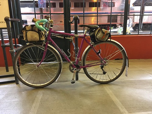
Sweetpea waiting to board

Pro: better schedule and cushier seats
Con: coach passengers sit in the very tail end of the train, baggage car is right behind the locomotive.  It is a very long train and "the stop in Eugene is 4 minutes!".  No wifi, and the water dispenser in the car was empty.  And the lighting was dim.

But with all that, I made good progress knitting on my sock, to the point of finishing it, but not weaving in the ends; I wanted better lighting!

First off the train, and scampered up to the front (as the conductor was announcing Last Call!), to find Michal holding my bike, waiting for me to show up with the claim ticket.  Whew.

Our route was Bill Alsup's Perm #1177: Eugene to Beaverton.

And so, up at 5am for the 7am start.  The drop down Michal's hill was kind of scary in the dark, like it always is, but I didn't work up to the whole bike shaking, like has happened before.  We found Chris at the coffee shop, and got ourselves some coffee as well.

Sunrise wasn't until 7:25am, so we got to enjoy heading north out of Eugene in the dawn.  All the coffee for breakfast and at the start meant that the customary pause at Armitage State Park was again observed.  We also decided that it wouldn't be raining any time soon, and ditched our rain jackets. Once over the McKenzie River and through Coburg, we were out in the rural Willamette Valley for most of the day.  Not that we could SEE anything, because there was a persistent fog, which stayed with us until we started the climb on Gap Rd (mile 22 or thereabouts).  We then dropped into Brownsville, pausing at the Chevron c-store, where I discovered PayDay bites, a convenient form factor presentation of the PayDay bar.

North through Brownsville, re-enacting the final scene in Stand By Me, then out the other side, eventually arriving at a road blockage.  Now, there's nothing OUT there, but looking ahead, we could see a small herd of cattle on the road.  It turned out to be the annual moving of the bulls from one field to another, and we watched them being herded by several guys on ATVs and an SUV bringing up the rear.
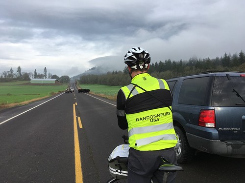
Cattle Drive on Brownsville Rd (Chris A in the foreground)

That settled, we continued on north.  Now, it was supposed to be raining most of the day, but we hadn't seen any rain to this point, and the skies looked like we wouldn't, for awhile anyway.  There were even bits of sunlight!

pic by Michal Young
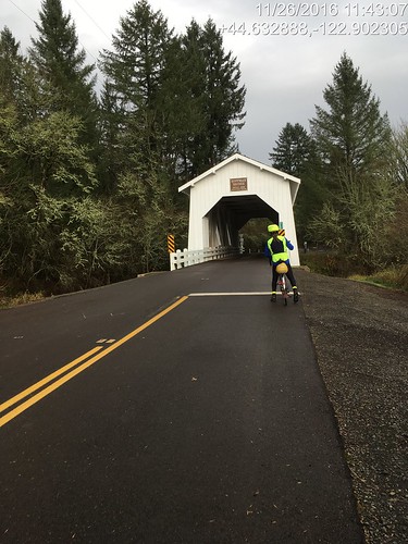
Passed through Lebanon, and Crabtree, on to our first control at the Hoffman Covered Bridge.  Although, the info control answer was found at the corner of Crabtree Drive and Hungry Hill Rd, rather than at the bridge, 1.6 miles further along.

Michal at the Hoffman Covered Bridge (first control)

After the bridge, a driver stopped to warn us that there was a chaser dog up ahead "on one of the downhills".  We did not find the chaser dog, but I did find a shard of glass, so there was a pause to fix the flat.  I just swapped in a fresh tube.

A few more ups and downs, and we found Chris waiting for us in Scio.  It wasn't a control, so we kept going, encountering the Leffler Grade.  I didn't know if I'd be riding up it or walking it; maybe a third of the way up, walking all of a sudden became a very attractive option.  Once at the top, we rolled along the ridgeline, finally dropping back down and entering Stayton (67 miles), our first open control.  On this route, the preferred stop is the Safeway; for other routes, the Roth's Market.  Drank down a half teaspoon of salt before going in.

I got a rice bowl with orange chicken, and Michal and Chris cheerfully refilled my bottles (one with plain water, the other needed hot water for the Gatorade-Tea-Maltodextrin beverage).  I ate about half of the orange chicken and rice.  I really like orange chicken, and white rice seemed to be a good thing for my stomach. Michal thought he'd have a taste, and proceeded to make serious inroads on the leftovers.

And with that, my stomach was all of a sudden very much happier, and we had a tailwind to Aumsville, and all was right with the world.  It looked like it might start raining at the corner of Shaw Hwy and Hwy 214, so Chris pulled on his rain jacket.  Michal and I didn't bother; we couldn't see where it would get any worse than a bit of drizzle.  And, indeed, it cleared right up.

pic by Michal Young
We also had a helpful tailwind on all 18+ miles of Howell Prairie Rd, and the first 2+ miles of gentle uphill didn't seem burdensome at all.  There's not much to say about Howell Prairie - the berry bushes are pretty with their fall coloring, lots of wide open space, the elevators at the Pratum Co-op.  Once you cross the Little Pudding River, there are more trees.

At the northern terminus we crossed Hwy 99E, turned into the wind for a bit, and then picked up Boones Ferry Rd (we'd see a lot of this road off and on for awhile), and ended up in downtown Woodburn, our next control.  We usually stop at the Del Sol market and get tacos or tamales.  We both ordered tacos, and I am pleased to report that I managed my entire transaction in Spanish (and yes, there was an actual conversation), then foraged around the store for other things.  I found Arroz con Leche (rice pudding!) in the refrigerated case, in a single serving container, and promptly snapped it up.  It was much better than the tacos - I had ordered Asada tacos, and they were dry and bland; I kind of expect Carne Asada to be moist and flavorful.  We never found Chris; he had gone ahead.
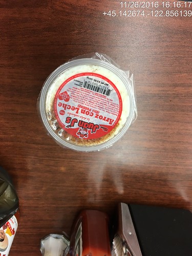
Rice Pudding!

Michal noted that the cars passing by had their windshield wipers on.  Darn.  On with the rain jackets and rain legs.  I was already wearing my Showers Pass waterproof socks; they'd likely get another trial.  I didn't bother to pull on the helmet rain cover.

So now it was dark and raining.  My helmet headlight seemed rather uninspired, and the stretch from Hubbard (just north of Woodburn) to Aurora (just south of Wilsonville) was not clear in my mind.  Michal had been fiddling with his gps and got it working again, so we'd be ok.

Heading out of Hubbard, we picked up Boones Ferry Rd again.  The traffic was rather heavier than in previous years; maybe these were folks headed home from the aforementioned football game.  I see now that we just head north on Boones Ferry, cross Ehlen, and then turn right on Keil, cross a very busy road (the rain had gotten much heavier), follow Keil to Airport, and head north to Miley, at which point I no longer need a cue sheet.

Yes.  Well.  From Miley Rd to get to Wilsonville, there is the small matter of crossing the Willamette River.  At this point the only way across is the Boone Bridge shoulder, which is a busy stretch of I-5.

So, dark. Pouring rain. Four lanes of high speed traffic.  Lots of debris on the shoulder - wheel parts, shredded tire parts, possibly a departed opossum or two.  Good times.

After exiting I-5, turning left onto Wilsonville Rd (there is also the part where one must leave the shoulder and move left two lanes), and onto the relative quiet of Boones Ferry Rd...  Whew.  We then turned into the industrial park, and I was on my work commute home from my stints at Microsoft in Wilsonville.

After topping out on the small climb on Boones Ferry Rd (there we are again), we dropped down into Tualatin.  There is usually a bike lane until there isn't, and the descent is ever so much more fun in the summer evening sunlight.  By now I was feeling soaked through, but not too much further to go!

Through Tualatin park, over the river and into Cook Park in Tigard, north on Hall Blvd, left into Old Downtown Tigard, then out the west side, the non-intuitive left onto Greenburg Rd, cross over Hwy 217, and ride up the back side of Washington Square Mall...  North on Scholls Ferry, and finally the left turn into the neighborhood before the last bit.  We actually got across to the turn lane without having to resort to the crosswalk and sidewalk to get to Elm St.

Through the unmarked and very subtle cut-though (always helps to have a local guide at this point), down 5th Ave (where I just wanted to turn right through the office park and go home!), under Hwy 217, up Griffith, and done.  12:22 elapsed time.
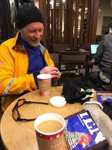
Michal at the finish at Starbucks

I barricaded my bike with tables and chairs up against the Starbucks window, and went inside to find hot coffee, and Chris A and Chris W (who rode one of my local perms and was planning to meet us at the finish).  They had obviously been there awhile, certainly long enough to change into dry clothing :-)  They eventually took their respective leaves, we finished our hot drinks, and rode the last mile to my house, where Fitz and Cyndi were awaiting our arrival.

Hot showers first, but Fitz had made an enormous pot of turkey chili and fresh cornbread.  With pie for dessert.

Friday, July 31, 2015

Fifth R-12 Completed

First, for the uninitiated: The RUSA R-12 Award.

As I have mentioned in previous posts, we are having a super hot summer.  It is forecasted to get to 100 degrees F today, and continue for awhile.

Last month I asked Michal if he wanted to ride Donuts to Total Domination, as the prevailing summer winds in the Willamette Valley are north to south.  There is a lot to be said for a constant tailwind.  After working though both our calendars, we settled on the weekend of July 25-26.  Leaving it a bit late, but, life.  The plan was to ride down, and help Michal with his bike packing for PBP.

So, yes, the heat.  We were so lucky.  The temperature moderated, and there was a possibility of rain.

I swapped the bike into touring mode, so as to carry rain gear and a change of clothes.  Cooked up some individual egg-rice-mushroom-onion-parsley-bacon-swiss cheese frittatas, made up a batch of dark chocolate hazelnut spread, and did up some tortilla-spread rollups.  Found a rain jacket, but optimistically didn't carry any other rain gear.  It wasn't going to be cold.

Michal decided to be ambitious, and ride the Eugene to Portland 200k starting the night before, rather than taking the train north.  He started at 5pm, and finished at 2:30am, arriving at the house around 3am.  So he got a bit of a nap before getting up at 5am to do it all over again.  He was very pleased with his pace.

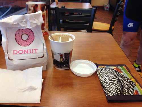
Breakfast (heavy on proteins) and coffee, then we rode over to Sesame Donuts (3+ miles, 15 minutes, give or take) to enjoy some more coffee and sweetened carbohydrates before the start.

starting out Donuts to Total Domination with a Sesame Donut!

We left right at 7am :-)

Suburban riding for the first 15+ miles, until we crossed the Willamette River just south of Wilsonville, and then nothing, really, until Keizer.  We had a headwind :-(.  Also new chipseal on Butteville and Broadacres.  Probably others; I remember endless chipseal.

Bits of refreshing drizzle, not worth donning the rain jacket.

River Rd into Keizer is always a bit nerve-wracking.  Take the lane take the lane take the lane.  No one will honk, but if one hugs the edge, they will try to squeeze by.  Take the lane.

Once into Salem, there are sharrows.  Also a bit of construction.  We stopped at the last place before leaving town - the Arco c-store.  I got more Gatorade; Michal did the same, and added in an ice cream cone.  A local was admiring our bikes.  He thought Michal's was just like a Harley Davidson, what with all the useful stuff on it (note: my bike has the exact same useful stuff...).  Then he asked what they cost.  We told him.  He didn't blanch.

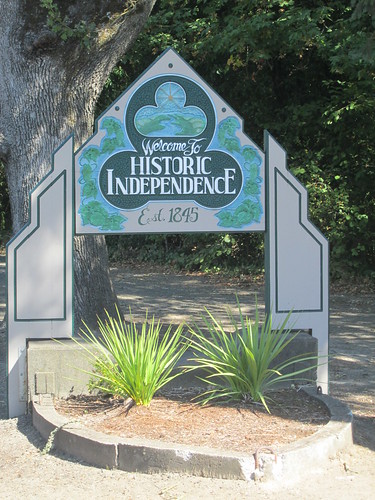
At this point we noticed that it was raining.  Rain jackets installed.  Off to Independence, where Michal claimed there were excellent tamales.  River Rd rolls most of the way there, but it wasn't particularly burdensome.  The headwind seemed to be letting up.  Onto the flats, over the Willamette River, and into Independence.

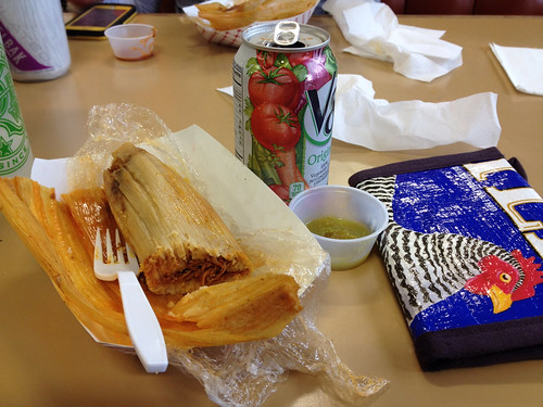
We rolled up to the convenience store where I usually stop, but I hadn't explored their cooked food offerings.  Yes, there were tamales.  Mystery filling, but I'd cope.  My receipt says it only cost 25 cents.  Must have been an error.  Yum. Consumed the whole thing, along with a V-8 (refrigerated drinks; same aisle as the tamales).

Tamale and V-8, Moothart's Market, Independence, OR

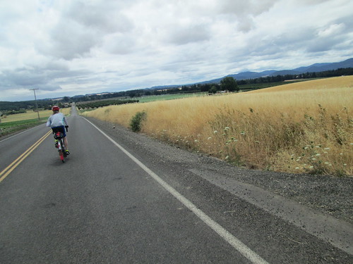
It was still raining lightly as we set out.  South of Independence is Corvallis Rd, with several abrupt climbs.  I didn't like it very much on the Blast Furnace 200k, but it wasn't that difficult this time.  We both stopped before the first climb to remove some rain gear.  In my case, my only rain gear.  It became rather amusing as Michal stopped before most of the pitches to remove another piece of rain gear.  I kept moving, so it was a bit of an equalizer.  That was it for the rain, and the temperature moved perceptibly up, into the 70's.  The wind was crosswind to quartering tailwind, a definite improvement from the headwind.

Michal, wheatfields, Corvallis Rd

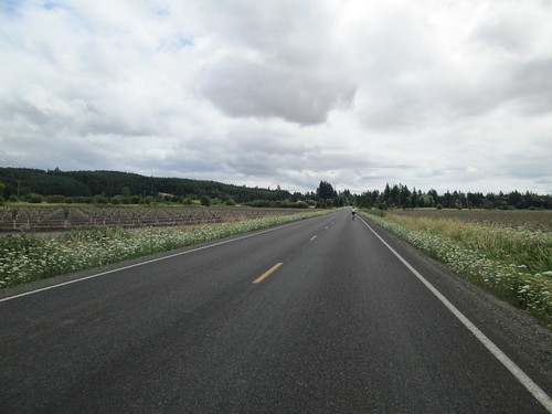
Corvallis Rd

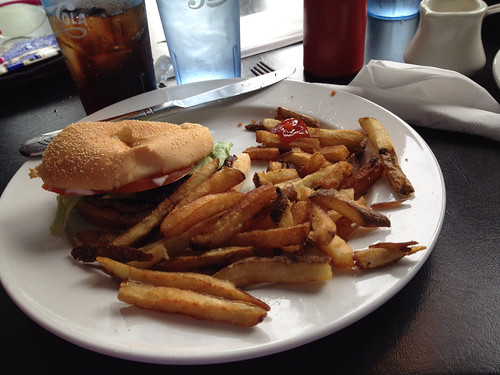
Then the fun drop down Buena Vista and the remaining 11 miles into Albany.  Last time we rode this it was stiflingly hot, and we didn't get water or food in Albany and suffered until the exceptionally sketchy off-route c-store on Hwy 34 and Peoria Rd.  This time, I noted the location of First Burger on the cue sheets.  As Michal was starting to feel the effect of riding all night, and I wouldn't have minded an infusion of salt, we pulled in.  We elected to split a burger.  Did we want to upgrade our side?  No, fries with extra salt, please.  Michal got some coffee; I had a Pepsi, and before the food arrived... "pass me that salt shaker, please..."  It is still amazing to me how an infusion of salt makes everything feel so much better.

Splitting a burger and fries, Independence OR

I started getting a tiny bit stressed inside, because we were stopping and sitting down and it wasn't a control.  I probably shouldn't have been worried, but I pushed it to the info control, pushed it to Hwy 34, and pushed it the whole 19+ boring and warm miles of Peoria Rd.  Peoria Rd has reasonably fresh chipseal as well :-(  I took to riding out in the right tire track, and moving back over when a car came along.  Drivers fly low on Peoria Rd, because it is so very boring, low traffic, and they just want to get to Harrisburg.  We wanted to get to Harrisburg, too.

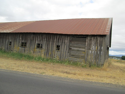
Old building

But anyway, about 5-ish miles before Harrisburg, the chipseal ended.  I was doing time math in my head, and decided we would be TOTALLY fine on time (not sure what I was thinking earlier).  First we found the public restrooms (turn left on Smith St; they are to the left side of the museum which is on the right side of the street.  If you pass the fire station, you've gone too far.)  Michal wanted an expedient stop, so I found more Gatorade, and elected to eat the food I was carrying.

We had a short, annoying stretch on Hwy 99E, then turned off onto Ayres/Lovelake for a bit of peaceful riding before the 9 miles on River Rd.  Lots of traffic, but not stressful beyond that, other than I wanted to be done.

Turning off River Rd onto Owosso and then the bikepaths... "whew!"  Both of us, simultaneously.  We were then in search of the penultimate info control, and eventually found it.  A little more bikepath riding, then onto the surface streets for a bit.

Willamette River, Eugene

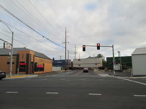
Oops.  Good thing we weren't at all close on time - there was a train.  So we waited.

Delayed by a train in Eugene, one block from the finish

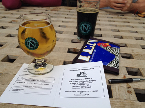
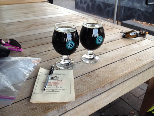
Another block, and the Ninkasi Brewery was waiting for us.  Mmm.  Beer.  Helles Lager.

Finish celebration, Ninkasi Brewery, Eugene OR

In case it isn't obvious where we are...  photo by Michal Young

Wednesday, September 17, 2014

Donuts to Total Domination

Michal has been wanting to ride this one so "I can see what those roads look like in daylight".  He took the train up on Friday, and caught our light rail (MAX) out to the Beaverton Transit Center, where we met up and rode back to the house.

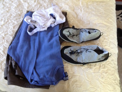
This would also be a test of Minimal Packing, for my Bicycle Adventure (tm) next month.  Everything fit in the Carradice Barley and Acorn Rando bag, including some shoes.

Test run of packing light for a future Adventure.

As we had planned for a 7am departure, we headed out of the house at 6:15 (well, 6:17 :-) ) and rode over to Sesame Donuts on every single road I generally avoid riding on - SW Walker eastbound, SW Canyon, and SW Beaverton Hillsdale.  All narrow and fast traffic.  But given the hour, it wasn't all that bad.

Starting with the donuts!

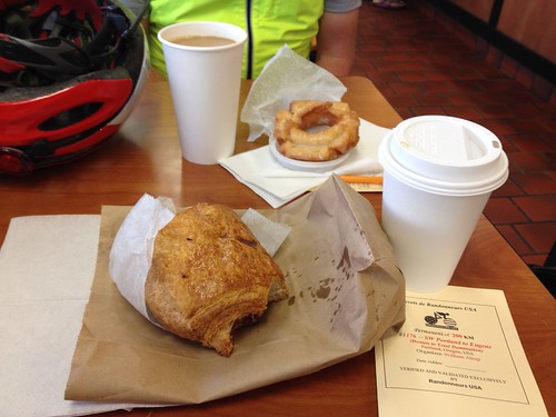
Donuts and coffee at Sesame Donuts.  They are operating completely in pennies, so I handed over 2000 and got back 14-something in change.  "We are practicing for when we win the lottery and become millionaires."

Our first challenge was getting by the SW Oleson Rd closure and construction.  There is a ped/bike temporary bridge (automobiles have a significant detour), and once we found it and transited the deep gravel to access it, smooth sailing southward.

The stretch from SW Portland to Wilsonville is very definitely suburbs and traffic lights, and a LOT more rolling than I remembered it.

Michal: "this route doesn't go over the river on the I-5 bridge, does it?"  Well, yes, it does.  Fortunately we were only riding southbound, which is the less stressful crossing - wider shoulders and higher bridge railings.  The shoulder was full of hubcaps.

Finally now, out into the country, all the way to Keizer/Salem.  We were meant to have a tailwind, and I might have felt a slight one.

We were looking out for a Burgerville, because Michal wanted a hamburger (at which point I then wanted one as well!), but there did not appear to be any on the route.  Just into Salem, a red car got behind us on a four lane road, sat on my rear wheel, and wouldn't pass.  Other cars were passing - 4 lane road, lots of room.   No honking, but just sitting there.  Stressful.  As we did not find the Burgerville, we stopped at the Arco minimart on the outskirts of town.  I had my first of several V-8s, plus Gatorade to top up the bottles. The day was heating up.

River Road to Independence looks much nicer in the daytime.  Michal: "from desolate to bucolic".  Yes indeed. It was also revealed that it is rolling.  I always wondered why it felt so hard riding it in the middle of the night, and now I know.  The Salem housing developments are creeping out along the road; I expect traffic will increase over time.

Then around a corner, and we popped out from the hills/forest into the Willamette Valley, with the Independence Bridge just up ahead.

Evidence of participation

Independence, Oregon

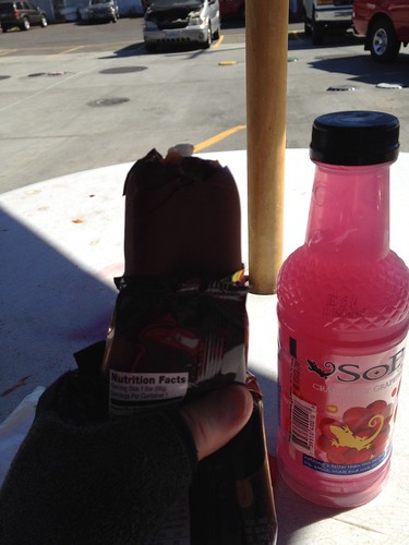
Indepizza had gone out of business :-( :-( :-(, so we went to the suggested minimart.  Ice cream bar and some Sobe.  Note to self - next time, go a few blocks further north and eat at Moothart's (just across from the public restrooms), or ride a bit further west on Monmouth road to Subway or something else. Or hope a decent, expedient food source opens on the main road.

Seeing SPOTz

First ice cream of the day, Independence, OR

I had remembered that it was somewhat hilly south of Independence, and, indeed, I had remembered correctly.  Lots of recent chipseal as well.  Slog up, fly down, repeat as needed.  At one point I looked ahead and muttered "please have the right turn there..." Not.  Some of you may remember the transit on Prather Rd from the Buena Vista Ferry, the year we rode the unofficial 150 mile version of the Watermelon Ride (2004?).  Gravel then.  Chipseal now.

Smell the cornfield!

We passed through the western edge of Albany.  By now, my feet were starting to hurt, so I lobbied for a "shoes off" pause.  We pulled over in the shade just outside of town and sat for a few minutes.  We also realized we needed more to drink to get us all the way to Harrisburg.  Should have stopped in Albany.  Oh well.

Michal remembered that there was a minimart on Hwy 34; we'd stock up there.  Passed the info control, and then popped out on Hwy 34.  Ah yes, the minimart was where Peoria Road met Hwy 34, not White Oak (our turn).  Rode west to the store, where we stocked up on water and Gatorade, and drank more V-8.  By now we had progressed to the "it is so hot, let's dump cold water on ourselves".  Ahhhh.

And, being good little randonneurs, rather than turning south on Peoria Rd right there, we rode back to White Oak Rd and turned there, to meet up with Peoria Rd.  Three bonus miles. Our promised tailwind never did show up.  Peoria Rd is 17+ miles of flat, exposed, boring...  At least there wasn't a headwind.

As we did not avail ourselves of the blue room at the minimart, Michal recalled that there was one at Peoria Park, just south of Fayetteville Rd.  About 6 miles later, there it was.  I never knew it was there; good to know.  Not only was there a blue room, there was also running water, so more cold water to put to good use!  Another "shoe off" pause, and then off again.

I learned that Peoria, which is now only a roadside park, a few street signs and homes, used to be a major river shipping point - this was as far as the grain barges could get upstream on the Willamette River.

Michal: "I can tell when your feet are hurting, just listening to your pedaling."  Yeah.  Maybe these aren't the shoes for me either.

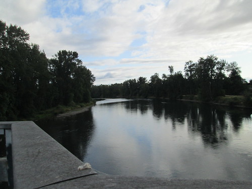
Willamette River alongside Peoria Rd

After quite some time, a friend of Michal's who was out riding on Peoria Rd came along; they chatted for a bit, and then he zoomed off.

Still hot.  Finally, finally, finally, we saw the silos of Harrisburg up ahead.  Stopped at the Dari-Mart.  By now, neither of us wanted anything to drink but water, so I gulped down a few Endurolytes, and had a mango popsicle.  I consolidated the Gatorade/Sobe/Orange-Vanilla Perpetuem into one bottle, and filled the insulated bottle with ice cold water.  There may also have been another extended water dumping session before leaving town.

I think the heat of the day finally passed, and it was perceptibly cooler.  The most recent drenching didn't hurt either.  Some very quiet rural roads and then we were on River Road for awhile, which takes us into Eugene through Santa Clara, which has amazing trees.  Under the beltline, onto the bike path, back onto the surface streets for a couple of blocks, and there was the brewery.  Ahhh.

We leaned the bikes inside the patio walls and went in search of some beer.  Cyndi joined us, and then we loaded up and went home.

Fini, Ninkasi Brewing, Eugene Oregon

And, delightfully, hamburgers for dinner!

The GPS track
All the pictures

Aftermath:
Well, I need to wear different shoes.  My winter shoes (PI Water Resistant Winter Shoes) don't hurt, so perhaps I shall return to those.  My old Shimano sandals are still wandering around the garage.  I remember why I no longer wear them, but maybe my feet have changed.  I can test them out locally.

Packing- it worked well, until I went to stuff the riding things on the bike, because I was wearing what I had carried.  Now, I don't expect to have to pack my cycling shoes on my Adventure, but it is highly probable that I will want to have rain gear and maybe a bit warmer accessories along, which will take up more space.  This bag calls, and I do have a venerable Jim Blackburn rear rack which will work, if the other rack I have ordered from France doesn't arrive in time.  At the moment, it seems to be made of unobtainium.  Yes, it DOES have to be silver.

Getting home - Amtrak, of course.  The schedule now only has a 5:30am departure; the more reasonably scheduled morning departure is no longer on the schedule.  I arrived home in time for waffles, and took an afternoon nap.

Tuesday, February 4, 2014

The New Bike Ride

Not mine :-)  Rando friend Michal just (as in just) took delivery of his custom Winter rando bike, so of course he wanted to ride.  Rando friend Graham was planning to ride Bill Alsup's Eugene to Beaverton 200k perm, taking the train down to Eugene on Saturday (Feb 1) morning, and starting at 11:30am, or something like that.  Michal suggested he come down Friday evening and start earlier Saturday morning, and I joined in. The finish is just over a mile from my house, so I offered up dinner for all afterwards.  Plans were made.

Michal (and new bike)

For me, it was "hop the MAX train downtown and figure out the best way to get to Union Station".  I could transfer trains and get right there, but with a 15 minute wait time, I could ride over there quicker.  Almost.  The roads are either one-way or transit mall.  Can't easily get there from here.  After trying this twice, I think I will stick to 4th St.  Anyway, got there, got my bike ticket, and Graham found me in the luggage room.  He got his bike ticket, and we went and hung out in the lobby waiting for the train.  Which was late.

When we got our boarding passes, they directed us to the left.  Everyone else was sent to line up on the right.  Eventually they told us it was so we could jump ahead of the group and get our bikes in the baggage car soonest.  Nice.  Other than the train being late, uneventful ride.  Graham and I got better acquainted, he did Sudoku puzzles, and I worked on my small knitting project. Cyndi was pulling in as we walked to the front of the station, and Michal had a batch of chili with tasty bread waiting.  And ice cream for dessert.

Of course, time was spent in the garage admiring the shiny new bike.  He really had only ridden it around the block when he picked it up, so this would be all new.

We planned to leave the house about 7am for a 7:30 start.  Michal and Cyndi had breakfast out and multiple cups of home-roasted coffee.  Still dim heading down the hill, but our bright headlights helped.  We arrived at Full City Coffee, and bought yet more coffee for that starting receipt.  I had some Caffe Latte Perpetuem and hot cocoa mix in my thermal bottle, and just had them fill it up with coffee.  Lots of coffee.  We set out only 4 minutes after 7:30, which has got to be a record.

Michal and Graham outside Full City Coffee in Eugene

So Michal had his entirely new bike, and I was riding on an entirely new saddle - a Rivet Pearl.  Right out of the box, and only a couple trips up and down the driveway, plus the 2 miles total riding to get to Union Station.  This could be an interesting ride.

First stretch, Eugene to Brownsville, 29.7 miles.  Early, sunny, cold.  The wind was not hindering, and might even have been a teeny bit helpful.  The climbs on Gap Road were not a big deal (somehow, they always hurt coming the other way toward the end of the Five Rivers perm), and the descents down the other side were quite fun.  Horses, cattle, sheep, and llamas out in the fields.  Still very much winter, but some trees were getting that pre-leaf fuzzy look.

Graham

There might have been a pause along the way to remove some layers.  Or we did it when we stopped in Brownsville; I really don't remember.  Bought some peanut butter crackers, but I really had plenty of food with me.  Also ate a slab of Italian Fruitcake.  Michal broke his bike in by plopping a bag of Cool Ranch Doritos on the seat.

Promptly breaking in the new bike rando-style, with Cool Ranch Doritos

Graham's front bag has a built in corndog holder.

Graham's bike has a built-in corndog holder

Brownsville to Hoffman Covered Bridge info control 24.2 miles.  Still wonderfully sunny.  More rolling hills (I think they call them buttes).

Nursery trees in mesmerizing rows

Passed through Lebanon and Crabtree (there isn't much in Crabtree), to turn onto Hungry Hill Road, where the bridge is to be found.  We stopped to write down the answer, and take a few pictures.

Info control selfie

Inside the bridge

Hoffman Covered Bridge to Stayton 13.2 miles.  The last time we rode this, we stopped in Scio, but not today.  The only wall of the route was waiting - gets up to 12% or 14% toward the top.  I bailed and spun my way up; Michal and Graham climbed somewhat faster.  This puts us on top of a ridge with wonderful views.

By now I was noticing that I had a new saddle.  Or, more to the point, the sitbones were noticing.  Shift, wiggle, shift. Michal was also noticing his new saddle, but perhaps not as acutely.

Found Michal and Graham at a corner, with a bit of a quandary on which way to go.  Michal's GPS was indecisive, and I thought we'd stay left.  I got to pull out MapsWithMeLite with the ride track installed and verify that this was indeed the case.  We continued on Stayton-Scio Road, and quite soon found ourselves in Stayton, headed for the Safeway.  Applied some lubricant to my poor sit bones.  Bought a sandwich, which seemed to take longer than it should have, but Michal was still in line at the Starbucks.  Got another bottle filled with coffee, Perpetuem and cocoa mix, and topped off my water bottle.  Ate half my sandwich and a banana, and we were off again.

Stayton to Woodburn  28.7 miles.  This stretch was mostly autopilot, as it goes from Stayton to Aumsville, north on Howell Prairie, and then, departing from the Mill City Coffee Run, into Woodburn, rather than Gervais.  We were all looking forward to some Mexican food in Woodburn, at one of the many stores which line the main street.  This is a pretty stretch of the route.

Between Stayton and Woodburn

The barn at the southern terminus of Howell Prairie Road

Howell Prairie Road, clouds and buildings

Trees in rows.  And good clouds

Heading into Woodburn, an impatient driver passed on a two lane road, with oncoming traffic.  The oncoming pickup almost ended up in the ditch.  We all shook our heads in disbelief.

Stopped at the same place in Woodburn as before, except all the window signs were now in Korean(?)  Bought a Red Bull to get a quick receipt, not that we were anywhere near pushing the time limit.  Receipt time was almost 30 minutes off :-)  Then went to order some food.  Brain freeze.  I just ordered what Michal had - three tamales.  They turned out to contain chicken, and were somewhat spicier than either of us were expecting.  I ate two.

Michal tanking up in Woodburn

Woodburn to Beaverton 29.6 miles.  And here we were leaving Woodburn, and it was still light!  Granted the shadows were getting long, but still...  A zombie freight train was heading north, same as us (the locomotive was at the other end, running in reverse), so I could head straight on, knowing that no one would be turning or crossing in front of me.  Michal and Graham came up in not too long, and we headed into and through Hubbard, then NW towards Aurora.  A stop to swap to the clear lenses and turn on a few more lights.  Rode alongside the Aurora airport, and Graham and I swapped stories about my brother's flying lessons there, and his flying lessons there.

Then it was time to hop onto I-5 for the Boone Bridge crossing.  Still not full dark.  That didn't happen until we were headed through the Wilsonville industrial park.

Last time we did this ride, it was dark and raining, and we had to stop and check the cue sheets much too often.  I had done some serious review of the route north from Wilsonville, and Michal had his GPS set up.  I was a bit stressed about the next stretch on Boone's Ferry/Tualatin Rd, because, again, the last time was in the dark and rain, and the road was two lanes, no shoulder, and heavily traveled.  I was in for quite the pleasant surprise!  Road widened, big shoulder/bike lane, and new white curbs, which my headlight picked out quite nicely!

Into Tualatin Community Park, over the Tualatin River bridge, and then the left turn in Cook Park on the bike path. Now, this is clearly a recreational, meandering path.  Not a single light in the park, and no edge lines painted on the path.  Good thing there was a wide beam on my headlight!

Now north on road with names I recognized - SW Hall, SW Burnham, a funny u-turn in downtown Tigard, through some neighborhoods, and then we popped out on SW Greenburg Rd, at which point I no longer needed the cue sheet.

Pulled into the Starbuck's at the Beaverton Freddie's, and I ducked in to get us a receipt.  Came out to find Bill A, the route owner.  Called home to say we'd all be there in about 10 minutes.  Graham wanted to get a picture of a license plate (200 DNF), so he said he'd be right behind us.  He never was right behind us, but as we headed up my street, I could see a bike taillight in front of us.  Bill pulled in right behind us.

Finish photo with Bill, the perm owner

Aftermath.  First things first, it being Graham's first R-12, his wife Sharon had brought a bottle of champagne, and we had a celebratory round.  Then we fell into dinner.  Sharon had also made a wonderful lasagna, which we accompanied by a big Rich and Charlie's salad, bread, apple cake and ice cream.  And beer and cider.

And Bill takes a picture of all of us

The route
130 miles in all,
13.05 moving average,
11:57 total time, about 15 minutes quicker than before, even without the tailwind assistance
about 3800 vertical feet

Monday, October 28, 2013

Alsea Loop 200k, in Between Coffeeneuring

The real reason I was going to Eugene was to ride with Lesli and Michal.  Lesli picked the date, and we settled on the Alsea 200 in a not-entirely-explainable process.

Alsea

Rather than drive (I really don't like to drive, especially after dark), I planned to take the train to and from.  So, at 4pm on Friday, I left work, went home, stuffed the Last Few Things into my daypack, hopped on the bike and rode up to the Sunset Transit Station, to catch the MAX downtown.

Arrived just as a train arrived, enabled one of my Tri-Met electronic tickets (HOW COOL IS THAT?), joined 6 other cyclists in the train car (there were also non-cyclists, and technically, the car maxes out at 4 bikes.  If it was crowded, I'd have been out of luck), and exited the train at Pioneer Square.  A bit of wandering around looking for the best way to head north; SW 6th St goes RIGHT THERE, but it is also the transit mall, and I did not want to mix it up with buses and the MAX Yellow Line.  Walked down to SW 4th, and went that way.

On the platform

Got to the station, got my bike baggage ticket, and immediately got in line to board the train.  The ride down was uneventful; the Eugene-bound cars were half full, so we all had window seats.  It was dark before we left Oregon City, so I entertained myself with knitting some booties for Asher (the new grandson I have only mentioned once.  I am a terrible grandma.).

Little Pink Bear on the train

Cyndi was waiting when the train arrived, we stuffed the bike in the van, drove home, visited and had a yummy dinner.  5:30am was going to happen pretty early, so we all turned in.

The alarm went off right in the middle of a dream about eating on a Rando ride.  So very weird.

Yes.  So.  Pre-ride breakfast and two cups of great coffee, then down the very steep hill in the dark to meet Lesli and coffeeneur.

After that, we started out.  Climbed back up the hill on the other side, then down (it was chilly).  We headed west toward Crow, and Lesli and I grilled Michal about his impending new custom Winter bicycle.  It has a color now.  And a list of parts.  Maybe the rear mudflap will stay straight.  One can hope.  I myself am trying to squelch the "I want a new bike TOO!" impulse.

Brief stop in Crow, then north through Veneta, where I almost skewered a wrong-way cyclist.  Michal was saying "there is a coffee shop in what used to be a church and a kamikazi cyclist and..." and then I saw her.  Ack.

This is not flat terrain.  Lots of undulations, not very long, but also 5-7%.

Eventually we ended up in Monroe, home of the generous ice cream servings.  Now, it had been chilly and drizzly up to this point, but somehow, we all bought ice cream anyway.  I also bought a turkey, cheese and pickle sandwich, big enough for now and later.

Lesli and Michal on McFarland Rd

Then west a bit and north some more, over the gravel stretch on McFarland.  Really more like dirt and hardly any washboard.  Further north to Decker Rd (a bit of a climb there), and then a left on Hwy 34 where the first sustained climb begins.  Lesli and I told Michal he didn't have to wait for us. About 4.5 miles later, we reassembled at the top, zipped up vests and jackets, and enjoyed the subsequent 8 mile descent.  We even saw patches of sunlight!

The control in Alsea is at John Boy's Mercantile, where there are deep fried poppers, Pepsi, and pickles in jars.  I scored an actual store stamp on my perm card, and we settled down at the big table inside to eat.  After seeing Joe P's Facebook posting about donuts at Top Pot, Michal had a sudden craving for donuts and bought a box of them.  We helped out as best we could, eating one right away, and taking one along for later.

Michal was overcome by a need for donuts

Lesli, headed out of Alsea

Bucolia

There was a mile or two of flat, and then we started up South Fork Rd.  Starts out steep (9%).  Michal: "this isn't the REAL climb.".  Me: "the REAL climb is easier."  And it mostly is, and very pretty as well, at least until Alsea Falls.  We didn't stop at the falls this day, but kept going.

Climbing up from Alsea on South Fork Rd

The climb got steeper here, and I didn't remember it going on for quite so long the last time we rode it.  Seemed like forever, winding in and out of the hillside, going up and up and up and up.  But it was only 4 miles from the falls to the summit at 1300'.  (I am sorry I looked at the elevations on Ride With GPS.  No wonder it hurt.)

Found Michal and Lesli pulling on outer layers again.  I zipped up the vest and pulled on long finger gloves.  The descent is a very steep 2.5 miles, and a bit technical at the top.  But I still had fun with it.  More undulations through Alpine and back to Monroe, where we made a quick stop for beverages and a bit of food.  Not a control this time.

Headed off to the Long Tom Grange, passing many pastures filled with cattle.  At one point Lesli rode up behind me and I heard "Hello there, handsome!"  Um.  I don't think she was talking to me.  She confirmed that she'd been chatting up the livestock the entire ride.

The terrain was still a bit lumpy, but once we got across the Territorial Hwy, it flattened out.  It was also getting quite dim, and I was hanging on to Michal and Lesli for all I was worth.  I did manage to eat some while riding along, but I was really wanting to get to Alvadore and catch my breath.  It seems to take forever to get there.

Alvadore, OR

Stopped in Alvadore for a snack (Fig Newtons) and a receipt.  Michal and Lesli also kindly backed the pace off a little bit :-)   More not particularly exciting riding in the dark, but at mile 123.6 we got onto the Fern Ridge Trail, which is an amazing path.  Wide, with lighting!  Too dark to see the herons, but we were on the outskirts of Eugene by now, and the ambient light brightened it up a bit.  I just followed along, and we eventually popped out by a school onto the surface streets, and then a few more blocks back to our start.

Lesli decided to get some groceries and go home.  I had wimped out on riding up the hill so many times previously (as in, I had so far, ridden up it ONCE), that I WAS going to ride up it this time.  Success.

After dinner, Michal thought I should take some home-roasted coffee back with me.  So I watched him roast up a batch.  Drank some this morning.  Tasty.

134 miles in all.

The route, best viewed with terrain on.
All the pictures here.