Monday, March 31, 2014

North Plains Lafayette 100k

Still not wanting to be away for long, I cast around for some company on a local 100k perm.  I am also recovering from a cold, so wanted an undemanding one.  The weather this past Sunday was supposed to be less bad than this past Saturday (hail, monsoons, floods, apocalypse).

Ray was up for it, and at the last minute, Kevin L joined in the fun.  This only works if all your riding buddies are perm owners :-)

The North Plains McDonalds construction is finished, so we assembled there.  Time for coffee and paperwork.  Ray told me that he's thinking about getting a GPS.  Those words are So Very Wrong coming out of Ray's mouth.  He'll call himself a Luddite, so I am not sharing anything new here.  So Very Wrong.  I mean, his cell phone, which he carries under duress, only makes phone calls!

It wasn't raining when we started out.  I was prepared for rain, because there were clouds on the radar, but not wearing any rain gear at the start.

We did have a not-unexpected headwind, and were looking forward to the tailwind on the return.

This route is familiar (at least from Forest Grove) to all the local riders - south through Forest Grove, and then to Lafayette through the usual and expected (paved!) route.

Vignettes from the ride:

Bald Peak to the left

Kevin and Ray at the picture pause

The wetlands on the west side of North Valley Road are so very flooded that all the causeways to homes are awash.  One homeowner parked their car at the street.  One homeowner had a boat moored at the end :-)

Flooded causeway.  See the boat?

Flooded wetlands

Carniceria Abastos in Lafayette is the traditional stop.  They've got an inside eating area, a hot counter, and an awesome refrigerated case.  I wanted something from the hot counter, but didn't see anything that called - I wanted a quesadilla or tacos with known fillings, and those weren't on the list (yes, I understand Spanish food descriptions.  They just didn't have many up; just the food.).  We all went for some variety of flan in the refrigerated case, and I added a banana and a Red Bull.

Eating flan in Lafayette with Kevin and Ray

After a nice pause, we headed back out.  The remains of the Red Bull went into my electrolyte water bottle.

Yeah, that expected tailwind?  No.  Unidirectional headwind.  Boo.  The guys would get ahead, then pull over for some reason, and I'd leapfrog them.  Then they'd easily catch up.  Discouraging.

Perfect shadows

We did get heavily drizzled upon, but I didn't pull on anything extra.  Two long sleeved layers of wool and a reflective windvest were just fine.  We could see heavier rain up ahead.  Ray cautioned us about riding too fast and catching up with it.

Rain to the NW.  Ray: "slow down, we don't want to catch up to it"

Ray noted that as we approached Forest Grove, that in 3 or so weeks, we'd be very happy to be at this place.  We can see the finish of the 300k from here :-)

But we had a few more miles to go to get to North Plains.  Less than 10.

Finish Happy Meal
Someone has been shopping at the RUSA store.
Finished at 5:34 elapsed, whereupon we ordered some of McDonalds finest (the cheeseburger Happy Meal includes apple slices AND a toy), did paperwork, socialized, discussed our respective leather saddles, and finally went our respective ways.

Wednesday, March 26, 2014

Aaaand the Official Oregon Randonneurs Season Opens!

Rickey's Populaire, Cornelius Pass Roadhouse, 9am start.  Be there!

The other person in the house had just had shoulder surgery, and kind of needed someone hanging around (he's doing much better, but still not sleeping in the bed).  I had babysat adorable grandson for a couple of weekdays, and daughter and partner said they owed me.  So I called in the marker.  I didn't figure Fitz would mind their company, Asher is a delightful baby to hang out with, and there was a Timbers soccer game on the tube.

Given the possible time constraints, I drove to the start.  The start is a half mile BEFORE my last job location, but still, it would be 50 minutes vs 15 minutes.

The weather was perfect.  Chatted up friends in the parking lot, and was relieved to see there were other women other there.  Not that I saw any of them on the ride.  Met some new riders, coincidentally all named some variation of "Michael".  Also experienced riders named "Michael".

Chatted with Chris W.  He wanted to know how I ended up on the RUSA Board.  Well, there was an election...  He was a member at the time.  Hmm.

Eventually it was 9am, and the seething mass of riders headed out.  I watched them all pass me.  Fine.  Actually I don't think they all did pass me, but I didn't see anyone behind me on Evergreen, and that's a long stretch.  Brief pause in North Plains, peeled off a layer while I was at it.  Sunny.  Warming up!

I was on my own for the first 11 or so miles, until the intersection with Harrington Road east of Roy, where I spied Kevin L lurking at the stop sign.  He took it out fast, but that was done, and wanted to ride with me. :-)  I am recruiting on him for my Flèche team, dangling my minimum distance, minimum climbing route as bait.  (Anyone else want to play?)

We rode on through Banks and out to the end of Cedar Canyon, watching the Portland Velo ride groups head east.  I stopped at the end, because that is where the info control is.  Not this year.  So, continuing on up Hwy 6 and down to Gales Creek Road, we found the first info control.  Whole bunch of cyclists in the dirt triangle in the middle of the intersection filling out cards and chatting.  We filled out our cards and left.

And joy of joys, there was a tailwind!  We zipped SE on Gales Creek, and I started eating a big candy bar I had picked up at a control some number of rides ago.  A goal for this ride was to consume all that front bag food I had been toting around.  Reese's Fastbreak Bar, 460 calories in 20 minutes.  Kevin worried that we had missed the turn onto Stringtown, but it was still a few miles ahead of us.

We were both happy to turn off onto the quietness and non-existent traffic on Stringtown Rd, and even happier to turn onto Carpenter Creek.

Stringtown Rd, Kevin up ahead

Kevin L

Paused at the info control to peel off the base layer - it was continuing to warm up.  Three riders came up.  One said he was a reader of my blog.  I thanked him.  And I thank all of you for reading!

Worked our way up Plumlee, the only real climb of the ride.  It didn't hurt.  Maybe all that suffering I have been going through is helping.

Summitting Plumlee.  Me and one of the many Michaels
photo by Kevin Lais

Plumlee Summit, looking S/SW

Once over the summit, we could see Mt St Helens and Mt Hood.

Mt St Helens from Plumlee

Careful descent - that last hard left has put at least one person in the ditch with a broken neck (not a rando, and he's fully recovered).

Then off to the the Gaston Pretty Good Grocery, by way of old Hwy 47, the Lake Stop store (not stopping), the lovely new bridge/pavement (same old horrible railroad crossing), and quiet back roads parallelling Hwy 47.  Many bikes lined up, and riders sitting in the sunshine enjoying some food and drink.

Gaston. Randos in the sunshine.  At least one was named Michael.

Line of bikes in Gaston.  Jeff A eating his signature pepperoni stick.

Kevin and I kept it relatively brief - things to drink, a banana, a pit stop, and we were out of there.  I guilted the heavy traffic on Hwy 47 into stopping so we could cross.

Pause on the other side to zip up my vest - the stop cooled me down.  Then the almost semi-automatic return to the Roadhouse.  Passing through Cornelius, we were almost lured over to a Latin grocery, which has some overwhelmingly yummy beef somethings grilling on their front stoop.

Passing through Cornelius.  That bbq on the front stoop was emitting enticing odors.

Cornelius Schefflin north out of Cornelius has been wonderfully repaved.

Eventually we turned onto SW Evergreen, and I was wanting to be done.  4+ flattish miles, and I turned it up.  Overtook a couple of riders, even.  Rode right up to the Roadhouse, left my bike outside by the picnic tables filled with riders, went inside and did the paperwork.

5:05 elapsed time.  Not bad at all.  Clearly my suffering of the past 3 or so outings did some good.

Enjoyed a lovely sunny after-ride lunch with the other riders.  I was just going to split a plate of tots with Kevin, but somehow, the allure of a Reuben sandwich interfered.

Post-ride Reuben and drink

Ellen M, spouse of Tom D, was one of the Portland Velo riders seen earlier, thought my bike was awfully heavy.  Tom empathized with me, and told me the bivy sack story.  And that he carries just as much stuff.  Now, I could have gotten out the Lemond, and ridden carrying practically nothing, but I figure riding on the usual bike, with the usual stuff, is better in the long run.

Saturday, March 22, 2014

When Last We Left This

I was still looking for a successful March 200k.  And a time in which to ride it.  Family circumstances dictated that I get it ridden BEFORE March 19, and the 15 and 16 (Saturday and Sunday) were booked.  Now, I am retired and can ride anytime.  It is more fun if I have company, so I put it out there that I was looking for ride partners, knowing that there are one or two folks who might be available on a weekday.  Best weather day was Tuesday, but had a conflict there also (this retired stuff is exhausting!)

Kevin B was up for it, and at the last minute, I got an email from Greg O, saying he'd be there as well.  And there we all were, standing outside the Hillboro-Century Fred Meyer at 7am, to get our receipts from the in-store coffee stand for our 7:15am start.


Our route was Hillsboro-Dallas, which, along with Mill City Coffee Run, is a fairly easy and scenic 200.  Perfect for that "gotta do it" ride.

And off we went.  The first four miles get us outside the Urban Growth Boundary, and, at mile 12.2, the left turn onto Fern Hill is where I feel completely in the country.

We had a headwind :-(  I was hoping for a tailwind on the return, but Greg was sure we'd have a headwind that way as well.

Early morning mist, North Valley Rd


South, past many turns to wineries, through Lafayette, and then the short bit to Dayton, our first control at 36+ miles.  No bananas :-(  They had them last time.  I got more stuff to drink (Doubleshot to add to the thermal bottle of coffee and hot cocoa mix), and Greg was eating some potato egg cheese thing from the hot fried case.  It looked like a McD's hash brown, but a little bit thicker.  I bought one, and it was surprisingly tasty.  Greg figured it had been sitting there for days.

Pulled off the jacket somewhere in the first stretch.  Maybe even somewhere on Fern Hill.  It didn't go back on.

Boring stretch to Amity.  Continued headwind.  Yeah, said Kevin. Like you have a flat, or something is grabbing your wheel.

BUT!  The left turn onto 99W, with the nasty pavement and narrow, nastier shoulder - GONE!  Lovely new pavement, wide shoulder, all the way into Amity.  Then it reverts.  We didn't stop, but there is a wonderful new market on the left side, heading south.  Many, many alpacas at the alpaca ranch.

The new wired tail light was duly admired (Secula Plus seatstay mount).

Farm Building, Bethel Rd

Now onto the hilliest part of the route - 99W to Bethel Rd to Perrydale Rd into Dallas.  Headwind/crosswind.  It also started drizzling a bit.  We expected that, but hadn't seen any until now.  Up and down (x4), and then the evil double ramp into Dallas.


Pulled into the Safeway - I got more things to drink, and a banana.  It being St Patrick's Day, I had brought along a corned beef sandwich on Irish brown bread, and ate that as well.  Greg commented that I was doing pretty well on the hills with the crosswind.  :-)

Then back - the flags were not looking good - standing straight out, the wrong way.

Kevin vanished ahead.  I figured we'd see him in Dayton.  It was raining.  Almost.  Sort of.  But not enough to pull on raingear. Greg and I could see where it wouldn't last long.

All so very clean and green

Riding back on Perrydale is always fun, wind notwithstanding.  At the highest point, you can look NE, and see all the way to Bethel Rd over the fields.  Right now, after last week's rain, it was all very clean and green.  Nice.

Perrydale Rd, last drop to the flats

99W was another story - the crosswind was strong enough that if I did not pay close attention, there might have been a "blow Lynne into the ditch" episode.

We were hoping for a tailwind at least to Amity, but the wind inexplicably calmed down at that point.  Can't win here.  Greg and I chatted about lots of stuff, all the brevets he's going to ride in California over the next month (he should complete his SR), and bicycle maintenance.  I have 4 bikes (3 in residence) and a notebook where I write down the date and mileage when something exciting happens (clean the chain.  New headset.  Flat tire.  New tire.  You know).  He has 15 bikes and doesn't bother...

Still trying to get the saddle position in a good place.  It was tipping me forward, but there were large blocks of the ride where I didn't think about it.  That is a good thing, but more adjustment needed.

Got to Dayton.  No Kevin.  The cashier said he'd been through some time ago.  Got some more things to drink, and headed out again. I was working on not stopping except at controls, and trying not to dawdle too long.  Greg cheerfully assured me that this was exactly the kind of ride he needed this week.

Full wetlands, Spring Hill Rd just before Fern Hill Rd

Greg, Spring Hill Rd

The last leg was slow - headwind.  Except, when we finally turned east on Geiger - tailwind!  Slight, but much better than the headwind/crosswind we had been fighting all day.

Pulled into the Fred Meyer at 11:40 elapsed.   Got a text from Kevin - he'd gotten ahead of the bit of rain out of Dallas, with the accompanying tailwind, and finished an hour ahead of us.

The route is certified at 3000 vertical feet, but Greg and I both had 4200 vertical feet on our bike computers, and RWGPS has it somewhere around there as well.  So I am guessing it is more than 3000 vertical feet :-)  Average moving speed 12.27mph.

March, check.  Three more months to finish off the R-12.


Tuesday, March 18, 2014

Errandonnee 12, Haircut

Look ma, much less hair!

Errandonnee 12, haircut, 5.6 miles

Rode over to see our haircut person (she's been cutting my hair for 35 years) on the Sweetpea, because I am trying to get the new saddle to like me, and wanted to check out another adjustment.  Mostly, I have been adjusting it, riding up and down the driveway in jeans, calling it good, and then going off and riding a 200k.  Four times.  It hasn't always been for the best.  So, in riding pants this time...

Yes.  So, Suyapa told me she wanted to try something NEW and was I up for it.  After detailed questioning, I agreed.  It would grow out in 5 or 6 weeks if I didn't like it.

Criteria:
wash, comb, and that's it.
symmetric (makes me crazy if it isn't)

She poured me a glass of wine and got started.  Then Fitz showed up (this was planned), and she poured HIM a glass of wine.  The pile of hair on the floor got bigger.  Just to mention, it wasn't really that long in the first place.  Now it is considerably less long.  That is ok for the warmer weather.  In the winter, my head gets cold.

Fitz got his haircut, we visited, she admired Sweetpea.

5.6 miles.  New haircut, which I think I like.


Sunday, March 16, 2014

Errandonnee 10 and 11, Portland Timbers Game and Coffee (again)

The Portland Timbers soccer match was a midday one today.  Thought I'd ride over the hill, enjoy the game, and ride back, pausing at the Starbucks at the summit.

Stuffed my Timbers jersey, cap and scarf in a bag, pulled on somewhat warmer riding gear than I would normally wear, because I'd be standing for a couple of hours.  Sit?  What is this SIT during a Timbers match?

Errandonnee 10 and 11, sporting event (go Timbers!) and coffee 14.6 miles

Arrived at the stadium in time to hear the Timbers Army chanting and then the National Anthem.  As I was locking up the bike, a security guy came over, did I have a Season Pass or parking sticker?  Well, I did have a Season Pass, so was allowed to lock up in the secure parking (actually the only parking, because events overwhelm the standard street parking).

Errandonnee 10 and 11, sporting event (go Timbers!) and coffee. 14.6 mi

The game ended in a tie.  Well, better than not losing.

Chatting with a couple of the other cyclists after, it appears I got very lucky.  Season ticket holders can get a transit pass, a car parking pass, or a bike parking pass.  We have the transit pass. Oops.

So, now climbing back UP Park Ave (reallyreallyreallysteep), through Washington Park, up to Sylvan and the Sylvan Starbucks.  Brief relaxing pause for an Iced Caramel Coffee.

Errandonnee 10 and 11, sporting event (go Timbers!) and coffee 14.6 miles

All downhill to home from there.

14.6 miles.  All the miles, one more errand to go.


Errandonnee 9 Coffee before Dawn

Crista Permanista reviewed the updated Perm 1513 cue sheet, and found a couple omissions, plus a few places where RideWithGPS "helped" which I did not catch on my proofread.  I expect riders WOULD want to know to turn R to get on the Broadway Bridge.  Details.

Maria. Starbucks at dawn.  3 miles

As three riders were going out THIS MORNING, I updated the cue sheet and printed out three new copies somewhere around midnight, set my alarm and got a few hours of sleep.  Up at 6:30, down the hill to find them.  Didn't see any bikes at Jim and Patty's, but there were some customers at Starbucks.

Observation:  I think I finally have the headlight adjusted to my liking.  Observation by others: bright tail light!
(dark downhill, dawn uphill.  Luxos U headlight, Secula Plus seatstay mount tail light)

Bought myself a cup of coffee, and shared some route notes ("there is a mudslide just past the fish hatchery").

Underway, rode with them back to my house (on the route), and loaned out a reflective item to a rider who had forgotten theirs.  I'll get it back this evening when they finish.

3 miles.

Friday, March 14, 2014

Errandonnee 8, The Bank

Quick trip, because the mobile banking app is leading us all through the deposit process and then dying.  Repeatedly.

Bank. 3.25 miles

3.25 miles
Wild Card
It was past statutory sunset, so it might qualify as "dark".  Well, "dusk".  The lights were on, and I was one reflective ankle band short of being Randonneurs USA compliant.

Lighting - SonDelux generator hub, Luxos U headlight, Secula Plus wired taillight.  Bright little thing.

Thursday, March 13, 2014

Errandonnee 5, 6, and 7

Today, Community Meeting (Knitting Group), the Library, and Trader Joe's (grocery)

Total mileage 10.2

Home to Community Meeting

Community meeting, library, and grocery store, 10.2 miles

There are ALPACAS on a lot on SW 106th across from the Elks Lodge.  Maybe two blocks from my house, and I didn't know!  In the Beaverton city limits, even.

Community meeting, library, and grocery store, 10.2 miles

At knitting group today we knitted (natch), except for the needlepoint lady and the quilt lady (we don't judge).  Also talked about retirement and how to do it right, and what to do about retired spouses.  That was funny.  I got about an inch knitted on my socks.

Community meeting, library, and grocery store, 10.2 miles

Community Meeting to Library
Returned my book.  Nothing exciting about the library today.

Community meeting, library, and grocery store, 10.2 miles

Library to Trader Joe's
Mt Hood was out today, and quite visible from SW 2nd Ave in Beaverton.

Community meeting, library, and grocery store, 10.2 miles

Trader Joe's had everything I needed.  The sample area (lunch?  did I forget to have lunch?) was fingerling potatoes and Irish Bangers with sweet hot mustard.  Oh my goodness.  Also had a sample taste of their Green Drink (maybe there is something to this hiding veg in your fruit drink) and some coffee.  Another customer profusely admired the bike (Rivendell).

Community meeting, library, and grocery store, 10.2 miles

And home.

Errandonnee, Errand 4, the grocery store

Cleaned out all the returnable bottles and cans.  Panniers full of bottles, cans on the front rack.  Fortunately, all downhill to the Fred Meyer!

Returning bottles and cans, picking up a few groceries. 3.2 miles, fortunately downhill. The panniers were full of glass bottles and heavy.

Learning: don't get too close to bottle machine with a bike; lots of broken glass on the pavement.  No flats.  Lucky.

Long line at the can and bottle return, so I gave them to someone else, and went into the store to pick up some milk and cheese.

Returning bottles and cans, picking up a few groceries. 3.2 miles, fortunately downhill. The panniers were full of glass bottles and heavy.

3.2 miles round trip.

Tuesday, March 11, 2014

Errandonnee, Errands 1-3

The list today included recycle batteries, go by the library, and, oh, maybe I want a T20 bit to carry in my on-bike toolkit...

Total distance 5.6 miles.
The route
Sweetpea has a new seatpost and the saddle has been rearranged yet again, so that was the logical bike for the errands.  All the luggage was off, so I put my two library books and the bucket of batteries in a small pack and headed out.  Weather was perfect.  Other than my helmet, gloves and cycling shoes, I was wearing street clothes - jeans and a hoodie commemorating the Sunset High School 15th Annual Marching Band Classic.  As an aside, my band member is going to his 10th HS reunion this year. :-O

Home to Batteries Plus Bulbs
Ended up riding three blocks westbound on SW Canyon.  Not recommended, but I managed the stretch between traffic lights.
Bicycle goes in the store.
Up to 5 lbs of batteries are recycled for free.  I had 4.5 lbs.

Errandonnèe trip 1 - batteries to recycle

Errandonnèe trip 1 - Batteries Plus Bulbs

Batteries Plus Bulbs to Beaverton Library
East on Millikan, cross-country to Lombard, then the standard route.
No bicycles allowed in the library; had to lock it up outside.
Picked up The Sons of Heaven, the final Company novel from Kage Baker.  I am sad it is the last one.
The Beaverton Library was designed by Thomas Hacker Architects, and has wonderful wood beams.

Errandonnèe trip 1 - Beaverton Library Interior

Errandonnèe trip 1 - Beaverton Library

Beaverton Library to Home Depot
There just isn't a low-stress direct route.  I could have gone back up to Beaverton Hillsdale, but that would have been a left turn across a very high traffic 4 lane highway at 5pm.  I elected to go east on SW 5th, then turn left into the office park across from SW 107th, turn left onto Beaverton Hillsdale at the light, and then right onto SW 110th to Home Depot.
The bike goes in with me there as well.
I knew the Torx T20 bits were on Aisle 8 Bay 102 and in stock (the interwebs are great).  Took a bit of hunting among all the various bits, but found them.  The T20 bit will fit in my Rachet Rocket, and in the Rachet Rocket case, displacing the unneeded T25 bit.  The T20 bit adjusts the Luxos U light angle.
The cashier wanted to know all about Sweetpea; we had a wonderful visit.

Errandonnèe trip 1 - Home Depot

Home Depot - Sweetpea among the bits and drivers

Home Depot to Home
EZ.  Except that I am still feeling Sunday's ride, and the uphills were definitely noticed.

Monday, March 10, 2014

Clearly Still a Work in Progress

Still don't have my March 200k, although not for lack of trying.  I had been wanting to ride my 
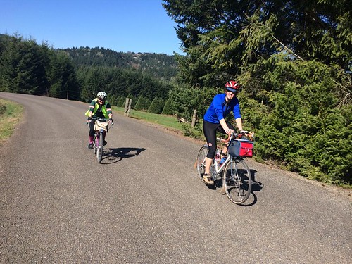
Beaverton-Bridge of the Gods perm again, to check out the new trail (no more riding on the I-84 shoulder!).  The ice and really bad weather postponed it from last weekend.  Michal came up to ride it with me yesterday (Sunday).

Horsetail Falls with Sweetpea

The weather was supposed to be awfully wet (100% chance of precip).  Well, only 200k, we'd survive.  To add on to the challenge, it was the start of Daylight Savings Time.  We'd have more daylight, but we'd also be short an hour of sleep.

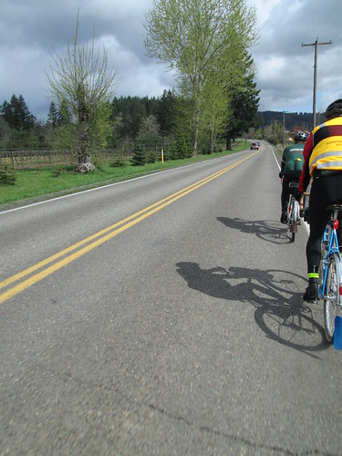
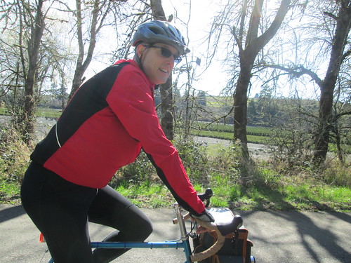
Down to Jim and Patty's for our start verification.  Oopers, they don't open until 7am on Sundays.  So, at 7:08, we were off.

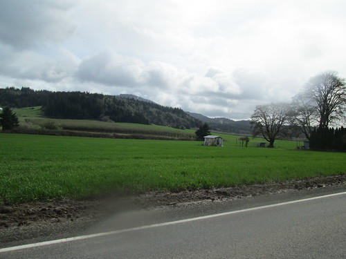
Back up the hill by the house, where Michal decided he was overdressed, so there was a pause for delayering.  It was raining, but not very hard.  Easiest climb of the ride, over Sylvan into Portland, and down through Washington Park.  Had to retrieve Michal from a couple of wrong turns.  Why wasn't his GPS beeping at him?

Into town, over the Steel Bridge, then north and east through NE PDX, eventually popping out by the I-205 trail at Sandy Blvd.  You will see the left turn to the bridge path by the large amount of trail construction. Over the bridge (loud).  The rain was by now a foggy drizzle.

We hadn't been making very good time - got to the gas station in Camas by three minutes.  I noticed that my SPOT had given it up, and installed new batteries.  Yes, I carry a few useful spare batteries.  Michal had total navigation electronics failure - his GPS had misplaced the route, and somehow, his front wheel magnet was not present, so no bike computer feedback either.

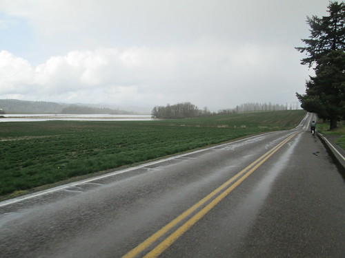
Ate some, drank some Coke, continued east.  What used to be a simple left turn onto SR-14 is now a large number of traffic circles.  Keep following the signs for SR-14 East, Kennewick.  Eventually you will be confronted by a ramp which is signed "Highway Entrance".  Take it, no worries.

Wound our way up to the top before Cape Horn.  There has been repaving, and the road is really nice.  Maybe even somewhat better shoulders, except, of course, when they go away.  Foggy.  There were occasional clumps of snow by the road, and lots of broken trees and branches from the winter storms.  At the first meadow, there are new landslide repair earthworks.  Stopped and zipped up jackets in preparation for the descent.

After the drop, on the way to Beacon Rock, we started to see bits of actual sunlight.  A pause for me to remove my jacket and helmet cover, because I was suffocating in the stored heat.

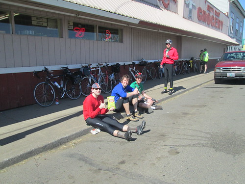
On to Stevenson; we finally got something that resembled a tailwind right around North Bonneville.  Got to Stevenson ("Land of pizza!" - Michal) with a half hour in the bank.  I got a slice of pizza and a coke.  Just couldn't consume it as quickly as I wanted, but I did eat it all.  Refilled my thermal bottle with coffee/perpetuem/hot cocoa, and we got our bridge toll money handy.  Or, Michal pulled out a dollar and informed me he was paying.

Bit of a headwind, but not bad, and a fun bridge crossing.  I like to look down and admire the river and bridge structure.  Not raining at all.

Onto the trail.  I don't know why it is, but any time the trail is adjacent to the freeway, it has that crushed red lava rock on it.  Gently riding over it, we soon moved away from the freeway and the trail became much nicer.

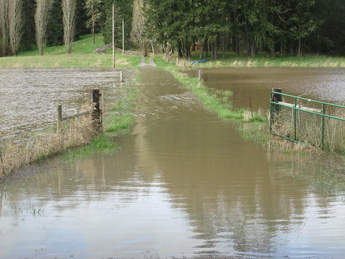
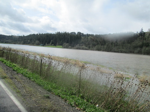
LOTS of water dumping down the creeks and falls.  Ruckel Creek was pretty spectacular.

Ruckel Creek, running high

We did encounter one landslide - right after the fish hatchery, where you are directed behind a fence... well, the bike path is covered in rocks and muck.  We went past that on the off-ramp and then lifted our bikes over the fence.  Not, of course without me trying to hike over the landslide.  Sucking mudpit, it was.

Moffett Creek Bridge

Michal riding along the new trail

And the new part of the trail?  Nice!  I never realized there was an existing bridge over Moffett Creek.  It is a bit more climby than the freeway shoulder; the path crosses under I-84 (nice new stone facing on the freeway bridge) and then switchbacks up.  Great views to the north, which you don't get from the freeway. The new bridge over McCord Creek is adorable.  Lots of Art Deco fun had there.

The new bridge on the new trail

I saw Michal standing at the far end of the bridge.  It turned out that there was a slick spot there and he'd fallen.  Casualties - handlebar tape, scrape on the brifter lever and the knee of his tights.

Horsetail Falls was exceptionally spectacular, and we paused for a couple of pictures.  Moving on, we passed by the Oneonta Tunnel, and were hit by a blast of frigid air coming out of Oneonta Gorge.  Very brief parking lot pause at Multnomah Falls - we could feel the ground vibrate from the force of all the water dropping over the falls.

Horsetail Falls spray

West, west, west, and then up to Crown Point.  Not my fastest ascent, but, of course, I got there.  Michal was waiting.  He then tried to go in to get some water, and discovered that Vista House closed at 4pm, and it was 4:30...  Well, ok, there are convenience stores in Troutdale.

eastward view from Crown Point

Michal's GPS was telling him all sorts of things, none of which were related to the route, or indeed, where we were.

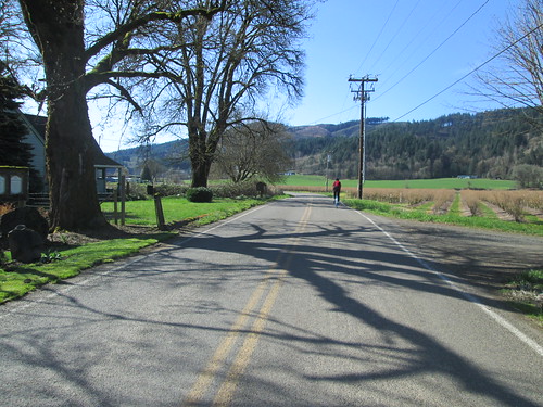
Climbed up to Women's Forum (road slumps repaired), and then prepared to enjoy one of my favorite descents (and, hopefully, make up some time).  There was a bit of a headwind, so we didn't get going for a mile, and then it was way fun.  Bell Road was, as usual, excellent fun, and then we continued dropping towards Troutdale.

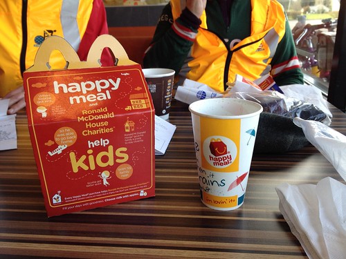
Stopped at the convenience store.  Happy to sell us stuff, but no public restrooms.  Ok, the next control will have restrooms.  Looped behind the Troutdale Airport, and up onto Marine Drive.  The wind was non-hindering.  Behind the Portland Airport and off to the control.  A Subway has joined the 7-11 and Dutch Bros.  There is a restroom, but you have to ask for the key.

A customer asked where we were riding, and was a bit taken aback that we had started in Beaverton, ridden out to Stevenson, and were headed back to Beaverton.  She had just lost 70 lbs and had hand surgery, and was looking forward to riding her bike, but perhaps not that distance.

Ok.  17 more miles, one climb. Two hours.  Yeah.

I had carefully studied the NE PDX return navigation this time.  Yes, I designed the route, and yes, I have actually ridden on those streets, but often following Cecil, who knew where she was going.  My route knowledge of NE PDX is more theoretical than practical.  But it was still light, and we did just fine.  Not fast, though - still climbing up from the Columbia River.  Also, urban riding, many stop signs.

Across the Steel Bridge, north on Naito.  Dark now.  Turned a bit early, so had to loop around and take the sidewalk up to NW 9th.  Got onto NW Kearney (definitely climbing now), headed up to NW 25th/Westover.  Many stop signs.  Bit of a pause, because I know where to go when I can SEE, but it being Portland, street signs are sometimes not present.  Ok.  Headed towards Burnside to cross over onto NW Stearns.  Me: "see that black hole?  That's where we are headed."

Climbing Stearns in the dark made me very happy I had both the Luxos U and the Ixon.  Must adjust the Luxos angle downward a bit, I think.  Last info control, still more climbing.

(For the unitiated, Stearns maybe used to be a road; it isn't now.  Switchbacked trail up to the Rose Garden.  Sketchy surface at the bottom. Right now it has fresh Lion of Flanders markers on it for the upcoming De Ronde)

Bailed on the climb out of the Rose Garden (17%), and walked it up to the turn.  Then up through Washington Park (dark, no street lighting).  I have ridden it enough times to know where we were, and was happy to see the lights of the Zoo come into view.

15 minutes.  Still climbing, up to Sylvan.  Downhill all the way from there.  We had until 8:32pm.  Popped out into my neighborhood at 8:33pm :-( :-( :-(

So, at that point we finished at my house (on the route).  Sigh.

That said, always a pretty ride.  And the weather was considerably better than promised.

125.9 miles.
7242 vertical feet (claims the bike computer)

-