Thursday, March 13, 2014

Errandonnee 5, 6, and 7

Today, Community Meeting (Knitting Group), the Library, and Trader Joe's (grocery)

Total mileage 10.2

Home to Community Meeting

Community meeting, library, and grocery store, 10.2 miles

There are ALPACAS on a lot on SW 106th across from the Elks Lodge.  Maybe two blocks from my house, and I didn't know!  In the Beaverton city limits, even.

Community meeting, library, and grocery store, 10.2 miles

At knitting group today we knitted (natch), except for the needlepoint lady and the quilt lady (we don't judge).  Also talked about retirement and how to do it right, and what to do about retired spouses.  That was funny.  I got about an inch knitted on my socks.

Community meeting, library, and grocery store, 10.2 miles

Community Meeting to Library
Returned my book.  Nothing exciting about the library today.

Community meeting, library, and grocery store, 10.2 miles

Library to Trader Joe's
Mt Hood was out today, and quite visible from SW 2nd Ave in Beaverton.

Community meeting, library, and grocery store, 10.2 miles

Trader Joe's had everything I needed.  The sample area (lunch?  did I forget to have lunch?) was fingerling potatoes and Irish Bangers with sweet hot mustard.  Oh my goodness.  Also had a sample taste of their Green Drink (maybe there is something to this hiding veg in your fruit drink) and some coffee.  Another customer profusely admired the bike (Rivendell).

Community meeting, library, and grocery store, 10.2 miles

And home.

Errandonnee, Errand 4, the grocery store

Cleaned out all the returnable bottles and cans.  Panniers full of bottles, cans on the front rack.  Fortunately, all downhill to the Fred Meyer!

Returning bottles and cans, picking up a few groceries. 3.2 miles, fortunately downhill. The panniers were full of glass bottles and heavy.

Learning: don't get too close to bottle machine with a bike; lots of broken glass on the pavement.  No flats.  Lucky.

Long line at the can and bottle return, so I gave them to someone else, and went into the store to pick up some milk and cheese.

Returning bottles and cans, picking up a few groceries. 3.2 miles, fortunately downhill. The panniers were full of glass bottles and heavy.

3.2 miles round trip.

Tuesday, March 11, 2014

Errandonnee, Errands 1-3

The list today included recycle batteries, go by the library, and, oh, maybe I want a T20 bit to carry in my on-bike toolkit...

Total distance 5.6 miles.
The route
Sweetpea has a new seatpost and the saddle has been rearranged yet again, so that was the logical bike for the errands.  All the luggage was off, so I put my two library books and the bucket of batteries in a small pack and headed out.  Weather was perfect.  Other than my helmet, gloves and cycling shoes, I was wearing street clothes - jeans and a hoodie commemorating the Sunset High School 15th Annual Marching Band Classic.  As an aside, my band member is going to his 10th HS reunion this year. :-O

Home to Batteries Plus Bulbs
Ended up riding three blocks westbound on SW Canyon.  Not recommended, but I managed the stretch between traffic lights.
Bicycle goes in the store.
Up to 5 lbs of batteries are recycled for free.  I had 4.5 lbs.

Errandonnèe trip 1 - batteries to recycle

Errandonnèe trip 1 - Batteries Plus Bulbs

Batteries Plus Bulbs to Beaverton Library
East on Millikan, cross-country to Lombard, then the standard route.
No bicycles allowed in the library; had to lock it up outside.
Picked up The Sons of Heaven, the final Company novel from Kage Baker.  I am sad it is the last one.
The Beaverton Library was designed by Thomas Hacker Architects, and has wonderful wood beams.

Errandonnèe trip 1 - Beaverton Library Interior

Errandonnèe trip 1 - Beaverton Library

Beaverton Library to Home Depot
There just isn't a low-stress direct route.  I could have gone back up to Beaverton Hillsdale, but that would have been a left turn across a very high traffic 4 lane highway at 5pm.  I elected to go east on SW 5th, then turn left into the office park across from SW 107th, turn left onto Beaverton Hillsdale at the light, and then right onto SW 110th to Home Depot.
The bike goes in with me there as well.
I knew the Torx T20 bits were on Aisle 8 Bay 102 and in stock (the interwebs are great).  Took a bit of hunting among all the various bits, but found them.  The T20 bit will fit in my Rachet Rocket, and in the Rachet Rocket case, displacing the unneeded T25 bit.  The T20 bit adjusts the Luxos U light angle.
The cashier wanted to know all about Sweetpea; we had a wonderful visit.

Errandonnèe trip 1 - Home Depot

Home Depot - Sweetpea among the bits and drivers

Home Depot to Home
EZ.  Except that I am still feeling Sunday's ride, and the uphills were definitely noticed.

Monday, March 10, 2014

Clearly Still a Work in Progress

Still don't have my March 200k, although not for lack of trying.  I had been wanting to ride my Beaverton-Bridge of the Gods perm again, to check out the new trail (no more riding on the I-84 shoulder!).  The ice and really bad weather postponed it from last weekend.  Michal came up to ride it with me yesterday (Sunday).

Horsetail Falls with Sweetpea

The weather was supposed to be awfully wet (100% chance of precip).  Well, only 200k, we'd survive.  To add on to the challenge, it was the start of Daylight Savings Time.  We'd have more daylight, but we'd also be short an hour of sleep.

Down to Jim and Patty's for our start verification.  Oopers, they don't open until 7am on Sundays.  So, at 7:08, we were off.

Back up the hill by the house, where Michal decided he was overdressed, so there was a pause for delayering.  It was raining, but not very hard.  Easiest climb of the ride, over Sylvan into Portland, and down through Washington Park.  Had to retrieve Michal from a couple of wrong turns.  Why wasn't his GPS beeping at him?

Into town, over the Steel Bridge, then north and east through NE PDX, eventually popping out by the I-205 trail at Sandy Blvd.  You will see the left turn to the bridge path by the large amount of trail construction. Over the bridge (loud).  The rain was by now a foggy drizzle.

We hadn't been making very good time - got to the gas station in Camas by three minutes.  I noticed that my SPOT had given it up, and installed new batteries.  Yes, I carry a few useful spare batteries.  Michal had total navigation electronics failure - his GPS had misplaced the route, and somehow, his front wheel magnet was not present, so no bike computer feedback either.

Ate some, drank some Coke, continued east.  What used to be a simple left turn onto SR-14 is now a large number of traffic circles.  Keep following the signs for SR-14 East, Kennewick.  Eventually you will be confronted by a ramp which is signed "Highway Entrance".  Take it, no worries.

Wound our way up to the top before Cape Horn.  There has been repaving, and the road is really nice.  Maybe even somewhat better shoulders, except, of course, when they go away.  Foggy.  There were occasional clumps of snow by the road, and lots of broken trees and branches from the winter storms.  At the first meadow, there are new landslide repair earthworks.  Stopped and zipped up jackets in preparation for the descent.

After the drop, on the way to Beacon Rock, we started to see bits of actual sunlight.  A pause for me to remove my jacket and helmet cover, because I was suffocating in the stored heat.

On to Stevenson; we finally got something that resembled a tailwind right around North Bonneville.  Got to Stevenson ("Land of pizza!" - Michal) with a half hour in the bank.  I got a slice of pizza and a coke.  Just couldn't consume it as quickly as I wanted, but I did eat it all.  Refilled my thermal bottle with coffee/perpetuem/hot cocoa, and we got our bridge toll money handy.  Or, Michal pulled out a dollar and informed me he was paying.

Bit of a headwind, but not bad, and a fun bridge crossing.  I like to look down and admire the river and bridge structure.  Not raining at all.

Onto the trail.  I don't know why it is, but any time the trail is adjacent to the freeway, it has that crushed red lava rock on it.  Gently riding over it, we soon moved away from the freeway and the trail became much nicer.

LOTS of water dumping down the creeks and falls.  Ruckel Creek was pretty spectacular.

Ruckel Creek, running high

We did encounter one landslide - right after the fish hatchery, where you are directed behind a fence... well, the bike path is covered in rocks and muck.  We went past that on the off-ramp and then lifted our bikes over the fence.  Not, of course without me trying to hike over the landslide.  Sucking mudpit, it was.

Moffett Creek Bridge

Michal riding along the new trail

And the new part of the trail?  Nice!  I never realized there was an existing bridge over Moffett Creek.  It is a bit more climby than the freeway shoulder; the path crosses under I-84 (nice new stone facing on the freeway bridge) and then switchbacks up.  Great views to the north, which you don't get from the freeway. The new bridge over McCord Creek is adorable.  Lots of Art Deco fun had there.

The new bridge on the new trail

I saw Michal standing at the far end of the bridge.  It turned out that there was a slick spot there and he'd fallen.  Casualties - handlebar tape, scrape on the brifter lever and the knee of his tights.

Horsetail Falls was exceptionally spectacular, and we paused for a couple of pictures.  Moving on, we passed by the Oneonta Tunnel, and were hit by a blast of frigid air coming out of Oneonta Gorge.  Very brief parking lot pause at Multnomah Falls - we could feel the ground vibrate from the force of all the water dropping over the falls.

Horsetail Falls spray

West, west, west, and then up to Crown Point.  Not my fastest ascent, but, of course, I got there.  Michal was waiting.  He then tried to go in to get some water, and discovered that Vista House closed at 4pm, and it was 4:30...  Well, ok, there are convenience stores in Troutdale.

eastward view from Crown Point

Michal's GPS was telling him all sorts of things, none of which were related to the route, or indeed, where we were.

Climbed up to Women's Forum (road slumps repaired), and then prepared to enjoy one of my favorite descents (and, hopefully, make up some time).  There was a bit of a headwind, so we didn't get going for a mile, and then it was way fun.  Bell Road was, as usual, excellent fun, and then we continued dropping towards Troutdale.

Stopped at the convenience store.  Happy to sell us stuff, but no public restrooms.  Ok, the next control will have restrooms.  Looped behind the Troutdale Airport, and up onto Marine Drive.  The wind was non-hindering.  Behind the Portland Airport and off to the control.  A Subway has joined the 7-11 and Dutch Bros.  There is a restroom, but you have to ask for the key.

A customer asked where we were riding, and was a bit taken aback that we had started in Beaverton, ridden out to Stevenson, and were headed back to Beaverton.  She had just lost 70 lbs and had hand surgery, and was looking forward to riding her bike, but perhaps not that distance.

Ok.  17 more miles, one climb. Two hours.  Yeah.

I had carefully studied the NE PDX return navigation this time.  Yes, I designed the route, and yes, I have actually ridden on those streets, but often following Cecil, who knew where she was going.  My route knowledge of NE PDX is more theoretical than practical.  But it was still light, and we did just fine.  Not fast, though - still climbing up from the Columbia River.  Also, urban riding, many stop signs.

Across the Steel Bridge, north on Naito.  Dark now.  Turned a bit early, so had to loop around and take the sidewalk up to NW 9th.  Got onto NW Kearney (definitely climbing now), headed up to NW 25th/Westover.  Many stop signs.  Bit of a pause, because I know where to go when I can SEE, but it being Portland, street signs are sometimes not present.  Ok.  Headed towards Burnside to cross over onto NW Stearns.  Me: "see that black hole?  That's where we are headed."

Climbing Stearns in the dark made me very happy I had both the Luxos U and the Ixon.  Must adjust the Luxos angle downward a bit, I think.  Last info control, still more climbing.

(For the unitiated, Stearns maybe used to be a road; it isn't now.  Switchbacked trail up to the Rose Garden.  Sketchy surface at the bottom. Right now it has fresh Lion of Flanders markers on it for the upcoming De Ronde)

Bailed on the climb out of the Rose Garden (17%), and walked it up to the turn.  Then up through Washington Park (dark, no street lighting).  I have ridden it enough times to know where we were, and was happy to see the lights of the Zoo come into view.

15 minutes.  Still climbing, up to Sylvan.  Downhill all the way from there.  We had until 8:32pm.  Popped out into my neighborhood at 8:33pm :-( :-( :-(

So, at that point we finished at my house (on the route).  Sigh.

That said, always a pretty ride.  And the weather was considerably better than promised.

125.9 miles.
7242 vertical feet (claims the bike computer)

-

Thursday, February 27, 2014

Arivaca CCW 210km. In Arizona!

I have taken to suggesting that our winter week-in-the-sun happen in a place where there is also randonneuring.  When we planned this year's escape, I picked Tucson.  Friend Susan O had ridden the Arivaca 210km perm, and recommended it.  Husband: "see if you can find someone to ride with you!".  Well, ok.  Joined the AZRandon google group and advertised.  And got a response!

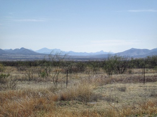
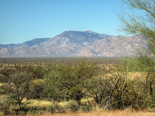
View to the north

After some email exchange finding a mutually agreeable date and time, Susan R and I registered for the counterclockwise version of the route - she doesn't like riding on Ajo Rd after dark.  Something about heavy traffic and junk on the shoulder.  Either way was fine with me.

Our respective spouses dropped us off at 6:45am at the McDonalds.  Bought some cookies, put on my summer shoes, said goodbyes, and headed out.  It was still quite chilly; I was wearing arm warmers, knee warmers, a windbreaker and a wind/reflective vest.  The shoulder was pretty yucky - expansion bumps and debris.  It improved after 5 or 6 miles, and the traffic dropped off as well.

I had fiddled with the adjustment on my new saddle, and there was some unfavorable interaction with the saddlebag and the rear wheel.  Several pauses to try to get it to that sweet spot of comfort and non-interference.  The Rachet Rocket got much use.  Susan wants one.

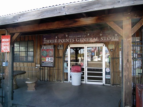
Three Points General Store

After 15 miles of headwind and saddle tweaking, we arrived at the first control.   Still not warm enough to remove the jacket.  Consumed a banana and some V-8.  I made sure I had plenty of water, including an extra bottle.  Susan offered to carry it, because my saddlebag was still having issues.  We had 45 miles of desert and no services.

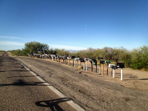
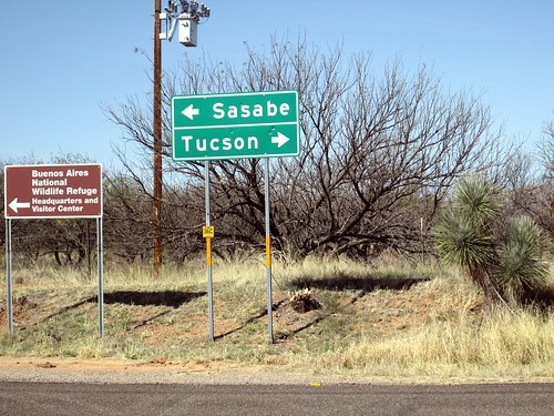
Long line of mailboxes on Arivaca-Sasabe Rd

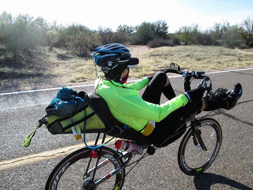
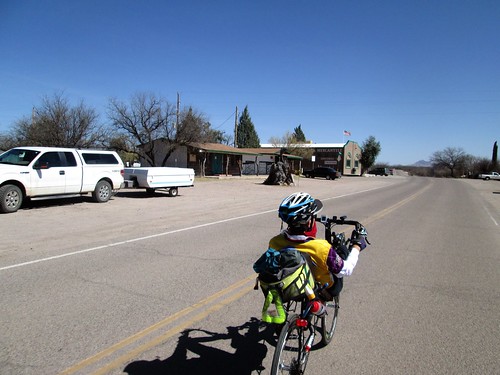
Susan riding along, Arivaca-Sasabe Rd

We were now out of the headwind, heading toward Mexico.  If we missed the next turn...  Lots of desert, and views of Kitt Peak Observatory.

Kitt Peak Observatory

I was hoping to see a road runner, but it was not to be.  We did see many Border Patrol vehicles, and passed through a Border Control checkpoint.  Cleanest portapotties ever.

Border Control Ahead

A couple more saddle adjustments, as well as a bottle refill.  I was drinking Skratch (husband: "what is that?" me: "artisanal Gatorade") and Perpetuem.  Started out with Caffe Latte mixed with coffee.  Went to Orange Vanilla later.  Ate my sandwich.

The turn we didn't want to miss

We stopped to get a picture at the turn, and wave at the Border Patrol guy sitting there in his vehicle.  Then nine miles of rolling on to Arivaca.  There is a store, but no public restroom.  We stocked up (Greek yogurt, banana, V-8) and relocated to some "shade".  The local restaurant has bathrooms off their patio, and are very nice about people coming in to use it.

Entering Arivaca

After a not overly long stop, we continued rollering along.  Susan said the next batch of rollers were pretty fun, and, once we summitted out of Arivaca, they were indeed great fun.  Lots of cattle guards, too.  Bzzzzp!

Delightful stretch, rollering down to I-19

It was easier riding into the wind there - air is drier and thinner.

Another Border Control checkpoint.  We stopped because the sign said Stop, and chatted up the staff.  They were interested in the ride, and probably thought we were more than a little nuts.  More exceptionally clean portapotties.  Shortly after that we came up to the I-19 frontage road, and paused for a water refill.

Then north, and then west and north again through Green Valley.  Nice pavement, wide bike lanes, because they were meant to be shared with golf carts.  Susan's rear derailleur checked out here, and we pulled into a golf course parking lot to poke at it.  A guy came over and poked as well, and he got it unstuck and working again.  The last on-course control was a few miles further north - another Circle K.  Their Circle K stores are so much cleaner and nicer than I remember the ones here in Oregon.  Of course, I haven't stopped in one since forever, probably because the last one in Salem was so grubby.

More bananas and water and nuts.  Then we popped out on Duval Mine Rd, right by the Titan Missile Museum, which Fitz and I had just visited the day before.  There were really big trucks, and not very much road for a few miles.  Then a cyclist came by who knew Susan, so they chatted for awhile.  I was not in the best place, mentally.  The road was going up, it was the hottest part of the day, and the snacks had not yet kicked in.

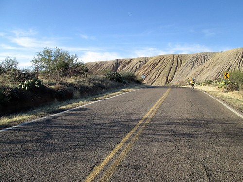
Then we turned onto Mission Rd.  Nine more miles of climbing, and then Susan promised me an awesome descent.  The food kicked in and my mood and pace improved.  We were riding along the back side of the Asarco open-pit copper mine.  Impressive huge piles of mine tailings.  Watching the miles tick by, and soon we were at the top.  I was still plenty warm, and didn't need to add any layers.

Back side of the Asarco open pit copper mine, Mission Rd

It was a great descent - nice pavement, not steep, but enough that I could keep well above 20mph most of the way down.  Eventually I could see the San Xavier Mission (we'd been there the day before as well), and knew that we'd be running out of downhill soon.  Darn.

Still not dark, but it was thinking about it.  We kept on Mission Rd for several more miles, before turning onto something else, where it finally did get dark.  Susan couldn't read her cue sheet or see her computer.  I could do both, so was calling out distances, not that there were many turns to the finish.

After the last turn onto Calle Don Miguel, I could see the McDonald's up ahead.  Whee!

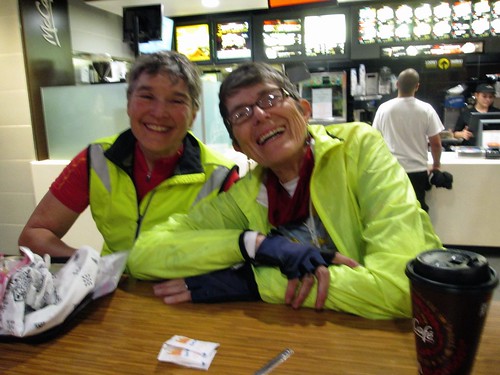
Fitz was inside waiting; tapped on the window, then went in to get a Coke and fries.  Kirk (Mr. Susan) was there also, and we visited and snacked for a bit before heading out.

Celebrating the finish

Very fun ride, and quite different from riding here in the Northwet.

130 miles/12:12 elapsed.  Wasted a lot of time with the saddle adjustment; I'll have to get it right when the bike goes back together.

Aftermath notes: while the saddle was not yet perfectly adjusted, I had none of the customary post-ride sore spots.  Not a one.  That alone is worth it.  The shoes on the other hand...  Maybe my feet are not the intended demographic for those shoes.

Wednesday, February 12, 2014

Cross Training

We had a bit of snow here.  For those of you who live where snow is expected, feel free to snicker.  Only the main roads are plowed or sanded or graveled.  Driving in a neighborhood is... challenging.  Where I live, all ways out of the neighborhood are down.

I was not interested in riding the bike - I no longer have a mountain bike, and the last time I tried to ride in snow, the fenders packed up with snow.  Traction was also nonexistent.

Running (yes, I run.  Or, I have been a runner and am working my way back into it).  No.

The snow was pretty nice, and there was certainly enough of it.  Then I remembered my parents had cross country skis.  And snowshoes.  My mom said the skis were in the cellar "somewhere", and they'd dig them up for me by the time I had hiked the two blocks over.  I figured I was "running" in the cold and dressed accordingly - three layers of wool on top with my Nike Storm vest over that, a ski cap, my Pearl Izumi AmFib cycling tights, heavy wool cycling socks, and wool gloves.

Not only that, my mom thought she'd snowshoe along.  Geared up (me staring at the skis and wondering if this was perhaps not the best idea I'd had), we proceeded over to the elementary school, and skied and tromped around the field.  I'd head out and then turn around and come back.

What did I just sign up to do here?
After a circumnavigation of the field, my mom thought that the wind was spectacularly strong, cold, and stinging ice, and she decided to head back home.

Mom considering her options
I thought I'd head out onto the streets to get in some more time and distance.  Headed out of the school, I saw another skier headed up the street.   As he got closer, I saw that it was friend and sometime cycling partner Chris.  We decided to continue on together.

Chris
He's a lot better at this, because he actually goes XC skiing.  This was my second time on XC skis ever; the first being a 6 mile outing by Mt Bachelor, mmm, decades ago.  I'd concentrate and move along reasonably well - we stuck to the flatter areas - and then lose the concentration and have a bit of a challenge :-)  Fell over once; very slow motion.

It was great catching up.  We both became grandparents this year, so there was that.  Still trying to get him to try randonneuring.  He was out playing while waiting for his bottles to sterilize so he could bottle his most recent brewing attempt.  He does brew good beer.

Me.  Picture by Chris
After an hour of wandering the neighborhood, it was time to head back to our respective homes.  I had to go by the parents' home (Axel Ski Rental and Party Supply) and return the skis and retrieve my boots.  I headed back through the school, and then the last bit to their house. Downhill.  Ack.  Edges.  I need my edges.  Managed to stop before causing any damage.

It was easier skiing than walking home.  The snow was starting to get an icy crust.

Aftermath - my core informed me that it had ALSO gotten a serious workout :-)

Snow was gone enough today that I could run.  It even felt good - I wasn't spending the 2:30 running parts wondering when the 2:30 would be over, and I had to tack on an extra loop, because I was farther along for the time than before.  Progress.

Tuesday, February 4, 2014

The New Bike Ride

Not mine :-)  Rando friend Michal just (as in just) took delivery of his custom Winter rando bike, so of course he wanted to ride.  Rando friend Graham was planning to ride Bill Alsup's Eugene to Beaverton 200k perm, taking the train down to Eugene on Saturday (Feb 1) morning, and starting at 11:30am, or something like that.  Michal suggested he come down Friday evening and start earlier Saturday morning, and I joined in. The finish is just over a mile from my house, so I offered up dinner for all afterwards.  Plans were made.

Michal (and new bike)

For me, it was "hop the MAX train downtown and figure out the best way to get to Union Station".  I could transfer trains and get right there, but with a 15 minute wait time, I could ride over there quicker.  Almost.  The roads are either one-way or transit mall.  Can't easily get there from here.  After trying this twice, I think I will stick to 4th St.  Anyway, got there, got my bike ticket, and Graham found me in the luggage room.  He got his bike ticket, and we went and hung out in the lobby waiting for the train.  Which was late.

When we got our boarding passes, they directed us to the left.  Everyone else was sent to line up on the right.  Eventually they told us it was so we could jump ahead of the group and get our bikes in the baggage car soonest.  Nice.  Other than the train being late, uneventful ride.  Graham and I got better acquainted, he did Sudoku puzzles, and I worked on my small knitting project. Cyndi was pulling in as we walked to the front of the station, and Michal had a batch of chili with tasty bread waiting.  And ice cream for dessert.

Of course, time was spent in the garage admiring the shiny new bike.  He really had only ridden it around the block when he picked it up, so this would be all new.

We planned to leave the house about 7am for a 7:30 start.  Michal and Cyndi had breakfast out and multiple cups of home-roasted coffee.  Still dim heading down the hill, but our bright headlights helped.  We arrived at Full City Coffee, and bought yet more coffee for that starting receipt.  I had some Caffe Latte Perpetuem and hot cocoa mix in my thermal bottle, and just had them fill it up with coffee.  Lots of coffee.  We set out only 4 minutes after 7:30, which has got to be a record.

Michal and Graham outside Full City Coffee in Eugene

So Michal had his entirely new bike, and I was riding on an entirely new saddle - a Rivet Pearl.  Right out of the box, and only a couple trips up and down the driveway, plus the 2 miles total riding to get to Union Station.  This could be an interesting ride.

First stretch, Eugene to Brownsville, 29.7 miles.  Early, sunny, cold.  The wind was not hindering, and might even have been a teeny bit helpful.  The climbs on Gap Road were not a big deal (somehow, they always hurt coming the other way toward the end of the Five Rivers perm), and the descents down the other side were quite fun.  Horses, cattle, sheep, and llamas out in the fields.  Still very much winter, but some trees were getting that pre-leaf fuzzy look.

Graham

There might have been a pause along the way to remove some layers.  Or we did it when we stopped in Brownsville; I really don't remember.  Bought some peanut butter crackers, but I really had plenty of food with me.  Also ate a slab of Italian Fruitcake.  Michal broke his bike in by plopping a bag of Cool Ranch Doritos on the seat.

Promptly breaking in the new bike rando-style, with Cool Ranch Doritos

Graham's front bag has a built in corndog holder.

Graham's bike has a built-in corndog holder

Brownsville to Hoffman Covered Bridge info control 24.2 miles.  Still wonderfully sunny.  More rolling hills (I think they call them buttes).

Nursery trees in mesmerizing rows

Passed through Lebanon and Crabtree (there isn't much in Crabtree), to turn onto Hungry Hill Road, where the bridge is to be found.  We stopped to write down the answer, and take a few pictures.

Info control selfie

Inside the bridge

Hoffman Covered Bridge to Stayton 13.2 miles.  The last time we rode this, we stopped in Scio, but not today.  The only wall of the route was waiting - gets up to 12% or 14% toward the top.  I bailed and spun my way up; Michal and Graham climbed somewhat faster.  This puts us on top of a ridge with wonderful views.

By now I was noticing that I had a new saddle.  Or, more to the point, the sitbones were noticing.  Shift, wiggle, shift. Michal was also noticing his new saddle, but perhaps not as acutely.

Found Michal and Graham at a corner, with a bit of a quandary on which way to go.  Michal's GPS was indecisive, and I thought we'd stay left.  I got to pull out MapsWithMeLite with the ride track installed and verify that this was indeed the case.  We continued on Stayton-Scio Road, and quite soon found ourselves in Stayton, headed for the Safeway.  Applied some lubricant to my poor sit bones.  Bought a sandwich, which seemed to take longer than it should have, but Michal was still in line at the Starbucks.  Got another bottle filled with coffee, Perpetuem and cocoa mix, and topped off my water bottle.  Ate half my sandwich and a banana, and we were off again.

Stayton to Woodburn  28.7 miles.  This stretch was mostly autopilot, as it goes from Stayton to Aumsville, north on Howell Prairie, and then, departing from the Mill City Coffee Run, into Woodburn, rather than Gervais.  We were all looking forward to some Mexican food in Woodburn, at one of the many stores which line the main street.  This is a pretty stretch of the route.

Between Stayton and Woodburn

The barn at the southern terminus of Howell Prairie Road

Howell Prairie Road, clouds and buildings

Trees in rows.  And good clouds

Heading into Woodburn, an impatient driver passed on a two lane road, with oncoming traffic.  The oncoming pickup almost ended up in the ditch.  We all shook our heads in disbelief.

Stopped at the same place in Woodburn as before, except all the window signs were now in Korean(?)  Bought a Red Bull to get a quick receipt, not that we were anywhere near pushing the time limit.  Receipt time was almost 30 minutes off :-)  Then went to order some food.  Brain freeze.  I just ordered what Michal had - three tamales.  They turned out to contain chicken, and were somewhat spicier than either of us were expecting.  I ate two.

Michal tanking up in Woodburn

Woodburn to Beaverton 29.6 miles.  And here we were leaving Woodburn, and it was still light!  Granted the shadows were getting long, but still...  A zombie freight train was heading north, same as us (the locomotive was at the other end, running in reverse), so I could head straight on, knowing that no one would be turning or crossing in front of me.  Michal and Graham came up in not too long, and we headed into and through Hubbard, then NW towards Aurora.  A stop to swap to the clear lenses and turn on a few more lights.  Rode alongside the Aurora airport, and Graham and I swapped stories about my brother's flying lessons there, and his flying lessons there.

Then it was time to hop onto I-5 for the Boone Bridge crossing.  Still not full dark.  That didn't happen until we were headed through the Wilsonville industrial park.

Last time we did this ride, it was dark and raining, and we had to stop and check the cue sheets much too often.  I had done some serious review of the route north from Wilsonville, and Michal had his GPS set up.  I was a bit stressed about the next stretch on Boone's Ferry/Tualatin Rd, because, again, the last time was in the dark and rain, and the road was two lanes, no shoulder, and heavily traveled.  I was in for quite the pleasant surprise!  Road widened, big shoulder/bike lane, and new white curbs, which my headlight picked out quite nicely!

Into Tualatin Community Park, over the Tualatin River bridge, and then the left turn in Cook Park on the bike path. Now, this is clearly a recreational, meandering path.  Not a single light in the park, and no edge lines painted on the path.  Good thing there was a wide beam on my headlight!

Now north on road with names I recognized - SW Hall, SW Burnham, a funny u-turn in downtown Tigard, through some neighborhoods, and then we popped out on SW Greenburg Rd, at which point I no longer needed the cue sheet.

Pulled into the Starbuck's at the Beaverton Freddie's, and I ducked in to get us a receipt.  Came out to find Bill A, the route owner.  Called home to say we'd all be there in about 10 minutes.  Graham wanted to get a picture of a license plate (200 DNF), so he said he'd be right behind us.  He never was right behind us, but as we headed up my street, I could see a bike taillight in front of us.  Bill pulled in right behind us.

Finish photo with Bill, the perm owner

Aftermath.  First things first, it being Graham's first R-12, his wife Sharon had brought a bottle of champagne, and we had a celebratory round.  Then we fell into dinner.  Sharon had also made a wonderful lasagna, which we accompanied by a big Rich and Charlie's salad, bread, apple cake and ice cream.  And beer and cider.

And Bill takes a picture of all of us

The route
130 miles in all,
13.05 moving average,
11:57 total time, about 15 minutes quicker than before, even without the tailwind assistance
about 3800 vertical feet