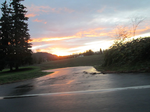
Michal was interested, so we planned to ride Bill's Eugene to Beaverton perm. One-way, heading north. I took the train down to Eugene on Friday evening, and we were up at 5am the next morning. Yummy breakfast and coffee, and soon time to plummet down the hill to the start point. The forecast had called for mid-30's in the morning, warming up to mid 50's later in the day. It wasn't raining at the moment, but I had all the rain gear along, and a few extra bits in case of extreme soaking (socks, baselayer, extra hat and gloves).
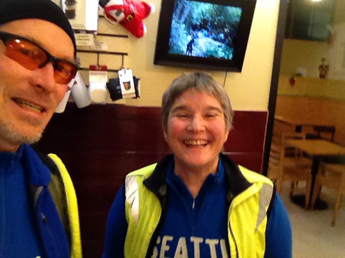
Tense descent (for me) down to the flats, and winding through Eugene to Full City Coffee Roasters. The bike shakes when I get tense, which adds to it :-) We ordered some hot drinks, took some pictures, and headed north.
I am playing with Adam G's RandoFriend phone app, and had created a ride for this perm. Nothing to do at the start; it just starts the clock at the provided start time.
Once we got to the outskirts of Eugene, we stopped at Armitage Park, and both of us ended up removing most of our extra layers. It was already in the 50's!
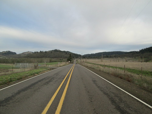
The tailwind was wonderful - we were blown north all the way to Diamond Hill Rd, at which point we had to ride east for awhile. That is where we discovered how nice a tailwind we had; it was hard going in the quartering headwind for the next 3+ miles. We could SEE the turn north, but it was not getting closer quickly enough.
From there we went up Gap Rd, one of the few "major" climbs on this route. It was nice to have the wind helping.
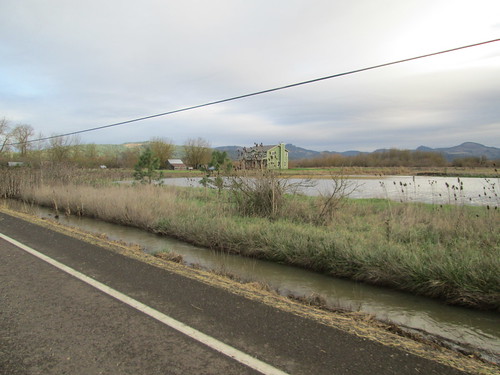
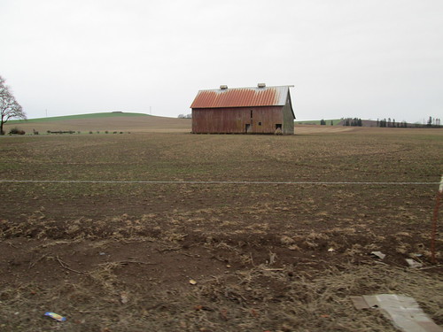
Down into Brownsville, back up a bit, then more relatively flat terrain all the way to out first control at the Hoffman Bridge. We then zipped through Scio, around a corner and... Michal: "oh". I wondered that he didn't remember this from previous rides. The Leffler Grade. I made it halfway up and then bailed. Michal, of course, rode right up.
We followed along the top of the ridge, eventually dropping into Stayton, our first timed control at 67 miles. I ate a plate of potstickers and noodles; Michal just had potstickers. I think I like the Chinese food counter there. Tasty wet salty food with protein and carbs.
Our Seattle Randonneur jerseys were confusing to people :-) Not that we planned to match, but with our jerseys and Gore Visibility vests, well, there we were.
The only attempt at rain to this point had been a few minutes of very faint drizzle.
From here we headed west and north through Aumsville to Howell Prairie Road, all with that tailwind, which made the first three hilly miles ever so much more pleasant. The next 14 miles were pretty nice, too!
Into Woodburn (perm owner: "I trust, though, that you'll follow Howell Prairie to its end" - the usual route is to follow the MAIN road into Gervais), where we stopped at one of the local Hispanic grocery/taquerias, now apparently owned by Asians. Adds a 4th language to the existing signage in Woodburn - currently English, Spanish, and Russian.
I had chicken tacos, which, when one removes the onions and cilantro, are just chicken and tortillas. Basic, but workable with salsa.
After a longish pause and a quick chain lube, we set out for the final 30 miles north. The route took us north along the railroad tracks to Hubbard, then northwest for our last bit of rural riding, following Boones Ferry north until we cut east to go around the Aurora airport, and hop onto I-5 to cross the Willamette River on the Boone Bridge. Real darkness fell somewhere alongside the airport.
The I-5 crossing was loud, and there were lots of branches on the shoulder, making it a bit challenging to keep as far right as I wanted to be. I found Michal waiting just after the turn onto Boones Ferry.
Aside: you know, if the French Prairie Bridge was a reality, we wouldn't have to ride on I-5.
And with that, we were into industrial parks and suburbia. We didn't stop at the north end of Wilsonville, but kept moving. After the short climb up on Boones Ferry, we dropped into Tualatin, "enjoying" the non-continuity of the bicycle facilities until the very end, where we went through the park, crossed the Tualatin River, and rode through more meandering park trails (I can see where folks might want to meander, but for transportational uses, meandering is just annoying. As is lack of lighting and trail delineation) to pop out in Tigard.
This route used to use the Fanno Creek Trail, but navigation is challenging if one isn't a local; also, the trail meanders and has poor sight lines and no lighting. It can be sketchy after dark.
There was that interesting little maneuver in Tigard to get north of the tracks, and then we were just south of Hwy 217 on Greenburg Rd, and almost done. Except that Greenburg Rd looked all kinds of closed with flashing lights and emergency vehicles. Given the location of the accident, we decided to use the sidewalk on the other side of the street for a couple of blocks, and after waiting for too many crossing signals, were again headed north to Hall, and there to Scholls Ferry, through the neighborhoods on the east side of it, a few more turns, and we were done.
After getting a receipt, we headed the 1.5 miles home for dinner. And maybe a celebratory beverage.
 |
| picture by Cyndi |

No comments:
Post a Comment